FAA INFORMATION EFFECTIVE 12 JUNE 2025
Location
| FAA Identifier: | LSE |
| Lat/Long: | 43-52-45.3564N 091-15-23.8810W
43-52.755940N 091-15.398017W
43.8792657,-91.2566336
(estimated) |
| Elevation: | 655.4 ft. / 199.8 m (surveyed) |
| Variation: | 01W (2015) |
| From city: | 4 miles NW of LA CROSSE, WI |
| Time zone: | UTC -5 (UTC -6 during Standard Time) |
| Zip code: | 54603 |
Airport Operations
| Airport use: | Open to the public |
| Activation date: | 02/1938 |
| Control tower: | yes |
| ARTCC: | MINNEAPOLIS CENTER |
| FSS: | GREEN BAY FLIGHT SERVICE STATION |
| NOTAMs facility: | LSE (NOTAM-D service available) |
| Attendance: | 0600-2100
FOR ATTENDANT OTHER HOURS CALL 608-783-8359. |
| Wind indicator: | lighted |
| Segmented circle: | yes |
| Lights: | WHEN ATCT CLSD MIRL RWY 13/31 PRESET LOW INTST; TO INCR INTST & ACTVT MALSR RWY 18; REIL RWY 13, 31, 36; MIRL RWY 13/31; HIRL RWY 18/36, RWY 04/22 - CTAF. PAPI RWY 04, 18, & 22; VASI RWY 13, 31, & 36 OPR CONSLY. |
| Beacon: | white-green (lighted land airport)
Operates sunset to sunrise. |
| Fire and rescue: | ARFF index B |
Airport Communications
| CTAF: | 118.45 |
| UNICOM: | 122.95 |
| ATIS: | 124.95 |
| WX ASOS: | 124.95 (608-781-9067) |
| LA CROSSE GROUND: | 121.8 [0600-2100] |
| LA CROSSE TOWER: | 118.45 251.075 [0600-2100] |
- APCH/DEP SVC PRVDD BY MINNEAPOLIS ARTCC ON FREQS 128.6/363.0 (LA CROSSE RCAG).
Nearby radio navigation aids
| VOR radial/distance | | VOR name | | Freq | | Var |
|---|
| ODIr101/9.3 | | NODINE VORTAC | | 117.90 | | 01E |
| NDB name | | Hdg/Dist | | Freq | | Var | | ID |
|---|
| MCCOY | | 262/26.8 | | 412 | | 00E | | CMY | -.-. -- -.-- |
Airport Services
| Fuel available: | 100LL JET-A |
| Parking: | hangars and tiedowns |
| Airframe service: | MAJOR |
| Powerplant service: | MAJOR |
| Bottled oxygen: | NONE |
| Bulk oxygen: | NONE |
Runway Information
Runway 18/36
| Dimensions: | 8742 x 150 ft. / 2665 x 46 m |
| Surface: | concrete/grooved, in good condition |
| Weight bearing capacity: | | Single wheel: | 120.0 | | Double wheel: | 200.0 | | Double tandem: | 340.0 | | Dual double tandem: | 810.0 |
|
| Runway edge lights: | high intensity |
| RUNWAY 18 | | RUNWAY 36 |
| Latitude: | 43-53.594975N | | 43-52.156123N |
| Longitude: | 091-15.532492W | | 091-15.513420W |
| Elevation: | 652.5 ft. | | 647.2 ft. |
| Traffic pattern: | left | | left |
| Runway heading: | 180 magnetic, 179 true | | 000 magnetic, 359 true |
| Displaced threshold: | no | | 1131 ft. |
| Declared distances: | TORA:8105 TODA:8742 ASDA:8536 LDA:8536 | | TORA:8742 TODA:8742 ASDA:8564 LDA:7433 |
| Markings: | precision, in good condition | | precision, in good condition |
| Visual slope indicator: | 4-light PAPI on left (3.00 degrees glide path) | | 4-box VASI on left (3.00 degrees glide path) |
| Approach lights: | MALSR: 1,400 foot medium intensity approach lighting system with runway alignment indicator lights | | |
| Runway end identifier lights: | no | | yes |
| Touchdown point: | yes, no lights | | yes, no lights |
| Instrument approach: | ILS | | |
| Obstructions: | 69 ft. tree, 3443 ft. from runway, 790 ft. right of centerline, 47:1 slope to clear | | 48 ft. tree, 1522 ft. from runway, 424 ft. left of centerline, 28:1 slope to clear
RY 36 APCH RATIO 50:1 AT DSPLCD THLD. |
Runway 13/31
| Dimensions: | 6050 x 150 ft. / 1844 x 46 m |
| Surface: | asphalt/grooved, in good condition |
| Weight bearing capacity: | | Single wheel: | 120.0 | | Double wheel: | 200.0 | | Double tandem: | 340.0 |
|
| Runway edge lights: | medium intensity |
| RUNWAY 13 | | RUNWAY 31 |
| Latitude: | 43-53.103327N | | 43-52.407087N |
| Longitude: | 091-15.858830W | | 091-14.874685W |
| Elevation: | 655.4 ft. | | 650.5 ft. |
| Traffic pattern: | left | | left |
| Runway heading: | 135 magnetic, 134 true | | 315 magnetic, 314 true |
| Displaced threshold: | no | | 739 ft. |
| Declared distances: | TORA:5310 TODA:5310 ASDA:5310 LDA:5310 | | TORA:6050 TODA:6050 ASDA:6050 LDA:5310 |
| Markings: | nonprecision, in good condition | | nonprecision, in good condition |
| Visual slope indicator: | 4-box VASI on left (3.00 degrees glide path) | | 4-box VASI on left (3.85 degrees glide path)
VASI UNUSBL BYD 9 DEGS RIGHT OF CNTRLN. |
| Runway end identifier lights: | yes | | yes |
| Touchdown point: | yes, no lights | | yes, no lights |
| Obstructions: | 68 ft. trees, 1995 ft. from runway, 327 ft. right of centerline, 26:1 slope to clear | | 40 ft. trees, 1250 ft. from runway, 350 ft. left of centerline, 26:1 slope to clear
RWY 31 APCH RATIO 24:1 AT DSPLCD THLD. |
Runway 4/22
| Dimensions: | 5199 x 150 ft. / 1585 x 46 m |
| Surface: | asphalt, in fair condition |
| Weight bearing capacity: | | Single wheel: | 90.0 | | Double wheel: | 150.0 | | Double tandem: | 280.0 |
|
| Runway edge lights: | high intensity |
| Operational restrictions: | RWY 4/22 NOT AVBL FOR SKEDD ACR OPNS WITH MORE THAN 9 PAX SEATS OR UNSKEDD ACR AT LEAST 31 PAX SEATS. |
| RUNWAY 4 | | RUNWAY 22 |
| Latitude: | 43-52.211185N | | 43-52.900157N |
| Longitude: | 091-15.575092W | | 091-14.873532W |
| Elevation: | 646.6 ft. | | 653.3 ft. |
| Traffic pattern: | left | | left |
| Runway heading: | 037 magnetic, 036 true | | 217 magnetic, 216 true |
| Declared distances: | TORA:5199 TODA:5199 ASDA:5199 LDA:5199 | | TORA:5199 TODA:5199 ASDA:5199 LDA:5199 |
| Markings: | nonprecision, in fair condition | | nonprecision, in fair condition |
| Visual slope indicator: | 4-light PAPI on left (4.00 degrees glide path) | | 4-light PAPI on left (4.00 degrees glide path) |
| Runway end identifier lights: | no | | no |
| Touchdown point: | yes, no lights | | yes, no lights |
| Obstructions: | 47 ft. pole, 1516 ft. from runway, 320 ft. left of centerline, 28:1 slope to clear | | 43 ft. trees, 994 ft. from runway, 350 ft. right of centerline, 18:1 slope to clear |
Airport Ownership and Management from official FAA records
| Ownership: | Publicly-owned |
| Owner: | CITY OF LA CROSSE
2850 AIRPORT ROAD
LA CROSSE, WI 54603
Phone 608-789-7464 |
| Manager: | JEFFREY TRIPP
2850 AIRPORT ROAD
LA CROSSE, WI 54603-1264
Phone 608-789-7456 |
Additional Remarks
| A39-18/36 | PCR VALUE: 630/R/B/W/T |
| A39-13/31 | PCR VALUE: 630/F/A/X/T |
| A39-04/22 | PCR VALUE: 330/F/A/X/T |
| - | TOWER, 1390 FT AGL 6NM SW. |
| - | 48 HR PPR FOR UNSKED ACR OPS GTR THAN 30 PAX SEATS, CALL AMGR. |
| - | NUMEROUS TOWERS UP TO 836 FT AGL; 4NM SE. |
| - | DEER; WATERFOWL & OTHER BIRDS ON & INVOF ARPT. HVY CONCENTRATIONS OF WATERFOWL SPRING & FALL. |
| - | HLDG PSN FOR THE WEST SIDE OF RWY 36 APCH END IS SET BACK ON TWY C. SEE HS-1 ON ARPT DIAGRAM. |
| - | COLD TEMPERATURE AIRPORT. ALTITUDE CORRECTION REQUIRED AT OR BELOW -22C. |
| - | RWY INCURSION RISK. PILOTS ARE REMINDED TO REVIEW ARPT HOT SPOT INFO BFR TXG FOR DEP AND BFR LNDG. SEE TPP ARPT DIAGRAM AND CHART SUPPL SXN ON HOT SPOTS FOR ADDNL INFO. |
| - | WRONG RWY ARRIVAL RISK, RWY 4 AND 36 APCH ENDS ARE CLOSELY ALIGNED. SEE TPP ARPT DIAGRAM. |
| - | FOR CD WHEN ATCT IS CLSD CTC ON FSS ON RCO FREQ; IF UNA CTC MINNEAPOLIS ARTCC AT 651-463-5588. |
| - | TWY A BTN RWY 13/31 AND TWY A4; TWY A4 NOT AVBL FOR SKEDD ACR OPNS WITH MORE THAN 9 PAX SEATS OR UNSKED ACR OPNS GTR THAN 30 PAX SEATS. |
Instrument Procedures
NOTE: All procedures below are presented as PDF files. If you need a reader for these files, you should download the free Adobe Reader.NOT FOR NAVIGATION. Please procure official charts for flight.
FAA instrument procedures published for use from 12 June 2025 at 0901Z to 10 July 2025 at 0900z.
IAPs - Instrument Approach Procedures |
|---|
| ILS OR LOC RWY 18 | |
download (311KB) |
| RNAV (GPS) RWY 04 | |
download (246KB) |
| RNAV (GPS) RWY 13 | |
download (295KB) |
| RNAV (GPS) RWY 18 | |
download (272KB) |
| RNAV (GPS) RWY 22 | |
download (223KB) |
| RNAV (GPS) RWY 31 | |
download (242KB) |
| RNAV (GPS) RWY 36 | |
download (269KB) |
| NOTE: Special Alternate Minimums apply | |
download (163KB) |
| NOTE: Special Take-Off Minimums/Departure Procedures apply | |
download (293KB) |
Other nearby airports with instrument procedures:
KCHU - Houston County Airport (20 nm SW)
KCMY - Sparta/Fort Mc Coy Airport (23 nm E)
KONA - Winona Municipal Airport/Max Conrad Field (23 nm NW)
Y51 - Viroqua Municipal Airport (24 nm SE)
55Y - Rushford Municipal Airport/Robert W Bunke Field (25 nm W)
|
|

Road maps at:
MapQuest
Bing
Google
| Aerial photo |
|---|
WARNING: Photo may not be current or correct
 Photo by Gary Chambers
Photo taken 04-Jun-2006
Photo by Gary Chambers
Photo taken 04-Jun-2006
Do you have a better or more recent aerial photo of La Crosse Regional Airport that you would like to share? If so, please send us your photo.
|
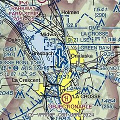
| Sectional chart |
|---|
|
 Download PDF
of official airport diagram from the FAA
| Airport distance calculator |
|---|
|
|
| Sunrise and sunset |
|---|
|
Times for 25-Jun-2025
| | Local
(UTC-5) | | Zulu
(UTC) |
|---|
| Morning civil twilight | | 04:49 | | 09:49 |
| Sunrise | | 05:25 | | 10:25 |
| Sunset | | 20:50 | | 01:50 |
| Evening civil twilight | | 21:27 | | 02:27 |
|
| Current date and time |
|---|
| Zulu (UTC) | 25-Jun-2025 10:15:25 |
|---|
| Local (UTC-5) | 25-Jun-2025 05:15:25 |
|---|
|
| METAR |
|---|
| KLSE | 250953Z AUTO 00000KT 10SM FEW020 SCT046 21/20 A3013 RMK AO2 SLP194 T02110200
|
|
| TAF |
|---|
| KLSE | 250520Z 2506/2606 06004KT P6SM BKN090 FM251000 08005KT P6SM OVC025 FM251400 11006KT 6SM -SHRA OVC011 FM251800 12007KT 6SM -SHRA BKN020 PROB30 2519/2601 2SM TSRA BKN011CB
|
|
| NOTAMs |
|---|
NOTAMs are issued by the DoD/FAA and will open in a separate window not controlled by AirNav.
|
|


