FAA INFORMATION EFFECTIVE 09 JULY 2026
Location
| FAA Identifier: | 4I9 |
| Lat/Long: | 40-31-28.2830N 082-51-00.2200W
40-31.471383N 082-51.003667W
40.5245231,-82.8500611
(estimated) |
| Elevation: | 1085.8 ft. / 331.0 m (surveyed) |
| Variation: | 08W (2015) |
| From city: | 2 miles SW of MOUNT GILEAD, OH |
| Time zone: | UTC -4 (UTC -5 during Standard Time) |
| Zip code: | 43338 |
Airport Operations
| Airport use: | Open to the public |
| Activation date: | 08/1969 |
| Control tower: | no |
| ARTCC: | INDIANAPOLIS CENTER |
| FSS: | CLEVELAND FLIGHT SERVICE STATION |
| NOTAMs facility: | 4I9 (NOTAM-D service available) |
| Attendance: | MON-FRI 0900-1800
FOR SVC AFT HRS CALL AMGR. |
| Wind indicator: | yes |
| Segmented circle: | no |
| Lights: | ACTVT PAPI RWY 28; MIRL RWY 10/28 - CTAF. |
| Beacon: | white-green (lighted land airport)
Operates sunset to sunrise. |
Airport Communications
| CTAF/UNICOM: | 122.8 |
| WX AWOS-3PT: | 121.4 (419-947-1039) |
| COLUMBUS APPROACH: | 125.95 |
| COLUMBUS DEPARTURE: | 125.95 |
| IC: | 125.95 |
| WX ASOS at MNN (11 nm NW): | 119.975 (740-223-7502) |
| WX AWOS-3 at 17G (16 nm N): | 126.625 (419-562-0279) |
| WX AWOS-3PT at 4I3 (19 nm SE): | 126.05 (740-397-6297) |
| WX AWOS-3PT at DLZ (19 nm SW): | 119.025 (740-203-1878) |
Nearby radio navigation aids
| VOR radial/distance | | VOR name | | Freq | | Var |
|---|
| BUDr125/(11.2) | | BUCKEYE VOR | | 109.80 | | 05W |
| APEr338/25.4 | | APPLETON VORTAC | | 116.70 | | 06W |
| NDB name | | Hdg/Dist | | Freq | | Var | | ID |
|---|
| TIFFIN | | 159/38.0 | | 269 | | 05W | | TII | - .. .. |
Airport Services
| Fuel available: | 100LL MOGAS |
| Parking: | hangars and tiedowns |
| Airframe service: | MAJOR |
| Powerplant service: | MAJOR |
| Bottled oxygen: | NONE |
| Bulk oxygen: | NONE |
Runway Information
Runway 10/28
| Dimensions: | 3495 x 65 ft. / 1065 x 20 m |
| Surface: | asphalt, in good condition |
| Weight bearing capacity: | |
| Runway edge lights: | medium intensity |
| RUNWAY 10 | | RUNWAY 28 |
| Latitude: | 40-31.476325N | | 40-31.466430N |
| Longitude: | 082-51.380773W | | 082-50.626562W |
| Elevation: | 1075.2 ft. | | 1085.0 ft. |
| Traffic pattern: | left | | left |
| Runway heading: | 099 magnetic, 091 true | | 279 magnetic, 271 true |
| Markings: | nonprecision, in good condition | | nonprecision, in good condition |
| Visual slope indicator: | | | 4-light PAPI on left (4.00 degrees glide path) |
| Runway end identifier lights: | no | | no |
| Touchdown point: | yes, no lights | | yes, no lights |
| Obstructions: | 60 ft. trees, 930 ft. from runway, 295 ft. left of centerline, 12:1 slope to clear | | 75 ft. trees, 930 ft. from runway, 285 ft. left of centerline, 9:1 slope to clear
+2 FT CROPS, 30-200 FT DIST, 175 FT L TO 250 FT R. |
Airport Ownership and Management from official FAA records
| Ownership: | Publicly-owned |
| Owner: | MORROW COUNTY ARPT AUTH
4679 TOWNSHIP ROAD 126
CARDINGTON, OH 43315-9511
Phone 419-947-4735
COUNTY ECONOMIC DEVELOPMENT OFC. |
| Manager: | CARL FISHER JR
4679 TOWNSHIP ROAD 126
CARDINGTON, OH 43315-9511
Phone 419-947-1833
OFC. |
Additional Remarks
| - | FOR CD CTC COLUMBUS APCH AT 614-338-8537. |
Instrument Procedures
NOTE: All procedures below are presented as PDF files. If you need a reader for these files, you should download the free Adobe Reader.NOT FOR NAVIGATION. Please procure official charts for flight.
FAA instrument procedures published for use from 09 July 2026 at 0901Z to 06 August 2026 at 0900Z.
IAPs - Instrument Approach Procedures |
|---|
| VOR-A **CHANGED** | |
download (177KB) |
| NOTE: Special Take-Off Minimums/Departure Procedures apply | |
download (487KB) |
Other nearby airports with instrument procedures:
KMNN - Marion Municipal Airport (11 nm NW)
KGQQ - Galion Municipal Airport (15 nm NE)
17G - Port Bucyrus/Crawford County Airport (16 nm N)
4I3 - Knox County Airport (19 nm SE)
KDLZ - Delaware Municipal Airport - Jim Moore Field (19 nm SW)
|
|

Road maps at:
MapQuest
Bing
Google
| Aerial photo |
|---|
WARNING: Photo may not be current or correct

Do you have a better or more recent aerial photo of Morrow County Airport that you would like to share? If so, please send us your photo.
|
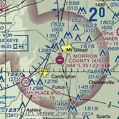
| Sectional chart |
|---|
|
| Airport distance calculator |
|---|
|
|
| Sunrise and sunset |
|---|
|
Times for 21-Jul-2026
| | Local
(UTC-4) | | Zulu
(UTC) |
|---|
| Morning civil twilight | | 05:48 | | 09:48 |
| Sunrise | | 06:19 | | 10:19 |
| Sunset | | 20:56 | | 00:56 |
| Evening civil twilight | | 21:28 | | 01:28 |
|
| Current date and time |
|---|
| Zulu (UTC) | 21-Jul-2026 22:40:34 |
|---|
| Local (UTC-4) | 21-Jul-2026 18:40:34 |
|---|
|
| METAR |
|---|
KMNN
11nm NW | 212153Z AUTO 27008KT 10SM FEW070 BKN100 29/19 A2966 RMK AO2 SLP037 T02890189
|
K4I3
19nm SE | 212215Z AUTO 28009KT 10SM FEW075 SCT090 28/22 A2969 RMK AO2
|
KDLZ
19nm SW | 212215Z AUTO 29011G17KT 10SM SCT085 29/23 A2969 RMK AO2 LTG DSNT S
|
|
| TAF |
|---|
KMFD
23nm NE | 212208Z 2122/2218 25008G18KT P6SM BKN080 PROB30 2122/2124 5SM -SHRA BKN025 FM220000 29009KT P6SM BKN050 FM220500 33010KT P6SM BKN035
|
|
| NOTAMs |
|---|
NOTAMs are issued by the DoD/FAA and will open in a separate window not controlled by AirNav.
|
|


