FAA INFORMATION EFFECTIVE 30 OCTOBER 2025
Location
| FAA Identifier: | CMY |
| Lat/Long: | 43-57-31.3780N 090-44-16.2290W
43-57.522967N 090-44.270483W
43.9587161,-90.7378414
(estimated) |
| Elevation: | 839.4 ft. / 256 m (estimated) |
| Variation: | 00E (2000) |
| From city: | 3 miles NE of SPARTA, WI |
| Time zone: | UTC -6 (UTC -5 during Daylight Saving Time) |
| Zip code: | 54656 |
Airport Operations
| Airport use: | Open to the public |
| Control tower: | yes |
| ARTCC: | CHICAGO CENTER |
| FSS: | GREEN BAY FLIGHT SERVICE STATION |
| NOTAMs facility: | CMY (NOTAM-D service available) |
| Attendance: | MON-FRI 1400-2200Z++
EXC FED HOL. |
| Wind indicator: | lighted |
| Segmented circle: | no |
| Lights: | WHEN TWR CLSD ACTVT REIL RWY 11 & 29; MIRL RWY 01/19 - CTAF. MIRL RWY 11/29 PRESET TO LOW SS-SR; INCR INTST CTAF. VGSI RWY 01, 11, 19 & 29 OPR CONSLY. |
| Beacon: | white-green (lighted land airport)
Operates sunset to sunrise. |
Airport Communications
| CTAF: | 124.6 |
| WX ASOS: | 119.775 |
| SPARTA/MC COY GROUND: | 123.625 [1400-2200Z++ MON-FRI EXCP FED HOL.] |
| SPARTA/MC COY TOWER: | 124.6 254.375 229.4 [1400-2200Z++ MON-FRI EXCP FED HOL.] |
| VOLK APPROACH: | 135.25 |
| VOLK DEPARTURE: | 135.25 |
| EMERG: | 121.5 |
| OPS: | 128.725 ;RANGE INFO |
| RANGE CTL: | 134.1 245.5 30.05 41.35 |
| WX AWOS-3PT at BCK (18 nm N): | 119.125 (715-284-0007) |
- APCH/DEP SVC PRVDD BY CHICAGO ARTCC ON FREQS 133.3/257.925 (LONE ROCK RCAG) WHEN VOLK APCH CTL CLSD.
Nearby radio navigation aids
| VOR radial/distance | | VOR name | | Freq | | Var |
|---|
| ODIr084/31.6 | | NODINE VORTAC | | 117.90 | | 01E |
| NDB name | | Hdg/Dist | | Freq | | Var | | ID |
|---|
| MCCOY | | 287/4.3 | | 412 | | 00E | | CMY | -.-. -- -.-- |
Airport Services
| Fuel available: | 100LL JET-A++
100LL:CREDIT CARD SELF SVC H24 ON CIVIL RAMP.
A++:MIL RAMP SELF SVC H24 1 APR - 30 SEP & MON-FRI 1 OCT - 31 MAR TO TRAINED MIL KEY HOLDERS. 1 OCT - 31 MAR PPR BY THURS 2200Z++ FOR WKEND FUEL OR SVC. |
| Parking: | tiedowns |
Runway Information
Runway 11/29
| Dimensions: | 4697 x 100 ft. / 1432 x 30 m |
| Surface: | asphalt, in good condition |
| Weight bearing capacity: | |
| Runway edge lights: | medium intensity |
| Operational restrictions: | HVY ASSAULT STRIP OPS E. NSTD N LATERAL CLNC; SEE KCMY AP/1 FOR INFO. |
| RUNWAY 11 | | RUNWAY 29 |
| Latitude: | 43-57.734272N | | 43-57.442795N |
| Longitude: | 090-44.759867W | | 090-43.768638W |
| Elevation: | 821.8 ft. | | 831.6 ft. |
| Traffic pattern: | left | | left |
| Runway heading: | 112 | | 292 |
| Displaced threshold: | no | | 431 ft. |
| Markings: | nonprecision, in good condition | | nonprecision, in good condition |
| Visual slope indicator: | 4-light PAPI on left (3.00 degrees glide path) | | 4-light PAPI on left (3.00 degrees glide path) |
| Runway end identifier lights: | yes | | yes |
| Touchdown point: | yes, no lights | | yes, no lights |
| Obstructions: | 55 ft. trees, 1315 ft. from runway, 210 ft. right of centerline, 20:1 slope to clear | | 15 ft. road, marked and lighted, 200 ft. from runway, 10 ft. left of centerline
15 FT ROAD 0-200 FT FM RWY END 0-107 FT L. |
Runway 1/19
| Dimensions: | 3032 x 95 ft. / 924 x 29 m |
| Surface: | asphalt, in good condition |
| Weight bearing capacity: | |
| Runway edge lights: | medium intensity |
| RUNWAY 1 | | RUNWAY 19 |
| Latitude: | 43-57.180833N | | 43-57.661833N |
| Longitude: | 090-44.372000W | | 090-44.188333W |
| Elevation: | 839.4 ft. | | 826.5 ft. |
| Traffic pattern: | left | | left |
| Runway heading: | 015 | | 195 |
| Markings: | nonprecision, in good condition | | nonprecision, in good condition |
| Visual slope indicator: | 2-light PAPI on left (3.50 degrees glide path) | | 2-light PAPI on left (3.50 degrees glide path) |
| Touchdown point: | yes, no lights | | yes, no lights |
Airport Ownership and Management from official FAA records
| Ownership: | U.S. Army |
| Owner: | US ARMY
COMMANDER
FORT MC COY, WI 54656
Phone 502-898-4207 |
| Manager: | JAMES HUBBARD
ATTN: AMIM-MCO-A
FORT MC COY, WI 54656
Phone 502-898-4107
CIVIL AMGR MARK VAN WORMER - 608-269-4340 EX: 9-5157. |
Additional Remarks
| A30A-11 | CTN: DEP; VEHICLES ON ROAD MAY APPEAR TO BE ON RWY. |
| A30A-19 | CTLD SMALL ARMS RANGE 1000 YDS DEP END. |
| - | RWY 01, 11, 29 NSTD SAFETY AREA BYD EACH END DUE TO TRRN & FENCE. |
| - | PAJA 3.5 NM E - NE YEAR ROUND. |
| - | RSTD: ARFF SVC AVBL WITH 72 HR NOTICE - C502-898-2508/3553; INDEX B SVC AVBL H24. |
| - | FOR CD WHEN ATCT CLSD CTC CHICAGO ARTCC AT 630-906-8921. |
| - | BIRDS & WILDLIFE ON & INVOF ARPT. |
| - | 24 HR PPR FOR SVC AFT 2200Z++ - C502-898-4107. CLSD FED HOL & BY NOTAM. R/W HOT PIT AVBL TO TRAINED OPRS. FUEL & T RQMNTS - AP/1. |
| - | FICON UNMNT AFT HR. |
| - | SNOW REMOVAL OPS MNT CTAF WHEN ATCT CLSD. |
| - | LGTD WINDCONE RWY 01 & 11. |
| - | RAPIDLY RISING TRRN 1 NM NW - NE. |
| - | C130 & LRGR 180 DEG TURNS PMTD ON CONC SFC RWY 11/29 E & W ENDS & RWY 01/19 S END. |
| - | R6901B 500 YDS DEP END RWY 11. |
Instrument Procedures
NOTE: All procedures below are presented as PDF files. If you need a reader for these files, you should download the free Adobe Reader.NOT FOR NAVIGATION. Please procure official charts for flight.
FAA instrument procedures published for use from 30 October 2025 at 0901Z to 27 November 2025 at 0900Z.
IAPs - Instrument Approach Procedures |
|---|
| RNAV (GPS) RWY 11 **CHANGED** | |
download (263KB) |
| RNAV (GPS) RWY 29 **CHANGED** | |
download (217KB) |
| VOR RWY 11 **NEW** | |
download (225KB) |
| NOTE: Special Alternate Minimums apply **CHANGED** | |
download (162KB) |
| NOTE: Special Take-Off Minimums/Departure Procedures apply | |
download (201KB) |
Other nearby airports with instrument procedures:
Y72 - Bloyer Field Airport (11 nm E)
KBCK - Black River Falls Area Airport (18 nm N)
KVOK - Volk Field Airport (21 nm E)
KLSE - La Crosse Regional Airport (23 nm W)
Y51 - Viroqua Municipal Airport (24 nm S)
|
|

Road maps at:
MapQuest
Bing
Google
| Aerial photo |
|---|
WARNING: Photo may not be current or correct

Do you have a better or more recent aerial photo of Sparta/Fort Mc Coy Airport that you would like to share? If so, please send us your photo.
|
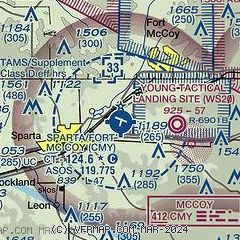
| Sectional chart |
|---|
|
| Airport distance calculator |
|---|
|
|
| Sunrise and sunset |
|---|
|
Times for 14-Nov-2025
| | Local
(UTC-6) | | Zulu
(UTC) |
|---|
| Morning civil twilight | | 06:27 | | 12:27 |
| Sunrise | | 06:58 | | 12:58 |
| Sunset | | 16:37 | | 22:37 |
| Evening civil twilight | | 17:08 | | 23:08 |
|
| Current date and time |
|---|
| Zulu (UTC) | 14-Nov-2025 18:47:25 |
|---|
| Local (UTC-6) | 14-Nov-2025 12:47:25 |
|---|
|
| METAR |
|---|
| KCMY | 141755Z AUTO 00000KT 9SM CLR 18/06 A2984 RMK AO2 SLP112 T01830058 10183 21034 57027
|
KBCK
18nm N | 141835Z AUTO 15004KT 10SM CLR 18/04 A2982 RMK AO2 T01770041
|
|
| TAF |
|---|
KVOK
21nm E | 141700Z 1417/1523 VRB06KT 9999 SKC QNH2987INS BECMG 1500/1501 VRB06KT 9999 BKN050 QNH2970INS BECMG 1502/1503 21015G25KT 9999 OVC010 QNH2966INS BECMG 1508/1509 VRB06KT 8000 BR OVC005 QNH2952INS BECMG 1513/1514 VRB06KT 9000 BR SCT005 BKN150 QNH2956INS TX15/1505Z TN09/1417Z LAST NO AMDS AFT 1421 NEXT 1509
|
KLSE
23nm W | 141727Z 1418/1518 19007KT P6SM FEW250 FM150300 21009KT P6SM BKN200 FM151100 31012KT P6SM BKN150
|
|
| NOTAMs |
|---|
NOTAMs are issued by the DoD/FAA and will open in a separate window not controlled by AirNav.
|
|

