FAA INFORMATION EFFECTIVE 16 APRIL 2026
Location
| FAA Identifier: | I71 |
| Lat/Long: | 39-39-15.2450N 081-48-11.4750W
39-39.254083N 081-48.191250W
39.6542347,-81.8031875
(estimated) |
| Elevation: | 1000 ft. / 305 m (estimated) |
| Variation: | 06W (1985) |
| From city: | 3 miles E of MC CONNELSVILLE, OH |
| Time zone: | UTC -4 (UTC -5 during Standard Time) |
| Zip code: | 43756 |
Airport Operations
| Airport use: | Open to the public |
| Activation date: | 08/1967 |
| Control tower: | no |
| ARTCC: | INDIANAPOLIS CENTER |
| FSS: | CLEVELAND FLIGHT SERVICE STATION |
| NOTAMs facility: | CLE (NOTAM-D service available) |
| Attendance: | UNATNDD |
| Pattern altitude: | 1800 ft. MSL |
| Wind indicator: | lighted |
| Segmented circle: | no |
| Lights: | ACTVT MIRL RWY 12/30 - CTAF. |
| Beacon: | white-green (lighted land airport)
Operates sunset to sunrise. |
Airport Communications
| CTAF/UNICOM: | 122.8 |
| WX ASOS at ZZV (18 nm N): | 127.0 (740-453-8139) |
Nearby radio navigation aids
| VOR radial/distance | | VOR name | | Freq | | Var |
|---|
| JPUr306/23.6 | | PARKERSBURG VOR/DME | | 114.45 | | 03W |
| NDB name | | Hdg/Dist | | Freq | | Var | | ID |
|---|
| UNIVERSITY | | 038/28.1 | | 250 | | 06W | | UGS | ..- --. ... |
Airport Services
| Fuel available: | 100LL
100LL:FOR FUEL REFER TO LIST IN ADMIN BLDG. |
| Parking: | hangars and tiedowns |
| Airframe service: | NONE |
| Powerplant service: | NONE |
| Bottled oxygen: | NONE |
| Bulk oxygen: | NONE |
Runway Information
Runway 12/30
| Dimensions: | 3500 x 65 ft. / 1067 x 20 m |
| Surface: | asphalt, in fair condition |
| Weight bearing capacity: | |
| Runway edge lights: | medium intensity |
| RUNWAY 12 | | RUNWAY 30 |
| Latitude: | 39-39.391667N | | 39-39.116500N |
| Longitude: | 081-48.519000W | | 081-47.863500W |
| Elevation: | 1000.0 ft. | | 1000.0 ft. |
| Traffic pattern: | left | | left |
| Runway heading: | 125 magnetic, 119 true | | 305 magnetic, 299 true |
| Displaced threshold: | 350 ft. | | no |
| Markings: | basic, in good condition | | basic, in good condition |
| Runway end identifier lights: | no | | no |
| Obstructions: | 25 ft. road, lighted, 225 ft. from runway, 125 ft. left of centerline, 1:1 slope to clear
+12 FT TRRN, 0 FT DIST, 125 FT L. | | 6 ft. hill, 250 ft. from runway, 125 ft. right of centerline, 8:1 slope to clear
+7 FT TRRN, 0 FT DIST, 125 FT R. |
Airport Ownership and Management from official FAA records
| Ownership: | Publicly-owned |
| Owner: | MORGAN COUNTY AIRPORT AUTH
995 E AIRPORT RD NE
MCCONNELSVILLE, OH 43756-9323
Phone 334-447-0624 |
| Manager: | KURT JOHNSON
995 E AIRPORT RD NE
MCCONNELLSVILLE, OH 43756-9323
Phone 334-447-0624
EMERG TEL 740-962-3333-SHERIFF OFC. |
Additional Remarks
| - | DEER ON & INVOF ARPT. |
| - | FOR CD CTC INDIANAPOLIS ARTCC AT 317-247-2411. |
Instrument Procedures
There are no published instrument procedures at I71.
Some nearby airports with instrument procedures:
I10 - Noble County Airport (15 nm NE)
KZZV - Zanesville Municipal Airport (18 nm N)
I86 - Ed Newlon Field Airport (18 nm W)
KCDI - Cambridge Municipal Airport (22 nm NE)
KPKB - Mid-Ohio Valley Regional Airport (25 nm SE)
|
|

Road maps at:
MapQuest
Bing
Google
| Aerial photo |
|---|
WARNING: Photo may not be current or correct
 Photo taken 07-Nov-2010
looking northwest.
Photo taken 07-Nov-2010
looking northwest.
Do you have a better or more recent aerial photo of Morgan County Airport that you would like to share? If so, please send us your photo.
|
| Sectional chart |
|---|
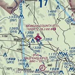
|
| Airport distance calculator |
|---|
|
|
| Sunrise and sunset |
|---|
|
Times for 21-Apr-2026
| | Local
(UTC-4) | | Zulu
(UTC) |
|---|
| Morning civil twilight | | 06:14 | | 10:14 |
| Sunrise | | 06:42 | | 10:42 |
| Sunset | | 20:10 | | 00:10 |
| Evening civil twilight | | 20:38 | | 00:38 |
|
| Current date and time |
|---|
| Zulu (UTC) | 21-Apr-2026 22:15:15 |
|---|
| Local (UTC-4) | 21-Apr-2026 18:15:15 |
|---|
|
| METAR |
|---|
KZZV
18nm N | 212153Z AUTO 21007KT 10SM CLR 22/05 A2999 RMK AO2 SLP157 T02220050
|
KCDI
22nm NE | 212155Z AUTO 23010G23KT 10SM CLR 23/05 A3000 RMK AO2 T02290053
|
KPKB
26nm SE | 212153Z 24017G23KT 10SM CLR 23/02 A3003 RMK AO2 SLP168 T02330022
|
KUNI
33nm SW | 212155Z AUTO 23014G25KT 10SM CLR 24/05 A3001 RMK AO2 T02430048
|
|
| TAF |
|---|
KZZV
18nm N | 211723Z 2118/2218 18010G20KT P6SM SCT100 FM220300 21006KT P6SM BKN100 WS020/23040KT FM220600 22006KT 6SM -SHRA BKN050 WS020/23040KT FM221100 23006KT P6SM BKN035 PROB30 2211/2213 6SM -SHRA BKN025 FM221300 25006KT P6SM OVC015
|
|
| NOTAMs |
|---|
NOTAMs are issued by the DoD/FAA and will open in a separate window not controlled by AirNav.
|
|


