FAA INFORMATION EFFECTIVE 14 MAY 2026
Location
| FAA Identifier: | PLR |
| Lat/Long: | 33-33-31.8000N 086-14-56.6000W
33-33.530000N 086-14.943333W
33.5588333,-86.2490556
(estimated) |
| Elevation: | 484.7 ft. / 147.7 m (surveyed) |
| Variation: | 04W (2020) |
| From city: | 3 miles SE of PELL CITY, AL |
| Time zone: | UTC -5 (UTC -6 during Standard Time) |
| Zip code: | 35128 |
Airport Operations
| Airport use: | Open to the public |
| Control tower: | no |
| ARTCC: | ATLANTA CENTER |
| FSS: | ANNISTON FLIGHT SERVICE STATION |
| NOTAMs facility: | ANB (NOTAM-D service available) |
| Attendance: | SUN UNTNDD, ALL MON-SAT 0730-1700 |
| Wind indicator: | lighted |
| Segmented circle: | no |
| Lights: | ACTVT PAPI RWY 03 & 21; MIRL RWY 03/21 - CTAF. |
| Beacon: | white-green (lighted land airport)
Operates sunset to sunrise. |
Airport Communications
| CTAF/UNICOM: | 123.05 |
| WX AWOS-3P: | 119.625 ((205) 884-4359) |
| BIRMINGHAM APPROACH: | 123.8 [0600-2300] |
| BIRMINGHAM DEPARTURE: | 123.8 [0600-2300] |
| CLEARANCE DELIVERY: | 121.725 |
| WX AWOS-3PT at ASN (10 nm E): | 118.425 (256-362-5847) |
| WX AWOS-3 at ANB (20 nm E): | 119.675 (256-835-3931) |
Nearby radio navigation aids
| VOR radial/distance | | VOR name | | Freq | | Var |
|---|
| GADr196/26.4 | | GADSDEN VOR/DME | | 112.30 | | 02E |
| VUZr100/33.2 | | VULCAN VORTAC | | 114.40 | | 02E |
Airport Services
| Fuel available: | 100LL JET-A+
100LL:100LL FUEL AVBL 24/7 WITH CC.
A+:FOR JET FUEL AFT HRS CALL 205-229-6668. |
| Parking: | tiedowns |
| Airframe service: | MAJOR |
| Powerplant service: | MAJOR |
| Bottled oxygen: | NONE |
| Bulk oxygen: | NONE |
Runway Information
Runway 3/21
| Dimensions: | 5001 x 80 ft. / 1524 x 24 m |
| Surface: | asphalt, in fair condition |
| Weight bearing capacity: | |
| Runway edge lights: | medium intensity |
| RUNWAY 3 | | RUNWAY 21 |
| Latitude: | 33-33.147892N | | 33-33.911823N |
| Longitude: | 086-15.127498W | | 086-14.756732W |
| Elevation: | 483.2 ft. | | 482.4 ft. |
| Traffic pattern: | left | | left |
| Runway heading: | 026 magnetic, 022 true | | 206 magnetic, 202 true |
| Displaced threshold: | 230 ft. | | no |
| Markings: | nonprecision, in fair condition | | nonprecision, in fair condition |
| Visual slope indicator: | 4-light PAPI on left (3.00 degrees glide path) | | 4-light PAPI on left (3.00 degrees glide path) |
| Touchdown point: | yes, no lights | | yes, no lights |
| Obstructions: | 100 ft. tree, 1038 ft. from runway, 385 ft. right of centerline, 8:1 slope to clear
RWY 03 APCH RATIO 24:1 TO DSPLCD THLD. | | 29 ft. tree, 385 ft. from runway, 196 ft. right of centerline, 6:1 slope to clear |
Airport Ownership and Management from official FAA records
| Ownership: | Publicly-owned |
| Owner: | ST CLAIR CO ARPT AUTH
240 AIRPORT ROAD
PELL CITY, AL 35128
Phone 205-338-9456
CONTACT PERSON: ERSKINE FUNDERBURG; CHAIRMAN ST. CLAIR COUNTY ARPT AUTHORITY. |
| Manager: | WENDY WATSON
240 AIRPORT ROAD
PELL CITY, AL 35128
Phone 205-338-9456 |
Additional Remarks
| - | GCO AVBL ON FREQ 121.725 THRU BIRMINGHAM (BMH) CLEARANCE DELIVERY. |
| - | FOR CD IF UNA VIA GCO CTC BIRMINGHAM APCH AT 205-769-3890/3891. |
Instrument Procedures
NOTE: All procedures below are presented as PDF files. If you need a reader for these files, you should download the free Adobe Reader.NOT FOR NAVIGATION. Please procure official charts for flight.
FAA instrument procedures published for use from 14 May 2026 at 0901Z to 11 June 2026 at 0900Z.
IAPs - Instrument Approach Procedures |
|---|
| RNAV (GPS) RWY 03 | |
download (247KB) |
| RNAV (GPS) RWY 21 | |
download (255KB) |
| NOTE: Special Alternate Minimums apply | |
download (91KB) |
| NOTE: Special Take-Off Minimums/Departure Procedures apply | |
download (344KB) |
Other nearby airports with instrument procedures:
KASN - Talladega Municipal Airport (10 nm E)
KANB - Anniston Regional Airport (20 nm E)
KSCD - Merkel Field Sylacauga Municipal Airport (23 nm S)
KBHM - Birmingham-Shuttlesworth International Airport (25 nm W)
20A - Robbins Field Airport (26 nm N)
|
|

Road maps at:
MapQuest
Bing
Google
| Aerial photo |
|---|
WARNING: Photo may not be current or correct
 Taken in November 2008
Do you have a better or more recent aerial photo of St Clair County Airport that you would like to share? If so, please send us your photo.
|
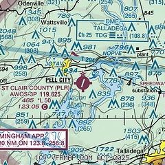
| Sectional chart |
|---|
|
| Airport distance calculator |
|---|
|
|
| Sunrise and sunset |
|---|
|
Times for 18-May-2026
| | Local
(UTC-5) | | Zulu
(UTC) |
|---|
| Morning civil twilight | | 05:16 | | 10:16 |
| Sunrise | | 05:43 | | 10:43 |
| Sunset | | 19:39 | | 00:39 |
| Evening civil twilight | | 20:07 | | 01:07 |
|
| Current date and time |
|---|
| Zulu (UTC) | 18-May-2026 13:18:20 |
|---|
| Local (UTC-5) | 18-May-2026 08:18:20 |
|---|
|
| METAR |
|---|
| KPLR | 181255Z AUTO 00000KT 10SM CLR 23/20 A3021 RMK A01
|
|
| NOTAMs |
|---|
NOTAMs are issued by the DoD/FAA and will open in a separate window not controlled by AirNav.
|
|

