FAA INFORMATION EFFECTIVE 11 JUNE 2026
Location
| FAA Identifier: | MOB |
| Lat/Long: | 30-41-29.1000N 088-14-34.2000W
30-41.485000N 088-14.570000W
30.6914167,-88.2428333
(estimated) |
| Elevation: | 218.7 ft. / 66.7 m (surveyed) |
| Variation: | 03W (2025) |
| From city: | 11 miles W of MOBILE, AL |
| Time zone: | UTC -5 (UTC -6 during Standard Time) |
| Zip code: | 36608 |
Airport Operations
| Airport use: | Open to the public |
| Activation date: | 04/1942 |
| Control tower: | yes |
| ARTCC: | HOUSTON CENTER |
| FSS: | ANNISTON FLIGHT SERVICE STATION |
| NOTAMs facility: | MOB (NOTAM-D service available) |
| Attendance: | CONTINUOUS |
| Pattern altitude: | 1018.7 ft. MSL
TPA: HEL/SNGL SRS CAT I 800 FT AGL, 1300 FT AGL FIXED WING ACFT, OVHD 1800 FT AGL. |
| Wind indicator: | lighted |
| Segmented circle: | yes |
| Lights: | WHEN ATCT CLSD ACTVT MALSR RWYS 15 & 33 - CTAF. PAPI RWYS 15 & 33 OPR CONSLY. HIRL RWY 15/33 PRESET STEP 3 OR HYR, BASED ON WX CONDS. |
| Beacon: | white-green (lighted land airport)
Operates sunset to sunrise. |
| Landing fee: | yes, LNDG FEE FOR NON-SKED COML ACFT OVR 65000 LBS. |
| Fire and rescue: | ARFF index B |
| International operations: | customs landing rights airport |
Airport Communications
| CTAF: | 118.3 |
| UNICOM: | 122.95 |
| ATIS: | 124.75 257.85 |
| WX ASOS: | 124.75 (251-206-0328) |
| MOBILE GROUND: | 121.9 348.6 [0600-2300] |
| MOBILE TOWER: | 118.3 239.0 [0600-2300] |
| MOBILE APPROACH: | 118.5 ;320-139 121.0 ;140-319 269.3 ;320-139 307.1 ;140-319 [0600-2300] |
| MOBILE DEPARTURE: | 118.5 ;320-139 121.0 ;140-319 269.3 ;320-139 307.1 ;140-319 [0600-2300] |
| CLEARANCE DELIVERY: | 119.85 |
| CG OPS: | 3123X ;MOBILE AIR 5696X ;MOBILE AIR 8984X ;MOBILE AIR |
| CLASS C: | 118.5 ;320-139 121.0 ;140-319 269.3 ;320-139 307.1 ;140-319 |
| EMERG: | 121.5 243.0 |
| IC: | 118.5 ;320-139 269.3 ;320-139 |
| WX ASOS at BFM (10 nm SE): | PHONE 251-431-6762 |
- APCH/DEP SVC PRVDD BY HOUSTON ARTCC (ZHU) ON FREQS 127.65/285.475 (MOBILE RCAG) WHEN MOBILE APCH CTL (MOB) CLSD.
Nearby radio navigation aids
| VOR radial/distance | | VOR name | | Freq | | Var |
|---|
| SJIr104/6.4 | | SEMMES VORTAC | | 115.30 | | 05E |
| BFMr292/10.8 | | BROOKLEY VORTAC | | 116.35 | | 04E |
| NDB name | | Hdg/Dist | | Freq | | Var | | ID |
|---|
| WISLE | | 144/5.2 | | 248 | | 01W | | MOB | -- --- -... |
Airport Services
| Fuel available: | 100LL JET-A JET-A+ |
| Parking: | hangars and tiedowns |
| Airframe service: | MAJOR |
| Powerplant service: | MAJOR |
| Bottled oxygen: | LOW |
| Bulk oxygen: | LOW |
Runway Information
Runway 15/33
| Dimensions: | 8502 x 150 ft. / 2591 x 46 m |
| Surface: | asphalt/grooved, in good condition |
| Weight bearing capacity: | | PCN 55 /F/D/W/U | | Single wheel: | 75.0 | | Double wheel: | 162.0 | | Double tandem: | 270.0 | | Dual double tandem: | 550.0 |
|
| Runway edge lights: | high intensity |
| RUNWAY 15 | | RUNWAY 33 |
| Latitude: | 30-42.137328N | | 30-40.999750N |
| Longitude: | 088-15.239153W | | 088-14.289955W |
| Elevation: | 212.9 ft. | | 213.2 ft. |
| Traffic pattern: | left | | left |
| Runway heading: | 147 magnetic, 144 true | | 327 magnetic, 324 true |
| Markings: | precision, in good condition | | precision, in good condition |
| Visual slope indicator: | 4-light PAPI on left (3.00 degrees glide path) | | 4-light PAPI on left (3.00 degrees glide path) |
| RVR equipment: | touchdown | | touchdown |
| Approach lights: | MALSR: 1,400 foot medium intensity approach lighting system with runway alignment indicator lights | | MALSR: 1,400 foot medium intensity approach lighting system with runway alignment indicator lights |
| Touchdown point: | yes, no lights | | yes, no lights |
| Instrument approach: | ILS | | ILS |
Runway 18/36
| Dimensions: | 4376 x 150 ft. / 1334 x 46 m |
| Surface: | asphalt/grooved, in good condition |
| Weight bearing capacity: | | PCN 14 /F/D/W/U | | Single wheel: | 47.0 | | Double wheel: | 60.0 | | Double tandem: | 96.0 |
|
| Runway edge lights: | medium intensity |
| Operational restrictions: | RWY 18/36 NOT AVBL FOR PART 121/PART 380 OPS WITH SKED PAX CARRYING OPS MORE THAN 9 PAX SEATS AND NON-SKED PAX CARRYING OPS MORE THAN 30 PAX SEATS. CLSD 2200-0700 EXCP FOR EMERG OPNS. |
| RUNWAY 18 | | RUNWAY 36 |
| Latitude: | 30-41.684442N | | 30-40.962622N |
| Longitude: | 088-14.191078W | | 088-14.190870W |
| Elevation: | 216.4 ft. | | 211.9 ft. |
| Traffic pattern: | left | | left |
| Runway heading: | 183 magnetic, 180 true | | 003 magnetic, 360 true |
| Markings: | nonprecision, in good condition | | nonprecision, in good condition |
| Touchdown point: | yes, no lights | | yes, no lights |
| Obstructions: | 32 ft. tree, 850 ft. from runway, 50 ft. right of centerline, 25:1 slope to clear | | 62 ft. trees, 1760 ft. from runway, 200 ft. left of centerline, 25:1 slope to clear |
Helipad H1
| Dimensions: | 100 x 100 ft. / 30 x 30 m |
| Surface: | asphalt, in good condition |
| Latitude: | 30-41.034667N | | |
| Longitude: | 088-14.890333W | | |
| Elevation: | 214.0 ft. | | |
| Traffic pattern: | left | | left |
Helipad H2
| Dimensions: | 60 x 40 ft. / 18 x 12 m |
| Surface: | asphalt |
| Latitude: | 30-42.240167N | | |
| Longitude: | 088-15.165667W | | |
| Elevation: | 208.0 ft. | | |
| Traffic pattern: | left | | left |
Helipad H3
| Dimensions: | 60 x 60 ft. / 18 x 18 m |
| Surface: | concrete |
| Operational restrictions: | MIL USE ONLY HELIPAD LCTD AT USCG APRON. |
| Latitude: | 30-41.583167N | | |
| Longitude: | 088-14.589667W | | |
| Elevation: | 215.0 ft. | | |
| Traffic pattern: | left | | left |
Airport Ownership and Management from official FAA records
| Ownership: | Publicly-owned |
| Owner: | MOBILE AIRPORT AUTHORITY
P O BOX 88004
MOBILE, AL 36608-0004
Phone 251-633-4510 |
| Manager: | ANDY WILSON
P O BOX 88004
MOBILE, AL 36608-0004
Phone 251-633-4510 |
Additional Remarks
| - | RVR UNAVBL WHEN ATCT CLSD. |
| - | COAST GUARD; W APRON , E APRON. |
| - | CONDS NOT MNTD WHEN ATCT CLSD. |
| - | FOR CD IF UNA TO CTC ON FSS FREQ, CTC HOUSTON ARTCC AT 281-230-5622. |
| - | MOB TWY C BTN TWY A AND TWY C3 CLSD TO ACFT WINGSPAN MORE THAN 78FT |
Instrument Procedures
NOTE: All procedures below are presented as PDF files. If you need a reader for these files, you should download the free Adobe Reader.NOT FOR NAVIGATION. Please procure official charts for flight.
FAA instrument procedures published for use from 11 June 2026 at 0901Z to 09 July 2026 at 0900z.
IAPs - Instrument Approach Procedures |
|---|
| ILS OR LOC RWY 15 | |
download (267KB) |
| ILS OR LOC RWY 33 | |
download (278KB) |
| ILS RWY 15 (SA CAT I - II) | |
download (265KB) |
| RNAV (GPS) RWY 15 | |
download (229KB) |
| RNAV (GPS) RWY 18 | |
download (223KB) |
| RNAV (GPS) RWY 33 | |
download (252KB) |
| RNAV (GPS) RWY 36 | |
download (233KB) |
| VOR OR TACAN-A | |
download (199KB) |
| Radar Approach Procedures available | |
download (161KB) |
| NOTE: Special Alternate Minimums apply | |
download |
| NOTE: Special Take-Off Minimums/Departure Procedures apply | |
download |
Other nearby airports with instrument procedures:
KBFM - Mobile International Airport (10 nm SE)
2R5 - St Elmo Airport (11 nm S)
KPQL - Trent Lott International Airport (20 nm SW)
KCQF - H L Sonny Callahan Airport (23 nm SE)
1R8 - Bay Minette Municipal Airport (24 nm NE)
|
|

Road maps at:
MapQuest
Bing
Google
| Aerial photo |
|---|
WARNING: Photo may not be current or correct

Do you have a better or more recent aerial photo of Mobile Regional Airport that you would like to share? If so, please send us your photo.
|
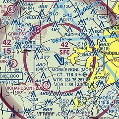
| Sectional chart |
|---|
|
 Download PDF
of official airport diagram from the FAA
| Airport distance calculator |
|---|
|
|
| Sunrise and sunset |
|---|
|
Times for 14-Jun-2026
| | Local
(UTC-5) | | Zulu
(UTC) |
|---|
| Morning civil twilight | | 05:23 | | 10:23 |
| Sunrise | | 05:51 | | 10:51 |
| Sunset | | 19:56 | | 00:56 |
| Evening civil twilight | | 20:23 | | 01:23 |
|
| Current date and time |
|---|
| Zulu (UTC) | 15-Jun-2026 00:14:01 |
|---|
| Local (UTC-5) | 14-Jun-2026 19:14:01 |
|---|
|
| METAR |
|---|
| KMOB | 142356Z 21010KT 10SM FEW023 FEW034 FEW200 31/24 A2996 RMK AO2 SLP143 T03060239 10344 20306 57002
|
KBFM
10nm SE | 142353Z VRB05KT 10SM CLR 31/25 A2997 RMK AO2 SLP147 T03110250 10350 20311 56003
|
|
| TAF |
|---|
| KMOB | 141729Z 1418/1518 25007KT P6SM SCT035 SCT100 FM150100 22004KT P6SM FEW040 SCT250 FM151200 29006KT 5SM -SHRA BKN020 PROB30 1513/1518 1SM TSRA BKN015CB
|
KBFM
10nm SE | 141729Z 1418/1518 21007KT P6SM SCT030 SCT100 FM150100 VRB03KT P6SM FEW040 SCT250 FM151200 29006KT 5SM -SHRA BKN020 PROB30 1513/1518 1SM TSRA BKN015CB
|
|
| NOTAMs |
|---|
NOTAMs are issued by the DoD/FAA and will open in a separate window not controlled by AirNav.
|
|


