FAA INFORMATION EFFECTIVE 27 NOVEMBER 2025
Location
| FAA Identifier: | Y37 |
| Lat/Long: | 48-23-38.7000N 097-46-50.7720W
48-23.645000N 097-46.846200W
48.3940833,-97.7807700
(estimated) |
| Elevation: | 1104.1 ft. / 336.5 m (surveyed) |
| Variation: | 07E (1985) |
| From city: | 1 mile W of PARK RIVER, ND |
| Time zone: | UTC -6 (UTC -5 during Daylight Saving Time) |
| Zip code: | 58270 |
Airport Operations
| Airport use: | Open to the public |
| Activation date: | 12/1959 |
| Control tower: | no |
| ARTCC: | MINNEAPOLIS CENTER |
| FSS: | GRAND FORKS FLIGHT SERVICE STATION |
| NOTAMs facility: | GFK (NOTAM-D service available) |
| Attendance: | ON CALL
FOR SERVICE AFTER HOURS CALL 701-331-0818. |
| Wind indicator: | lighted |
| Segmented circle: | yes |
| Lights: | ACTVT PAPI RWYS 13 & 31; MIRL RWY 13/31 - CTAF. |
| Beacon: | white-green (lighted land airport)
Operates sunset to sunrise. |
Airport Communications
| CTAF/UNICOM: | 122.8 |
| WX AWOS-3 at GAF (16 nm E): | 118.625 (701-352-0581) |
Nearby radio navigation aids
| VOR radial/distance | | VOR name | | Freq | | Var |
|---|
| GFKr309/35.5 | | GRAND FORKS VOR/DME | | 114.30 | | 09E |
Airport Services
| Fuel available: | 100LL JET-A |
| Parking: | hangars and tiedowns |
| Airframe service: | NONE |
| Powerplant service: | NONE |
| Bottled oxygen: | NONE |
| Bulk oxygen: | NONE |
Runway Information
Runway 13/31
| Dimensions: | 3100 x 60 ft. / 945 x 18 m |
| Surface: | asphalt, in good condition |
| Weight bearing capacity: | |
| Runway edge lights: | medium intensity |
| RUNWAY 13 | | RUNWAY 31 |
| Latitude: | 48-23.787177N | | 48-23.434075N |
| Longitude: | 097-47.123903W | | 097-46.571620W |
| Elevation: | 1104.1 ft. | | 1086.6 ft. |
| Traffic pattern: | left | | left |
| Runway heading: | 127 magnetic, 134 true | | 307 magnetic, 314 true |
| Markings: | nonprecision, in good condition | | nonprecision, in good condition |
| Visual slope indicator: | 2-light PAPI on left (3.00 degrees glide path) | | 2-light PAPI on left (3.00 degrees glide path) |
| Touchdown point: | yes, no lights | | yes, no lights |
| Obstructions: | 103 ft. trees, 2100 ft. from runway, 100 ft. both sides of centerline, 18:1 slope to clear | | none |
Runway 4/22
| Dimensions: | 2499 x 100 ft. / 762 x 30 m |
| Surface: | turf, in good condition |
| RUNWAY 4 | | RUNWAY 22 |
| Latitude: | 48-23.536040N | | 48-23.839223N |
| Longitude: | 097-47.052513W | | 097-46.636055W |
| Elevation: | 1103.1 ft. | | 1087.0 ft. |
| Traffic pattern: | left | | left |
| Runway heading: | 035 magnetic, 042 true | | 215 magnetic, 222 true |
| Touchdown point: | yes, no lights | | yes, no lights |
Airport Ownership and Management from official FAA records
| Ownership: | Publicly-owned |
| Owner: | PARK RIVER AIRPORT AUTH
P.O. BOX 611
PARK RIVER, ND 58270
Phone 701-331-0818 |
| Manager: | JAYSE WHARAM
P.O. BOX 611
PARK RIVER, ND 58270
Phone 701-331-0818 |
Additional Remarks
| A52-22 | ALSO +23 FT PLINE 580 FT FROM THR ON CNTRLN APCH RATIO 25:1. |
| - | DEER & BIRDS ON & INVOF ARPT. |
| - | RWY 04/22 CLSD WINTER MONTHS DUE TO LACK OF SNOW REMOVAL. |
| - | CFM WINTER CONDS AFT MAJOR STORM CALL 701-331-0818. |
| - | FOR CD CTC MINNEAPOLIS ARTCC AT 651-463-5588. |
Instrument Procedures
There are no published instrument procedures at Y37.
Some nearby airports with instrument procedures:
KGAF - Hutson Field Airport (16 nm E)
2C8 - Cavalier Municipal Airport (24 nm N)
KRDR - Grand Forks Air Force Base (30 nm SE)
5L0 - Lakota Municipal Airport (31 nm SW)
D55 - Robertson Field Airport (33 nm NW)
|
|

Road maps at:
MapQuest
Bing
Google
| Aerial photo |
|---|
WARNING: Photo may not be current or correct

Do you have a better or more recent aerial photo of Park River Airport-W C Skjerven Field that you would like to share? If so, please send us your photo.
|
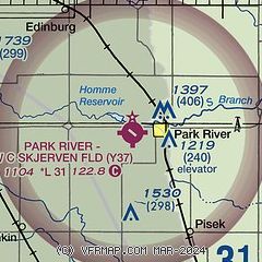
| Sectional chart |
|---|
|
| Airport distance calculator |
|---|
|
|
| Sunrise and sunset |
|---|
|
Times for 04-Dec-2025
| | Local
(UTC-6) | | Zulu
(UTC) |
|---|
| Morning civil twilight | | 07:30 | | 13:30 |
| Sunrise | | 08:06 | | 14:06 |
| Sunset | | 16:37 | | 22:37 |
| Evening civil twilight | | 17:13 | | 23:13 |
|
| Current date and time |
|---|
| Zulu (UTC) | 04-Dec-2025 07:21:21 |
|---|
| Local (UTC-6) | 04-Dec-2025 01:21:21 |
|---|
|
| METAR |
|---|
KGAF
16nm E | 040655Z AUTO 21007KT 10SM CLR M21/M23 A3029 RMK AO2 PWINO
|
K2C8
24nm N | 040635Z AUTO 20005KT 10SM CLR M21/M22 A3025 RMK AO2
|
KRDR
30nm SE | 040655Z AUTO 24005KT 10SM CLR M20/M23 A3027 RMK AO2 SLP286 T11981230 $
|
KD55
32nm NW | 040655Z AUTO 21009KT 10SM FEW048 M21/M21 A3015 RMK AO2
|
|
| TAF |
|---|
KRDR
30nm SE | 040200Z 0402/0508 VRB06KT 9999 SKC QNH3013INS BECMG 0411/0412 19009KT 9999 BKN020 QNH2999INS BECMG 0414/0415 18015G25KT 8000 -SN BLSN OVC020 620201 QNH2991INS BECMG 0416/0417 19015G25KT 9999 NSW OVC020 620201 QNH2970INS BECMG 0421/0422 22010G20KT 9999 OVC020 620205 QNH2968INS BECMG 0502/0503 VRB06KT 9999 OVC020 620203 QNH2968INS TXM07/0422Z TNM22/0409Z
|
KGFK
36nm SE | 040520Z 0406/0506 21006KT P6SM SCT200 FM040900 19009KT P6SM SCT200 FM041400 19015G25KT P6SM BKN060 FM042200 21012KT P6SM BKN025 FM050100 29008KT P6SM OVC018
|
|
| NOTAMs |
|---|
NOTAMs are issued by the DoD/FAA and will open in a separate window not controlled by AirNav.
|
|

