FAA INFORMATION EFFECTIVE 17 APRIL 2025
Location
| FAA Identifier: | CMI |
| Lat/Long: | 40-02-18.8190N 088-16-35.5410W
40-02.313650N 088-16.592350W
40.0385608,-88.2765392
(estimated) |
| Elevation: | 754.9 ft. / 230.1 m (surveyed) |
| Variation: | 03W (2015) |
| From city: | 5 miles SW of central business district of the associated city |
| Time zone: | UTC -5 (UTC -6 during Standard Time) |
| Zip code: | 61874 |
Airport Operations
| Airport use: | Open to the public |
| Activation date: | 05/1945 |
| Control tower: | yes |
| ARTCC: | CHICAGO CENTER |
| FSS: | SAINT LOUIS FLIGHT SERVICE STATION |
| NOTAMs facility: | CMI (NOTAM-D service available) |
| Attendance: | CONTINUOUS |
| Pattern altitude: | 1504.9 ft. MSL |
| Wind indicator: | lighted |
| Segmented circle: | no |
| Lights: | WHEN ATCT CLSD ACTVT MALSR RWY 32R; PAPI RWY 14L/32R; MIRL RWY 04/22; HIRL RWY 14L/32R - CTAF. HIRL RWY 14L/32R PRESET TO LOW INTST; INCR INTST - CTAF. |
| Beacon: | white-green (lighted land airport)
Operates sunset to sunrise. |
| Fire and rescue: | ARFF index B |
| International operations: | 2 HR PPR - 217-729-7607. |
Airport Communications
| CTAF: | 120.4 |
| UNICOM: | 122.95 |
| ATIS: | 124.85 |
| WX ASOS: | PHONE 217-355-4072 |
| CHAMPAIGN GROUND: | 121.8 [0600-2300] |
| CHAMPAIGN TOWER: | 120.4 229.4 127.825 [0600-2300] |
| CHAMPAIGN APPROACH: | 121.35 ;319-138 132.85 ;139-318 285.65 ;319-138 290.225 ;139-318 [0600-2300] |
| CHICAGO ARTCC APPROACH: | 133.975 |
| CHAMPAIGN DEPARTURE: | 121.35 ;319-138 132.85 ;139-318 285.65 ;319-138 290.225 ;139-318 [0600-2300] |
| CHICAGO ARTCC DEPARTURE: | 133.975 |
| CLEARANCE DELIVERY: | 128.75 |
| CLASS C: | 121.35 ;319-138 132.85 ;139-318 285.65 ;319-138 290.225 ;139-318 |
| EMERG: | 121.5 243.0 |
| IC: | 121.35 ;319-138 132.85 ;139-318 285.65 ;319-138 290.225 ;139-318 |
| WX AWOS-3 at TIP (16 nm N): | 119.025 (217-892-4999) |
- APCH/DEP SVC PRVDD BY CHICAGO ARTCC ON REMOTED CHAMPAIGN APCH CTL FREQS 121.35 & 353.95 (DANVILLE RCAG) WHEN CHAMPAIGN APCH CTL CLSD.
- PRACTICE.
Nearby radio navigation aids
| VOR radial/distance | | VOR name | | Freq | | Var |
|---|
| CMI at field | | CHAMPAIGN VORTAC | | 115.75 | | 03E |
| AXCr053/32.2 | | ADDERS VORTAC | | 117.20 | | 03E |
| RBSr187/33.0 | | ROBERTS VOR/DME | | 116.80 | | 02E |
| NDB name | | Hdg/Dist | | Freq | | Var | | ID |
|---|
| VEALS | | 318/6.1 | | 407 | | 03W | | CM | -.-. -- |
Airport Services
| Fuel available: | 100LL JET-A1+ |
| Parking: | tiedowns |
| Airframe service: | MAJOR |
| Powerplant service: | MAJOR |
| Bottled oxygen: | NONE |
| Bulk oxygen: | HIGH |
Runway Information
Runway 14L/32R
| Dimensions: | 8101 x 150 ft. / 2469 x 46 m |
| Surface: | asphalt/concrete/grooved, in fair condition |
| Weight bearing capacity: | | Single wheel: | 120.0 | | Double wheel: | 403.0 | | Double tandem: | 250.0 | | Dual double tandem: | 900.0 |
|
| Runway edge lights: | high intensity |
| RUNWAY 14L | | RUNWAY 32R |
| Latitude: | 40-02.841682N | | 40-01.888240N |
| Longitude: | 088-17.143775W | | 088-15.929385W |
| Elevation: | 754.9 ft. | | 749.4 ft. |
| Traffic pattern: | left | | left |
| Runway heading: | 139 magnetic, 136 true | | 319 magnetic, 316 true |
| Declared distances: | TORA:8101 TODA:8101 ASDA:8101 LDA:8101 | | TORA:8101 TODA:8101 ASDA:8101 LDA:8101 |
| Markings: | precision, in fair condition | | precision, in fair condition |
| Visual slope indicator: | 4-light PAPI on left (3.00 degrees glide path) | | 4-light PAPI on left (3.00 degrees glide path) |
| RVR equipment: | touchdown, rollout | | touchdown, rollout |
| Approach lights: | | | MALSR: 1,400 foot medium intensity approach lighting system with runway alignment indicator lights |
| Runway end identifier lights: | | | no |
| Touchdown point: | yes, no lights | | yes, no lights |
| Instrument approach: | | | ILS/DME |
Runway 4/22
| Dimensions: | 6502 x 150 ft. / 1982 x 46 m |
| Surface: | asphalt/grooved, in excellent condition |
| Weight bearing capacity: | | Single wheel: | 120.0 | | Double wheel: | 259.0 | | Double tandem: | 193.0 | | Dual double tandem: | 714.0 |
|
| Runway edge lights: | medium intensity |
| RUNWAY 4 | | RUNWAY 22 |
| Latitude: | 40-01.909440N | | 40-02.716727N |
| Longitude: | 088-17.124297W | | 088-16.209060W |
| Elevation: | 751.1 ft. | | 746.4 ft. |
| Traffic pattern: | left | | left |
| Runway heading: | 044 magnetic, 041 true | | 224 magnetic, 221 true |
| Declared distances: | TORA:6502 TODA:6502 ASDA:6502 LDA:6502 | | TORA:6502 TODA:6502 ASDA:6502 LDA:6502 |
| Markings: | nonprecision, in good condition | | nonprecision, in good condition |
| Touchdown point: | yes, no lights | | yes, no lights |
| Obstructions: | none | | 53 ft. tree, 1687 ft. from runway, 279 ft. left of centerline, 28:1 slope to clear |
Runway 14R/32L
| Dimensions: | 3816 x 75 ft. / 1163 x 23 m |
| Surface: | asphalt, in good condition |
| Weight bearing capacity: | | Single wheel: | 37.0 | | Double tandem: | 53.0 |
|
| Runway edge lights: | medium intensity |
| Operational restrictions: | CLSD 2300-0600 & TO ACFT ABV 12500 LB. NOT AVBL FOR SKED ACR OPS MORE THAN 9 PAX SEATS OR UNSKED ACR OPS MORE THAN 31 PAX SEATS. |
| RUNWAY 14R | | RUNWAY 32L |
| Latitude: | 40-02.430212N | | 40-01.980963N |
| Longitude: | 088-16.870113W | | 088-16.298320W |
| Elevation: | 750.1 ft. | | 743.1 ft. |
| Traffic pattern: | left | | left |
| Runway heading: | 139 magnetic, 136 true | | 319 magnetic, 316 true |
| Declared distances: | TORA:3816 TODA:3816 ASDA:3816 LDA:3816 | | TORA:3816 TODA:3816 ASDA:3816 LDA:3816 |
| Markings: | basic, in fair condition | | basic, in fair condition |
| Visual slope indicator: | 4-light PAPI on left (3.00 degrees glide path) | | 4-light PAPI on left (3.00 degrees glide path) |
| Touchdown point: | yes, no lights | | yes, no lights |
Airport Ownership and Management from official FAA records
| Ownership: | Publicly-owned |
| Owner: | UNIV OF ILLINOIS
11 AIRPORT ROAD
SAVOY, IL 61874
Phone 217-244-8604 |
| Manager: | TIMOTHY BANNON
11 AIRPORT RD
SAVOY, IL 61874
Phone 217-244-8604 |
Additional Remarks
| A39-14R/32L | PCR VALUE: 140/F/D/X/T |
| A39-14L/32R | PCR VALUE: 900/R/D/W/T |
| A39-04/22 | PCR VALUE: 600/F/D/X/T |
| A30A-32R | RWY 32R CALM WIND RWY WHEN ATCT CLSD. |
| - | TSNT PRKG ON SE GA APN. |
| - | OPS HR H24; ATNDD CONSLY. |
| - | BIRDS ON & INVOF ARPT. |
| - | TWY E & D SW OF RWY 14L/32R CLSD TO ACFT ABV 11800 LB. |
| - | TWY A2 & A3 ADJ TO ACR APN NOT VSB FM ATCT. |
| - | RWY 22 & 32R ENDS NOT VSB FM EACH OTR. |
| - | FOR CD IF UNA TO CTC ON FSS FREQ, CTC CHICAGO ARTCC AT 630-906-8921. |
Instrument Procedures
NOTE: All procedures below are presented as PDF files. If you need a reader for these files, you should download the free Adobe Reader.NOT FOR NAVIGATION. Please procure official charts for flight.
FAA instrument procedures published for use from 17 April 2025 at 0901Z to 15 May 2025 at 0900z.
IAPs - Instrument Approach Procedures |
|---|
| ILS OR LOC RWY 32R | |
download (272KB) |
| RNAV (GPS) RWY 04 | |
download (254KB) |
| RNAV (GPS) RWY 14L | |
download (264KB) |
| RNAV (GPS) RWY 22 | |
download (226KB) |
| RNAV (GPS) RWY 32R | |
download (296KB) |
| VOR RWY 04 | |
download (191KB) |
| VOR RWY 22 | |
download (255KB) |
| Radar Approach Procedures available | |
download (151KB) |
| NOTE: Special Alternate Minimums apply | |
download (162KB) |
| NOTE: Special Take-Off Minimums/Departure Procedures apply | |
download (484KB) |
Other nearby airports with instrument procedures:
C16 - Frasca Field Airport (7 nm NE)
KTIP - Rantoul National Aviation Center Airport-Frank Elliott Field (16 nm N)
1C1 - Paxton Airport (26 nm N)
KDEC - Decatur Airport (30 nm SW)
KDNV - Vermilion Regional Airport (33 nm E)
|
|

Road maps at:
MapQuest
Bing
Google
| Aerial photo |
|---|
WARNING: Photo may not be current or correct
 Photo taken 29-Apr-2007
from FL360
Photo taken 29-Apr-2007
from FL360
Do you have a better or more recent aerial photo of University of Illinois/Willard Airport that you would like to share? If so, please send us your photo.
|
| Sectional chart |
|---|
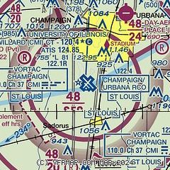
|
CAUTION: Diagram may not be current
 Download PDF
of official airport diagram from the FAA
| Airport distance calculator |
|---|
|
|
| Sunrise and sunset |
|---|
|
Times for 20-Apr-2025
| | Local
(UTC-5) | | Zulu
(UTC) |
|---|
| Morning civil twilight | | 05:40 | | 10:40 |
| Sunrise | | 06:09 | | 11:09 |
| Sunset | | 19:35 | | 00:35 |
| Evening civil twilight | | 20:04 | | 01:04 |
|
| Current date and time |
|---|
| Zulu (UTC) | 20-Apr-2025 14:10:57 |
|---|
| Local (UTC-5) | 20-Apr-2025 09:10:57 |
|---|
|
| METAR |
|---|
| KCMI | 201353Z 10015G23KT 10SM BKN041 BKN060 12/08 A3022 RMK AO2 SLP235 T01220083 $
|
KTIP
17nm N | 201355Z AUTO 10011KT 10SM BKN050 OVC060 11/06 A3024 RMK AO2 LTG DSNT W T01110061
|
|
| TAF |
|---|
| KCMI | 201120Z 2012/2112 08010G21KT P6SM VCSH FEW045 OVC070 FM201600 11015G23KT P6SM BKN070 FM210200 14016G23KT P6SM SCT040 OVC080 WS020/18050KT FM210400 15016G23KT 6SM -SHRA SCT040 OVC080 WS020/18050KT PROB30 2104/2106 4SM TSRA BKN025CB FM210600 20018G25KT P6SM OVC026
|
|
| NOTAMs |
|---|
NOTAMs are issued by the DoD/FAA and will open in a separate window not controlled by AirNav.
|
|


