FAA INFORMATION EFFECTIVE 22 JANUARY 2026
Location
| FAA Identifier: | S95 |
| Lat/Long: | 46-02-48.9810N 118-25-01.8400W
46-02.816350N 118-25.030667W
46.0469392,-118.4171778
(estimated) |
| Elevation: | 750 ft. / 229 m (estimated) |
| Variation: | 19E (1985) |
| From city: | 1 mile W of COLLEGE PLACE, WA |
| Time zone: | UTC -8 (UTC -7 during Daylight Saving Time) |
| Zip code: | 99324 |
Airport Operations
| Airport use: | Open to the public |
| Activation date: | 07/1942 |
| Control tower: | no |
| ARTCC: | SEATTLE CENTER |
| FSS: | SEATTLE FLIGHT SERVICE STATION |
| NOTAMs facility: | SEA (NOTAM-D service available) |
| Attendance: | MON-FRI 0800-1700
CALL IN ADVN (509) 386-0000. |
| Wind indicator: | yes |
| Segmented circle: | no |
| Lights: | ACTVT NSTD LIRL RY 05/23 AND VASI RYS 05 AND 23 - CTAF |
| Landing fee: | no, OVERNIGHT PARKING FEE OF $3.00. |
Airport Communications
| CTAF/UNICOM: | 122.8 |
| WX ASOS at ALW (6 nm NE): | 135.875 (509-525-3014) |
Nearby radio navigation aids
| VOR radial/distance | | VOR name | | Freq | | Var |
|---|
| ALWr231/5.7 | | WALLA WALLA VOR/DME | | 116.40 | | 14E |
| PDTr032/30.2 | | PENDLETON VORTAC | | 114.70 | | 14E |
| PSCr100/32.0 | | PASCO VOR/DME | | 113.75 | | 15E |
| NDB name | | Hdg/Dist | | Freq | | Var | | ID |
|---|
| TRINA | | 216/12.0 | | 353 | | 14E | | AL | .- .-.. |
Airport Services
| Fuel available: | 100LL
100LL:24 HR SELF SERVICE CREDIT CARD FUELING FACILITY. |
| Parking: | tiedowns |
| Airframe service: | MINOR |
| Powerplant service: | MINOR |
| Bottled oxygen: | NONE |
Runway Information
Runway 5/23
| Dimensions: | 3819 x 60 ft. / 1164 x 18 m |
| Surface: | asphalt, in poor condition
2/3 OF THE RWY HAS WDSPR, OPN, UNSEALED CRACKS & JOINTS, HI LVL OF RAVELING & ALLIGATOR CRACKING. |
| Weight bearing capacity: | |
| Runway edge lights: | non-standard
RY 05/23 NSTD LIRL; SW 1240 FT MED INTST. |
| RUNWAY 5 | | RUNWAY 23 |
| Latitude: | 46-02.684733N | | 46-02.947950N |
| Longitude: | 118-25.440333W | | 118-24.620950W |
| Elevation: | 750.0 ft. | | 740.0 ft. |
| Traffic pattern: | left | | left |
| Runway heading: | 046 magnetic, 065 true | | 226 magnetic, 245 true |
| Markings: | basic, in fair condition | | basic, in fair condition |
| Visual slope indicator: | 2-box VASI on left | | 2-box VASI on right |
| Runway end identifier lights: | no | | no |
| Obstructions: | none | | 15 ft. road, 200 ft. from runway
ROAD 170 FT, ROAD 50 FT R 0, FENCE & MAIL BOX +3 FT; SIDEWALK AND FENCE 32 FT R OF CNTRLN. |
Airport Ownership and Management from official FAA records
| Ownership: | Privately-owned |
| Owner: | MARTIN AIRPORT LLC
5 W. ALDER SUITE 400
WALLA WALLA, WA 99362
Phone 509-386-0000 |
| Manager: | TARRAGON NW LLC
5 W. ALDER SUITE 400
WALLA WALLA, WA 99362
Phone 509-386-0000 |
Additional Remarks
| - | PRIVATE ROAD CROSSES 700 FT FROM SW END OF RWY. |
| - | GLIDERS AND OTHER AIRCRAFT PERFORM OPERATIONS ON TURF BETWEEN RWY 05/23 AND TAXIWAY. |
| - | FOR CD CTC SPOKANE APCH AT 509-742-2525, WHEN APCH CLSD CTC SEATTLE ARTCC AT 253-351-3694. |
Instrument Procedures
There are no published instrument procedures at S95.
Some nearby airports with instrument procedures:
KALW - Walla Walla Regional Airport (6 nm NE)
KPDT - Eastern Oregon Regional Airport at Pendleton (28 nm SW)
KPSC - Tri-Cities Airport (32 nm NW)
KHRI - Hermiston Municipal Airport (38 nm W)
KRLD - Richland Airport (40 nm NW)
|
|

Road maps at:
MapQuest
Bing
Google
| Aerial photo |
|---|
WARNING: Photo may not be current or correct
 Photo by Domenick Venezia, 2005-07-16
Do you have a better or more recent aerial photo of Martin Field Airport that you would like to share? If so, please send us your photo.
|
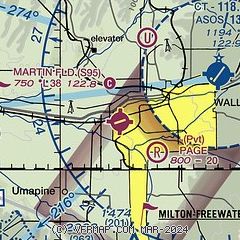
| Sectional chart |
|---|
|
| Airport distance calculator |
|---|
|
|
| Sunrise and sunset |
|---|
|
Times for 06-Feb-2026
| | Local
(UTC-8) | | Zulu
(UTC) |
|---|
| Morning civil twilight | | 06:39 | | 14:39 |
| Sunrise | | 07:11 | | 15:11 |
| Sunset | | 17:05 | | 01:05 |
| Evening civil twilight | | 17:37 | | 01:37 |
|
| Current date and time |
|---|
| Zulu (UTC) | 06-Feb-2026 23:03:05 |
|---|
| Local (UTC-8) | 06-Feb-2026 15:03:05 |
|---|
|
| METAR |
|---|
KALW
6nm NE | 062253Z 18004KT 10SM OVC017 06/03 A3017 RMK AO2 SLP224 T00610028
|
|
| TAF |
|---|
KALW
6nm NE | 061732Z 0618/0718 22004KT P6SM OVC015 FM062300 VRB03KT P6SM OVC200 FM070500 VRB03KT 5SM BR OVC035 FM071600 VRB02KT P6SM OVC150
|
|
| NOTAMs |
|---|
NOTAMs are issued by the DoD/FAA and will open in a separate window not controlled by AirNav.
|
|

