FAA INFORMATION EFFECTIVE 14 MAY 2026
Location
| FAA Identifier: | SQI |
| Lat/Long: | 41-44-34.2000N 089-40-34.6000W
41-44.570000N 089-40.576667W
41.7428333,-89.6762778
(estimated) |
| Elevation: | 647.6 ft. / 197.4 m (surveyed) |
| Variation: | 02W (2020) |
| From city: | 2 miles S of central business district of the associated city |
| Time zone: | UTC -5 (UTC -6 during Standard Time) |
| Zip code: | 61071 |
Airport Operations
| Airport use: | Open to the public |
| Activation date: | 03/1948 |
| Control tower: | no |
| ARTCC: | CHICAGO CENTER |
| FSS: | KANKAKEE FLIGHT SERVICE STATION |
| NOTAMs facility: | SQI (NOTAM-D service available) |
| Attendance: | 0800-1700
ARPT UNATNDD NEW YEARS; XMAS & THANKSGIVING. |
| Wind indicator: | lighted |
| Segmented circle: | yes |
| Lights: | MIRL RY 18/36 PRESET ON LOW INTST; TO INCR INTST & ACTVT HIRL RY 07/25; MALSR RY 25 & REIL RYS 07, 18 & 36 - CTAF. |
| Beacon: | white-green (lighted land airport)
Operates sunset to sunrise. |
Airport Communications
| CTAF/UNICOM: | 123.0 |
| WX AWOS-3PT: | 119.175 (815-626-2704) |
| ROCKFORD APPROACH: | 126.0 |
| ROCKFORD DEPARTURE: | 126.0 |
| CLEARANCE DELIVERY: | 128.0 |
| WX AWOS-AV at C73 (12 nm NE): | 118.575 (815-288-2039) |
Nearby radio navigation aids
| VOR radial/distance | | VOR name | | Freq | | Var |
|---|
| CVAr083/36.2 | | DAVENPORT VORTAC | | 113.80 | | 04E |
Airport Services
| Fuel available: | 100LL JET-A
100LL:100LL AND JET A FUEL DISPENSER IS SELF SERVE WITH CREDIT CARD. |
| Parking: | hangars and tiedowns |
| Airframe service: | MAJOR |
| Powerplant service: | MAJOR |
Runway Information
Runway 7/25
| Dimensions: | 6499 x 150 ft. / 1981 x 46 m |
| Surface: | asphalt/porous friction courses, in fair condition |
| Weight bearing capacity: | | Single wheel: | 50.0 | | Double wheel: | 60.0 | | Double tandem: | 90.0 |
|
| Runway edge lights: | high intensity |
| RUNWAY 7 | | RUNWAY 25 |
| Latitude: | 41-44.350508N | | 41-44.713893N |
| Longitude: | 089-41.082825W | | 089-39.739070W |
| Elevation: | 647.6 ft. | | 647.2 ft. |
| Traffic pattern: | left | | left |
| Runway heading: | 072 magnetic, 070 true | | 252 magnetic, 250 true |
| Markings: | nonprecision, in fair condition | | precision, in fair condition |
| Visual slope indicator: | 4-light PAPI on left (3.00 degrees glide path) | | |
| Approach lights: | | | MALSR: 1,400 foot medium intensity approach lighting system with runway alignment indicator lights |
| Runway end identifier lights: | yes | | no |
| Touchdown point: | yes, no lights | | yes, no lights |
| Instrument approach: | | | ILS/DME |
Runway 18/36
| Dimensions: | 3900 x 100 ft. / 1189 x 30 m |
| Surface: | asphalt/grooved, in good condition |
| Weight bearing capacity: | |
| Runway edge lights: | medium intensity |
| RUNWAY 18 | | RUNWAY 36 |
| Latitude: | 41-44.955200N | | 41-44.313042N |
| Longitude: | 089-40.853847W | | 089-40.855815W |
| Elevation: | 642.0 ft. | | 644.1 ft. |
| Traffic pattern: | left | | left |
| Runway heading: | 182 magnetic, 180 true | | 002 magnetic, 000 true |
| Markings: | basic, in good condition | | basic, in good condition |
| Runway end identifier lights: | yes | | yes |
| Touchdown point: | yes, no lights | | yes, no lights |
Airport Ownership and Management from official FAA records
| Ownership: | Publicly-owned |
| Owner: | WHITESIDE COUNTY
WHITESIDE COUNTY COURTHOUSE, 200 EAST KNOX STREET
MORRISON, IL 61270
Phone (815) 213-7939 |
| Manager: | DARIN HEFFELFINGER
10950 HOOVER RD
ROCKFALLS, IL 61071
Phone (815) 213-7939 |
Additional Remarks
| - | RY 07 PREFERRED CALM WIND RY. |
| - | TERMINAL BLDG CAN BE ACCESSED AFTER HOURS BY CIPHER LOCK WHICH HAS APPLICABLE INSTRUCTIONS |
| - | OXY SVC UNAVBL. |
| - | FOR CD CTC CHICAGO ARTCC AT 630-906-8921. |
Instrument Procedures
NOTE: All procedures below are presented as PDF files. If you need a reader for these files, you should download the free Adobe Reader.NOT FOR NAVIGATION. Please procure official charts for flight.
FAA instrument procedures published for use from 14 May 2026 at 0901Z to 11 June 2026 at 0900Z.
IAPs - Instrument Approach Procedures |
|---|
| ILS OR LOC RWY 25 | |
download (243KB) |
| RNAV (GPS) RWY 07 | |
download (205KB) |
| RNAV (GPS) RWY 25 | |
download (234KB) |
| LOC BC RWY 07 | |
download (241KB) |
| NOTE: Special Alternate Minimums apply | |
download (162KB) |
| NOTE: Special Take-Off Minimums/Departure Procedures apply | |
download (478KB) |
Other nearby airports with instrument procedures:
C73 - Dixon Municipal Airport-Charles R. Walgreen Field (12 nm NE)
KSFY - Tri-Township Airport (26 nm NW)
KRPJ - Rochelle Municipal Airport/Koritz Field (28 nm E)
KCWI - Clinton Municipal Airport (30 nm W)
KFEP - Albertus Airport (30 nm N)
|
|

Road maps at:
MapQuest
Bing
Google
| Aerial photo |
|---|
WARNING: Photo may not be current or correct
 Photo courtesy of AirNav, LLC
Photo taken 09-Nov-2013
looking north.
Photo courtesy of AirNav, LLC
Photo taken 09-Nov-2013
looking north.
Do you have a better or more recent aerial photo of Whiteside County Airport/Jos H Bittorf Field that you would like to share? If so, please send us your photo.
|
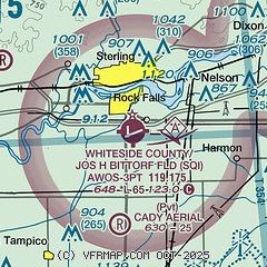
| Sectional chart |
|---|
|
| Airport distance calculator |
|---|
|
|
| Sunrise and sunset |
|---|
|
Times for 16-May-2026
| | Local
(UTC-5) | | Zulu
(UTC) |
|---|
| Morning civil twilight | | 05:07 | | 10:07 |
| Sunrise | | 05:39 | | 10:39 |
| Sunset | | 20:11 | | 01:11 |
| Evening civil twilight | | 20:43 | | 01:43 |
|
| Current date and time |
|---|
| Zulu (UTC) | 16-May-2026 07:01:14 |
|---|
| Local (UTC-5) | 16-May-2026 02:01:14 |
|---|
|
| METAR |
|---|
| KSQI | 160656Z AUTO 35009KT 10SM CLR 21/16 A2980 RMK AO2 SLP086 T02060161 $
|
|
| TAF |
|---|
KRFD
38nm NE | 160540Z 1606/1706 19008KT 5SM -SHRA VCTS SCT035 BKN060CB OVC200 TEMPO 1606/1608 28025G40KT 2SM TSRA BR BKN025CB FM161200 25011KT P6SM SCT045 SCT250 FM162000 20008KT P6SM BKN045 FM170000 08006KT P6SM SCT045 BKN060 PROB30 1703/1706 3SM -TSRA SCT020 BKN040CB
|
KMLI
42nm SW | 160530Z 1606/1706 21012KT P6SM BKN100 TEMPO 1609/1611 VRB15G30KT 4SM -TSRA BKN035CB FM161200 VRB04KT 4SM BR SCT150 FM161500 25005KT P6SM SCT250 FM162100 14010KT P6SM BKN150 TEMPO 1700/1703 4SM -TSRA BKN045CB
|
|
| NOTAMs |
|---|
NOTAMs are issued by the DoD/FAA and will open in a separate window not controlled by AirNav.
|
|


