FAA INFORMATION EFFECTIVE 23 JANUARY 2025
Location
| FAA Identifier: | OGD |
| Lat/Long: | 41-11-42.2533N 112-00-43.9010W
41-11.704222N 112-00.731683W
41.1950704,-112.0121947
(estimated) |
| Elevation: | 4472.5 ft. / 1363.2 m (surveyed) |
| Variation: | 11E (2020) |
| From city: | 3 miles SW of OGDEN, UT |
| Time zone: | UTC -7 (UTC -6 during Daylight Saving Time) |
| Zip code: | 84067 |
Airport Operations
| Airport use: | Open to the public |
| Activation date: | 12/1941 |
| Control tower: | yes |
| ARTCC: | SALT LAKE CITY CENTER |
| FSS: | CEDAR CITY FLIGHT SERVICE STATION |
| NOTAMs facility: | OGD (NOTAM-D service available) |
| Attendance: | CONTINUOUS
ARPT SFC COND UNMON 2000-0700L EXC ACR. |
| Pattern altitude: | TPA 5200 MSL REQD DUE TO INTERFACING TFC FM HILL AFB. |
| Wind indicator: | lighted |
| Segmented circle: | yes |
| Lights: | WHEN ATCT CLSD ACTVT MALS RWY 03; REIL RWY 17 & 35; PAPI RWY 03 & 21, 17 & 35; HIRL RWY 03/21; MIRL RWY 17/35; TWY LGTS - CTAF. |
| Beacon: | white-green (lighted land airport)
Operates sunset to sunrise. |
| Landing fee: | yes, GTR THAN 12500 LB. |
| Fire and rescue: | ARFF index B |
| Airline operations: | CLSD TO OPS GTR THAN 30 PAX SEATS EXC 6 HR MNM PPR - AMGR. |
Airport Communications
| CTAF: | 118.7 |
| UNICOM: | 122.95 |
| ATIS: | 125.55 |
| WX ASOS: | PHONE 801-622-5600 |
| OGDEN GROUND: | 121.7 [0700-2000] |
| OGDEN TOWER: | 118.7 253.5 [0700-2000] |
| SALT LAKE CITY APPROACH: | 121.1 |
| SALT LAKE CITY DEPARTURE: | 121.1 |
Nearby radio navigation aids
| VOR radial/distance | | VOR name | | Freq | | Var |
|---|
| OGDr100/4.3 | | OGDEN VORTAC | | 115.70 | | 14E |
| TCHr340/20.7 | | WASATCH VORTAC | | 116.80 | | 16E |
| LHOr166/35.9 | | BRIGHAM CITY VOR/DME | | 112.90 | | 14E |
Airport Services
| Fuel available: | 100 100LL JET-A1+ J
J:JP4 |
| Parking: | hangars and tiedowns |
| Airframe service: | MAJOR |
| Powerplant service: | MAJOR |
| Bulk oxygen: | HIGH/LOW |
Runway Information
Runway 3/21
| Dimensions: | 8107 x 150 ft. / 2471 x 46 m |
| Surface: | asphalt/grooved, in excellent condition |
| Weight bearing capacity: | | Single wheel: | 120.0 | | Double wheel: | 203.0 | | Double tandem: | 344.0, ST 152 |
|
| Runway edge lights: | high intensity |
| RUNWAY 3 | | RUNWAY 21 |
| Latitude: | 41-11.281573N | | 41-12.228047N |
| Longitude: | 112-01.249218W | | 112-00.003480W |
| Elevation: | 4472.5 ft. | | 4409.0 ft. |
| Traffic pattern: | left | | right |
| Runway heading: | 033 magnetic, 044 true | | 213 magnetic, 224 true |
| Displaced threshold: | no | | 854 ft. |
| Declared distances: | TORA:8103 TODA:8103 ASDA:7252 LDA:7252 | | TORA:8103 TODA:8103 ASDA:8103 LDA:7252 |
| Markings: | precision, in good condition | | nonprecision, in good condition |
| Visual slope indicator: | 4-light PAPI on left (3.00 degrees glide path) | | 4-light PAPI on left (3.00 degrees glide path) |
| Approach lights: | MALS: 1,400 foot medium intensity approach lighting system | | |
| Touchdown point: | yes, no lights | | yes, no lights |
| Instrument approach: | ILS/DME | | |
| Obstructions: | 54 ft. trees, 2425 ft. from runway, 305 ft. left of centerline, 44:1 slope to clear | | 24 ft. pole, 1017 ft. from runway, 161 ft. left of centerline, 34:1 slope to clear
17 FT ROAD 350 FT FM THR. |
Runway 17/35
| Dimensions: | 5195 x 100 ft. / 1583 x 30 m |
| Surface: | asphalt/grooved, in good condition |
| Weight bearing capacity: | | PCN 63 /F/A/X/T | | Single wheel: | 80.0 | | Double wheel: | 140.0 |
|
| Runway edge lights: | medium intensity |
| RUNWAY 17 | | RUNWAY 35 |
| Latitude: | 41-12.052905N | | 41-11.197652N |
| Longitude: | 112-00.898067W | | 112-00.894055W |
| Elevation: | 4436.4 ft. | | 4457.4 ft. |
| Traffic pattern: | right | | left |
| Runway heading: | 168 magnetic, 179 true | | 348 magnetic, 359 true |
| Declared distances: | TORA:5195 TODA:5195 ASDA:5195 LDA:5195 | | TORA:5195 TODA:5195 ASDA:5195 LDA:5195 |
| Markings: | basic, in good condition | | basic, in good condition |
| Visual slope indicator: | 4-light PAPI on left (3.00 degrees glide path) | | 4-light PAPI on left (3.00 degrees glide path) |
| Runway end identifier lights: | yes | | yes |
| Touchdown point: | yes, no lights | | yes, no lights |
| Obstructions: | 3 ft. road, 210 ft. from runway, 125 ft. right of centerline, 3:1 slope to clear | | 50 ft. sign, 1200 ft. from runway, 200 ft. right of centerline, 20:1 slope to clear |
Airport Ownership and Management from official FAA records
| Ownership: | Publicly-owned |
| Owner: | OGDEN CITY CORPORATION
2549 WASHINGTON BLVD
OGDEN, UT 84401
Phone 801-629-8223 |
| Manager: | ADAM NELSON
3909 AIRPORT ROAD
ODGEN, UT 84405
Phone 801-629-8223 |
Additional Remarks
| A39-03/21 | PCR VALUE: 500/F/B/X/T |
| - | MULT & PRAC APCH NA. FSL 2200-0700. |
| - | PAJA NE PTN OF ARPT E OF TWY A. |
| - | SNOW REMOVAL NA WHEN ATCT CLSD . |
| - | MIL OPS 5700-6300 FT MSL OVR ARPT ENRT TO HILL AFB. |
| - | FOR CD WHEN ATCT IS CLSD CTC SLC APCH AT 801-325-9670. |
Instrument Procedures
NOTE: All procedures below are presented as PDF files. If you need a reader for these files, you should download the free Adobe Reader.NOT FOR NAVIGATION. Please procure official charts for flight.
FAA instrument procedures published for use from 23 January 2025 at 0901Z to 20 February 2025 at 0900z.
STARs - Standard Terminal Arrivals |
|---|
| WLKRR ONE (RNAV) | |
download (190KB) |
IAPs - Instrument Approach Procedures |
|---|
| ILS OR LOC RWY 03 | |
download (363KB) |
| RNAV (GPS) RWY 03 | |
download (341KB) |
| VOR-A | |
download (330KB) |
| NOTE: Special Alternate Minimums apply | |
download (135KB) |
|
|---|
| EMONT THREE (OBSTACLE) | |
download (288KB) |
| NOTE: Special Take-Off Minimums/Departure Procedures apply | |
download (379KB) |
Other nearby airports with instrument procedures:
KHIF - Hill Air Force Base (5 nm SE)
KBMC - Brigham City Regional Airport (22 nm N)
KSLC - Salt Lake City International Airport (24 nm S)
U42 - South Valley Regional Airport (35 nm S)
KLGU - Logan-Cache Airport (37 nm N)
|
|

Road maps at:
MapQuest
Bing
Google
| Aerial photo |
|---|
WARNING: Photo may not be current or correct

Do you have a better or more recent aerial photo of Ogden-Hinckley Airport that you would like to share? If so, please send us your photo.
|
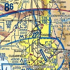
| Sectional chart |
|---|
|
CAUTION: Diagram may not be current
 Download PDF
of official airport diagram from the FAA
| Airport distance calculator |
|---|
|
|
| Sunrise and sunset |
|---|
|
Times for 05-Feb-2025
| | Local
(UTC-7) | | Zulu
(UTC) |
|---|
| Morning civil twilight | | 07:07 | | 14:07 |
| Sunrise | | 07:36 | | 14:36 |
| Sunset | | 17:48 | | 00:48 |
| Evening civil twilight | | 18:17 | | 01:17 |
|
| Current date and time |
|---|
| Zulu (UTC) | 05-Feb-2025 09:40:31 |
|---|
| Local (UTC-7) | 05-Feb-2025 02:40:31 |
|---|
|
| METAR |
|---|
| KOGD | 050853Z AUTO 17020G29KT 10SM CLR 14/M02 A2963 RMK AO2 PK WND 17031/0839 SLP991 T01391022 56009
|
KHIF
5nm SE | 050855Z AUTO 18025G34KT 10SM CLR 12/M03 A2966 RMK AO2 PK WND 18034/44 SLP005 T01211033 57008 $
|
|
| TAF |
|---|
| KOGD | 050528Z 0506/0606 17015G24KT P6SM SCT060 BKN100 FM050900 18018G32KT P6SM VCSH SCT060 BKN100 FM051500 30011G20KT P6SM -RA BKN060
|
KHIF
5nm SE | 050640Z 0506/0612 17015G25KT 9999 BKN090 BKN150 510009 QNH2965INS TEMPO 0507/0514 19025G35KT 520009 BECMG 0517/0518 29015G25KT 9999 -SHRA BKN050 OVC090 620505 510009 QNH2980INS BECMG 0523/0524 32009KT 9999 NSW SCT070 BKN180 QNH2990INS TX13/0506Z TN02/0606Z
|
|
| NOTAMs |
|---|
NOTAMs are issued by the DoD/FAA and will open in a separate window not controlled by AirNav.
|
|


