FAA INFORMATION EFFECTIVE 16 APRIL 2026
Location
| FAA Identifier: | 8D7 |
| Lat/Long: | 44-53-42.1140N 097-42-37.7250W
44-53.701900N 097-42.628750W
44.8950317,-97.7104792
(estimated) |
| Elevation: | 1793.2 ft. / 546.6 m (surveyed) |
| Variation: | 04E (2020) |
| From city: | 2 miles NE of CLARK, SD |
| Time zone: | UTC -5 (UTC -6 during Standard Time) |
| Zip code: | 57225 |
Airport Operations
| Airport use: | Open to the public |
| Activation date: | 09/1960 |
| Control tower: | no |
| ARTCC: | MINNEAPOLIS CENTER |
| FSS: | HURON FLIGHT SERVICE STATION |
| NOTAMs facility: | HON (NOTAM-D service available) |
| Attendance: | UNATNDD |
| Wind indicator: | lighted |
| Segmented circle: | no |
| Lights: | ACTVT PAPI RWY 13 & 31; MIRL RWY 13/31 - CTAF. |
| Beacon: | white-green (lighted land airport)
Operates sunset to sunrise. |
Airport Communications
- UNICOM UNMON.
- APCH/DEP SVC PRVDD BY MINNEAPOLIS ARTCC (ZMP) ON FREQS 128.5/306.2 (WATERTOWN RCAG).
Airport Services
| Fuel available: | 100LL JET-A
100LL:FUEL AVBL 24 HRS WITH CREDIT CARD. |
| Parking: | hangars and tiedowns |
| Airframe service: | MAJOR |
| Powerplant service: | MAJOR |
| Bottled oxygen: | NONE |
| Bulk oxygen: | NONE |
Runway Information
Runway 13/31
| Dimensions: | 3697 x 60 ft. / 1127 x 18 m |
| Surface: | asphalt, in excellent condition |
| Weight bearing capacity: | |
| Runway edge lights: | medium intensity |
| RUNWAY 13 | | RUNWAY 31 |
| Latitude: | 44-53.874380N | | 44-53.446447N |
| Longitude: | 097-42.937938W | | 097-42.329483W |
| Elevation: | 1793.2 ft. | | 1790.5 ft. |
| Traffic pattern: | left | | left |
| Runway heading: | 131 magnetic, 135 true | | 311 magnetic, 315 true |
| Markings: | nonprecision, in good condition | | nonprecision, in good condition |
| Visual slope indicator: | 2-light PAPI on left (3.00 degrees glide path) | | 2-light PAPI on left (3.00 degrees glide path) |
| Runway end identifier lights: | no | | no |
| Touchdown point: | yes, no lights | | yes, no lights |
| Obstructions: | 19 ft. road, 893 ft. from runway, 36:1 slope to clear | | none |
Runway 3/21
| Dimensions: | 1258 x 100 ft. / 383 x 30 m |
| Surface: | turf, in fair condition |
| Runway edge markings: | 03/21 MKD WITH YELLOW & BLACK SPLIT BARRELS. |
| RUNWAY 3 | | RUNWAY 21 |
| Latitude: | 44-53.750353N | | 44-53.897253N |
| Longitude: | 097-42.716880W | | 097-42.511588W |
| Elevation: | 1789.5 ft. | | 1788.8 ft. |
| Traffic pattern: | left | | left |
| Runway heading: | 041 magnetic, 045 true | | 221 magnetic, 225 true |
| Runway end identifier lights: | no | | no |
| Touchdown point: | yes, no lights | | yes, no lights |
| Obstructions: | 17 ft. road, 400 ft. from runway, 165 ft. right of centerline, 23:1 slope to clear | | 50 ft. trees, 1500 ft. from runway, 305 ft. right of centerline, 30:1 slope to clear |
Airport Ownership and Management from official FAA records
| Ownership: | Publicly-owned |
| Owner: | COUNTY OF CLARK
PO BOX 294
CLARK, SD 57225
Phone 605-532-3512 |
| Manager: | JED HANSEN
1531 425TH AVE. N.
CLARK, SD 57225
Phone 605-233-1411 |
Additional Remarks
| - | RY 21 HAS 3 FT FENCE 215 FT FM THLD. |
| - | WILDLIFE AROUND AND INVOF ARPT. |
| - | CAUTION: UNLIT TOWER 300 FEET HIGH, 10 NM W OF AIRPORT. |
| - | FOR CD CTC MINNEAPOLIS ARTCC AT 651-463-5588. |
Instrument Procedures
NOTE: All procedures below are presented as PDF files. If you need a reader for these files, you should download the free Adobe Reader.NOT FOR NAVIGATION. Please procure official charts for flight.
FAA instrument procedures published for use from 16 April 2026 at 0901Z to 14 May 2026 at 0900Z.
IAPs - Instrument Approach Procedures |
|---|
| RNAV (GPS) RWY 13 | |
download (189KB) |
| RNAV (GPS) RWY 31 | |
download (178KB) |
| NOTE: Special Take-Off Minimums/Departure Procedures apply | |
download (599KB) |
Other nearby airports with instrument procedures:
KATY - Watertown Regional Airport (24 nm E)
6E5 - Wilder Airport (28 nm S)
1D8 - Redfield Municipal Airport (35 nm W)
KHON - Huron Regional Airport (38 nm SW)
KABR - Aberdeen Regional Airport (45 nm NW)
|
|

Road maps at:
MapQuest
Bing
Google
| Aerial photo |
|---|
WARNING: Photo may not be current or correct
 Photo taken 30-May-2014
looking southeast.
Photo taken 30-May-2014
looking southeast.
Do you have a better or more recent aerial photo of Clark County Airport that you would like to share? If so, please send us your photo.
|
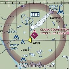
| Sectional chart |
|---|
|
| Airport distance calculator |
|---|
|
|
| Sunrise and sunset |
|---|
|
Times for 16-Apr-2026
| | Local
(UTC-5) | | Zulu
(UTC) |
|---|
| Morning civil twilight | | 06:15 | | 11:15 |
| Sunrise | | 06:45 | | 11:45 |
| Sunset | | 20:16 | | 01:16 |
| Evening civil twilight | | 20:47 | | 01:47 |
|
| Current date and time |
|---|
| Zulu (UTC) | 17-Apr-2026 00:04:33 |
|---|
| Local (UTC-5) | 16-Apr-2026 19:04:33 |
|---|
|
| TAF |
|---|
KATY
24nm E | 162210Z 1622/1718 22021G32KT P6SM FEW240 FM162300 21013G21KT P6SM FEW240 FM170300 15010G18KT P6SM SCT200 WS020/19040KT FM170800 03013G22KT P6SM SCT230 FM171000 36014G23KT P6SM BKN130 PROB30 1713/1714 6SM -SHRA OVC025 FM171400 34018G27KT P6SM OVC018 PROB30 1714/1718 6SM -SHRASN OVC008
|
|
| NOTAMs |
|---|
NOTAMs are issued by the DoD/FAA and will open in a separate window not controlled by AirNav.
|
|

