FAA INFORMATION EFFECTIVE 09 JULY 2026
Location
| FAA Identifier: | LGA |
| Lat/Long: | 40-46-38.0720N 073-52-21.3800W
40-46.634533N 073-52.356333W
40.7772422,-73.8726056
(estimated) |
| Elevation: | 20.7 ft. / 6.3 m (surveyed) |
| Variation: | 12W (1980) |
| From city: | 4 miles E of NEW YORK, NY |
| Time zone: | UTC -4 (UTC -5 during Standard Time) |
| Zip code: | 11371 |
Airport Operations
| Airport use: | Open to the public |
| Control tower: | yes |
| ARTCC: | NEW YORK CENTER |
| FSS: | NEW YORK FLIGHT SERVICE STATION |
| NOTAMs facility: | LGA (NOTAM-D service available) |
| Attendance: | CONTINUOUS |
| Wind indicator: | lighted |
| Segmented circle: | no |
| Beacon: | white-green (lighted land airport)
Operates sunset to sunrise. |
| Landing fee: | yes |
| Fire and rescue: | ARFF index D |
| International operations: | customs landing rights airport |
Airport Communications
| UNICOM: | 122.95 |
| WX ASOS: | PHONE 929-229-1994 |
| LAGUARDIA GROUND: | 121.7 322.35 121.85 127.675 |
| LAGUARDIA TOWER: | 118.7 322.35 |
| NEW YORK APPROACH: | 120.8 120.05 124.95 127.3 128.8 ;FINAL 132.7 |
| NEW YORK DEPARTURE: | 120.4 124.45 127.05 |
| CLEARANCE DELIVERY: | 121.875 ;HELICOPTER 135.2 |
| PRE-TAXI CLEARANCE: | 135.2 |
| APPLE STAR: | 124.55 127.3 119.75 |
| CLASS B: | 126.05 ;NORTH, FREQS WITHIN 6 NM ARE 126.05 ;SOUTH 322.35 ;FREQS WITHIN 6 NM ARE TWR CN 125.7 ;071-142 126.4 ;329-071 127.6 ;270-328 128.125 ;142-231 128.55 ;231-270 |
| CLASS B/S: | 120.55 ;329-071 |
| D-ATIS: | 125.95 ;ARR 127.05 ;DEP |
| EMERG: | 121.5 243.0 |
| GLDMN DP: | 120.4 |
| HOPEA DP: | 120.4 |
| JUTES DP: | 120.4 |
| LAGUARDIA DP: | 120.4 |
| MILTON STAR: | 127.3 |
| NOBBI STAR: | 120.8 |
| NTHNS DP: | 120.4 |
| PARK VISUAL RWY 31: | 120.8 |
| PROUD STAR: | 127.3 |
| RIVER VISUAL RWY 13: | 120.8 |
| TNNIS DP: | 120.4 |
| VADDR STAR: | 120.8 |
| WX AWOS-3PT at JRB (8 nm SW): | 128.175 (212-425-1534) |
| WX ASOS at JFK (9 nm SE): | PHONE 347-588-1609 |
| WX ASOS at TEB (10 nm NW): | PHONE 201-473-3130 |
| WX ASOS at EWR (14 nm W): | PHONE 862-381-4743 |
| WX ASOS at HPN (19 nm NE): | PHONE 914-288-0216 |
| WX AWOS-3 at LDJ (19 nm SW): | 124.025 (908-862-7383) |
| WX ASOS at CDW (19 nm W): | 135.5 (631-594-4523) |
- ASDE-X IN USE. OPERATE TRANSPONDERS WITH ALTITUDE REPORTING MODE AND ADS-B (IF EQUIPPED) ENABLED ON ALL AIRPORT SURFACES.
- (CLASS_B_AIRSPACE) EXPECT TO LEAVE AND RE-ENTER THE CLASS B AIRSPACE DURING MODERATE TO HEAVY ARRIVAL PERIODS.
Nearby radio navigation aids
| VOR radial/distance | | VOR name | | Freq | | Var |
|---|
| LGA at field | | LA GUARDIA VOR/DME | | 113.10 | | 12W |
| TEBr127/9.6 | | TETERBORO VOR/DME | | 108.40 | | 11W |
| JFKr344/9.8 | | KENNEDY VOR/DME | | 115.90 | | 12W |
| CRIr017/9.9 | | CANARSIE VOR/DME | | 112.30 | | 11W |
| DPKr280/25.9 | | DEER PARK VOR/DME | | 117.70 | | 12W |
| COLr036/30.9 | | COLTS NECK VOR/DME | | 115.40 | | 11W |
| CMKr216/32.9 | | CARMEL VOR/DME | | 116.60 | | 12W |
| SAXr131/34.8 | | SPARTA VORTAC | | 115.70 | | 11W |
Airport Services
| Fuel available: | 100LL JET-A |
| Parking: | tiedowns |
| Airframe service: | MAJOR |
| Powerplant service: | MAJOR |
| Bottled oxygen: | HIGH/LOW |
| Bulk oxygen: | HIGH/LOW |
Runway Information
Runway 4/22
| Dimensions: | 7002 x 150 ft. / 2134 x 46 m |
| Surface: | asphalt/concrete/grooved, in good condition |
| Weight bearing capacity: | | Single wheel: | 80.0 | | Double wheel: | 170.0 | | Double tandem: | 360.0 |
|
| Runway edge lights: | high intensity |
| RUNWAY 4 | | RUNWAY 22 |
| Latitude: | 40-46.149755N | | 40-47.126200N |
| Longitude: | 073-53.047142W | | 073-52.240402W |
| Elevation: | 20.5 ft. | | 11.5 ft. |
| Traffic pattern: | left | | left |
| Runway heading: | 044 magnetic, 032 true | | 224 magnetic, 212 true |
| Declared distances: | TORA:7002 TODA:7002 ASDA:7002 LDA:7002 | | TORA:7002 TODA:7002 ASDA:7002 LDA:7002 |
| Markings: | precision, in good condition | | precision, in good condition |
| Visual slope indicator: | 4-light PAPI on right (3.14 degrees glide path) | | 4-light PAPI on right (3.00 degrees glide path) |
| RVR equipment: | touchdown, rollout | | touchdown, rollout |
| Approach lights: | MALSR: 1,400 foot medium intensity approach lighting system with runway alignment indicator lights | | ALSF1: standard 2,400 foot high intensity approach lighting system with centerline sequenced flashers (category I) |
| Runway end identifier lights: | | | no |
| Centerline lights: | yes | | yes |
| Touchdown point: | yes, lighted | | yes, lighted |
| Instrument approach: | ILS/DME | | ILS/DME |
| Obstructions: | 80 ft. bldg, lighted, 2950 ft. from runway, 400 ft. right of centerline, 34:1 slope to clear
+11 FT FENCE 245 FT RIGHT OF RWY END. | | none |
Runway 13/31
| Dimensions: | 7002 x 150 ft. / 2134 x 46 m |
| Surface: | asphalt/concrete/grooved, in good condition |
| Weight bearing capacity: | | Single wheel: | 80.0 | | Double wheel: | 170.0 | | Double tandem: | 360.0 |
|
| Runway edge lights: | high intensity |
| RUNWAY 13 | | RUNWAY 31 |
| Latitude: | 40-46.937752N | | 40-46.324287N |
| Longitude: | 073-52.711150W | | 073-51.426695W |
| Elevation: | 11.6 ft. | | 6.5 ft. |
| Traffic pattern: | left | | left |
| Runway heading: | 134 magnetic, 122 true | | 314 magnetic, 302 true |
| Declared distances: | TORA:7002 TODA:7002 ASDA:7002 LDA:7002 | | TORA:7002 TODA:7002 ASDA:7002 LDA:7002 |
| Markings: | precision, in good condition | | precision, in good condition |
| Visual slope indicator: | 4-light PAPI on left (3.10 degrees glide path)
PAPI RWY 13 UNUSBL 8 DEGS LEFT OF CNTRLN AND 9 DEGS RIGHT OF CNTRLN. | | 4-light PAPI on right (3.00 degrees glide path) |
| RVR equipment: | touchdown, rollout | | touchdown, rollout |
| Approach lights: | MALSR: 1,400 foot medium intensity approach lighting system with runway alignment indicator lights | | |
| Runway end identifier lights: | no | | yes |
| Centerline lights: | yes | | yes |
| Touchdown point: | yes, lighted | | yes, no lights |
| Instrument approach: | ILS/DME | | LOC/DME |
| Obstructions: | none | | 95 ft. bldg, lighted, 2750 ft. from runway, 510 ft. right of centerline, 26:1 slope to clear |
Helipad H1
| Dimensions: | 45 x 45 ft. / 14 x 14 m |
| Surface: | asphalt, in excellent condition |
| Latitude: | 40-46.560563N | | |
| Longitude: | 073-52.857797W | | |
| Elevation: | 11.9 ft. | | |
| Traffic pattern: | left | | left |
Airport Ownership and Management from official FAA records
| Ownership: | Publicly-owned |
| Owner: | PORT. AUTH. OF N.Y. & N.J.
4 WORLD TRADE CENTER
NEW YORK, NY 10048
Phone 212-435-3703
LEASEE. PROPERTY OWNED BY THE CITY OF NEW YORK. |
| Manager: | ANTHONY VERO
HANGAR #7, THIRD FLOOR
FLUSHING, NY 11371
Phone 718-533-3401
PORT AUTHORITY OF NEW YORK AND NEW JERSEY. |
Additional Remarks
| A39-13/31 | PCR VALUE: 577/F/B/X/T |
| A39-04/22 | PCR VALUE: 530/F/A/X/T |
| E60-22 | ENGINEERED MATERIALS ARRESTING SYSTEM (EMAS) 272 FT IN LENGTH BY 170 FT IN WIDTH LCTD AT THE DER 22. |
| E60-13 | EMAS PARTIALLY DAMAGED RESULTING IN REDUCED ARRESTING CAPABILITY. ENGINEERED MATERIALS ARRESTING SYSTEM (EMAS) 327 FT IN LENGTH BY 170 FT IN WIDTH LCTD AT THE DER 13. |
| E60-31 | ENGINEERED MATERIALS ARRESTING SYSTEM (EMAS) 215 FT IN LENGTH BY 170 FT IN WIDTH LCTD AT THE DER 31. |
| E60-04 | ENGINEERED MATERIALS ARRESTING SYSTEM (EMAS) 215 FT IN LENGTH BY 170 FT IN WIDTH LCTD AT THE DER 04. |
| - | FLOCKS OF BIRDS ON & INVOF ARPT. |
| - | CODED TRANSPONDER RQRD. VFR RSVN INFO AVBL ON ATIS. |
| - | SHIP MASTS IN APCH RWY 31. |
| - | FOR NOISE ABATEMENT RSTRNS CALL 212-435-3782 DURG NML BUS HRS. |
| - | B767-400 ACFT RSTRD TO 10 KTS ON TWYS DD, Z, B & AA. |
| - | TWYS F & D WEST OF TWY BB CLSD TO ACFT WITH WINGSPANS IN EXCESS OF 125 FT. |
| - | OBST SIGN STRUCTURE UNKN (39 AGL) 500 FT E RWY 4/22 CNTRLN & 4800 FT S RWY 13/31 CNTRLN. |
| - | RUNWAY STATUS LIGHTS IN OPERATION. |
| - | SPECIAL AIR TFC RULES-PART 93; HIGH DENSITY ARPT; PRIOR RSVN RQRD; SEE AIM. |
| - | OVHD PAX BRIDGES ON N SIDE OF TERMINAL B PRVD 50 FT TAIL HGT CLNC WHEN ON TAXILANE CNTRLN. |
| - | RWY 13/31: NW 944 FT OF RWY IS A DECK OVR WTR; RWY FRICTION MAY BE DIFFERENT THAN RMNG PTN OF RWY DURG WINT WX. |
| - | RWY 04/22: NE 1776 FT OF RWY IS A DECK OVR WTR; RWY FRICTION MAY BE DIFFERENT THAN RMNG PTN OF RWY DURG WINT WX. |
| - | ACFT OPS & TWY WT RSTRNS EXIST FOR ADG-III & ADG-IV. PLEASE CTC LGA ARPT OPS AT 718-533-3700 FOR MORE INFO. |
| - | MAG ANOMALIES MAY AFFECT COMPASS HDG WHEN USING EXTENSION RWYS 13 & 22 FOR TKOF. |
| - | TWYS G, P, R & U CONCRETE DECK RSTD TO 5KT TURNS; 10KTS STRAIGHT. |
Instrument Procedures
NOTE: All procedures below are presented as PDF files. If you need a reader for these files, you should download the free Adobe Reader.NOT FOR NAVIGATION. Please procure official charts for flight.
FAA instrument procedures published for use from 09 July 2026 at 0901Z to 06 August 2026 at 0900Z.
STARs - Standard Terminal Arrivals |
|---|
| APPLE THREE (RNAV) **NEW** | |
2 pages:
[1] [2] (332KB) |
| MILTON FOUR **NEW** | |
download (251KB) |
| NOBBI ONE (RNAV) **NEW** | |
download (231KB) |
| PROUD TWO (RNAV) **NEW** | |
2 pages:
[1] [2] (388KB) |
| VADDR ONE (RNAV) **NEW** | |
2 pages:
[1] [2] (317KB) |
IAPs - Instrument Approach Procedures |
|---|
| ILS OR LOC RWY 04 **CHANGED** | |
download (354KB) |
| ILS OR LOC RWY 13 **CHANGED** | |
download (312KB) |
| ILS OR LOC RWY 22 **CHANGED** | |
download (262KB) |
| ILS RWY 22 (SA CAT I - II) **CHANGED** | |
download (262KB) |
| RNAV (RNP) Z RWY 22 **CHANGED** | |
download (204KB) |
| RNAV (GPS) X RWY 22 **CHANGED** | |
download (245KB) |
| RNAV (GPS) X RWY 31 **CHANGED** | |
download (266KB) |
| RNAV (GPS) Y RWY 04 **CHANGED** | |
download (334KB) |
| RNAV (GPS) Y RWY 13 **CHANGED** | |
download (233KB) |
| RNAV (GPS) Y RWY 22 **CHANGED** | |
download (210KB) |
| RNAV (GPS) Y RWY 31 **CHANGED** | |
download (269KB) |
| RNAV (GPS) Z RWY 13 **CHANGED** | |
download (195KB) |
| RNAV (GPS) Z RWY 31 **CHANGED** | |
download (255KB) |
| LOC RWY 31 **CHANGED** | |
download (240KB) |
| COPTER ILS OR LOC RWY 13 **CHANGED** | |
download (272KB) |
| COPTER ILS OR LOC RWY 22 **CHANGED** | |
download (243KB) |
| COPTER RNAV (GPS) 250 **CHANGED** | |
download (228KB) |
| PARK VISUAL RWY 31 **CHANGED** | |
download (258KB) |
| RIVER VISUAL RWY 13 **CHANGED** | |
download (171KB) |
| NOTE: Special Alternate Minimums apply | |
download (163KB) |
Departure Procedures |
|---|
| GLDMN EIGHT (RNAV) **CHANGED** | |
download (241KB) |
| HOPEA THREE (RNAV) **CHANGED** | |
download (206KB) |
| JUTES FOUR (RNAV) **CHANGED** | |
download (213KB) |
| JUTES FOUR (RNAV) **CHANGED** | |
download (213KB) |
| LAGUARDIA SEVEN **CHANGED** | |
2 pages:
[1] [2] (578KB) |
| LAGUARDIA SEVEN, CONT.2 | |
download (204KB) |
| NTHNS SIX (RNAV) **CHANGED** | |
download (215KB) |
| NTHNS SIX (RNAV) **CHANGED** | |
download (215KB) |
| TNNIS SIX (RNAV) **CHANGED** | |
2 pages:
[1] [2] (431KB) |
| NOTE: Special Take-Off Minimums/Departure Procedures apply | |
download (440KB) |
Other nearby airports with instrument procedures:
6N5 - East 34th Street Heliport (5 nm SW)
KJRA - West 30th St Heliport (6 nm W)
KJRB - Downtown Manhattan/Wall Street Heliport (8 nm SW)
KJFK - John F Kennedy International Airport (9 nm SE)
KTEB - Teterboro Airport (10 nm NW)
KEWR - Newark Liberty International Airport (14 nm W)
KHPN - Westchester County Airport (19 nm NE)
KLDJ - Linden Airport (19 nm SW)
KCDW - Essex County Airport (19 nm W)
|
|

Road maps at:
MapQuest
Bing
Google
| Aerial photo |
|---|
WARNING: Photo may not be current or correct
 Photo courtesy of New York Jet Charter Flights, jetcharterrewards.com/newyork.htm
Photo taken 03-Jun-2014
looking southwest.
Photo courtesy of New York Jet Charter Flights, jetcharterrewards.com/newyork.htm
Photo taken 03-Jun-2014
looking southwest.
Do you have a better or more recent aerial photo of LaGuardia Airport that you would like to share? If so, please send us your photo.
|
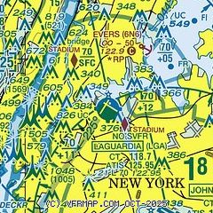
| Sectional chart |
|---|
|
 Download PDF
of official airport diagram from the FAA
| Airport distance calculator |
|---|
|
|
| Sunrise and sunset |
|---|
|
Times for 15-Jul-2026
| | Local
(UTC-4) | | Zulu
(UTC) |
|---|
| Morning civil twilight | | 05:06 | | 09:06 |
| Sunrise | | 05:38 | | 09:38 |
| Sunset | | 20:25 | | 00:25 |
| Evening civil twilight | | 20:57 | | 00:57 |
|
| Current date and time |
|---|
| Zulu (UTC) | 15-Jul-2026 19:20:17 |
|---|
| Local (UTC-4) | 15-Jul-2026 15:20:17 |
|---|
|
| METAR |
|---|
| KLGA | 151851Z 27011G23KT 9SM FEW200 BKN250 BKN300 36/21 A2978 RMK AO2 PK WND 27027/1838 SLP084 FU BKN300 T03610206 $
|
KNYC
4nm W | 151851Z AUTO 27007G16KT 230V310 6SM HZ CLR 34/22 A2982 RMK AO2 SLP088 T03440217 $
|
KJRB
8nm SW | 151856Z AUTO 27011G18KT 10SM CLR 36/21 A2980 RMK AO2 PK WND 28036/1806 SLP089 T03560211
|
KTEB
10nm NW | 151900Z 28016G25KT 7SM CLR 36/20 A2979 RMK AO2 WSHFT 1840 T03560200 $
|
KJFK
10nm SE | 151851Z 27020G30KT 10SM SCT250 BKN300 35/20 A2980 RMK AO2 PK WND 27030/1847 SLP089 FU BKN300 T03500200
|
KEWR
15nm SW | 151851Z 26018G31KT 9SM FEW190 SCT250 BKN300 36/21 A2979 RMK AO2 PK WND 27031/1843 SLP089 FU BKN300 T03610206 $
|
KHPN
19nm NE | 151856Z 31010G20KT 2 1/2SM HZ FU CLR 32/22 A2981 RMK AO2 SLP085 T03170217
|
KLDJ
19nm SW | 151855Z AUTO 30017G22KT 10SM CLR 36/20 A2981 RMK AO2 T03560196
|
KCDW
20nm W | 151853Z 30013G23KT 8SM CLR 36/21 A2981 RMK AO2 SLP097 T03560206
|
|
| TAF |
|---|
| KLGA | 151720Z 1518/1624 27014G22KT 5SM FU BKN250 FM152000 30016G25KT 5SM FU BKN250 TEMPO 1520/1524 3SM FU FM160000 33011KT 6SM FU BKN250 TEMPO 1600/1604 4SM FU FM160400 32006KT 6SM FU BKN250 FM161500 29011G22KT 5SM FU BKN250
|
KTEB
10nm NW | 151720Z 1518/1624 29012G19KT 5SM FU BKN250 FM152000 28015G24KT 5SM FU BKN250 TEMPO 1520/1524 3SM FU FM160000 32010KT 6SM FU BKN250 TEMPO 1600/1604 3SM FU FM160400 32005KT 6SM FU BKN250 FM161500 30010G20KT 5SM FU BKN250
|
KJFK
10nm SE | 151720Z 1518/1624 26015G23KT 6SM FU BKN250 TEMPO 1518/1520 5SM FU FM152000 28018G27KT 5SM FU BKN250 TEMPO 1520/1524 3SM FU FM160000 32013KT 6SM FU BKN250 TEMPO 1600/1604 4SM FU FM160400 30007KT 6SM FU BKN250 FM161500 28012G20KT 5SM FU BKN250
|
KEWR
15nm SW | 151720Z 1518/1624 27015G23KT 6SM FU BKN250 TEMPO 1518/1520 5SM FU FM152000 28017G27KT 5SM FU BKN250 TEMPO 1520/1524 3SM FU FM160000 32011KT 6SM FU BKN250 TEMPO 1600/1604 4SM FU FM160400 31006KT 6SM FU BKN250 FM161500 28011G21KT 5SM FU BKN250
|
KHPN
19nm NE | 151720Z 1518/1618 30012KT 3SM FU BKN250 FM151900 30015G25KT 3SM FU BKN250 TEMPO 1519/1523 2SM FU FM152300 32012G21KT 6SM FU BKN250 TEMPO 1523/1603 5SM FU FM160300 32006KT 6SM FU BKN250 FM161500 28009KT 5SM FU BKN250 AMD NOT SKED
|
|
| NOTAMs |
|---|
NOTAMs are issued by the DoD/FAA and will open in a separate window not controlled by AirNav.
|
|


