FAA INFORMATION EFFECTIVE 22 JANUARY 2026
Location
| FAA Identifier: | TDF |
| Lat/Long: | 36-17-04.6000N 078-59-04.7000W
36-17.076667N 078-59.078333W
36.2846111,-78.9846389
(estimated) |
| Elevation: | 608.9 ft. / 185.6 m (surveyed) |
| Variation: | 08W (2000) |
| From city: | 6 miles S of ROXBORO, NC |
| Time zone: | UTC -5 (UTC -4 during Daylight Saving Time) |
| Zip code: | 27583 |
Airport Operations
| Airport use: | Open to the public |
| Activation date: | 10/1987 |
| Control tower: | no |
| ARTCC: | WASHINGTON CENTER |
| FSS: | RALEIGH FLIGHT SERVICE STATION |
| NOTAMs facility: | TDF (NOTAM-D service available) |
| Attendance: | 0900-1700
ARPT UNATNDD THANKSGIVING & CHRISTMAS.
FOR SVC AFT HRS CALL 615-351-9845. |
| Wind indicator: | lighted |
| Segmented circle: | yes |
| Lights: | REIL RWY 24; MIRL RWY 06/24 OPR SS-SR; TO ACTVT OTR TIMES AND ACTVT MALSR RWY 06; PAPI RWY 06 & 24 - CTAF. |
| Beacon: | white-green (lighted land airport)
Operates sunset to sunrise. |
Airport Communications
| CTAF/UNICOM: | 122.7 |
| WX AWOS-3: | 126.725 (336-364-1651) |
| RALEIGH APPROACH: | 132.35 |
| RALEIGH DEPARTURE: | 132.35 |
Nearby radio navigation aids
| VOR radial/distance | | VOR name | | Freq | | Var |
|---|
| SBVr181/23.5 | | SOUTH BOSTON VORTAC | | 110.40 | | 05W |
| RDUr347/26.6 | | RALEIGH/DURHAM VORTAC | | 117.20 | | 09W |
| NDB name | | Hdg/Dist | | Freq | | Var | | ID |
|---|
| HUNTSBORO | | 276/17.7 | | 271 | | 09W | | HXO | .... -..- --- |
| SLAMMER | | 106/38.1 | | 423 | | 07W | | SIF | ... .. ..-. |
Airport Services
| Fuel available: | 100LL JET-A1+ |
| Parking: | tiedowns |
Runway Information
Runway 6/24
| Dimensions: | 6005 x 100 ft. / 1830 x 30 m |
| Surface: | asphalt, in excellent condition |
| Weight bearing capacity: | | Single wheel: | 45.0 | | Double wheel: | 68.0 |
|
| Runway edge lights: | medium intensity |
| RUNWAY 6 | | RUNWAY 24 |
| Latitude: | 36-16.772270N | | 36-17.380075N |
| Longitude: | 078-59.559902W | | 078-58.595158W |
| Elevation: | 590.4 ft. | | 604.4 ft. |
| Traffic pattern: | left | | left |
| Runway heading: | 060 magnetic, 052 true | | 240 magnetic, 232 true |
| Displaced threshold: | 303 ft. | | no |
| Markings: | precision, in good condition | | nonprecision, in good condition |
| Visual slope indicator: | 4-light PAPI on left (3.00 degrees glide path) | | 2-light PAPI on left (3.00 degrees glide path) |
| Approach lights: | MALSR: 1,400 foot medium intensity approach lighting system with runway alignment indicator lights | | |
| Runway end identifier lights: | no | | yes |
| Touchdown point: | yes, no lights | | yes, no lights |
| Instrument approach: | ILS/DME | | |
| Obstructions: | none | | 48 ft. trees, 2498 ft. from runway, 83 ft. right of centerline, 47:1 slope to clear |
Airport Ownership and Management from official FAA records
| Ownership: | Publicly-owned |
| Owner: | PERSON COUNTY
COUNTY BLDG, 304 S MORGAN ST
ROXBORO, NC 27573-5245
Phone 336-597-1735 |
| Manager: | BILL TOUGAS
385 MONTGOMERY DRIVE
TIMBERLAKE, NC 27583-5245
Phone 336-364-1111 |
Additional Remarks
| - | DEER & BIRDS ON & INVOF ARPT. |
| - | GCO AVBL ON FREQ 119.700 THRU RALEIGH APCH. |
| - | CONC HELIPAD, ADJ AND NE OF MAIN APRON, UNLGTD, VFR ONLY. |
| - | NO LINE OF SIGHT BTN RWY ENDS. |
| - | FOR CD IF UNA VIA GCO CTC RALEIGH APCH AT 919-380-3144. |
| - | (CONTACT TITLE) FAX: 336-364-2224. |
Instrument Procedures
NOTE: All procedures below are presented as PDF files. If you need a reader for these files, you should download the free Adobe Reader.NOT FOR NAVIGATION. Please procure official charts for flight.
FAA instrument procedures published for use from 22 January 2026 at 0901Z to 19 February 2026 at 0900z.
IAPs - Instrument Approach Procedures |
|---|
| ILS OR LOC RWY 06 | |
download (294KB) |
| RNAV (GPS) RWY 06 | |
download (242KB) |
| RNAV (GPS) RWY 24 | |
download (244KB) |
| NOTE: Special Alternate Minimums apply | |
download (143KB) |
| NOTE: Special Take-Off Minimums/Departure Procedures apply | |
download (391KB) |
Other nearby airports with instrument procedures:
KHNZ - Henderson/Oxford Airport (22 nm E)
KDAN - Danville Regional Airport (24 nm NW)
KRDU - Raleigh-Durham International Airport (26 nm S)
W78 - William M Tuck Airport (26 nm N)
KBUY - Burlington/Alamance Regional Airport (28 nm SW)
|
|

Road maps at:
MapQuest
Bing
Google
| Aerial photo |
|---|
WARNING: Photo may not be current or correct
 Photo by Brian Tesar
Photo taken 09-Apr-2017
looking northeast.
Photo by Brian Tesar
Photo taken 09-Apr-2017
looking northeast.
Do you have a better or more recent aerial photo of Raleigh Regional Airport at Person County that you would like to share? If so, please send us your photo.
|
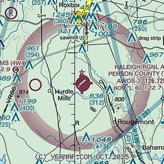
| Sectional chart |
|---|
|
| Airport distance calculator |
|---|
|
|
| Sunrise and sunset |
|---|
|
Times for 25-Jan-2026
| | Local
(UTC-5) | | Zulu
(UTC) |
|---|
| Morning civil twilight | | 06:56 | | 11:56 |
| Sunrise | | 07:23 | | 12:23 |
| Sunset | | 17:34 | | 22:34 |
| Evening civil twilight | | 18:01 | | 23:01 |
|
| Current date and time |
|---|
| Zulu (UTC) | 26-Jan-2026 00:04:46 |
|---|
| Local (UTC-5) | 25-Jan-2026 19:04:46 |
|---|
|
| METAR |
|---|
| KTDF | 252355Z AUTO 17004KT 7SM UP SCT005 BKN050 OVC100 M03/M03 A2985 RMK AO2 P0013
|
|
| TAF |
|---|
KDAN
24nm NW | 252130Z 2522/2618 VRB02KT 2SM FZRA BR SCT003 OVC007 TEMPO 2600/2601 1SM -FZRA BR BKN003 FM260400 VRB02KT 2SM BR SCT002 BKN015 FM260800 VRB03KT 6SM BR SCT018 BKN040
|
KRDU
27nm S | 252029Z 2520/2618 03008KT 1SM -FZDZ BR OVC004 WS018/23040KT FM252200 05007KT 1SM -FZRA OVC006 WS018/23040KT TEMPO 2522/2602 1/2SM FZRA OVC004 FM260400 30003KT 1/2SM FZDZ OVC003 WS018/23040KT FM261200 34005KT P6SM OVC015 FM261600 32010G18KT P6SM FEW030 BKN100
|
|
| NOTAMs |
|---|
NOTAMs are issued by the DoD/FAA and will open in a separate window not controlled by AirNav.
|
|


