FAA INFORMATION EFFECTIVE 23 JANUARY 2025
Location
| FAA Identifier: | ORD |
| Lat/Long: | 41-58-36.9850N 087-54-29.3390W
41-58.616417N 087-54.488983W
41.9769403,-87.9081497
(estimated) |
| Elevation: | 680 ft. / 207.3 m (surveyed) |
| Variation: | 03W (2010) |
| From city: | 14 miles NW of CHICAGO, IL |
| Time zone: | UTC -6 (UTC -5 during Daylight Saving Time) |
| Zip code: | 60018 |
Airport Operations
| Airport use: | Open to the public |
| Activation date: | 02/1944 |
| Control tower: | yes |
| ARTCC: | CHICAGO CENTER |
| FSS: | KANKAKEE FLIGHT SERVICE STATION |
| NOTAMs facility: | ORD (NOTAM-D service available) |
| Attendance: | CONTINUOUS |
| Wind indicator: | lighted |
| Segmented circle: | no |
| Beacon: | white-green (lighted land airport)
Operates sunset to sunrise. |
| Landing fee: | yes |
| Fire and rescue: | ARFF index E |
| International operations: | customs landing rights airport |
Airport Communications
| UNICOM: | 122.95 |
| WX ASOS: | PHONE 773-462-0118 |
| O HARE GROUND: | 118.05 ;TWR SOUTH 121.675 121.75 ;TWR CENTER OUTBOUND 121.9 ;TWR CENTER INBOUND 124.125 ;TWR NORTH 226.675 134.15 ;TWR CENTER |
| O HARE TOWER: | 120.75 ;RWY 04R/22L 120.75 ;RWY 10C/28C 121.15 ;RWY 09C/27C 126.9 ;RWY 09R/27L 126.9 ;RWY 22R 128.15 ;RWY 09L/27R 132.7 ;RWY 10L/28R 133.0 ;RWY 10R/28L 348.0 |
| CHICAGO APPROACH: | 119.0 ;360-179 133.625 ;180-359 124.35 125.7 ;180-359 |
| CHICAGO DEPARTURE: | 125.0 ;320-149 EAST/NORTH 126.625 ;150-219 SOUTH 126.625 ;220-319 WEST |
| CLEARANCE DELIVERY: | 121.6 121.6 119.25 |
| PRE-TAXI CLEARANCE: | 121.6 |
| ALCP: | 252.1 |
| CLASS B: | 120.55 ;NORTH 128.2 ;SOUTHEAST 133.5 ;SOUTH |
| D-ATIS: | 135.4 282.225 |
| EMERG: | 121.5 243.0 |
| IC: | 119.0 ;360-179 |
| METERING: | 121.675 |
| PRM: | 119.625 ;RWY 10C/28C 128.05 ;RWY 10R/28L |
| VFR ADZY: | 126.8 |
| WX ASOS at PWK (8 nm N): | PHONE 847-465-0291 |
| WX AWOS-3 at 06C (9 nm W): | 128.275 ((847) 895-2887) |
| WX ASOS at MDW (13 nm SE): | PHONE 773-884-4424 |
| WX ASOS at DPA (16 nm W): | PHONE 630-587-3668 |
- CLASS B FREQS 120.55/306.925 FOR VFR AIRCRAFT REQUESTING TRAFFIC ADVISORIES OR TO TRANSITION CLASS B NORTH OF OHARE.
- CLASS B FREQS 133.5/349.0 FOR VFR AIRCRAFT REQUESTING TRAFFIC ADVISORIES OR TO TRANSITION CLASS B SOUTH OF OHARE.
- ASR-7 (N) UNUSBL 166-193 8-50 NM.
- IF UNABLE TO CONTACT CHICAGO APCH/DEP CTL ON 133.1; CALL 312-686-0681 TO OBTAIN IFR CLNC.
- DUAL VHF COMMUNICATIONS REQUIRED FOR SIMULTANEOUS CLOSE PARALLEL ILS PRM APPROACHES. RY 10C MONITOR 119.625, RY 10R MONITOR 128.05.
- CLASS B FREQS 128.2/353.875 FOR VFR AIRCRAFT REQUESTING TRAFFIC ADVISORIES OR TO TRANSITION CLASS B SOUTHEAST OF OHARE.
- ASDE-X IN USE. OPERATE TRANSPONDERS WITH ALTITUDE REPORTING MODE AND ADS-B (IF EQUIPPED) ENABLED ON ALL AIRPORT SURFACES.
Nearby radio navigation aids
| VOR radial/distance | | VOR name | | Freq | | Var |
|---|
| OBKr174/14.8 | | NORTHBROOK VOR/DME | | 113.00 | | 02W |
| DPAr073/20.4 | | DUPAGE VOR/DME | | 108.40 | | 02E |
| JOTr033/31.7 | | JOLIET VOR/DME | | 112.30 | | 02E |
| CGTr330/31.8 | | CHICAGO HEIGHTS VORTAC | | 114.20 | | 02E |
Airport Services
| Fuel available: | 100LL JET-A |
| Airframe service: | MAJOR |
| Powerplant service: | MAJOR |
| Bottled oxygen: | HIGH |
| Bulk oxygen: | HIGH/LOW |
Runway Information
Runway 10L/28R
| Dimensions: | 13000 x 150 ft. / 3962 x 46 m |
| Surface: | asphalt/concrete/grooved, in good condition |
| Weight bearing capacity: | | Single wheel: | 100.0 | | Double wheel: | 185.0 | | Double tandem: | 350.0 |
|
| Runway edge lights: | high intensity |
| RUNWAY 10L | | RUNWAY 28R |
| Latitude: | 41-58.139693N | | 41-58.144215N |
| Longitude: | 087-55.891903W | | 087-53.023740W |
| Elevation: | 672.1 ft. | | 651.4 ft. |
| Traffic pattern: | left | | left |
| Runway heading: | 093 magnetic, 090 true | | 273 magnetic, 270 true |
| Declared distances: | TORA:13000 TODA:13000 ASDA:13000 LDA:12246 | | TORA:13000 TODA:13000 ASDA:13000 LDA:13000 |
| Markings: | precision, in good condition | | precision, in good condition |
| Visual slope indicator: | 4-light PAPI on left (3.00 degrees glide path) | | 4-light PAPI on left (3.00 degrees glide path) |
| RVR equipment: | touchdown, midfield, rollout | | touchdown, midfield, rollout |
| Approach lights: | ALSF2: standard 2,400 foot high intensity approach lighting system with centerline sequenced flashers (category II or III) | | ALSF2: standard 2,400 foot high intensity approach lighting system with centerline sequenced flashers (category II or III) |
| Runway end identifier lights: | no | | no |
| Centerline lights: | yes | | yes |
| Touchdown point: | yes, lighted | | yes, lighted |
| Instrument approach: | ILS/DME | | ILS/DME |
| Obstructions: | none | | 47 ft. trees, lighted, 2336 ft. from runway, 678 ft. right of centerline, 45:1 slope to clear |
Runway 9R/27L
| Dimensions: | 11260 x 150 ft. / 3432 x 46 m |
| Surface: | asphalt/concrete/grooved, in excellent condition |
| Weight bearing capacity: | | Single wheel: | 120.0 | | Double wheel: | 250.0 | | Double tandem: | 550.0 | | Dual double tandem: | 1120.0 |
|
| Runway edge lights: | high intensity |
| Operational restrictions: | TRIPLE DUAL TANDEM (3D) 768,000 LBS; DUAL TANDUM W/DUAL WHEEL (2D/D1) 632,755 LBS. |
| RUNWAY 9R | | RUNWAY 27L |
| Latitude: | 41-59.033620N | | 41-59.034020N |
| Longitude: | 087-55.894145W | | 087-53.409293W |
| Elevation: | 668.0 ft. | | 650.2 ft. |
| Traffic pattern: | left | | left |
| Runway heading: | 093 magnetic, 090 true | | 273 magnetic, 270 true |
| Declared distances: | TORA:11260 TODA:11260 ASDA:11260 LDA:11260 | | TORA:11260 TODA:11260 ASDA:11260 LDA:11260 |
| Markings: | precision, in good condition | | precision, in good condition |
| Visual slope indicator: | 4-light PAPI on left (3.00 degrees glide path) | | 4-light PAPI on right (3.00 degrees glide path)
PAPI UNUSBL BYD 8 DEGS RIGHT AND 9 DEGS LEFT OF CNTRLN. |
| RVR equipment: | touchdown, midfield, rollout | | touchdown, midfield, rollout |
| Approach lights: | ALSF2: standard 2,400 foot high intensity approach lighting system with centerline sequenced flashers (category II or III) | | ALSF2: standard 2,400 foot high intensity approach lighting system with centerline sequenced flashers (category II or III) |
| Runway end identifier lights: | no | | no |
| Centerline lights: | yes | | yes |
| Touchdown point: | yes, lighted | | yes, lighted |
| Instrument approach: | ILS/DME | | ILS/DME |
| Obstructions: | 47 ft. tree, 2157 ft. from runway, 252 ft. left and right of centerline, 41:1 slope to clear | | 50 ft. rr, 1938 ft. from runway, 34:1 slope to clear |
Runway 9C/27C
| Dimensions: | 11245 x 200 ft. / 3427 x 61 m |
| Surface: | concrete/grooved, in excellent condition |
| Weight bearing capacity: | | Single wheel: | 120.0 | | Double wheel: | 250.0 | | Double tandem: | 550.0 | | Dual double tandem: | 1120.0 |
|
| Runway edge lights: | high intensity |
| RUNWAY 9C | | RUNWAY 27C |
| Latitude: | 41-59.298193N | | 41-59.298620N |
| Longitude: | 087-55.894273W | | 087-53.412603W |
| Elevation: | 673.3 ft. | | 652.4 ft. |
| Traffic pattern: | left | | left |
| Runway heading: | 093 magnetic, 090 true | | 273 magnetic, 270 true |
| Declared distances: | TORA:11245 TODA:11245 ASDA:11245 LDA:11245 | | TORA:11245 TODA:11245 ASDA:11245 LDA:11245 |
| Markings: | precision, in good condition | | precision, in good condition |
| Visual slope indicator: | 4-light PAPI on left (3.00 degrees glide path) | | 4-light PAPI on left (3.00 degrees glide path) |
| RVR equipment: | touchdown, midfield, rollout | | touchdown, midfield, rollout |
| Approach lights: | ALSF2: standard 2,400 foot high intensity approach lighting system with centerline sequenced flashers (category II or III) | | ALSF2: standard 2,400 foot high intensity approach lighting system with centerline sequenced flashers (category II or III) |
| Centerline lights: | yes | | yes |
| Touchdown point: | yes, lighted | | yes, lighted |
| Instrument approach: | ILS/DME | | ILS/DME |
| Obstructions: | 126 ft. ant, lighted, 5411 ft. from runway, 721 ft. left of centerline, 41:1 slope to clear | | none |
Runway 10C/28C
| Dimensions: | 10800 x 200 ft. / 3292 x 61 m |
| Surface: | concrete/grooved, in excellent condition |
| Weight bearing capacity: | | Single wheel: | 75.0 | | Double wheel: | 135.0 | | Double tandem: | 375.0 | | Dual double tandem: | 902.0 |
|
| Runway edge lights: | high intensity |
| RUNWAY 10C | | RUNWAY 28C |
| Latitude: | 41-57.942085N | | 41-57.945947N |
| Longitude: | 087-55.891297W | | 087-53.508618W |
| Elevation: | 669.4 ft. | | 650.1 ft. |
| Traffic pattern: | left | | left |
| Runway heading: | 093 magnetic, 090 true | | 273 magnetic, 270 true |
| Declared distances: | TORA:10800 TODA:10800 ASDA:10540 LDA:10540 | | TORA:10800 TODA:10800 ASDA:10800 LDA:10800 |
| Markings: | precision, in good condition | | precision, in good condition |
| Visual slope indicator: | 4-light PAPI on left (3.00 degrees glide path) | | 4-light PAPI on left (3.00 degrees glide path) |
| RVR equipment: | touchdown, midfield, rollout | | touchdown, midfield, rollout |
| Approach lights: | ALSF2: standard 2,400 foot high intensity approach lighting system with centerline sequenced flashers (category II or III) | | ALSF2: standard 2,400 foot high intensity approach lighting system with centerline sequenced flashers (category II or III) |
| Runway end identifier lights: | no | | no |
| Centerline lights: | yes | | yes |
| Touchdown point: | yes, lighted | | yes, lighted |
| Instrument approach: | ILS/DME | | ILS/DME |
Runway 4R/22L
| Dimensions: | 8075 x 150 ft. / 2461 x 46 m |
| Surface: | asphalt/grooved, in good condition |
| Weight bearing capacity: | | Single wheel: | 100.0 | | Double wheel: | 200.0 | | Double tandem: | 350.0 |
|
| Runway edge lights: | high intensity |
| RUNWAY 4R | | RUNWAY 22L |
| Latitude: | 41-57.199630N | | 41-58.195300N |
| Longitude: | 087-53.965110W | | 087-52.784598W |
| Elevation: | 661.4 ft. | | 654.4 ft. |
| Traffic pattern: | left | | left |
| Runway heading: | 045 magnetic, 042 true | | 225 magnetic, 222 true |
| Declared distances: | TORA:8075 TODA:8075 ASDA:8075 LDA:8075 | | TORA:8075 TODA:8075 ASDA:8075 LDA:8075 |
| Markings: | precision, in good condition | | precision, in good condition |
| Visual slope indicator: | 4-light PAPI on right (3.00 degrees glide path) | | 4-light PAPI on left (3.00 degrees glide path) |
| RVR equipment: | touchdown, midfield, rollout | | touchdown, midfield, rollout |
| Approach lights: | MALSR: 1,400 foot medium intensity approach lighting system with runway alignment indicator lights | | MALSR: 1,400 foot medium intensity approach lighting system with runway alignment indicator lights |
| Runway end identifier lights: | no | | no |
| Centerline lights: | yes | | yes |
| Touchdown point: | yes, lighted | | yes, lighted |
| Instrument approach: | ILS | | ILS |
| Obstructions: | none | | 45 ft. trees, 1997 ft. from runway, 628 ft. left of centerline, 39:1 slope to clear |
Runway 4L/22R
| Dimensions: | 7500 x 150 ft. / 2286 x 46 m |
| Surface: | asphalt/grooved, in good condition |
| Weight bearing capacity: | | Single wheel: | 100.0 | | Double wheel: | 185.0 | | Double tandem: | 350.0 |
|
| Runway edge lights: | high intensity |
| RUNWAY 4L | | RUNWAY 22R |
| Latitude: | 41-58.899335N | | 41-59.852227N |
| Longitude: | 087-54.835065W | | 087-53.782273W |
| Elevation: | 655.7 ft. | | 647.7 ft. |
| Traffic pattern: | left | | left |
| Runway heading: | 042 magnetic, 039 true | | 222 magnetic, 219 true |
| Declared distances: | TORA:7500 TODA:7500 ASDA:7500 | | LDA:7300 |
| Markings: | precision, in good condition | | precision, in good condition |
| Visual slope indicator: | | | 4-light PAPI on left (3.00 degrees glide path) |
| RVR equipment: | touchdown, rollout | | touchdown, rollout |
| Approach lights: | | | MALSR: 1,400 foot medium intensity approach lighting system with runway alignment indicator lights |
| Runway end identifier lights: | no | | no |
| Centerline lights: | yes | | yes |
| Touchdown point: | yes, no lights | | yes, lighted |
| Instrument approach: | LOCALIZER | | ILS |
| Obstructions: | none | | 43 ft. trees, 2415 ft. from runway, 640 ft. left of centerline |
Runway 9L/27R
| Dimensions: | 7500 x 150 ft. / 2286 x 46 m |
| Surface: | concrete/grooved, in good condition |
| Weight bearing capacity: | | Single wheel: | 75.0 | | Double wheel: | 210.0 | | Double tandem: | 500.0 | | Dual double tandem: | 913.0 |
|
| Runway edge lights: | high intensity |
| RUNWAY 9L | | RUNWAY 27R |
| Latitude: | 42-00.169923N | | 42-00.169848N |
| Longitude: | 087-55.600565W | | 087-53.944995W |
| Elevation: | 668.0 ft. | | 663.6 ft. |
| Traffic pattern: | left | | left |
| Runway heading: | 093 magnetic, 090 true | | 273 magnetic, 270 true |
| Declared distances: | TORA:7500 TODA:7500 ASDA:7500 LDA:7500 | | TORA:7500 TODA:7500 ASDA:7500 LDA:7500 |
| Markings: | precision, in good condition | | precision, in good condition |
| RVR equipment: | touchdown, midfield, rollout | | touchdown, midfield, rollout |
| Approach lights: | ALSF2: standard 2,400 foot high intensity approach lighting system with centerline sequenced flashers (category II or III) | | ALSF2: standard 2,400 foot high intensity approach lighting system with centerline sequenced flashers (category II or III) |
| Runway end identifier lights: | no | | no |
| Centerline lights: | yes | | yes |
| Touchdown point: | yes, lighted | | yes, lighted |
| Instrument approach: | ILS/DME | | ILS/DME |
| Obstructions: | 745 ft. tower, marked and lighted, 27413 ft. from runway, 4442 ft. right of centerline, 36:1 slope to clear | | 84 ft. bldg, marked and lighted, 3793 ft. from runway, 118 ft. left of centerline, 42:1 slope to clear |
Runway 10R/28L
| Dimensions: | 7500 x 150 ft. / 2286 x 46 m |
| Surface: | concrete/grooved, in excellent condition |
| Weight bearing capacity: | | Single wheel: | 120.0 | | Double wheel: | 250.0 | | Double tandem: | 550.0 | | Dual double tandem: | 1120.0 |
|
| Runway edge lights: | high intensity |
| RUNWAY 10R | | RUNWAY 28L |
| Latitude: | 41-57.432067N | | 41-57.434775N |
| Longitude: | 087-55.671673W | | 087-54.017258W |
| Elevation: | 680.0 ft. | | 658.0 ft. |
| Traffic pattern: | left | | left |
| Runway heading: | 093 magnetic, 090 true | | 273 magnetic, 270 true |
| Declared distances: | TORA:7500 TODA:7500 ASDA:7500 LDA:7500 | | TORA:7500 TODA:7500 ASDA:7500 LDA:7500 |
| Markings: | precision, in good condition | | precision, in good condition |
| RVR equipment: | touchdown, midfield, rollout | | touchdown, midfield, rollout |
| Approach lights: | ALSF2: standard 2,400 foot high intensity approach lighting system with centerline sequenced flashers (category II or III) | | ALSF2: standard 2,400 foot high intensity approach lighting system with centerline sequenced flashers (category II or III) |
| Centerline lights: | yes | | yes |
| Touchdown point: | yes, lighted | | yes, lighted |
| Instrument approach: | ILS/DME | | ILS/DME |
| Obstructions: | 74 ft. tree, lighted, 2555 ft. from runway, 831 ft. right of centerline, 31:1 slope to clear | | none |
Helipad H1
| Dimensions: | 200 x 100 ft. / 61 x 30 m |
| Surface: | concrete |
| Runway edge lights: | PERI |
| Operational restrictions: | APCH/ DEP PATHS ARE EAST & WEST. |
| Latitude: | 41-58.651073N | | |
| Longitude: | 087-53.066802W | | |
| Elevation: | 649.7 ft. | | |
| Traffic pattern: | left | | left |
| Markings: | basic, in good condition | | |
Airport Ownership and Management from official FAA records
| Ownership: | Publicly-owned |
| Owner: | CITY OF CHICAGO
P.O. BOX 66142, 10510 WEST ZEMKE RO, 10510 WEST ZEMKE RO
CHICAGO, IL 60666
Phone 773-686-2200 |
| Manager: | JAMIE RHEE
10510 WEST ZEMKE RO
CHICAGO, IL 60666
Phone 773-686-8060
PLANNING INQUIRIES CTC ADAM ROD - (773) 894-6907. |
Additional Remarks
| A39-10L/28R | PCR VALUE: 1180/R/C/W/U |
| A39-09R/27L | PCR VALUE: 1180/R/C/W/T |
| A39-09L/27R | PCR VALUE: 800/R/C/W/U |
| A39-04R/22L | PCR VALUE: 1180/R/C/W/U |
| A39-10C/28C | PCR VALUE: 1180/R/C/W/T |
| A39-09C/27C | PCR VALUE: 1180/R/C/W/T |
| A39-04L/22R | PCR VALUE: 1180/R/C/W/T |
| A39-10R/28L | PCR VALUE: 800/R/C/W/T |
| A30A-04L | CLSD TO ARR. |
| A30A-22R | CLSD TO DEP. |
| E60-22L | ENGINEERED MATERIALS ARRESTING SYSTEM (EMAS), 170 FT WIDE BY 303 FT LENGTH, LCTD AT THE DER 22L. |
| E60-04R | ENGINEERED MATERIALS ARRESTING SYSTEM (EMAS), 170 FT WIDE BY 546 FT LENGTH, LCTD AT THE DER 04R. |
| - | NOISE ABATEMENT PROC IN EFFECT FM 2200 TO 0700; CTC AMGR - 773-686-2255. |
| - | MAG DEVIATION PSBL IMT W OF TWY Y & RWY 22L APCH ON TWY N. |
| - | PAEW NEAR VARIOUS TWYS. |
| - | PERIODIC FIRE DEPT TRNG AT N SECTOR OF THE ARPT. |
| - | BIRDS ON & INVOF ARPT; PYROTECHNICS & BIRD CANNONS IN USE. |
| - | PRIM RUN-UP LOCATION GROUND RUN UP ENCLOSURE; SECONDARY RUN UP LOCATIONS AVBL UPON REQ - CTC CITY OPS 773-686-2255. |
| - | LINE UP AND WAIT AUTHORIZATION IN EFF BTWN SS AND SR AT THE FLWG INTS: RWY 28R AT TWY GG, TWY EE AND TWY N5; RWY 10L AT TWY DD AND TWY CC AND TWY SS; RWY 27C AT TWY TT; RWY 9C AT TWY FF; RWY 27L AT TWY TT; RWY 9R AT TWY SS AND FF. THESE RWYS WILL BE USED FOR DEPS ONLY WHEN EXERCISING THE PROVISIONS OF THIS AUTHORIZATION. |
| - | ALL PART 91 & UNSKED PART 125, 133 & 135 CHARTER OPERATORS CTC SIGNATURE FLIGHT SUPPORT AT 773-686-7000 REGARDING NEW SECURITY REGULATIONS PRIOR TO DEP. |
| - | EAST AND WEST GATES ARE MANNED 24 HRS A DAY. |
| - | ATCT IS AUTH TO CONDUCT SIMUL DEPS FM RWY 04L/04R, RWY 22L/22R, RWY 09R WITH RWY 09L OR RWY 10L, RWY 09C WITH RWY 09L OR RWY 10L, RWY 10C WITH RWY 09R OR RWY 09C, RWY 27L WITH RWY 27R OR RWY 28R, RWY 27C WITH RWY 27R OR RWY 28R, RWY 28C WITH RWY 27L OR RWY 27C WITH CRS DIVERGENCE BEGINNING NO LATER THAN 4 MILES FM RWY END. |
| - | BE ALERT: TWY S1 OBND OR EB ONLY, TWY S2 INBD OR WB ONLY, TWY P1, P2, P3, P5, AND P6 NB ONLY, TWY E1, E2, E3 & E4 SB ONLY. TWY E3 WB ONLY FM RWY 09C/27C. |
| - | A380-800 OPR CONSTRAINTS EXIST ON RWYS, TWYS, & RAMPS - CTC ARPT OPS FOR INFO 773-686-2255. |
| - | DVRSN ACRS WO A PRESENCE AT ORD SHOULD CTC ARPT OPNS 773-686-2255 PRIOR TO DIVERTING TO THE EXTENT PRACTICAL AND PRVD: CO, FLIGHT OPS CTC INFO, ACFT TYPE, PERSONS OB, INTL OR DOMESTIC, ANY GND HANDLER AGRMTS IN PLACE. |
| - | BE ALERT: THE NORTHEAST/SOUTHWEST PORTION OF TWY YY IS NOT VSBL FM THE CENTER ATCT. |
| - | B747-8 OPS NOT AUTHORIZED ON RWY 09R/27L, 09L/27R & 10R/28L. |
| - | ACFT ARE NOT PMTD TO STOP ON EITHER TWY A OR B BRIDGES. |
| - | RWY STATUS LGTS ARE IN OPN. |
| - | TWY NN1 INBD/EB ONLY; TWY NN2 OUBD/WB ONLY. |
| - | ACFT WITH WINGSPAN GREATER THAN 214 FT RQR 48 HRS PPR - 773-686-2255. |
| - | SEE LND & HOLD SHORT OPS SECTION. |
| - | ALERT: DUPE ALPHA-NUMERIC TWY DESIGNATORS & TRML GATE DESIGNATIONS INVOLVING THE LTRS B, C, G, H, K, L & M. |
| A30-10X | RWY 10X SUPPORTS THE SECOND STRAIGHT IN ILS SYSTEM I-IZJ ON RWY 10R. |
Instrument Procedures
NOTE: All procedures below are presented as PDF files. If you need a reader for these files, you should download the free Adobe Reader.NOT FOR NAVIGATION. Please procure official charts for flight.
FAA instrument procedures published for use from 23 January 2025 at 0901Z to 20 February 2025 at 0900z.
STARs - Standard Terminal Arrivals |
|---|
| BENKY SIX (RNAV) | |
2 pages:
[1] [2] (396KB) |
| BRADFORD NINE **NEW** | |
2 pages:
[1] [2] (286KB) |
| BRADFORD NINE **NEW** | |
2 pages:
[1] [2] (286KB) |
| ERNNY EIGHT (RNAV) | |
2 pages:
[1] [2] (407KB) |
| ESSPO FIVE (RNAV) | |
download (240KB) |
| FYTTE SEVEN (RNAV) | |
2 pages:
[1] [2] (434KB) |
| JANESVILLE ONE | |
download (186KB) |
| MADII SEVEN (RNAV) | |
2 pages:
[1] [2] (390KB) |
| SHAIN TWO (RNAV) **CHANGED** | |
2 pages:
[1] [2] (372KB) |
| TRTLL SIX (RNAV) **CHANGED** | |
2 pages:
[1] [2] (407KB) |
| VEECK FIVE (RNAV) | |
2 pages:
[1] [2] (364KB) |
| WATSN FOUR (RNAV) | |
download (223KB) |
| WYNDE TWO (RNAV) | |
2 pages:
[1] [2] (416KB) |
IAPs - Instrument Approach Procedures |
|---|
| ILS OR LOC RWY 04R | |
download (366KB) |
| ILS OR LOC RWY 09C | |
download (406KB) |
| ILS OR LOC RWY 09L | |
download (366KB) |
| ILS OR LOC RWY 09R | |
download (422KB) |
| ILS OR LOC RWY 10C | |
download (410KB) |
| ILS OR LOC RWY 10L | |
download (404KB) |
| ILS OR LOC RWY 22L | |
download (335KB) |
| ILS OR LOC RWY 22R | |
download (376KB) |
| ILS OR LOC RWY 27C | |
download (408KB) |
| ILS OR LOC RWY 27L | |
download (410KB) |
| ILS OR LOC RWY 27R | |
download (369KB) |
| ILS OR LOC RWY 28C | |
download (390KB) |
| ILS OR LOC RWY 28L | |
download (391KB) |
| ILS OR LOC RWY 28R | |
download (371KB) |
| ILS Y OR LOC Y RWY 10R | |
download (384KB) |
| ILS Z OR LOC Z RWY 10R | |
download (368KB) |
| ILS RWY 09C (SA CAT I) | |
download (388KB) |
| ILS RWY 09L (SA CAT I) | |
download (353KB) |
| ILS RWY 10C (SA CAT I) | |
download (389KB) |
| ILS RWY 10L (SA CAT I) | |
download (381KB) |
| ILS RWY 27C (SA CAT I) | |
download (380KB) |
| ILS RWY 27L (SA CAT I) | |
download (375KB) |
| ILS RWY 27R (SA CAT I) | |
download (366KB) |
| ILS RWY 28C (SA CAT I) | |
download (366KB) |
| ILS RWY 28L (SA CAT I) | |
download (366KB) |
| ILS RWY 28R (SA CAT I) | |
download (368KB) |
| ILS Z RWY 10R (SA CAT I) | |
download (352KB) |
| ILS RWY 04R (SA CAT I - II) | |
download (379KB) |
| ILS RWY 22L (SA CAT I - II) | |
download (348KB) |
| ILS RWY 09C (CAT II - III) | |
download (396KB) |
| ILS RWY 09L (CAT II - III) | |
download (348KB) |
| ILS RWY 09R (CAT II - III) | |
download (387KB) |
| ILS RWY 10C (CAT II - III) | |
download (397KB) |
| ILS RWY 10L (CAT II - III) | |
download (377KB) |
| ILS RWY 27C (CAT II - III) | |
download (391KB) |
| ILS RWY 27L (CAT II - III) | |
download (373KB) |
| ILS RWY 27R (CAT II - III) | |
download (360KB) |
| ILS RWY 28C (CAT II - III) | |
download (377KB) |
| ILS RWY 28L (CAT II - III) | |
download (371KB) |
| ILS RWY 28R (CAT II - III) | |
download (362KB) |
| ILS Z RWY 10R (CAT II - III) | |
download (360KB) |
| RNAV (RNP) Y RWY 27L | |
download (313KB) |
| RNAV (GPS) PRM RWY 28C | |
download (334KB) |
| RNAV (GPS) RWY 04R | |
download (304KB) |
| RNAV (GPS) RWY 09C | |
download (344KB) |
| RNAV (GPS) RWY 09L | |
download (336KB) |
| RNAV (GPS) RWY 09R | |
download (348KB) |
| RNAV (GPS) RWY 10C | |
download (350KB) |
| RNAV (GPS) RWY 10L | |
download (354KB) |
| RNAV (GPS) RWY 22L | |
download (317KB) |
| RNAV (GPS) RWY 22R | |
download (336KB) |
| RNAV (GPS) RWY 27C | |
download (333KB) |
| RNAV (GPS) RWY 27R | |
download (324KB) |
| RNAV (GPS) RWY 28C | |
download (347KB) |
| RNAV (GPS) RWY 28R | |
download (346KB) |
| RNAV (GPS) Y RWY 10R | |
download (337KB) |
| RNAV (GPS) Y RWY 28L | |
download (338KB) |
| RNAV (GPS) Z RWY 10R | |
download (337KB) |
| RNAV (GPS) Z RWY 27L | |
download (322KB) |
| RNAV (GPS) Z RWY 28L | |
download (325KB) |
| PRM AAUP | |
download (267KB) |
| ILS PRM RWY 10C | |
download (393KB) |
| ILS PRM RWY 28C | |
download (365KB) |
| ILS PRM Y RWY 10R | |
download (360KB) |
| ILS PRM RWY 10C (SA CAT I) | |
download (411KB) |
| ILS PRM RWY 28C (SA CAT I) | |
download (384KB) |
| ILS PRM RWY 10C (CAT II - III) | |
download (421KB) |
| ILS PRM RWY 28C (CAT II - III) | |
download (392KB) |
| RNAV (GPS) PRM RWY 10C | |
download (344KB) |
| RNAV (GPS) PRM Y RWY 10R | |
download (327KB) |
| RNAV (GPS) PRM Y RWY 28L | |
download (332KB) |
| NOTE: Special Alternate Minimums apply | |
download (112KB) |
Departure Procedures |
|---|
| OHARE EIGHT | |
2 pages:
[1] [2] (335KB) |
| NOTE: Special Take-Off Minimums/Departure Procedures apply | |
download (483KB) |
Other nearby airports with instrument procedures:
KPWK - Chicago Executive Airport (8 nm N)
KMDW - Chicago Midway International Airport (13 nm SE)
KDPA - DuPage Airport (16 nm W)
1C5 - Bolingbrook's Clow International Airport (20 nm SW)
C81 - Campbell Airport (22 nm N)
|
|

Road maps at:
MapQuest
Bing
Google
| Aerial photo |
|---|
WARNING: Photo may not be current or correct
 Photo by Maciej Wezowicz
Photo taken 04-Apr-2015
looking north.
Photo by Maciej Wezowicz
Photo taken 04-Apr-2015
looking north.
Do you have a better or more recent aerial photo of Chicago O'Hare International Airport that you would like to share? If so, please send us your photo.
|
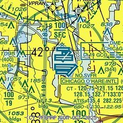
| Sectional chart |
|---|
|
| Airport distance calculator |
|---|
|
|
| Sunrise and sunset |
|---|
|
Times for 01-Feb-2025
| | Local
(UTC-6) | | Zulu
(UTC) |
|---|
| Morning civil twilight | | 06:36 | | 12:36 |
| Sunrise | | 07:05 | | 13:05 |
| Sunset | | 17:05 | | 23:05 |
| Evening civil twilight | | 17:35 | | 23:35 |
|
| Current date and time |
|---|
| Zulu (UTC) | 02-Feb-2025 05:13:45 |
|---|
| Local (UTC-6) | 01-Feb-2025 23:13:45 |
|---|
|
| METAR |
|---|
| KORD | 020451Z 14016KT 10SM FEW020 OVC120 00/M05 A3011 RMK AO2 SLP203 T00001050
|
KPWK
8nm N | 020452Z AUTO 15016G27KT 10SM OVC090 00/M04 A3011 RMK AO2 PK WND 15027/0450 SLP205 T00001044 $
|
K06C
9nm W | 020455Z AUTO 14009G18KT 10SM OVC110 00/M04 A3009 RMK AO2 T10051042
|
KMDW
14nm SE | 020453Z 13014G20KT 10SM FEW020 BKN130 OVC190 00/M05 A3012 RMK AO2 SLP211 T00001050 $
|
KDPA
16nm W | 020452Z 14014G21KT 10SM FEW110 00/M04 A3008 RMK AO2 SLP195 T00001044
|
|
| TAF |
|---|
| KORD | 020300Z 0203/0306 14012G22KT P6SM FEW020 OVC150 FM020800 17012G18KT 6SM -RASN SCT010 OVC020 TEMPO 0208/0211 3SM -SNRA BR SCT005 OVC010 FM021100 19009KT 2SM BR SCT002 OVC005 TEMPO 0211/0215 1SM -DZ BR OVC002 FM021600 21009KT 6SM BR OVC007 FM021900 23009KT P6SM BKN015 FM030000 21005KT P6SM SCT020
|
KMDW
14nm SE | 020300Z 0203/0306 14012G22KT P6SM FEW020 OVC150 FM020800 17012G18KT 6SM -RASN SCT010 OVC020 TEMPO 0208/0211 3SM -SNRA BR SCT005 OVC010 FM021100 19009KT 2SM BR SCT002 OVC005 TEMPO 0211/0215 1SM -DZ BR OVC002 FM021600 21009KT 6SM BR OVC007 FM021900 23009KT P6SM BKN015 FM030000 21005KT P6SM SCT020
|
KDPA
16nm W | 020300Z 0203/0224 13012G22KT P6SM FEW020 OVC150 FM020800 17012G18KT 6SM -RASN SCT010 OVC020 TEMPO 0208/0211 3SM -SNRA BR SCT005 OVC010 FM021100 19009KT 1 1/2SM BR SCT002 OVC004 TEMPO 0211/0215 3/4SM -DZ BR OVC002 FM021600 21009KT 6SM BR OVC007 FM021900 23009KT P6SM BKN015
|
|
| NOTAMs |
|---|
NOTAMs are issued by the DoD/FAA and will open in a separate window not controlled by AirNav.
|
|


