FAA INFORMATION EFFECTIVE 09 JULY 2026
Location
| FAA Identifier: | DVO |
| Lat/Long: | 38-08-36.8730N 122-33-25.5290W
38-08.614550N 122-33.425483W
38.1435758,-122.5570914
(estimated) |
| Elevation: | 4 ft. / 1.2 m (surveyed) |
| Variation: | 16E (1995) |
| From city: | 3 miles N of NOVATO, CA |
| Time zone: | UTC -7 (UTC -8 during Standard Time) |
| Zip code: | 94945 |
Airport Operations
| Airport use: | Open to the public |
| Activation date: | 09/1947 |
| Control tower: | no |
| ARTCC: | OAKLAND CENTER |
| FSS: | OAKLAND FLIGHT SERVICE STATION |
| NOTAMs facility: | OAK (NOTAM-D service available) |
| Attendance: | 0800-1700 |
| Wind indicator: | lighted |
| Segmented circle: | yes |
| Beacon: | white-green (lighted land airport)
Operates sunset to sunrise. |
Airport Communications
| CTAF/UNICOM: | 123.075 |
| WX AWOS-3P: | 120.675 (415-897-2236) |
| WX AWOS-3P at O69 (7 nm N): | 132.325 (707-773-1529) |
| WX ASOS at APC (14 nm E): | PHONE 707-252-7916 |
- APCH/DEP CTL SVC PRVDD BY OAKLAND ARTCC (ZOA) ON FREQ 127.8/353.5 (MOUNT TAMALPAIS RCAG).
Nearby radio navigation aids
| VOR radial/distance | | VOR name | | Freq | | Var |
|---|
| SGDr239/8.9 | | SCAGGS ISLAND VORTAC | | 112.10 | | 17E |
| PYEr058/15.2 | | POINT REYES VOR/DME | | 113.70 | | 17E |
| SAUr338/17.4 | | SAUSALITO VOR/DME | | 116.20 | | 17E |
| CCRr267/24.9 | | CONCORD VOR/DME | | 117.00 | | 17E |
| OAKr311/29.6 | | OAKLAND VOR/DME | | 116.80 | | 17E |
| SFOr328/32.6 | | SAN FRANCISCO VOR/DME | | 115.80 | | 17E |
Airport Services
| Fuel available: | 100LL JET-A |
| Parking: | tiedowns |
| Airframe service: | MAJOR |
| Powerplant service: | MAJOR |
| Bulk oxygen: | HIGH/LOW |
Runway Information
Runway 13/31
| Dimensions: | 3303 x 75 ft. / 1007 x 23 m |
| Surface: | asphalt, in good condition |
| Weight bearing capacity: | |
| Runway edge lights: | medium intensity |
| Operational restrictions: | RY 13 HAS PAVED 125 FT OVERRUN. RY 31 HAS 100 FT OVERRUN. |
| RUNWAY 13 | | RUNWAY 31 |
| Latitude: | 38-08.849510N | | 38-08.379587N |
| Longitude: | 122-33.599248W | | 122-33.251748W |
| Elevation: | 3.8 ft. | | 3.1 ft. |
| Traffic pattern: | left | | right |
| Runway heading: | 134 magnetic, 150 true | | 314 magnetic, 330 true |
| Markings: | nonprecision, in good condition | | basic, in good condition |
| Visual slope indicator: | 2-light PAPI on right (3.50 degrees glide path) | | 2-light PAPI on left (4.00 degrees glide path) |
| Runway end identifier lights: | no | | no |
| Touchdown point: | yes, no lights | | yes, no lights |
| Obstructions: | 82 ft. tree, 3000 ft. from runway, 34:1 slope to clear | | 180 ft. hill, 4700 ft. from runway, 500 ft. right of centerline, 25:1 slope to clear |
Helipad H1
| Dimensions: | 60 x 60 ft. / 18 x 18 m |
| Surface: | concrete, in good condition |
| Operational restrictions: | APPROACH 050/230 MAG |
| Latitude: | 38-08.391333N | | |
| Longitude: | 122-33.132667W | | |
| Elevation: | 2.0 ft. | | |
| Traffic pattern: | left | | left |
| Markings: | basic, in good condition | | |
Airport Ownership and Management from official FAA records
| Ownership: | Publicly-owned |
| Owner: | MARIN COUNTY
P.O. BOX 4055
SAN RAFAEL, CA 94913-4055
Phone 415-897-1754 |
| Manager: | DAN JENSEN
451 A AIRPORT ROAD
NOVATO, CA 94945
Phone 415-897-1754
DAN.JENSEN@MARINCOUNTY.GOV |
Additional Remarks
| - | DITCHES SURROUND RWY. |
| - | MOUNTAINS W, HILLS S. |
| - | NOISE SENSITIVE AREA SE OF ARPT. AVOID STRAIGHT - OUT DEPS ON RY 13 & STRAIGHT - IN LNDGS ON RY 31. |
| - | RY 13 CALM WIND RY. |
| - | JET AND TURBINE ACFT LAND RY 13 DEP RY 31 AS WIND AND TRAFFIC PERMIT. |
| - | HELICOPTERS APCH FM EAST AND DEP TO EAST, REMAIN NORTH OF RADIO TOWERS. |
| - | FOR CD CTC OAKLAND ARTCC AT 510-745-3380. |
Instrument Procedures
NOTE: All procedures below are presented as PDF files. If you need a reader for these files, you should download the free Adobe Reader.NOT FOR NAVIGATION. Please procure official charts for flight.
FAA instrument procedures published for use from 09 July 2026 at 0901Z to 06 August 2026 at 0900Z.
STARs - Standard Terminal Arrivals |
|---|
| REBAS ONE (RNAV) **NEW** | |
2 pages:
[1] [2] (289KB) |
| VNYRD ONE (RNAV) **NEW** | |
2 pages:
[1] [2] (288KB) |
IAPs - Instrument Approach Procedures |
|---|
| RNAV (GPS) RWY 13 | |
download (203KB) |
| NOTE: Special Alternate Minimums apply | |
download (137KB) |
| NOTE: Special Take-Off Minimums/Departure Procedures apply | |
download (348KB) |
Other nearby airports with instrument procedures:
O69 - Petaluma Municipal Airport (7 nm N)
CA35 - San Rafael Airport (8 nm S)
KAPC - Napa County Airport (14 nm E)
KSTS - Charles M Schulz/Sonoma County Airport (25 nm NW)
KCCR - Buchanan Field Airport (25 nm E)
|
|

Road maps at:
MapQuest
Bing
Google
| Aerial photo |
|---|
WARNING: Photo may not be current or correct
 Photo by Jan Sears
Taken in March 2018
looking southwest at 3500 feet.
Photo by Jan Sears
Taken in March 2018
looking southwest at 3500 feet.
Do you have a better or more recent aerial photo of Gnoss Field Airport that you would like to share? If so, please send us your photo.
|
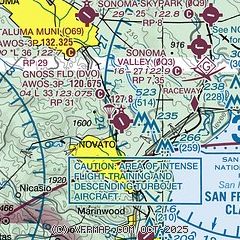
| Sectional chart |
|---|
|
| Airport distance calculator |
|---|
|
|
| Sunrise and sunset |
|---|
|
Times for 26-Jul-2026
| | Local
(UTC-7) | | Zulu
(UTC) |
|---|
| Morning civil twilight | | 05:39 | | 12:39 |
| Sunrise | | 06:09 | | 13:09 |
| Sunset | | 20:25 | | 03:25 |
| Evening civil twilight | | 20:54 | | 03:54 |
|
| Current date and time |
|---|
| Zulu (UTC) | 26-Jul-2026 19:58:40 |
|---|
| Local (UTC-7) | 26-Jul-2026 12:58:40 |
|---|
|
| METAR |
|---|
| KDVO | 261935Z AUTO 23017KT 10SM CLR 22/15 A3002 RMK AO2
|
KO69
7nm N | 261935Z AUTO 25008G13KT 9SM CLR 22/12 A3005 RMK A01
|
KAPC
13nm E | 261954Z 20011KT 10SM CLR 23/14 A3002 RMK AO2 SLP157 T02330144
|
|
| TAF |
|---|
KAPC
13nm E | 261739Z 2618/2718 21010KT P6SM SKC FM262000 24015KT P6SM SKC FM270300 25010KT P6SM SKC FM271200 25005KT P6SM SCT010
|
|
| NOTAMs |
|---|
NOTAMs are issued by the DoD/FAA and will open in a separate window not controlled by AirNav.
|
|


