FAA INFORMATION EFFECTIVE 15 MAY 2025
Location
| FAA Identifier: | SAV |
| Lat/Long: | 32-07-39.3000N 081-12-07.7000W
32-07.655000N 081-12.128333W
32.1275833,-81.2021389
(estimated) |
| Elevation: | 50.2 ft. / 15.3 m (surveyed) |
| Variation: | 06W (2005) |
| From city: | 7 miles NW of SAVANNAH, GA |
| Time zone: | UTC -4 (UTC -5 during Standard Time) |
| Zip code: | 31408 |
Airport Operations
| Airport use: | Open to the public |
| Activation date: | 09/1942 |
| Control tower: | yes |
| ARTCC: | JACKSONVILLE CENTER |
| FSS: | MACON FLIGHT SERVICE STATION |
| NOTAMs facility: | SAV (NOTAM-D service available) |
| Attendance: | 1100-0300Z++ |
| Pattern altitude: | MILITARY JET-OVHDS 2000 FT. |
| Wind indicator: | lighted |
| Segmented circle: | yes |
| Lights: | WHEN ATCT CLSD ACTVT MALSR RWY 10; REIL RWYS 19 & 28; HIRL RWYS 01/19 & 10/28 - CTAF. VASI RWY 19 AND PAPI RWYS 01, 10, & 28 OPER CONTINUOUSLY. |
| Beacon: | white-green (lighted land airport)
Operates sunset to sunrise. |
| Fire and rescue: | ARFF index C |
| International operations: | customs landing rights airport
US CUST NR: 912-210-0348 OR 912-232-7507. |
Airport Communications
| CTAF: | 125.975 |
| UNICOM: | 122.95 |
| ATIS: | 123.75 |
| WX ASOS: | PHONE 912-226-2578 |
| SAVANNAH GROUND: | 121.9 348.6 [0600-0000] |
| SAVANNAH TOWER: | 125.975 257.8 [0600-0000] |
| SAVANNAH APPROACH: | 118.4 ;270-010 120.4 ;110-269 125.3 ;011-109 353.775 ;110-269 354.0 ;270-010 371.875 ;011-109 [0600-0000] |
| JACKSONVILLE ARTCC APPROACH: | 121.1 [0000-0600] |
| SAVANNAH DEPARTURE: | 118.4 ;270-010 120.4 ;110-269 125.3 ;011-109 353.775 ;110-269 354.0 ;270-010 371.875 ;011-109 [0600-0000] |
| JACKSONVILLE ARTCC DEPARTURE: | 121.1 [0000-0600] |
| CLEARANCE DELIVERY: | 119.55 291.775 |
| CLASS C: | 118.4 ;270-010 120.4 ;110-269 125.3 ;011-109 353.775 ;110-269 354.0 ;270-010 371.875 ;011-109 |
| COMD POST: | 225.75 ;DAWG OPNS |
| EMERG: | 121.5 243.0 |
| IC: | 125.3 ;011-109 |
| OPS: | 297.1 ;COMBAT READINESS TRNG CNTR |
| PMSV METRO: | 309.0 |
- APCH/DEP SVC PRVDD BY JACKSONVILLE ARTCC ON FREQS 132.925/363.2 (SAVANNAH RCAG) WHEN APCH CTL CLSD.
- ARPT FIRE DEPT MONITORS FREQ 125.975 WHEN ATCT CLSD.
- TWR PH# 912-964-3700.
Nearby radio navigation aids
| VOR radial/distance | | VOR name | | Freq | | Var |
|---|
| SAVr194/1.1 | | SAVANNAH VORTAC | | 115.95 | | 06W |
| SVNr338/7.6 | | HUNTER VOR/DME | | 111.60 | | 02W |
| NDB name | | Hdg/Dist | | Freq | | Var | | ID |
|---|
| BULLO | | 131/29.1 | | 407 | | 05W | | BZQ | -... --.. --.- |
Airport Services
| Fuel available: | 100LL JET-A JET-A+ JET-A++
A:FUEL: A++100(MIL), (NC-100LL).
A+:AVBL 1100-0300Z++ C912-964-1557, OT 2 HR PN, C912-313-6310. SVC FEE. |
| Parking: | hangars and tiedowns |
| Airframe service: | MAJOR |
| Powerplant service: | MAJOR |
| Bottled oxygen: | HIGH/LOW |
| Bulk oxygen: | HIGH/LOW |
Runway Information
Runway 10/28
| Dimensions: | 9351 x 150 ft. / 2850 x 46 m |
| Surface: | concrete/grooved, in good condition
RY 10/28 CENTER 75 FT KEEL SECTION CONCRETE FULL LENGTH; ALL TWY INTERSECTIONS CONCRETE EXCEPT TWY C2 AND C3. REMAINDER OF RY 10/28 ASPHALT. |
| Weight bearing capacity: | | Single wheel: | 75.0 | | Double wheel: | 190.0 | | Double tandem: | 310.0 |
|
| Runway edge lights: | high intensity |
| RUNWAY 10 | | RUNWAY 28 |
| Latitude: | 32-07.725230N | | 32-07.708475N |
| Longitude: | 081-13.127560W | | 081-11.315372W |
| Elevation: | 16.9 ft. | | 46.2 ft. |
| Traffic pattern: | left | | left |
| Runway heading: | 097 magnetic, 091 true | | 277 magnetic, 271 true |
| Declared distances: | TORA:9351 TODA:9351 ASDA:9351 LDA:9351 | | TORA:9351 TODA:9351 ASDA:9351 LDA:9351 |
| Markings: | precision, in good condition | | precision, in good condition |
| Visual slope indicator: | 4-light PAPI on left (3.00 degrees glide path) | | 4-light PAPI on left (3.00 degrees glide path) |
| RVR equipment: | touchdown, midfield
NO RVR WHEN ATCT CLSD. | | midfield, rollout
NO RVR WHEN ATCT CLSD. |
| Approach lights: | MALSR: 1,400 foot medium intensity approach lighting system with runway alignment indicator lights
MALSR RWY 10 NSTD SPACING. | | |
| Runway end identifier lights: | | | yes |
| Centerline lights: | yes | | yes |
| Touchdown point: | yes, lighted | | yes, no lights |
| Instrument approach: | ILS/DME | | |
Runway 1/19
| Dimensions: | 7002 x 150 ft. / 2134 x 46 m |
| Surface: | concrete/grooved, in good condition
RY 1/19 CENTER 75 FT KEEL SECTION OF RY CONCRETE FULL LENGTH; LAST 500 FT CONCRETE, FULL WIDTH, BOTH ENDS. ALL TWY INTERSECTIONS CONCRETE EXCEPT TWY B AT THE NORTH END OF THE RY AND TWY B2. REMAINDER OF RY 1/19 ASPHALT. |
| Weight bearing capacity: | | Single wheel: | 75.0 | | Double wheel: | 190.0 | | Double tandem: | 310.0 |
|
| Runway edge lights: | high intensity |
| RUNWAY 1 | | RUNWAY 19 |
| Latitude: | 32-06.994227N | | 32-08.148973N |
| Longitude: | 081-11.999508W | | 081-12.008325W |
| Elevation: | 29.3 ft. | | 41.8 ft. |
| Traffic pattern: | left | | left |
| Runway heading: | 006 magnetic, 360 true | | 186 magnetic, 180 true |
| Declared distances: | TORA:7002 TODA:7002 ASDA:7002 LDA:7002 | | TORA:7002 TODA:7002 ASDA:7002 LDA:7002 |
| Markings: | precision, in good condition | | precision, in good condition |
| Visual slope indicator: | 4-light PAPI on left (3.00 degrees glide path) | | 4-box VASI on right (3.00 degrees glide path) |
| RVR equipment: | touchdown, midfield
NO RVR WHEN ATCT CLSD. | | midfield, rollout
NO RVR WHEN ATCT CLSD. |
| Runway end identifier lights: | no | | yes |
| Touchdown point: | yes, no lights | | yes, no lights |
| Instrument approach: | ILS | | |
Airport Ownership and Management from official FAA records
| Ownership: | Publicly-owned |
| Owner: | SAVANNAH AIRPORT COMMISSION
400 AIRWAYS AVE.
SAVANNAH, GA 31408
Phone 912-964-0514 |
| Manager: | GREG B. KELLY, A.A.E.
400 AIRWAYS AVE.
SAVANNAH, GA 31408
Phone 912-964-0514 |
Additional Remarks
| A39-01/19 | PCR VALUE: 567/R/B/W/T |
| A39-10/28 | PCR VALUE: 576/R/B/W/T |
| E60-28 | BAK-12 BAK 14M(B) (1977 FT). |
| E60-10 | BAK-12 BAK 14M(B) (1500FT). |
| - | BIRDS & DEER ON & INVOF OF ARPT. AIR CARRIER ACFT CTC GND PRIOR TO PUSH BACK FROM ALL GATES. PILOTS SHOULD COMPLETE ALL CALCULATIONS PRIOR TO PUSH BACK FM TRML GATE. OPR TRANSPONDERS WITH ALT REPORTING MODE AND ADS-B (IF EQUIPPED) ENABLED ON ALL AIRPORT SURFACES. |
| - | TWY 'E2' CONNECTOR CLSD TO ACFT LANDING RY 28. DISTANCE FM TOUCHDOWN TOO SHORT FOR SAFE TURN. |
| - | ANG: COMBAT READINESS TRNG CNTR (CRTC)/AIR DOMINANCE CENTER (ADC) AFLD MGMT DSN 860-3145/3497, C912-963-3145/3497. DUTY HR 1230-2100Z++ MON-FRI. CTC ADC BASE OPS ON UHF 237.00 (CALL SIGN "ADC OPS"). |
| - | 165AW (C130 UNIT) AFLD MGMT DSN 860-8184/8433, C912-966-8184. DUTY HR 1230-2100Z++MON-THUR, 1230-1900Z++ FRI. ACFT INBD TO 165AW CTC COMD POST DSN 860-8244, C912-966-8244 OR UHF 225.75 WITHIN 50 NM WITH ETA AND REQ. ADC COMSEC STORAGE UNAVBL. 165AW COMSEC STORAGE UP TO SECRET AVBL VIA COMD POST DUR NORMAL DUTY HR ONLY. |
| - | TRAN ALERT: TRAN ACFT PROHIBITED WHEN TRAN ALERT UNAVBL. FLEET SVC UNAVBL. |
| - | ACFT/VEHICLES ON THE SOUTH END OF TWY A AND THE EAST END OF TWY E NOT VSB FROM THE ATCT. |
| - | BASH PHASE II 01 APR - 31 OCT. CTC TWR OR COMD POST FOR BIRD HAZ. WILDLIFE MOST ACTIVE +/- 1 HR OF SS OR SR. |
| - | ANG: MIL E2 TAXILANE. |
| - | FOR CD IF UNA TO CTC ON FSS FREQ, CTC SAVANNAH APCH AT 912-964-3205, WHEN APCH CLSD CTC JACKSONVILLE ARTCC AT 904-845-1592. |
| - | ARPT CLSD TO INTL GA ARR EXC 24HR PPR CTC US CUST 912-232-7507 OR 912-210-0348 AND SERVICING FIXED BASE OPR FOR PROCESSING AND INSTRUCTIONS. |
| - | MILITARY: A-GEAR BAK-12B CABLE RAISED BY BAK-14M DEVICE O/R TO TWR. |
| - | PILOTS CONDUCTING EFVS OPS; BE AWARE LED ALS IN USE RWY 10. |
| - | NO 180 DEG TURNS ON ASPH FOR ACFT OVER 12500 LBS GROSS. |
| - | PPR FOR ACES OF GEN AVN ACFT ON THE ACR TRML RAMP CTC 912-964-7501. |
| - | TWY A, TWY B TWY C, TWY D, TWY E, TWY F, TWY G AND TWY H ARE LTD TO DUAL WHEEL ACFT UP TO 173,000 LBS AND DUAL TANDEM WHEEL ACFT UP TO 310,000 LBS. |
| - | TWY B2, C2 ARE LIMITED TO 12500 LBS. |
| - | TWY E CLSD FM RY 28 TO BUT NOT INCLUDING TWY E2 TO ACFT WITH WING SPAN OF 175 FT OR GREATER. |
Instrument Procedures
NOTE: All procedures below are presented as PDF files. If you need a reader for these files, you should download the free Adobe Reader.NOT FOR NAVIGATION. Please procure official charts for flight.
FAA instrument procedures published for use from 15 May 2025 at 0901Z to 13 June 2025 at 0900z.
IAPs - Instrument Approach Procedures |
|---|
| HI-ILS OR LOC RWY 10 | |
download (206KB) |
| ILS OR LOC RWY 01 | |
download (346KB) |
| ILS OR LOC RWY 10 | |
download (298KB) |
| ILS RWY 10 (SA CAT I - II) | |
download (314KB) |
| RNAV (GPS) RWY 01 | |
download (337KB) |
| RNAV (GPS) RWY 10 | |
download (335KB) |
| RNAV (GPS) RWY 19 | |
download (365KB) |
| RNAV (GPS) Z RWY 28 | |
download (300KB) |
| VOR/DME-A | |
download (270KB) |
| VOR/DME OR TACAN RWY 01 | |
download (268KB) |
| VOR/DME OR TACAN RWY 19 | |
download (269KB) |
| NOTE: Special Alternate Minimums apply | |
download (158KB) |
| NOTE: Special Take-Off Minimums/Departure Procedures apply | |
download (365KB) |
Other nearby airports with instrument procedures:
KSVN - Hunter Army Airfield (8 nm S)
KLHW - Wright Army Airfield (Fort Stewart)/Midcoast Regional Airport (23 nm SW)
KHXD - Hilton Head Airport (26 nm E)
KNBC - Beaufort Marine Corps Air Station (Merritt Field) Airport (32 nm NE)
KARW - Beaufort Executive Airport (33 nm NE)
|
|

Road maps at:
MapQuest
Bing
Google
| Aerial photo |
|---|
WARNING: Photo may not be current or correct
 Photo by William C Harris
Photo taken 09-Jul-2019
looking northwest.
Photo by William C Harris
Photo taken 09-Jul-2019
looking northwest.
Do you have a better or more recent aerial photo of Savannah/Hilton Head International Airport that you would like to share? If so, please send us your photo.
|
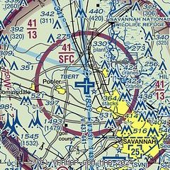
| Sectional chart |
|---|
|
CAUTION: Diagram may not be current

| Airport distance calculator |
|---|
|
|
| Sunrise and sunset |
|---|
|
Times for 31-May-2025
| | Local
(UTC-4) | | Zulu
(UTC) |
|---|
| Morning civil twilight | | 05:53 | | 09:53 |
| Sunrise | | 06:20 | | 10:20 |
| Sunset | | 20:24 | | 00:24 |
| Evening civil twilight | | 20:52 | | 00:52 |
|
| Current date and time |
|---|
| Zulu (UTC) | 31-May-2025 22:34:08 |
|---|
| Local (UTC-4) | 31-May-2025 18:34:08 |
|---|
|
| METAR |
|---|
| KSAV | 312153Z 26013KT 10SM FEW130 BKN250 27/13 A2977 RMK AO2 SLP081 T02720133
|
KSVN
7nm S | 312155Z AUTO 27012KT 10SM CLR 28/13 A2974 RMK AO2 SLP074 T02830126 $
|
|
| TAF |
|---|
| KSAV | 311726Z 3118/0118 29012G19KT P6SM FEW250 FM010000 26005KT P6SM SKC FM011200 30005KT P6SM SCT250
|
KSVN
7nm S | 310100Z 3101/0107 24009KT 9999 BKN150 OVC250 QNH2974INS BECMG 3104/3105 30010G16KT 9999 SKC QNH2978INS BECMG 3118/3119 28009KT 9999 SCT050 QNH2982INS TX29/3121Z TN19/3112Z LAST NO AMDS AFT 3102 NEXT 0209
|
|
| NOTAMs |
|---|
NOTAMs are issued by the DoD/FAA and will open in a separate window not controlled by AirNav.
|
|


