FAA INFORMATION EFFECTIVE 09 JULY 2026
Location
| FAA Identifier: | BWG |
| Lat/Long: | 36-57-52.3000N 086-25-10.8000W
36-57.871667N 086-25.180000W
36.9645278,-86.4196667
(estimated) |
| Elevation: | 547.2 ft. / 166.8 m (surveyed) |
| Variation: | 04W (2015) |
| From city: | 2 miles SE of BOWLING GREEN, KY |
| Time zone: | UTC -5 (UTC -6 during Standard Time) |
| Zip code: | 42103 |
Airport Operations
| Airport use: | Open to the public |
| Activation date: | 04/1940 |
| Control tower: | no |
| ARTCC: | MEMPHIS CENTER |
| FSS: | LOUISVILLE FLIGHT SERVICE STATION |
| NOTAMs facility: | BWG (NOTAM-D service available) |
| Attendance: | CONTINUOUS |
| Wind indicator: | lighted |
| Segmented circle: | no |
| Lights: | ACTVT REIL RWY 03, 21; PAPI RWY 03, 21; HIRL RWY 03/21 - CTAF. |
| Beacon: | white-green (lighted land airport)
Operates sunset to sunrise. |
| Fire and rescue: | ARFF index A |
| Airline operations: | OPS WITH MORE THAN 30 PAX SEATS 24 HR PPR - AMGR. |
Airport Communications
| CTAF/UNICOM: | 123.0 |
| WX ASOS: | 127.825 (270-843-8136) |
- APCH/DEP SVC PRVDD BY MEMPHIS ARTCC ON FREQS 133.85/285.5 (NASHVILLE RCAG).
- COMMUNICATIONS PRVDD BY LOUISVILLE RADIO ON FREQ 122.4 (BOWLING GREEN RCO).
Nearby radio navigation aids
| NDB name | | Hdg/Dist | | Freq | | Var | | ID |
|---|
| NOORA | | 034/5.9 | | 236 | | 04W | | BW | -... .-- |
Airport Services
| Fuel available: | 100LL JET-A |
| Parking: | hangars and tiedowns |
| Airframe service: | MAJOR |
| Powerplant service: | MAJOR |
Runway Information
Runway 3/21
| Dimensions: | 6501 x 150 ft. / 1982 x 46 m |
| Surface: | asphalt, in good condition |
| Weight bearing capacity: | | Single wheel: | 120.0 | | Double wheel: | 221.0 | | Double tandem: | 358.0 |
|
| Runway edge lights: | high intensity |
| RUNWAY 3 | | RUNWAY 21 |
| Latitude: | 36-57.521050N | | 36-58.449822N |
| Longitude: | 086-25.502403W | | 086-24.836933W |
| Elevation: | 547.1 ft. | | 520.4 ft. |
| Traffic pattern: | left | | left |
| Runway heading: | 034 magnetic, 030 true | | 214 magnetic, 210 true |
| Declared distances: | TORA:6500 TODA:6500 ASDA:6500 LDA:6500 | | TORA:6500 TODA:6500 ASDA:6500 LDA:6500 |
| Markings: | precision, in good condition | | nonprecision, in good condition |
| Visual slope indicator: | 4-light PAPI on left (3.00 degrees glide path) | | 4-light PAPI on left (3.00 degrees glide path) |
| Runway end identifier lights: | yes | | yes |
| Touchdown point: | yes, no lights | | yes, no lights |
| Instrument approach: | ILS | | |
Runway 12/30
| Dimensions: | 3956 x 150 ft. / 1206 x 46 m |
| Surface: | asphalt, in poor condition
LONGL & TRANSVERSE CRACKING; UNEVEN SFC. |
| Weight bearing capacity: | | PCN 9 /F/C/X/T | | Single wheel: | 25.5 | | Double wheel: | 40.0 |
|
| Runway edge lights: | medium intensity |
| Operational restrictions: | RWY 12/30 NOT AVBL FOR PART 121/PART 380 OPS WITH SKED PAX CARRYING OPS MORE THAN 9 PAX SEATS AND NON-SKED PAX CARRYING OPS MORE THAN 30 PAX SEATS. |
| RUNWAY 12 | | RUNWAY 30 |
| Latitude: | 36-57.844947N | | 36-57.520115N |
| Longitude: | 086-25.551220W | | 086-24.847000W |
| Elevation: | 530.9 ft. | | 531.2 ft. |
| Traffic pattern: | left | | left |
| Runway heading: | 124 magnetic, 120 true | | 304 magnetic, 300 true |
| Displaced threshold: | no | | 349 ft. |
| Markings: | basic, in good condition | | basic, in good condition |
| Touchdown point: | yes, no lights | | yes, no lights |
Airport Ownership and Management from official FAA records
| Ownership: | Publicly-owned |
| Owner: | CITY BOWLING GREEN-WARREN CO
1000 WOODHURST ST
BOWLING GREEN, KY 42103
Phone 270-842-1101 |
| Manager: | SUSAN HARMON
1000 WOODHURST ST
BOWLING GREEN, KY 42103
Phone 270-842-1101 |
Additional Remarks
| A39-03/21 | PCR VALUE: 560/F/C/X/T |
| A57-03 | FIRST 1300 FT LONGL GRADIENT SLOPE 1.5 PERCENT; STEEPER THAN STD FOR APCH SPD GTR THAN 122 KTS. |
| A57-30 | +54 FT TREE DIST 860 FT 200 FT L; 15:1 BASED ON DTHR. |
| - | BIRDS ON & INVOF ARPT. |
| - | CNL IFR - LOUISVILLE FSS 122.2. |
| - | FOR CD CTC MEMPHIS ARTCC AT 901-368-8453/8449. |
Instrument Procedures
NOTE: All procedures below are presented as PDF files. If you need a reader for these files, you should download the free Adobe Reader.NOT FOR NAVIGATION. Please procure official charts for flight.
FAA instrument procedures published for use from 09 July 2026 at 0901Z to 06 August 2026 at 0900Z.
IAPs - Instrument Approach Procedures |
|---|
| ILS Y OR LOC Y RWY 03 **CHANGED** | |
download (238KB) |
| ILS Z OR LOC Z RWY 03 **CHANGED** | |
download (255KB) |
| RNAV (GPS) RWY 03 **CHANGED** | |
download (263KB) |
| RNAV (GPS) RWY 21 **CHANGED** | |
download (265KB) |
| NDB RWY 03 **CHANGED** | |
download (169KB) |
| NOTE: Special Alternate Minimums apply | |
download (163KB) |
| NOTE: Special Take-Off Minimums/Departure Procedures apply | |
download (126KB) |
Other nearby airports with instrument procedures:
4M7 - Russellville-Logan County Airport (21 nm SW)
1M5 - Douglas Hunter Field Airport (22 nm S)
KGLW - Glasgow Municipal Airport (23 nm E)
M20 - Leitchfield-Grayson County Airport (27 nm N)
3M7 - Lafayette Municipal Airport (32 nm SE)
|
|

Road maps at:
MapQuest
Bing
Google
| Aerial photo |
|---|
WARNING: Photo may not be current or correct
 Photo by Bob Pitchford
Photo taken 06-Nov-2016
looking southwest
Photo by Bob Pitchford
Photo taken 06-Nov-2016
looking southwest
Do you have a better or more recent aerial photo of Bowling Green-Warren County Regional Airport that you would like to share? If so, please send us your photo.
|
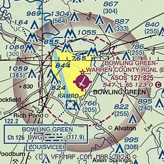
| Sectional chart |
|---|
|
CAUTION: Diagram may not be current

| Airport distance calculator |
|---|
|
|
| Sunrise and sunset |
|---|
|
Times for 10-Jul-2026
| | Local
(UTC-5) | | Zulu
(UTC) |
|---|
| Morning civil twilight | | 05:05 | | 10:05 |
| Sunrise | | 05:36 | | 10:36 |
| Sunset | | 20:06 | | 01:06 |
| Evening civil twilight | | 20:37 | | 01:37 |
|
| Current date and time |
|---|
| Zulu (UTC) | 10-Jul-2026 08:14:18 |
|---|
| Local (UTC-5) | 10-Jul-2026 03:14:18 |
|---|
|
| METAR |
|---|
| KBWG | 100753Z AUTO 21006KT 10SM BKN110 23/22 A2996 RMK AO2 SLP138 T02280217 $
|
|
| TAF |
|---|
| KBWG | 100520Z 1006/1106 21006KT P6SM -SHRA SCT025 BKN050 TEMPO 1006/1008 3SM -TSRA BR BKN035CB FM101000 22007KT 6SM -SHRA SCT015 OVC025 TEMPO 1010/1013 3SM -TSRA BKN035CB FM101600 23011G20KT P6SM BKN025 OVC050 PROB30 1017/1021 4SM -TSRA BKN035CB FM102100 24009KT P6SM SCT050 BKN100 FM110200 VRB03KT P6SM BKN050
|
|
| NOTAMs |
|---|
NOTAMs are issued by the DoD/FAA and will open in a separate window not controlled by AirNav.
|
|


