FAA INFORMATION EFFECTIVE 19 FEBRUARY 2026
Location
| FAA Identifier: | SBX |
| Lat/Long: | 48-32-26.5000N 111-52-16.5000W
48-32.441667N 111-52.275000W
48.5406944,-111.8712500
(estimated) |
| Elevation: | 3442.9 ft. / 1049.4 m (surveyed) |
| Variation: | 15E (2005) |
| From city: | 2 miles N of SHELBY, MT |
| Time zone: | UTC -7 (UTC -6 during Daylight Saving Time) |
| Zip code: | 59474 |
Airport Operations
| Airport use: | Open to the public |
| Activation date: | 10/1948 |
| Control tower: | no |
| ARTCC: | SALT LAKE CITY CENTER |
| FSS: | GREAT FALLS FLIGHT SERVICE STATION |
| NOTAMs facility: | GTF (NOTAM-D service available) |
| Attendance: | MON-FRI 0800-1800 |
| Wind indicator: | lighted |
| Segmented circle: | yes |
| Lights: | ACTVT PAPI RWY 05 & 23; MIRL RWY 05/23 & 11/29-CTAF. |
| Beacon: | white-green (lighted land airport)
Operates sunset to sunrise. |
Airport Communications
| CTAF/UNICOM: | 122.8 |
| WX AWOS-3PT: | 128.325 (406-434-2542) |
- APCH/DEP CTL SVC PRVDD BY SALT LAKE CITY ARTCC ( ZLC) ON FREQS 133.4/285.4 (GREAT FALLS RCAG).
- COMMUNICATIONS PRVDD BY GREAT FALLS RADIO ON FREQ 122.2 (CUT BANK RCO).
Nearby radio navigation aids
| VOR radial/distance | | VOR name | | Freq | | Var |
|---|
| CTBr077/18.8 | | CUT BANK VOR/DME | | 113.35 | | 17E |
Airport Services
| Fuel available: | 100LL JET-A+
100LL:FOR FUEL AFTER HRS CALL 406-450-2461 OR 406-450-2463. SELF SVC CREDIT CARD FOR 100LL & JET A+. FUEL TRUCK AVBL FOR JET A+. |
| Parking: | tiedowns |
| Airframe service: | NONE |
| Powerplant service: | NONE |
| Bottled oxygen: | NONE |
| Bulk oxygen: | NONE |
Runway Information
Runway 5/23
| Dimensions: | 5005 x 75 ft. / 1526 x 23 m |
| Surface: | asphalt, in excellent condition |
| Weight bearing capacity: | | PCN 6 /F/D/Y/T | | Single wheel: | 15.0 |
|
| Runway edge lights: | medium intensity |
| RUNWAY 5 | | RUNWAY 23 |
| Latitude: | 48-32.301142N | | 48-32.649302N |
| Longitude: | 111-52.885620W | | 111-51.762763W |
| Elevation: | 3418.1 ft. | | 3442.8 ft. |
| Traffic pattern: | left | | left |
| Runway heading: | 050 magnetic, 065 true | | 230 magnetic, 245 true |
| Markings: | nonprecision, in good condition | | nonprecision, in good condition |
| Visual slope indicator: | 2-light PAPI on left (3.00 degrees glide path) | | 2-light PAPI on left (3.00 degrees glide path) |
| Touchdown point: | yes, no lights | | yes, no lights |
Runway 11/29
| Dimensions: | 3701 x 60 ft. / 1128 x 18 m |
| Surface: | asphalt, in excellent condition |
| Weight bearing capacity: | |
| Runway edge lights: | medium intensity |
| RUNWAY 11 | | RUNWAY 29 |
| Latitude: | 48-32.586037N | | 48-32.203802N |
| Longitude: | 111-52.565437W | | 111-51.852208W |
| Elevation: | 3419.6 ft. | | 3428.7 ft. |
| Traffic pattern: | left | | left |
| Runway heading: | 114 magnetic, 129 true | | 294 magnetic, 309 true |
| Markings: | basic, in good condition | | basic, in good condition |
| Visual slope indicator: | 2-light PAPI on left (3.00 degrees glide path) | | 2-light PAPI on left (3.00 degrees glide path) |
| Touchdown point: | yes, no lights | | yes, no lights |
Airport Ownership and Management from official FAA records
| Ownership: | Publicly-owned |
| Owner: | TOOLE COUNTY
226 1ST ST. SOUTH
SHELBY, MT 59474-1920
Phone 406-424-8310 |
| Manager: | JERRY LARSON JR
PO BOX 210
SHELBY, MT 59474
Phone (406) 450-2463 |
Additional Remarks
| - | DEER ON & INVOF ARPT. |
| - | TWY EDGES MKD WITH REFLECTORS. |
| - | FOR CD CTC SALT LAKE ARTCC AT 801-320-2568. |
Instrument Procedures
NOTE: All procedures below are presented as PDF files. If you need a reader for these files, you should download the free Adobe Reader.NOT FOR NAVIGATION. Please procure official charts for flight.
FAA instrument procedures published for use from 19 February 2026 at 0901Z to 19 March 2026 at 0900Z.
IAPs - Instrument Approach Procedures |
|---|
| RNAV (GPS) RWY 05 **CHANGED** | |
download (230KB) |
| RNAV (GPS) RWY 23 **CHANGED** | |
download (227KB) |
| NOTE: Special Alternate Minimums apply | |
download (211KB) |
| NOTE: Special Take-Off Minimums/Departure Procedures apply | |
download (223KB) |
Other nearby airports with instrument procedures:
KCTB - Cut Bank International Airport (20 nm W)
S01 - Conrad Airport (23 nm S)
KCII - Choteau Airport (44 nm S)
79S - Fort Benton Airport (65 nm SE)
KGTF - Great Falls International Airport (67 nm S)
|
|

Road maps at:
MapQuest
Bing
Google
| Aerial photo |
|---|
WARNING: Photo may not be current or correct

Do you have a better or more recent aerial photo of Shelby Airport that you would like to share? If so, please send us your photo.
|
| Sectional chart |
|---|
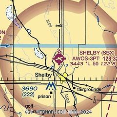
|
| Airport distance calculator |
|---|
|
|
| Sunrise and sunset |
|---|
|
Times for 05-Mar-2026
| | Local
(UTC-7) | | Zulu
(UTC) |
|---|
| Morning civil twilight | | 06:31 | | 13:31 |
| Sunrise | | 07:02 | | 14:02 |
| Sunset | | 18:16 | | 01:16 |
| Evening civil twilight | | 18:47 | | 01:47 |
|
| Current date and time |
|---|
| Zulu (UTC) | 06-Mar-2026 03:35:29 |
|---|
| Local (UTC-7) | 05-Mar-2026 20:35:29 |
|---|
|
| METAR |
|---|
| KSBX | 060315Z AUTO 30008KT 10SM OVC075 01/M01 A2998 RMK AO2
|
KCTB
20nm W | 060256Z AUTO 29010KT 10SM SCT110 01/M01 A2995 RMK AO2 SNE0159 SLP172 P0000 60002 T00061011 53026
|
|
| TAF |
|---|
KCTB
20nm W | 051735Z 0518/0618 33005KT P6SM SCT060 BKN120 FM060300 VRB05KT P6SM SCT060 BKN130 FM061000 25005KT P6SM SCT100
|
|
| NOTAMs |
|---|
NOTAMs are issued by the DoD/FAA and will open in a separate window not controlled by AirNav.
|
|

