FAA INFORMATION EFFECTIVE 16 APRIL 2026
Location
| FAA Identifier: | 6V0 |
| Lat/Long: | 43-17-42.0000N 103-50-34.7300W
43-17.700000N 103-50.578833W
43.2950000,-103.8429806
(estimated) |
| Elevation: | 3593.6 ft. / 1095 m (estimated) |
| Variation: | 11E (1985) |
| From city: | 1 mile SW of EDGEMONT, SD |
| Time zone: | UTC -6 (UTC -7 during Standard Time) |
| Zip code: | 57735 |
Airport Operations
| Airport use: | Open to the public |
| Activation date: | 11/1937 |
| Control tower: | no |
| ARTCC: | DENVER CENTER |
| FSS: | HURON FLIGHT SERVICE STATION |
| NOTAMs facility: | HON (NOTAM-D service available) |
| Attendance: | UNATNDD |
| Wind indicator: | lighted |
| Segmented circle: | yes |
| Lights: | ACTVT PAPI RWY 12 & 30: MIRL RWY 12/30 - CTAF. |
| Beacon: | white-green (lighted land airport)
Operates sunset to sunrise. |
Airport Communications
Airport Services
| Parking: | tiedowns |
| Airframe service: | NONE |
| Powerplant service: | NONE |
| Bottled oxygen: | NONE |
| Bulk oxygen: | NONE |
Runway Information
Runway 12/30
| Dimensions: | 3900 x 60 ft. / 1189 x 18 m |
| Surface: | asphalt, in good condition |
| Runway edge lights: | medium intensity |
| RUNWAY 12 | | RUNWAY 30 |
| Latitude: | 43-17.991667N | | 43-17.555667N |
| Longitude: | 103-50.974333W | | 103-50.329333W |
| Elevation: | 3590.7 ft. | | 3586.6 ft. |
| Traffic pattern: | left | | left |
| Runway heading: | 122 magnetic, 133 true | | 302 magnetic, 313 true |
| Markings: | basic, in good condition | | basic, in good condition |
| Visual slope indicator: | 2-light PAPI on left (3.00 degrees glide path) | | 2-light PAPI on left (3.00 degrees glide path) |
| Runway end identifier lights: | no | | no |
| Touchdown point: | yes, no lights | | yes, no lights |
Runway 16/34
| Dimensions: | 2016 x 100 ft. / 614 x 30 m |
| Surface: | turf, in good condition |
| RUNWAY 16 | | RUNWAY 34 |
| Latitude: | 43-17.722333N | | 43-17.392667N |
| Longitude: | 103-50.463333W | | 103-50.411500W |
| Elevation: | 3588.0 ft. | | 3588.0 ft. |
| Traffic pattern: | left | | left |
| Runway heading: | 162 magnetic, 173 true | | 343 magnetic, 354 true |
| Markings: | none | | none |
| Runway end identifier lights: | no | | no |
| Touchdown point: | yes, no lights | | yes, no lights |
| Obstructions: | 24 ft. bldg, 507 ft. from runway, 120 ft. left of centerline, 21:1 slope to clear | | 5 ft. fence, 100 ft. from runway, 20:1 slope to clear |
Airport Ownership and Management from official FAA records
| Ownership: | Publicly-owned |
| Owner: | CITY OF EDGEMONT
PO BOX A
EDGEMONT, SD 57735
Phone 605-622-7422 |
| Manager: | CITY OF EDGEMONT
PO BOX A
EDGEMONT, SD 57735
Phone 605-662-7422 |
Additional Remarks
| - | WILDLIFE ON & INVOF ARPT. |
| - | ULTRALGT ACTVTY ON & INVOF ARPT. |
| - | FOR CD CTC DENVER ARTCC AT 303-651-4257. |
Instrument Procedures
There are no published instrument procedures at 6V0.
Some nearby airports with instrument procedures:
KHSR - Hot Springs Municipal Airport (20 nm E)
KECS - Mondell Field Airport (41 nm NW)
KCDR - Chadron Municipal Airport (43 nm SE)
KRAP - Rapid City Regional Airport (56 nm NE)
KRCA - Ellsworth Air Force Base (60 nm NE)
|
|

Road maps at:
MapQuest
Bing
Google
| Aerial photo |
|---|
WARNING: Photo may not be current or correct
 Photo by Andreas Lauschke
Photo taken 06-Oct-2024
looking northwest.
Photo by Andreas Lauschke
Photo taken 06-Oct-2024
looking northwest.
Do you have a better or more recent aerial photo of Edgemont Municipal Airport that you would like to share? If so, please send us your photo.
|
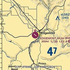
| Sectional chart |
|---|
|
| Airport distance calculator |
|---|
|
|
| Sunrise and sunset |
|---|
|
Times for 29-Apr-2026
| | Local
(UTC-6) | | Zulu
(UTC) |
|---|
| Morning civil twilight | | 05:21 | | 11:21 |
| Sunrise | | 05:52 | | 11:52 |
| Sunset | | 19:53 | | 01:53 |
| Evening civil twilight | | 20:24 | | 02:24 |
|
| Current date and time |
|---|
| Zulu (UTC) | 29-Apr-2026 11:59:12 |
|---|
| Local (UTC-6) | 29-Apr-2026 05:59:12 |
|---|
|
| METAR |
|---|
KCUT
28nm N | 291153Z AUTO 29005KT 10SM CLR M01/M03 A3008 RMK AO2 SLP207 70030 T10111028 11006 21033 58001
|
|
| TAF |
|---|
KCDR
43nm SE | 291136Z 2912/3012 23006KT P6SM SKC FM291800 31011G19KT P6SM FEW050 SCT250 PROB30 2920/2924 VRB15G30KT 6SM -TSRA BKN050CB FM300000 02011KT P6SM SCT100 FM300300 VRB05KT P6SM SCT100
|
|
| NOTAMs |
|---|
NOTAMs are issued by the DoD/FAA and will open in a separate window not controlled by AirNav.
|
|

