FAA INFORMATION EFFECTIVE 16 APRIL 2026
Location
| FAA Identifier: | RAP |
| Lat/Long: | 44-02-43.2000N 103-03-26.5000W
44-02.720000N 103-03.441667W
44.0453333,-103.0573611
(estimated) |
| Elevation: | 3203.5 ft. / 976.4 m (surveyed) |
| Variation: | 08E (2010) |
| From city: | 8 miles SE of RAPID CITY, SD |
| Time zone: | UTC -6 (UTC -7 during Standard Time) |
| Zip code: | 57703 |
Airport Operations
| Airport use: | Open to the public |
| Activation date: | 08/1950 |
| Control tower: | yes |
| ARTCC: | DENVER CENTER |
| FSS: | HURON FLIGHT SERVICE STATION |
| NOTAMs facility: | RAP (NOTAM-D service available) |
| Attendance: | CONTINUOUS |
| Wind indicator: | lighted |
| Segmented circle: | yes |
| Lights: | WHEN ATCT CLSD ACTVT MALSR RWY 32; REIL RWY 14; HIRL RWY 14/32; MIRL RWY 05/23; TWY A & B LGTS - CTAF. PAPI RWYS 05, 14, 23, 32 OPR CONSLY. |
| Beacon: | white-green (lighted land airport)
Operates sunset to sunrise. |
| Landing fee: | yes, LNDG FEES RQRD FOR AIRCRAFT 12,500 LBS OR GTR. |
| Fire and rescue: | ARFF index B |
| Airline operations: | ARFF INDEX C AVBL UPON REQ. |
Airport Communications
| CTAF: | 125.85 |
| UNICOM: | 122.95 |
| WX ASOS: | 118.525 (605-223-0202) |
| RAPID CITY GROUND: | 121.9 [0600-2200] |
| RAPID CITY TOWER: | 125.85 257.8 [0600-2200] |
| ELLSWORTH APPROACH: | 119.5 |
| ELLSWORTH DEPARTURE: | 119.5 |
| EMERG: | 121.5 243.0 |
| NG OPS: | 123.05 238.375FM 41.925FM |
- APCH/DEP CTL SVC PRVDD BY DENVER ARTCC (ZDV) ON FREQS 127.95/338.2 (RAPID CITY RCAG) WHEN ELLSWORTH APCH CTL (RCA) CLSD.
Nearby radio navigation aids
| VOR radial/distance | | VOR name | | Freq | | Var |
|---|
| RAPr322/4.6 | | RAPID CITY VORTAC | | 112.30 | | 13E |
Airport Services
| Fuel available: | 100LL JET-A
A:100LL & JETA SELF SVC AVBL 24 HRS WITH CREDIT CARD ONLY NE SIDE OF GA RAMP. |
| Parking: | hangars and tiedowns |
| Airframe service: | MAJOR |
| Powerplant service: | MAJOR |
| Bottled oxygen: | HIGH |
| Bulk oxygen: | NONE |
Runway Information
Runway 14/32
| Dimensions: | 8701 x 150 ft. / 2652 x 46 m |
| Surface: | concrete/grooved, in good condition |
| Weight bearing capacity: | | Single wheel: | 140.0 | | Double wheel: | 190.0 | | Double tandem: | 300.0 |
|
| Runway edge lights: | high intensity |
| RUNWAY 14 | | RUNWAY 32 |
| Latitude: | 44-03.229725N | | 44-01.967497N |
| Longitude: | 103-03.900403W | | 103-02.963327W |
| Elevation: | 3191.2 ft. | | 3142.8 ft. |
| Traffic pattern: | left | | left |
| Runway heading: | 144 magnetic, 152 true | | 324 magnetic, 332 true |
| Declared distances: | TORA:8701 TODA:8701 ASDA:8701 LDA:8701 | | TORA:8701 TODA:8701 ASDA:8701 LDA:8701 |
| Markings: | precision, in good condition | | precision, in good condition |
| Visual slope indicator: | 4-light PAPI on left (3.00 degrees glide path) | | 4-light PAPI on left (3.00 degrees glide path) |
| RVR equipment: | rollout | | touchdown |
| Approach lights: | | | MALSR: 1,400 foot medium intensity approach lighting system with runway alignment indicator lights |
| Runway end identifier lights: | yes | | no |
| Touchdown point: | yes, no lights | | yes, no lights |
| Instrument approach: | | | ILS/DME |
| Obstructions: | 25 ft. fence, 1000 ft. from runway, 435 ft. left of centerline, 32:1 slope to clear | | none |
Runway 5/23
| Dimensions: | 3601 x 75 ft. / 1098 x 23 m |
| Surface: | asphalt, in good condition |
| Weight bearing capacity: | |
| Runway edge lights: | medium intensity |
| Operational restrictions: | RWY 05/23 NOT AVBL FOR PART 121/PART 380 OPS WITH SKED PAX CARRYING OPS MORE THAN 9 PAX SEATS AND NON-SKED PAX CARRYING OPS MORE THAN 30 PAX SEATS. |
| RUNWAY 5 | | RUNWAY 23 |
| Latitude: | 44-02.872045N | | 44-03.151763N |
| Longitude: | 103-03.829250W | | 103-03.104955W |
| Elevation: | 3173.0 ft. | | 3203.5 ft. |
| Traffic pattern: | right | | left |
| Runway heading: | 054 magnetic, 062 true | | 234 magnetic, 242 true |
| Declared distances: | TORA:3601 TODA:3601 ASDA:3601 LDA:3601 | | TORA:3601 TODA:3601 ASDA:3601 LDA:3601 |
| Markings: | nonprecision, in fair condition | | nonprecision, in fair condition |
| Visual slope indicator: | 2-light PAPI on left (3.00 degrees glide path) | | 2-light PAPI on left (3.00 degrees glide path) |
| Runway end identifier lights: | no | | no |
| Touchdown point: | yes, no lights | | yes, no lights |
| Obstructions: | none | | 15 ft. road, 628 ft. from runway, 28:1 slope to clear |
Airport Ownership and Management from official FAA records
| Ownership: | Publicly-owned |
| Owner: | CITY OF RAPID CITY
4550 TERMINAL RD - STE 102
RAPID CITY, SD 57703
Phone 605-394-4195 |
| Manager: | PATRICK DAME
4550 TERMINAL RD - STE 102
RAPID CITY, SD 57703
Phone 605-394-4195 |
Additional Remarks
| A39-05/23 | PCR VALUE: 80/F/C/X/T |
| A39-14/32 | PCR VALUE: 635/R/D/W/T |
| - | BIRDS ON & INVOF ARPT. |
| - | TWR HAS LIMITED VISIBILITY OF TWY T1 AND TWY T2 AND TWY B AT AER RWY 23 |
| - | USE OF ARMY NATIONAL GUARD (ANG) RAMP IS OFFICIAL BUSINESS ONLY; FOR PPR CALL ANG FLIGHT OPS AT (605) 737-6128. NORMAL ANG OPS ARE TUES-FRI 1400-0030Z++ EXCEPT HOLIDAYS. |
| - | OVERNIGHT PARKING ALLOWED IN DESIGNATED TIEDOWN AREAS ONLY. |
| - | CTC GROUND FOR FREE TIE-DOWN LOCATIONS, OR CALL ARPT OPNS AT 605-593-3419. |
| - | ALL CHARTER SERVICED ACFT OVER 12,500 LBS MUST CTC ARPT OPNS AT 605-593-3419 AT LEAST 48 HOURS PRIOR TO ARRIVAL. |
| - | DIVERTING NON-BASED AIR CARRIERS CTC ARPT OPS AT (605) 593-3419 PRIOR TO DIVERTING DUE TO LIMITED GATE SPACE. NO CUSTOMS SERVICE AVBL. |
| - | FOR CD CTC GND OR ATCT ON FREQ. IF UNA, CTC RAP ATCT AT 605-393-1161. WHEN ATCT CLSD, CTC ELLSWORTH APCH AT 605-385-6198. WHEN APCH CLSD CTC DENVER ARTCC AT 303-651-4257. |
| - | RWY 5/23 NOT AVBL TO ACFT OVER 12500 LBS TO TAXI. |
| - | HIGH VOL OF HELI TOURS INVOF MT RUSHMORE AND CRAZY HORSE MONUMENTS AT OR BLW 7500 FT; ALL OTR ACFT SHOULD RMN AT OR ABOVE 7700 FT AND MAINTAIN 1 NM HORIZONTAL SEPARATION FROM THE MONUMENTS; PILOTS ARE ADVISED TO MONITOR 122.85 FOR TFC ADVISORIES. |
| - | BE ALERT: EXTENSIVE MILITARY JET TFC INVOF & NNW OF ARPT. |
| - | LINE-OF-SIGHT IS RESTRICTED BETWEEN RY 14 & RY 23 PHYSICAL ENDS. |
| - | 152 FT AGL TWR 2.5 NM NNW OF ARPT. |
| - | BE ALERT DO NOT MISTAKE ELLSWORTH AFB, LOCATED 6.5 NM NNW FOR RAPID CITY RGNL. |
Instrument Procedures
NOTE: All procedures below are presented as PDF files. If you need a reader for these files, you should download the free Adobe Reader.NOT FOR NAVIGATION. Please procure official charts for flight.
FAA instrument procedures published for use from 16 April 2026 at 0901Z to 14 May 2026 at 0900Z.
IAPs - Instrument Approach Procedures |
|---|
| ILS OR LOC RWY 32 | |
download (249KB) |
| RNAV (GPS) RWY 05 | |
download (224KB) |
| RNAV (GPS) RWY 14 | |
download (223KB) |
| RNAV (GPS) RWY 23 | |
download (223KB) |
| RNAV (GPS) RWY 32 | |
download (229KB) |
| VOR OR TACAN RWY 14 | |
download (248KB) |
| VOR OR TACAN RWY 32 | |
download (230KB) |
| NOTE: Special Alternate Minimums apply | |
download (175KB) |
| NOTE: Special Take-Off Minimums/Departure Procedures apply | |
download (156KB) |
Other nearby airports with instrument procedures:
KRCA - Ellsworth Air Force Base (6 nm N)
49B - Sturgis Municipal Airport (26 nm NW)
KSPF - Black Hills Airport-Clyde Ice Field (41 nm NW)
KHSR - Hot Springs Municipal Airport (43 nm S)
KEFC - Belle Fourche Municipal Airport (54 nm NW)
|
|

Road maps at:
MapQuest
Bing
Google
| Aerial photo |
|---|
WARNING: Photo may not be current or correct
 Photo by Andreas Lauschke
Photo taken 13-Sep-2024
from East looking West.
Photo by Andreas Lauschke
Photo taken 13-Sep-2024
from East looking West.
Do you have a better or more recent aerial photo of Rapid City Regional Airport that you would like to share? If so, please send us your photo.
|
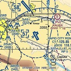
| Sectional chart |
|---|
|
 Download PDF
of official airport diagram from the FAA
| Airport distance calculator |
|---|
|
|
| Sunrise and sunset |
|---|
|
Times for 21-Apr-2026
| | Local
(UTC-6) | | Zulu
(UTC) |
|---|
| Morning civil twilight | | 05:29 | | 11:29 |
| Sunrise | | 06:00 | | 12:00 |
| Sunset | | 19:42 | | 01:42 |
| Evening civil twilight | | 20:13 | | 02:13 |
|
| Current date and time |
|---|
| Zulu (UTC) | 21-Apr-2026 13:40:57 |
|---|
| Local (UTC-6) | 21-Apr-2026 07:40:57 |
|---|
|
| METAR |
|---|
| KRAP | 211252Z 30003KT 10SM CLR 08/00 A2991 RMK AO2 SLP116 T00830000
|
KRCA
5nm N | 211255Z AUTO 27003KT 10SM CLR 09/M01 A2986 RMK AO2 SLP101 T00941008
|
|
| TAF |
|---|
| KRAP | 211120Z 2112/2212 VRB06KT P6SM SKC FM211700 17012G22KT P6SM SKC FM212100 06010KT P6SM FEW250
|
KRCA
5nm N | 211100Z 2111/2217 VRB06KT 9999 FEW100 QNH2985INS BECMG 2117/2118 16015G25KT 9999 FEW100 QNH2985INS BECMG 2200/2201 06006KT 9999 FEW100 QNH2983INS TX29/2122Z TN06/2112Z
|
|
| NOTAMs |
|---|
NOTAMs are issued by the DoD/FAA and will open in a separate window not controlled by AirNav.
|
|


