FAA INFORMATION EFFECTIVE 15 MAY 2025
Location
| FAA Identifier: | EUG |
| Lat/Long: | 44-07-28.5000N 123-12-43.1000W
44-07.475000N 123-12.718333W
44.1245833,-123.2119722
(estimated) |
| Elevation: | 373.7 ft. / 113.9 m (surveyed) |
| Variation: | 15E (2020) |
| From city: | 7 miles NW of EUGENE, OR |
| Time zone: | UTC -7 (UTC -8 during Standard Time) |
| Zip code: | 97402 |
Airport Operations
| Airport use: | Open to the public |
| Activation date: | 02/1943 |
| Control tower: | yes |
| ARTCC: | SEATTLE CENTER |
| FSS: | MC MINNVILLE FLIGHT SERVICE STATION |
| NOTAMs facility: | EUG (NOTAM-D service available) |
| Attendance: | CONTINUOUS |
| Pattern altitude: | 1173.7 ft. MSL |
| Wind indicator: | lighted |
| Segmented circle: | yes |
| Lights: | WHEN ATCT CLSD ACTVT ALSF2 RWY 16R; MALSR RWY 16L; ODALS RWY 34L; REIL RWY 34R - CTAF. PAPI RWY 16R, 16L & 34R; VASI RWY 34L OPR CONSLY. WHEN ATCT CLSD HIRL RWY 16L/34R & 16R/34L PRESET MED INTST. |
| Beacon: | white-green (lighted land airport)
Operates sunset to sunrise. |
| Fire and rescue: | ARFF index B |
| Airline operations: | PPR FOR UNSKED ACR OPS GTR THAN 30 PAX SEATS - 541-682-5430. ARFF AVBL H24. ARFF INDEX C & D H24; PPR. |
Airport Communications
| CTAF: | 118.9 |
| UNICOM: | 122.95 |
| ATIS: | 125.225 |
| WX ASOS: | PHONE 541-203-2648 |
| EUGENE GROUND: | 121.7 269.5 [0600-2330] |
| EUGENE TOWER: | 118.9 ;RWY 16R/34L 124.15 ;RWY 16L/34R 371.9 [0600-2330] |
| CASCADE APPROACH: | 119.6 ;340-159 120.25 ;160-339 298.9 ;160-339 348.7 ;340-159 [0600-2330] |
| CASCADE DEPARTURE: | 119.6 ;340-159 120.25 ;160-339 298.9 ;160-339 348.7 ;340-159 [0600-2330] |
| CLEARANCE DELIVERY: | 121.7 269.5 |
| EMERG: | 121.5 243.0 |
| IC: | 119.6 ;340-159 348.7 ;340-159 |
| WX AWOS-3 at 77S (15 nm SE): | 119.275 (541 895 2349) |
- APCH/DEP CTL SVC PRVDD BY SEATTLE ARTCC (ZSE) ON FREQS 125.8/291.7 (HORTON RCAG) WHEN CASCADE APCH CTL (EUG) CLSD.
Nearby radio navigation aids
| VOR radial/distance | | VOR name | | Freq | | Var |
|---|
| EUG at field | | EUGENE VORTAC | | 112.90 | | 15E |
| CVOr153/22.8 | | CORVALLIS VOR/DME | | 115.40 | | 18E |
Airport Services
| Fuel available: | 100LL JET-A |
| Parking: | tiedowns |
| Airframe service: | MAJOR |
| Powerplant service: | MAJOR |
| Bottled oxygen: | HIGH/LOW |
| Bulk oxygen: | HIGH/LOW |
Runway Information
Runway 16R/34L
| Dimensions: | 8009 x 150 ft. / 2441 x 46 m |
| Surface: | asphalt/grooved, in good condition |
| Weight bearing capacity: | | Single wheel: | 120.0 | | Double wheel: | 250.0 | | Double tandem: | 550.0 |
|
| Runway edge lights: | high intensity |
| RUNWAY 16R | | RUNWAY 34L |
| Latitude: | 44-08.126913N | | 44-06.808782N |
| Longitude: | 123-13.148880W | | 123-13.128960W |
| Elevation: | 360.2 ft. | | 365.5 ft. |
| Traffic pattern: | left | | left |
| Runway heading: | 164 magnetic, 179 true | | 344 magnetic, 359 true |
| Declared distances: | TORA:8009 TODA:8009 ASDA:8009 LDA:8009 | | TORA:8009 TODA:8009 ASDA:8009 LDA:8009 |
| Markings: | precision, in good condition | | precision, in good condition |
| Visual slope indicator: | 4-light PAPI on left (3.00 degrees glide path) | | 4-box VASI on left (3.00 degrees glide path) |
| RVR equipment: | touchdown, midfield, rollout | | touchdown, midfield, rollout |
| Approach lights: | ALSF2: standard 2,400 foot high intensity approach lighting system with centerline sequenced flashers (category II or III) | | ODALS: omnidirectional approach lighting system |
| Centerline lights: | yes | | yes |
| Touchdown point: | yes, lighted | | yes, no lights |
| Instrument approach: | ILS/DME | | |
Runway 16L/34R
| Dimensions: | 6000 x 150 ft. / 1829 x 46 m |
| Surface: | asphalt/grooved, in good condition |
| Weight bearing capacity: | | Single wheel: | 120.0 | | Double wheel: | 211.0 | | Double tandem: | 342.0 |
|
| Runway edge lights: | high intensity |
| RUNWAY 16L | | RUNWAY 34R |
| Latitude: | 44-07.978465N | | 44-06.991027N |
| Longitude: | 123-12.163748W | | 123-12.149110W |
| Elevation: | 363.5 ft. | | 373.6 ft. |
| Traffic pattern: | left | | left |
| Runway heading: | 164 magnetic, 179 true | | 344 magnetic, 359 true |
| Declared distances: | TORA:6000 TODA:6000 ASDA:6000 LDA:6000 | | TORA:6000 TODA:6000 ASDA:6000 LDA:6000 |
| Markings: | precision, in good condition | | precision, in good condition |
| Visual slope indicator: | 4-light PAPI on left (3.00 degrees glide path) | | 4-light PAPI on left (3.00 degrees glide path) |
| Approach lights: | MALSR: 1,400 foot medium intensity approach lighting system with runway alignment indicator lights | | |
| Runway end identifier lights: | | | yes |
| Touchdown point: | yes, no lights | | yes, no lights |
| Instrument approach: | ILS/DME | | |
Airport Ownership and Management from official FAA records
| Ownership: | Publicly-owned |
| Owner: | CITY OF EUGENE
125 E. 8TH
EUGENE, OR 97401
Phone (541) 682-5010 |
| Manager: | CATHRYN STEPHENS
28855 LOCKHEED DRIVE
EUGENE, OR 97402
Phone 541-682-5430 |
Additional Remarks
| A39-16L/34R | PCR VALUE: 688/F/D/X/T |
| A39-16R/34L | PCR VALUE: 2818/F/D/X/T |
| - | WATERFOWL & BIRDS ON & INVOF ARPT. |
| - | TWYS H & K UNAVBL TO 21000 LB SW & 40000 LB DW GWT. |
| - | TRML APRON CLSD; PPR EXC SKED ACR. |
| - | HEL ARR & DEP AVOID OTFC OF AIRLINE PAX TRML & RAMP E OF RWY 16R/34L. |
| - | RWY 34L ACES BYD TWY A6 NA. |
| - | FOR CD IF UNA TO CTC ON FSS FREQ, CTC SEATTLE ARTCC AT 253-351-3694. |
Instrument Procedures
NOTE: All procedures below are presented as PDF files. If you need a reader for these files, you should download the free Adobe Reader.NOT FOR NAVIGATION. Please procure official charts for flight.
FAA instrument procedures published for use from 15 May 2025 at 0901Z to 13 June 2025 at 0900z.
IAPs - Instrument Approach Procedures |
|---|
| ILS OR LOC RWY 16L **CHANGED** | |
download (270KB) |
| ILS OR LOC RWY 16R **CHANGED** | |
download (293KB) |
| ILS RWY 16R (SA CAT I) **CHANGED** | |
download (287KB) |
| ILS RWY 16R (CAT II - III) **CHANGED** | |
download (296KB) |
| RNAV (RNP) Z RWY 16L **CHANGED** | |
download (308KB) |
| RNAV (RNP) Z RWY 16R **CHANGED** | |
download (312KB) |
| RNAV (RNP) Z RWY 34L **CHANGED** | |
download (312KB) |
| RNAV (RNP) Z RWY 34R **CHANGED** | |
download (289KB) |
| RNAV (GPS) Y RWY 16L **CHANGED** | |
download (282KB) |
| RNAV (GPS) Y RWY 16R **CHANGED** | |
download (278KB) |
| RNAV (GPS) Y RWY 34L **CHANGED** | |
download (294KB) |
| RNAV (GPS) Y RWY 34R **CHANGED** | |
download (301KB) |
| VOR OR TACAN RWY 34L **CHANGED** | |
download (261KB) |
| NOTE: Special Alternate Minimums apply | |
download (179KB) |
Departure Procedures |
|---|
| EUGENE ONE | |
download (224KB) |
| NOTE: Special Take-Off Minimums/Departure Procedures apply | |
download (530KB) |
Other nearby airports with instrument procedures:
77S - Hobby Field Airport (15 nm SE)
KCVO - Corvallis Municipal Airport (23 nm N)
S12 - Albany Municipal Airport (31 nm N)
KONP - Newport Municipal Airport (45 nm NW)
KSLE - McNary Field Airport (48 nm N)
|
|

Road maps at:
MapQuest
Bing
Google
| Aerial photo |
|---|
WARNING: Photo may not be current or correct
 Taken in 2006
Do you have a better or more recent aerial photo of Mahlon Sweet Field Airport that you would like to share? If so, please send us your photo.
|
| Sectional chart |
|---|
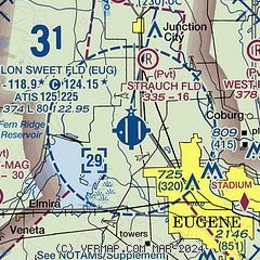
|
CAUTION: Diagram may not be current
 Download PDF
of official airport diagram from the FAA
| Airport distance calculator |
|---|
|
|
| Sunrise and sunset |
|---|
|
Times for 25-May-2025
| | Local
(UTC-7) | | Zulu
(UTC) |
|---|
| Morning civil twilight | | 05:03 | | 12:03 |
| Sunrise | | 05:38 | | 12:38 |
| Sunset | | 20:42 | | 03:42 |
| Evening civil twilight | | 21:16 | | 04:16 |
|
| Current date and time |
|---|
| Zulu (UTC) | 25-May-2025 17:38:34 |
|---|
| Local (UTC-7) | 25-May-2025 10:38:34 |
|---|
|
| METAR |
|---|
| KEUG | 251654Z 16007KT 10SM FEW022 OVC029 13/08 A3008 RMK AO2 SLP184 T01330078 $
|
K77S
15nm SE | 251715Z AUTO 00000KT 10SM BKN017 OVC021 12/09 A3007 RMK A01
|
|
| TAF |
|---|
| KEUG | 251133Z 2512/2612 20006KT P6SM BKN015 FM251700 24008KT P6SM SCT025 BKN250 FM260800 20007KT P6SM -SHRA OVC040
|
|
| NOTAMs |
|---|
NOTAMs are issued by the DoD/FAA and will open in a separate window not controlled by AirNav.
|
|


