FAA INFORMATION EFFECTIVE 16 APRIL 2026
Location
| FAA Identifier: | K81 |
| Lat/Long: | 38-32-26.3090N 094-55-12.8040W
38-32.438483N 094-55.213400W
38.5406414,-94.9202233
(estimated) |
| Elevation: | 943.1 ft. / 287.5 m (surveyed) |
| Variation: | 03E (2000) |
| From city: | 3 miles SW of PAOLA, KS |
| Time zone: | UTC -5 (UTC -6 during Standard Time) |
| Zip code: | 66071 |
Airport Operations
| Airport use: | Open to the public |
| Activation date: | 12/1951 |
| Control tower: | no |
| ARTCC: | KANSAS CITY CENTER |
| FSS: | WICHITA FLIGHT SERVICE STATION |
| NOTAMs facility: | ICT (NOTAM-D service available) |
| Attendance: | IREG
AFTR HRS SVC ON REQ. |
| Wind indicator: | lighted |
| Segmented circle: | yes |
| Lights: | ACTVT REIL RWY 03 & 21; PAPI RWY 03 & 21, MIRL RWY 03/21 - CTAF. |
| Beacon: | white-green (lighted land airport)
DUSK-2400 |
Airport Communications
| CTAF/UNICOM: | 122.8 |
| KANSAS CITY APPROACH: | 118.9 |
| KANSAS CITY DEPARTURE: | 118.9 |
| WX AWOS-3PT at OWI (16 nm W): | 118.25 (785-242-2185) |
| WX ASOS at IXD (17 nm N): | 135.325 (913-780-6987) |
Nearby radio navigation aids
| VOR radial/distance | | VOR name | | Freq | | Var |
|---|
| BUMr301/25.9 | | BUTLER VORTAC | | 115.90 | | 07E |
Airport Services
| Fuel available: | 100LL
100LL:FUEL 24 HRS SELF-SERV. |
| Parking: | tiedowns |
| Airframe service: | MAJOR |
| Powerplant service: | MAJOR |
| Bottled oxygen: | NONE |
| Bulk oxygen: | NONE |
Runway Information
Runway 3/21
| Dimensions: | 3398 x 60 ft. / 1036 x 18 m |
| Surface: | asphalt, in good condition |
| Weight bearing capacity: | |
| Runway edge lights: | medium intensity |
| RUNWAY 3 | | RUNWAY 21 |
| Latitude: | 38-32.248577N | | 38-32.689225N |
| Longitude: | 094-55.393732W | | 094-54.954027W |
| Elevation: | 938.8 ft. | | 940.7 ft. |
| Traffic pattern: | left | | left |
| Runway heading: | 035 magnetic, 038 true | | 215 magnetic, 218 true |
| Markings: | nonprecision, in good condition | | nonprecision, in good condition |
| Visual slope indicator: | 2-light PAPI on left (3.40 degrees glide path) | | 2-light PAPI on left (3.00 degrees glide path) |
| Runway end identifier lights: | yes | | yes |
| Touchdown point: | yes, no lights | | yes, no lights |
| Obstructions: | 70 ft. trees, 1600 ft. from runway, 26 ft. left of centerline, 20:1 slope to clear | | 65 ft. tree, 1850 ft. from runway, 295 ft. left and right of centerline, 25:1 slope to clear |
Runway 15/33
| Dimensions: | 1940 x 60 ft. / 591 x 18 m |
| Surface: | turf, in fair condition |
| RUNWAY 15 | | RUNWAY 33 |
| Latitude: | 38-32.527147N | | 38-32.243273N |
| Longitude: | 094-55.376110W | | 094-55.189127W |
| Elevation: | 925.9 ft. | | 941.0 ft. |
| Traffic pattern: | left | | left |
| Runway heading: | 150 magnetic, 153 true | | 330 magnetic, 333 true |
| Touchdown point: | yes, no lights | | yes, no lights |
| Obstructions: | 33 ft. pline, 90 ft. from runway, 135 ft. left and right of centerline, 2:1 slope to clear | | none |
Airport Ownership and Management from official FAA records
| Ownership: | Publicly-owned |
| Owner: | MIAMI COUNTY
201 S. PEARL
PAOLA, KS 66071
Phone 913-294-9500
SHANE KRULL, CO. ADMIN. |
| Manager: | CHARLES BARTLETT
32549 W 327TH ST
PAOLA, KS 66071
Phone 913-594-0978
CHASBART@EMBARQMAIL.COM |
Additional Remarks
| - | FOR CD CTC KANSAS CITY APCH AT 816-329-2710. |
Instrument Procedures
NOTE: All procedures below are presented as PDF files. If you need a reader for these files, you should download the free Adobe Reader.NOT FOR NAVIGATION. Please procure official charts for flight.
FAA instrument procedures published for use from 16 April 2026 at 0901Z to 14 May 2026 at 0900Z.
IAPs - Instrument Approach Procedures |
|---|
| RNAV (GPS) RWY 03 | |
download (197KB) |
| RNAV (GPS) RWY 21 | |
download (204KB) |
| NOTE: Special Take-Off Minimums/Departure Procedures apply | |
download (360KB) |
Other nearby airports with instrument procedures:
KOWI - Ottawa Municipal Airport (16 nm W)
KIXD - New Century AirCenter Airport (17 nm N)
KOJC - Johnson County Executive Airport (20 nm NE)
KLRY - Lawrence Smith Memorial Airport (27 nm E)
KBUM - Butler Memorial Airport (31 nm SE)
|
|

Road maps at:
MapQuest
Bing
Google
| Aerial photo |
|---|
WARNING: Photo may not be current or correct
 Phtoo by Dave W.
Photo taken 18-Mar-2009
Phtoo by Dave W.
Photo taken 18-Mar-2009
Do you have a better or more recent aerial photo of Miami County Airport that you would like to share? If so, please send us your photo.
|
| Sectional chart |
|---|
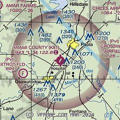
|
| Airport distance calculator |
|---|
|
|
| Sunrise and sunset |
|---|
|
Times for 12-May-2026
| | Local
(UTC-5) | | Zulu
(UTC) |
|---|
| Morning civil twilight | | 05:42 | | 10:42 |
| Sunrise | | 06:12 | | 11:12 |
| Sunset | | 20:20 | | 01:20 |
| Evening civil twilight | | 20:50 | | 01:50 |
|
| Current date and time |
|---|
| Zulu (UTC) | 12-May-2026 15:41:27 |
|---|
| Local (UTC-5) | 12-May-2026 10:41:27 |
|---|
|
| METAR |
|---|
KOWI
16nm W | 121515Z AUTO 20020G26KT CLR 23/09 A3006 RMK AO2 PWINO
|
KIXD
17nm N | 121453Z 20017G29KT 10SM CLR 21/09 A3009 RMK AO2 PK WND 20029/1435 SLP180 T02110089 58005 $
|
KOJC
21nm NE | 121453Z 20011G19KT 10SM CLR 21/10 A3008 RMK AO2 SLP180 T02110100 58003
|
KGVW
24nm NE | 121515Z AUTO 06006KT M1/4SM HZ OVC014 22/19 A3012 RMK A01
|
KLRY
27nm E | 121515Z AUTO 23012G18KT 10SM CLR 22/09 A3014 RMK AO2
|
|
| TAF |
|---|
KIXD
17nm N | 121120Z 1212/1312 17008KT P6SM SCT250 FM121400 21017G25KT P6SM SCT250 FM122200 25010KT P6SM BKN100 FM130100 32006KT P6SM SCT250
|
|
| NOTAMs |
|---|
NOTAMs are issued by the DoD/FAA and will open in a separate window not controlled by AirNav.
|
|

