FAA INFORMATION EFFECTIVE 16 APRIL 2026
Location
| FAA Identifier: | ATA |
| Lat/Long: | 33-06-09.1000N 094-11-42.1000W
33-06.151667N 094-11.701667W
33.1025278,-94.1950278
(estimated) |
| Elevation: | 280.3 ft. / 85.4 m (surveyed) |
| Variation: | 04E (2000) |
| From city: | 2 miles SW of ATLANTA, TX |
| Time zone: | UTC -5 (UTC -6 during Standard Time) |
| Zip code: | 75551 |
Airport Operations
| Airport use: | Open to the public |
| Activation date: | 11/1946 |
| Control tower: | no |
| ARTCC: | FORT WORTH CENTER |
| FSS: | FORT WORTH FLIGHT SERVICE STATION |
| NOTAMs facility: | FTW (NOTAM-D service available) |
| Attendance: | IREG |
| Wind indicator: | lighted |
| Segmented circle: | yes |
| Lights: | ACTVT REIL RWY 05 & 23; MIRL RWY 05/23 - CTAF. |
| Beacon: | white-green (lighted land airport)
Operates sunset to sunrise. |
Airport Communications
| CTAF: | 122.9 |
| WX AWOS-3: | 118.250 (903-799-4066) |
- APCH/DEP CTL SVC PRVDD BY FORT WORTH ARTCC (ZFW) ON FREQS 123.925/269.475 (TEXARKANA RCAG).
Nearby radio navigation aids
| VOR radial/distance | | VOR name | | Freq | | Var |
|---|
| TXKr187/25.4 | | TEXARKANA VORTAC | | 116.30 | | 07E |
| EICr309/27.8 | | BELCHER VORTAC | | 117.40 | | 07E |
| NDB name | | Hdg/Dist | | Freq | | Var | | ID |
|---|
| ATLANTA | | at field | | 347 | | 04E | | ATA | .- - .- |
Airport Services
| Fuel available: | 100LL
100LL:FUEL AVBL 24 HRS SELF-SERVE. |
| Parking: | tiedowns |
| Bottled oxygen: | NONE |
| Bulk oxygen: | NONE |
Runway Information
Runway 5/23
| Dimensions: | 3800 x 60 ft. / 1158 x 18 m |
| Surface: | asphalt, in fair condition |
| Weight bearing capacity: | |
| Runway edge lights: | medium intensity |
| RUNWAY 5 | | RUNWAY 23 |
| Latitude: | 33-05.974165N | | 33-06.358928N |
| Longitude: | 094-11.980172W | | 094-11.392522W |
| Elevation: | 280.3 ft. | | 268.2 ft. |
| Traffic pattern: | left | | left |
| Runway heading: | 048 magnetic, 052 true | | 228 magnetic, 232 true |
| Markings: | nonprecision, in fair condition | | nonprecision, in fair condition |
| Visual slope indicator: | 2-light PAPI on left (4.00 degrees glide path) | | 2-light PAPI on left (4.00 degrees glide path) |
| Runway end identifier lights: | yes | | yes |
| Touchdown point: | yes, no lights | | yes, no lights |
| Obstructions: | 45 ft. trees, 350 ft. from runway, 250 ft. right of centerline, 3:1 slope to clear
25 FT TREES, 0 FT DSTC, 165 FT R. | | 60 ft. trees, 201 ft. from runway, 185 ft. left of centerline
40 FT TREES 0-199 FT FM THR 135 L. |
Runway 15/33
| Dimensions: | 2264 x 75 ft. / 690 x 23 m |
| Surface: | turf, in good condition |
| Runway edge markings: | RWY MKD WITH 1 FT YELLOW PLASTIC PIPES. |
| RUNWAY 15 | | RUNWAY 33 |
| Latitude: | 33-06.299907N | | 33-05.949653N |
| Longitude: | 094-11.805742W | | 094-11.652232W |
| Elevation: | 273.2 ft. | | 261.4 ft. |
| Traffic pattern: | left | | left |
| Runway heading: | 156 magnetic, 160 true | | 336 magnetic, 340 true |
| Touchdown point: | yes, no lights | | yes, no lights |
| Obstructions: | 30 ft. trees, 80 ft. left of centerline
50 FT UNMKD PWR LINES 560 DSTC ACRS APCH. MKD PWR LINES LWR THAN TREES. | | 50 ft. trees, 50 ft. left and right of centerline |
Airport Ownership and Management from official FAA records
| Ownership: | Publicly-owned |
| Owner: | CITY OF ATLANTA
CITY HALL 315 N BUCKER, P.O. BOX 669
ATLANTA, TX 75551
Phone 903-796-7153 |
| Manager: | DANICA PORTER
PO BOX 669
ATLANTA, TX 75551
Phone 903-796-2192
EXT 120. |
Additional Remarks
| - | FERAL HOGS & DEER ON ARPT. |
| - | RWY 23, 24 FT MKD POWERLINE 500 FT DSTC. |
| - | RWY 05 TRRN SLOPES +20 FT 670 FT FM THR. |
| - | RWY 33, 42 FT MKD POWERLINE, 285 FT DSTC. |
| - | FOR CD CTC FORT WORTH ARTCC AT 817-858-7584. |
Instrument Procedures
NOTE: All procedures below are presented as PDF files. If you need a reader for these files, you should download the free Adobe Reader.NOT FOR NAVIGATION. Please procure official charts for flight.
FAA instrument procedures published for use from 16 April 2026 at 0901Z to 14 May 2026 at 0900Z.
IAPs - Instrument Approach Procedures |
|---|
| RNAV (GPS) RWY 05 | |
download (226KB) |
| NDB RWY 05 | |
download (199KB) |
| NOTE: Special Take-Off Minimums/Departure Procedures apply | |
download (304KB) |
Other nearby airports with instrument procedures:
3F4 - Vivian Airport (17 nm SE)
KTXK - Texarkana Regional Airport-Webb Field (23 nm NE)
KASL - Harrison County Airport (35 nm S)
KOSA - Mount Pleasant Regional Airport (39 nm W)
KSPH - Springhill Airport (40 nm E)
|
|

Road maps at:
MapQuest
Bing
Google
| Aerial photo |
|---|
WARNING: Photo may not be current or correct
 Photo taken 03-Sep-2006
Do you have a better or more recent aerial photo of Hall-Miller Municipal Airport that you would like to share? If so, please send us your photo.
|
| Sectional chart |
|---|
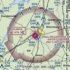
|
| Airport distance calculator |
|---|
|
|
| Sunrise and sunset |
|---|
|
Times for 03-May-2026
| | Local
(UTC-5) | | Zulu
(UTC) |
|---|
| Morning civil twilight | | 06:02 | | 11:02 |
| Sunrise | | 06:28 | | 11:28 |
| Sunset | | 19:59 | | 00:59 |
| Evening civil twilight | | 20:26 | | 01:26 |
|
| Current date and time |
|---|
| Zulu (UTC) | 03-May-2026 21:35:00 |
|---|
| Local (UTC-5) | 03-May-2026 16:35:00 |
|---|
|
| METAR |
|---|
| KATA | 032115Z AUTO RMK AO2 PWINO TSNO $
|
|
| TAF |
|---|
KTXK
23nm NE | 032018Z 0320/0418 23011G17KT P6SM FEW070 FM040000 20007KT P6SM SCT250 FM041500 21015G25KT P6SM SCT250
|
|
| NOTAMs |
|---|
NOTAMs are issued by the DoD/FAA and will open in a separate window not controlled by AirNav.
|
|

