FAA INFORMATION EFFECTIVE 09 JULY 2026
Location
| FAA Identifier: | BTM |
| Lat/Long: | 45-57-17.3000N 112-29-50.9000W
45-57.288333N 112-29.848333W
45.9548056,-112.4974722
(estimated) |
| Elevation: | 5550.5 ft. / 1691.8 m (surveyed) |
| Variation: | 12E (2020) |
| From city: | 3 miles SE of BUTTE, MT |
| Time zone: | UTC -6 (UTC -7 during Standard Time) |
| Zip code: | 59701 |
Airport Operations
| Airport use: | Open to the public |
| Activation date: | 04/1940 |
| Control tower: | no |
| ARTCC: | SALT LAKE CITY CENTER |
| FSS: | GREAT FALLS FLIGHT SERVICE STATION |
| NOTAMs facility: | BTM (NOTAM-D service available) |
| Attendance: | DAWN-DUSK |
| Wind indicator: | lighted |
| Segmented circle: | yes |
| Lights: | ACTVT MALSR RWY 15; REIL RWY 12 & 30; PAPI RWY 12 & 30; VASI RWY 33; MIRL RWY 15/33 & 12/30 - CTAF. PAPI RWY 15 OPR CONSLY. |
| Beacon: | white-green (lighted land airport)
Operates sunset to sunrise. |
| Landing fee: | yes, FEE FOR ALL COML ACFT & ACFT OVER 9000 LBS. |
| Fire and rescue: | ARFF index A |
| Airline operations: | PPR FOR UNSKED ACR OPNS WITH MORE THAN 30 PSGR SEATS CALL AMGR 406-494-3771. |
| International operations: | customs landing rights airport |
Airport Communications
| CTAF/UNICOM: | 123.0 |
| WX ASOS: | 135.175 (406-494-1870) |
| WX AWOS-3PT at 3U3 (19 nm NW): | 124.175 (406-563-8275) |
- APCH/DEP CTL SVC PRVDD BY SALT LAKE ARTCC (ZLC) ON FREQS 132.4/338.3 (BUTTE RCAG).
- COMMUNICATIONS PRVDD BY GREAT FALLS RADIO ON FREQ 122.3 (COPPERTOWN RCO).
Nearby radio navigation aids
| VOR radial/distance | | VOR name | | Freq | | Var |
|---|
| CPNr098/11.4 | | COPPERTOWN VOR/DME | | 116.05 | | 16E |
| HIAr274/14.8 | | WHITEHALL VOR/DME | | 113.70 | | 18E |
Airport Services
| Fuel available: | 100 100LL JET-A |
| Parking: | hangars and tiedowns |
| Airframe service: | MAJOR |
| Powerplant service: | MAJOR |
| Bottled oxygen: | HIGH/LOW |
| Bulk oxygen: | HIGH/LOW |
Runway Information
Runway 15/33
| Dimensions: | 9000 x 150 ft. / 2743 x 46 m |
| Surface: | asphalt/grooved, in good condition |
| Weight bearing capacity: | | Single wheel: | 60.0 | | Double wheel: | 125.0 | | Double tandem: | 175.0 |
|
| Runway edge lights: | medium intensity |
| RUNWAY 15 | | RUNWAY 33 |
| Latitude: | 45-58.015583N | | 45-56.573850N |
| Longitude: | 112-30.072095W | | 112-29.589963W |
| Elevation: | 5506.7 ft. | | 5550.4 ft. |
| Traffic pattern: | right | | left |
| Runway heading: | 155 magnetic, 167 true | | 335 magnetic, 347 true |
| Declared distances: | TORA:9000 TODA:9000 ASDA:9000 LDA:9000 | | TORA:9000 TODA:9000 ASDA:9000 LDA:9000 |
| Markings: | precision, in good condition | | basic, in good condition |
| Visual slope indicator: | 4-light PAPI on left (3.50 degrees glide path) | | 2-box VASI on left (3.00 degrees glide path)
DO NOT USE VASI BYD 1.5 MI DUE TO HIGH TERRAIN. |
| Approach lights: | MALSR: 1,400 foot medium intensity approach lighting system with runway alignment indicator lights | | |
| Runway end identifier lights: | no | | no |
| Touchdown point: | yes, no lights | | yes, no lights |
| Instrument approach: | ILS/DME | | |
| Obstructions: | none | | 65 ft. tower, 2986 ft. from runway, 248 ft. right of centerline, 42:1 slope to clear |
Runway 12/30
| Dimensions: | 5100 x 75 ft. / 1554 x 23 m |
| Surface: | asphalt/grooved, in good condition
SURFACE CONDITIONS UNMONITORED BETWEEN MIDNIGHT AND 5 A.M. |
| Weight bearing capacity: | |
| Runway edge lights: | medium intensity |
| RUNWAY 12 | | RUNWAY 30 |
| Latitude: | 45-57.539507N | | 45-57.010190N |
| Longitude: | 112-30.344165W | | 112-29.411215W |
| Elevation: | 5520.7 ft. | | 5530.6 ft. |
| Traffic pattern: | left | | left |
| Runway heading: | 117 magnetic, 129 true | | 297 magnetic, 309 true |
| Declared distances: | TORA:5100 TODA:5100 ASDA:5100 LDA:5100 | | TORA:5100 TODA:5100 ASDA:5100 LDA:5100 |
| Markings: | basic, in good condition | | basic, in good condition |
| Visual slope indicator: | 2-light PAPI on left (4.00 degrees glide path)
PAPI UNUSBL BYD 5 DEG RIGHT OF RCL. | | 2-light PAPI on left (4.00 degrees glide path)
PAPI RSTRD TO 2.1 NM FM RWY 30 THLD DUE TO HIGH TERRAIN. PAPI UNUSBL BYD 2 DEG RIGHT OF RCL. |
| Runway end identifier lights: | yes | | yes |
| Touchdown point: | yes, no lights | | yes, no lights |
| Obstructions: | 16 ft. road, 560 ft. from runway, 275 ft. right of centerline, 22:1 slope to clear | | 36 ft. bldg, 1251 ft. from runway, 100 ft. right of centerline, 29:1 slope to clear |
Airport Ownership and Management from official FAA records
| Ownership: | Publicly-owned |
| Owner: | BERT MOONEY, ARPT AUTH
101 AIRPORT ROAD
BUTTE, MT 59701
Phone 406-494-3771 |
| Manager: | PAM CHAMBERLIN
101 AIRPORT RD
BUTTE, MT 59701
Phone 406-494-3771 |
Additional Remarks
| A39-12/30 | PCR VALUE: 210/F/A/X/T |
| A39-15/33 | PCR VALUE: 510/F/A/X/T |
| - | FOR CD IF UNA TO CTC ON FSS FREQ, CTC SALT LAKE ARTCC AT 801-320-2568. |
| - | TWY D RSTD TO ACFT WITH WINGSPAN LESS THAN 100 FT WO PPR, CALL APMGR 406-494-3771. |
| - | DEER IN VICINITY OF AIRPORT. |
| - | SNOW REMOVAL OPS IN PROGRES DURING PERIODS OF SNOW. |
| - | COLD TEMPERATURE AIRPORT. ALTITUDE CORRECTION REQUIRED AT OR BELOW -24C. |
Instrument Procedures
NOTE: All procedures below are presented as PDF files. If you need a reader for these files, you should download the free Adobe Reader.NOT FOR NAVIGATION. Please procure official charts for flight.
FAA instrument procedures published for use from 09 July 2026 at 0901Z to 06 August 2026 at 0900Z.
IAPs - Instrument Approach Procedures |
|---|
| ILS OR LOC RWY 15 | |
download (378KB) |
| RNAV (GPS) RWY 15 | |
download (366KB) |
| VOR-A | |
download (296KB) |
| NOTE: Special Alternate Minimums apply | |
download (214KB) |
| NOTE: Special Take-Off Minimums/Departure Procedures apply | |
download (422KB) |
Other nearby airports with instrument procedures:
3U3 - Bowman Field Airport (19 nm NW)
KRVF - Ruby Valley Field Airport (26 nm S)
38S - Deer Lodge-City-County Airport (28 nm NW)
KDLN - Dillon Airport (42 nm S)
KHLN - Helena Regional Airport (45 nm NE)
|
|

Road maps at:
MapQuest
Bing
Google
| Aerial photo |
|---|
WARNING: Photo may not be current or correct
 Photo taken 16-Jan-2006
from a Cessna 172 at 6500' msl looking northward
Photo taken 16-Jan-2006
from a Cessna 172 at 6500' msl looking northward
Do you have a better or more recent aerial photo of Bert Mooney Airport that you would like to share? If so, please send us your photo.
|
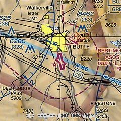
| Sectional chart |
|---|
|
CAUTION: Diagram may not be current

| Airport distance calculator |
|---|
|
|
| Sunrise and sunset |
|---|
|
Times for 01-Aug-2026
| | Local
(UTC-6) | | Zulu
(UTC) |
|---|
| Morning civil twilight | | 05:39 | | 11:39 |
| Sunrise | | 06:14 | | 12:14 |
| Sunset | | 20:59 | | 02:59 |
| Evening civil twilight | | 21:33 | | 03:33 |
|
| Current date and time |
|---|
| Zulu (UTC) | 01-Aug-2026 09:27:34 |
|---|
| Local (UTC-6) | 01-Aug-2026 03:27:34 |
|---|
|
| METAR |
|---|
| KBTM | 010853Z AUTO 00000KT 10SM CLR 14/08 A3024 RMK AO2 SLP176 T01440078 58003
|
K3U3
19nm NW | 010855Z AUTO 22005KT 10SM CLR 14/05 A3017 RMK AO2 T01430054 $
|
|
| TAF |
|---|
| KBTM | 010523Z 0106/0206 15004KT P6SM SKC FM011900 22010G18KT P6SM SKC FM012200 25015G25KT P6SM SKC FM020300 32010KT P6SM SKC
|
|
| NOTAMs |
|---|
NOTAMs are issued by the DoD/FAA and will open in a separate window not controlled by AirNav.
|
|


