FAA INFORMATION EFFECTIVE 14 MAY 2026
Location
| FAA Identifier: | CMA |
| Lat/Long: | 34-12-49.5300N 119-05-39.6750W
34-12.825500N 119-05.661250W
34.2137583,-119.0943542
(estimated) |
| Elevation: | 76.8 ft. / 23.4 m (surveyed) |
| Variation: | 14E (1990) |
| From city: | 3 miles W of CAMARILLO, CA |
| Time zone: | UTC -7 (UTC -8 during Standard Time) |
| Zip code: | 93010 |
Airport Operations
| Airport use: | Open to the public |
| Activation date: | 12/1976 |
| Control tower: | yes |
| ARTCC: | LOS ANGELES CENTER |
| FSS: | HAWTHORNE FLIGHT SERVICE STATION |
| NOTAMs facility: | CMA (NOTAM-D service available) |
| Attendance: | 0700-2300 |
| Pattern altitude: | 876.8 ft. MSL
TPA SINGLE ENGINE 800 FT AGL; MULTI ENGINE AND JETS 1000 FT AGL. |
| Wind indicator: | lighted |
| Segmented circle: | yes |
| Lights: | WHEN ATCT CLSD ACTVT MIRL RY 08/26, REIL RYS 08 AND 26 AND PAPI RYS 8 AND 26 - CTAF. |
| Beacon: | white-green (lighted land airport)
Operates sunset to sunrise. |
| Landing fee: | yes, LNDG FEE FOR ACFT OVER 12,500 LBS. |
Airport Communications
| CTAF: | 128.2 |
| UNICOM: | 122.95 |
| ATIS: | 126.025 |
| WX ASOS: | 126.025 (805-384-9294) |
| CAMARILLO GROUND: | 121.8 [0700-2100] |
| CAMARILLO TOWER: | 128.2 269.4 [0700-2100] |
| POINT MUGU APPROACH: | 124.7 |
| POINT MUGU DEPARTURE: | 124.7 |
| CLEARANCE DELIVERY: | 120.75 ;2100-2300, POINT MUGU NAS 121.8 ;0700-2100 120.75 |
| GUERA STAR: | 120.4 |
| WX ASOS at OXR (6 nm W): | PHONE 805-382-0569 |
- APCH/DEP CTL SVC PRVDD BY LOS ANGELES ARTCC (ZLA) ON FREQS 135.5/327.1 (SANTA BARBARA RCAG) WHEN POINT MUGU APCH CTL (NTD) CLSD.
- FOR AFTR HRS IFR CLNC DEL CTC LOS ANGELES ARTCC 661 575-2052.
Nearby radio navigation aids
| VOR radial/distance | | VOR name | | Freq | | Var |
|---|
| CMA at field | | CAMARILLO VOR/DME | | 116.85 | | 15E |
| VTUr324/6.3 | | VENTURA VOR/DME | | 116.55 | | 15E |
| FIMr216/13.6 | | FILLMORE VORTAC | | 112.50 | | 15E |
| VNYr254/29.9 | | VAN NUYS VOR/DME | | 113.10 | | 15E |
| SMOr276/33.9 | | SANTA MONICA VOR/DME | | 110.80 | | 15E |
| LAXr282/37.0 | | LOS ANGELES VORTAC | | 113.60 | | 15E |
| GMNr182/37.2 | | GORMAN VORTAC | | 116.10 | | 16E |
| RZSr104/37.9 | | SAN MARCUS VORTAC | | 114.90 | | 14E |
| LHSr207/38.1 | | LAKE HUGHES VORTAC | | 114.35 | | 15E |
Airport Services
| Fuel available: | 100LL JET-A
100LL:FUEL AVBL 24 HRS SELF SERVE. |
| Parking: | tiedowns |
| Airframe service: | MAJOR |
| Powerplant service: | MAJOR |
| Bottled oxygen: | NONE |
| Bulk oxygen: | LOW |
Runway Information
Runway 8/26
| Dimensions: | 6013 x 150 ft. / 1833 x 46 m |
| Surface: | asphalt/concrete/rubberized friction seal coat, in good condition |
| Weight bearing capacity: | | Single wheel: | 50.0 | | Double wheel: | 80.0 | | Double tandem: | 125.0 |
|
| Runway edge lights: | medium intensity |
| RUNWAY 8 | | RUNWAY 26 |
| Latitude: | 34-12.830325N | | 34-12.820615N |
| Longitude: | 119-06.257833W | | 119-05.064652W |
| Elevation: | 63.1 ft. | | 76.8 ft. |
| Traffic pattern: | right | | left |
| Runway heading: | 076 magnetic, 090 true | | 256 magnetic, 270 true |
| Markings: | nonprecision, in good condition | | nonprecision, in good condition |
| Visual slope indicator: | 4-light PAPI on left (3.00 degrees glide path) | | 4-light PAPI on left (3.00 degrees glide path) |
| Runway end identifier lights: | yes | | yes |
| Touchdown point: | yes, no lights | | yes, no lights |
Helipad H1
| Dimensions: | 34 x 34 ft. / 10 x 10 m |
| Surface: | concrete |
| Latitude: | 34-12.904680N | | |
| Longitude: | 119-05.475840W | | |
| Elevation: | 71.0 ft. | | |
| Traffic pattern: | left | | left |
Helipad H2
| Dimensions: | 34 x 34 ft. / 10 x 10 m |
| Surface: | concrete |
| Latitude: | 34-12.905280N | | |
| Longitude: | 119-05.517780W | | |
| Elevation: | 72.0 ft. | | |
| Traffic pattern: | left | | left |
Airport Ownership and Management from official FAA records
| Ownership: | Publicly-owned |
| Owner: | COUNTY OF VENTURA
555 AIRPORT WAY
CAMARILLO, CA 93010-8544
Phone 805-388-4372 |
| Manager: | KEITH FREITAS
555 AIRPORT WAY, SUITE B
CAMARILLO, CA 93010-8544
Phone 805-388-4372
KEITH.FREITAS@VENTURA.ORG |
Additional Remarks
| A96 | ULTRALIGHT ACTIVITY SW QUAD OF ARPT. |
| - | UNLGTD MTN 1173 FT MSL; BEGINNING 5 MILES FM EAST END RY 26. UNLGTD MTN 1814 FT MSL 5 MILES TO ESE OF APCH END RY 26. |
| - | NO FORMATION TKOFS OR LDGS. |
| - | HEL TRNG PADS TO THE N OF TWY B AND RY 8/26. |
| - | UPON ARR CTC FBO OR ARPT OPS 805-947-6803 FOR ASSISTANCE. |
| - | NOISE ORDINANCE CURFEW: ALL ACFT NO TKOFS BTN 0000 AND 0500 EXCP MIL, GOVT, MERCY FLTS & EMERG RESP. |
| - | NOISE: AVOID OVERFLIGHT OF RESIDENTIAL COMMUNITIES EAST AND NORTH OF ARPT WHEN POSS. |
| - | NOISE: ALL JET/TURBINE ACFT AVOID FLTS BTN 10PM AND 6AM LOCAL TO RDC NOISE OVER COMMUNITY. |
| - | WILDLIFE ON AND INVOF ARPT. |
| - | NOISE: ARR USE RWY 8, IF ABLE, WHEN ATCT CLSD. |
| - | NOISE: FLY FRIENDLY PROCEDURES IN EFFECT. VISIT VENTURA COUNTY AIRPORTS WEBSITE FOR DETAILS. |
| - | WT RSTRD TO ACFT WITH MAX TKOF WT BLW 115OOO LBS DUAL WHEEL GEAR. |
| - | NO LDGS/TAXIING/TKOFS ON CHEVERONED AREA EAST OF RY 26 THR. |
| - | NOISE: EXTREME NOISE SENSITIVE AREA. |
| - | BE ALERT TO HIGH PERFORMANCE MIL ACFT OPNS INVOF ARPT. |
Instrument Procedures
NOTE: All procedures below are presented as PDF files. If you need a reader for these files, you should download the free Adobe Reader.NOT FOR NAVIGATION. Please procure official charts for flight.
FAA instrument procedures published for use from 14 May 2026 at 0901Z to 11 June 2026 at 0900Z.
STARs - Standard Terminal Arrivals |
|---|
| GUERA TWO (RNAV) | |
2 pages:
[1] [2] (400KB) |
IAPs - Instrument Approach Procedures |
|---|
| RNAV (GPS) RWY 08 | |
download (303KB) |
| RNAV (GPS) Y RWY 26 | |
download (341KB) |
| RNAV (GPS) Z RWY 26 | |
download (302KB) |
| VOR RWY 26 | |
download (362KB) |
| NOTE: Special Alternate Minimums apply | |
download (118KB) |
| NOTE: Special Take-Off Minimums/Departure Procedures apply | |
download (198KB) |
Other nearby airports with instrument procedures:
KOXR - Oxnard Airport (6 nm W)
KNTD - Point Mugu Naval Air Station (Naval Base Ventura County) (6 nm S)
KVNY - Van Nuys Airport (30 nm E)
KWHP - Whiteman Airport (34 nm E)
KSMO - Santa Monica Municipal Airport (34 nm E)
|
|

Road maps at:
MapQuest
Bing
Google
| Aerial photo |
|---|
WARNING: Photo may not be current or correct
 Photo by www.focalflight.com
Photo taken 12-Jun-2020
looking northeast.
Photo by www.focalflight.com
Photo taken 12-Jun-2020
looking northeast.
Do you have a better or more recent aerial photo of Camarillo Airport that you would like to share? If so, please send us your photo.
|
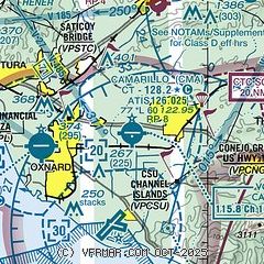
| Sectional chart |
|---|
|
CAUTION: Diagram may not be current
 Download PDF
of official airport diagram from the FAA
| Airport distance calculator |
|---|
|
|
| Sunrise and sunset |
|---|
|
Times for 24-May-2026
| | Local
(UTC-7) | | Zulu
(UTC) |
|---|
| Morning civil twilight | | 05:21 | | 12:21 |
| Sunrise | | 05:50 | | 12:50 |
| Sunset | | 19:57 | | 02:57 |
| Evening civil twilight | | 20:25 | | 03:25 |
|
| Current date and time |
|---|
| Zulu (UTC) | 25-May-2026 06:11:55 |
|---|
| Local (UTC-7) | 24-May-2026 23:11:55 |
|---|
|
| METAR |
|---|
| KCMA | 250555Z 00000KT 10SM CLR 14/11 A2999 RMK AO2 SLP162 T01440106 10206 20139 53011
|
KOXR
5nm W | 250551Z AUTO 28006KT 10SM CLR 14/11 A2998 RMK AO2 SLP152 T01440111 10183 20144 53010
|
KNTD
6nm S | 250555Z AUTO 29003KT 10SM CLR 13/11 A3000 RMK AO2 SLP159 6//// T01330111 10189 20133 53011 PWINO PNO $
|
|
| TAF |
|---|
| KCMA | 250543Z 2506/2606 VRB03KT P6SM FEW020 FM251500 23005KT P6SM SCT025 FM252100 25010G16KT P6SM FEW025 FM260400 26006KT P6SM SCT025
|
KOXR
5nm W | 250543Z 2506/2606 29005KT P6SM FEW020 FM251400 22007KT P6SM SCT025 FM252100 27012G18KT P6SM FEW025 FM260400 27008KT P6SM SCT025
|
|
| NOTAMs |
|---|
NOTAMs are issued by the DoD/FAA and will open in a separate window not controlled by AirNav.
|
|


