FAA INFORMATION EFFECTIVE 22 JANUARY 2026
Location
| FAA Identifier: | GGG |
| Lat/Long: | 32-23-02.4000N 094-42-41.4000W
32-23.040000N 094-42.690000W
32.3840000,-94.7115000
(estimated) |
| Elevation: | 365.5 ft. / 111.4 m (surveyed) |
| Variation: | 03E (2010) |
| From city: | 8 miles S of LONGVIEW, TX |
| Time zone: | UTC -6 (UTC -5 during Daylight Saving Time) |
| Zip code: | 75603 |
Airport Operations
| Airport use: | Open to the public |
| Activation date: | 07/1945 |
| Control tower: | yes |
| ARTCC: | FORT WORTH CENTER |
| FSS: | FORT WORTH FLIGHT SERVICE STATION |
| NOTAMs facility: | GGG (NOTAM-D service available) |
| Attendance: | 0600-2100 |
| Wind indicator: | lighted |
| Segmented circle: | yes |
| Lights: | HIRL RWY 13/31 PRESET MED INTST; TO INCR INTST ACTVT - CTAF. WHEN ATCT CLSD ACTVT MALSR RWY 13 - CTAF. MIRL RWY 18/36 NOT AVBL WHEN ATCT CLSD. |
| Beacon: | white-green (lighted land airport)
Operates sunset to sunrise. |
| Fire and rescue: | ARFF index A |
| Airline operations: | PPR FOR UNSCHEDULED ACR OPNS WITH OVER 30 PSGR SEATS. INDEX B AVBL ON REQUEST. |
Airport Communications
| CTAF: | 119.2 |
| UNICOM: | 122.95 |
| ATIS: | 119.65 |
| WX ASOS: | PHONE 903-643-4029 |
| EASTEX GROUND: | 121.6 [0600-2200] |
| EASTEX TOWER: | 119.2 377.05 [0600-2200] |
| LONGVIEW APPROACH: | 124.275 ;EAST 4000 FT & BLW 124.675 ;WEST, 5000 & BLW 127.325 ;AT OR BLW 4000 FT 127.325 ;EAST 4500-12000 FT 128.75 ;WEST, 7000 & BLW 257.975 ;EAST, 4000 & BLW 282.225 ;WEST 5000 FT & BLW 379.15 ;WEST 5000 & BLW [0600-2200] |
| LONGVIEW DEPARTURE: | 124.275 ;EAST 4000 FT & BLW 127.325 ;AT OR BLW 4000 FT 127.325 ;EAST 4500-12000 FT 128.75 ;WEST, 7000 & BLW 257.975 ;EAST, 4000 & BLW 282.225 ;WEST 5000 FT & BLW 379.15 ;WEST 5000 & BLW [0600-2200] |
| EMERG: | 121.5 243.0 |
| IC: | 124.675 ;WEST, 5000 & BLW 257.975 ;EAST, 4000 & BLW |
| TRSA: | 124.275 ;EAST 4000 FT & BLW 124.675 ;WEST 5000 FT & BLW 127.325 ;4500 FT & ABV 128.75 ;WEST 7000 FT & BLW 257.975 ;EAST 4000 FT & BLW 282.225 ;WEST 5000 FT & BLW 379.15 ;WEST 5000 FT & BLW |
| WX AWOS-3 at RFI (16 nm SW): | 119.375 (903-657-0384) |
- APCH/DEP CTL SVC PRVDD BY FORT WORTH ARTCC (ZFW) ON FREQS 126.325/346.25 (SHREVEPORT RCAG) WHEN LONGVIEW APCH CTL (GGG) CLSD.
Nearby radio navigation aids
| VOR radial/distance | | VOR name | | Freq | | Var |
|---|
| GGGr127/2.9 | | GREGG COUNTY VORTAC | | 112.90 | | 07E |
| TYRr081/35.1 | | TYLER VOR/DME | | 114.20 | | 06E |
| NDB name | | Hdg/Dist | | Freq | | Var | | ID |
|---|
| AMBASSADOR | | 114/23.7 | | 404 | | 07E | | ABG | .- -... --. |
Airport Services
| Fuel available: | 100LL JET-A
100LL:FOR FUEL AFT HRS CALL 903-643-8748. |
| Parking: | hangars and tiedowns |
| Airframe service: | MAJOR |
| Powerplant service: | MAJOR |
| Bottled oxygen: | HIGH/LOW |
| Bulk oxygen: | NONE |
Runway Information
Runway 13/31
| Dimensions: | 10000 x 150 ft. / 3048 x 46 m |
| Surface: | asphalt/grooved, in good condition |
| Weight bearing capacity: | | Single wheel: | 95.0 | | Double wheel: | 155.0 | | Double tandem: | 288.0 |
|
| Runway edge lights: | high intensity |
| RUNWAY 13 | | RUNWAY 31 |
| Latitude: | 32-23.552655N | | 32-22.411608N |
| Longitude: | 094-43.207380W | | 094-41.804342W |
| Elevation: | 357.7 ft. | | 353.9 ft. |
| Traffic pattern: | left | | left |
| Runway heading: | 131 magnetic, 134 true | | 311 magnetic, 314 true |
| Displaced threshold: | 800 ft. | | no |
| Declared distances: | TORA:10000 TODA:10000 ASDA:10000 LDA:9200 | | TORA:10000 TODA:10000 ASDA:9200 LDA:9200 |
| Markings: | precision, in good condition | | precision, in good condition |
| Visual slope indicator: | | | 4-light PAPI on left (3.00 degrees glide path) |
| RVR equipment: | touchdown | | rollout |
| Approach lights: | MALSR: 1,400 foot medium intensity approach lighting system with runway alignment indicator lights | | |
| Touchdown point: | yes, no lights | | yes, no lights |
| Instrument approach: | ILS | | |
Runway 18/36
| Dimensions: | 6110 x 150 ft. / 1862 x 46 m |
| Surface: | asphalt/grooved, in good condition |
| Weight bearing capacity: | | Single wheel: | 95.0 | | Double wheel: | 155.0 | | Double tandem: | 280.0 |
|
| Runway edge lights: | medium intensity |
| RUNWAY 18 | | RUNWAY 36 |
| Latitude: | 32-23.640502N | | 32-22.633192N |
| Longitude: | 094-43.001867W | | 094-42.976775W |
| Elevation: | 354.3 ft. | | 365.5 ft. |
| Traffic pattern: | left | | left |
| Runway heading: | 176 magnetic, 179 true | | 356 magnetic, 359 true |
| Declared distances: | TORA:6109 TODA:6109 ASDA:6109 LDA:6109 | | TORA:6109 TODA:6109 ASDA:6109 LDA:6109 |
| Markings: | nonprecision, in good condition | | nonprecision, in good condition |
| Visual slope indicator: | 4-light PAPI on left (3.00 degrees glide path) | | 4-light PAPI on right (3.00 degrees glide path)
PAPI UNSBL BYD 8 DEG RIGHT OF RCL. |
| Touchdown point: | yes, no lights | | yes, no lights |
| Obstructions: | 46 ft. tree, 1584 ft. from runway, 465 ft. right of centerline, 30:1 slope to clear | | 52 ft. tree, 1813 ft. from runway, 446 ft. right of centerline, 31:1 slope to clear |
Airport Ownership and Management from official FAA records
| Ownership: | Publicly-owned |
| Owner: | GREGG COUNTY
GREGG COUNTY COURTHOUSE
LONGVIEW, TX 75601
Phone 903-738-7606 |
| Manager: | MAX TOVAR, MBA
269 TERMINAL CIRCLE
LONGVIEW, TX 75603
Phone 903-234-3194 |
Additional Remarks
| A39-18/36 | PCR VALUE: 311/F/D/X/T |
| A39-13/31 | PCR VALUE: 503/F/B/X/T |
| A58-13 | +7 FT ROAD 194 FT FM THR 474 FT R. |
| - | BIRDS ON & INVOF ARPT (SEASONAL). |
Instrument Procedures
NOTE: All procedures below are presented as PDF files. If you need a reader for these files, you should download the free Adobe Reader.NOT FOR NAVIGATION. Please procure official charts for flight.
FAA instrument procedures published for use from 22 January 2026 at 0901Z to 19 February 2026 at 0900z.
IAPs - Instrument Approach Procedures |
|---|
| ILS OR LOC RWY 13 | |
download (301KB) |
| RNAV (GPS) RWY 13 | |
download (297KB) |
| RNAV (GPS) RWY 18 | |
download (270KB) |
| RNAV (GPS) RWY 31 | |
download (265KB) |
| RNAV (GPS) RWY 36 | |
download (222KB) |
| VOR/DME OR TACAN RWY 13 | |
download (265KB) |
| VOR/DME OR TACAN RWY 31 | |
download (242KB) |
| VOR-A | |
download (190KB) |
| NOTE: Special Alternate Minimums apply | |
download (138KB) |
| NOTE: Special Take-Off Minimums/Departure Procedures apply | |
download (113KB) |
Other nearby airports with instrument procedures:
07F - Gladewater Municipal Airport (16 nm NW)
KRFI - Rusk County Airport (16 nm SW)
KASL - Harrison County Airport (22 nm E)
KJXI - Fox Stephens Field/Gilmer Municipal Airport (22 nm NW)
4F2 - Panola County Airport-Sharpe Field (24 nm SE)
|
|

Road maps at:
MapQuest
Bing
Google
| Aerial photo |
|---|
WARNING: Photo may not be current or correct
 Photo by Phil Rispin
Photo taken 23-Sep-2012
looking southeast.
Photo by Phil Rispin
Photo taken 23-Sep-2012
looking southeast.
Do you have a better or more recent aerial photo of East Texas Regional Airport that you would like to share? If so, please send us your photo.
|
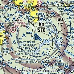
| Sectional chart |
|---|
|
CAUTION: Diagram may not be current
 Download PDF
of official airport diagram from the FAA
| Airport distance calculator |
|---|
|
|
| Sunrise and sunset |
|---|
|
Times for 14-Feb-2026
| | Local
(UTC-6) | | Zulu
(UTC) |
|---|
| Morning civil twilight | | 06:38 | | 12:38 |
| Sunrise | | 07:04 | | 13:04 |
| Sunset | | 18:03 | | 00:03 |
| Evening civil twilight | | 18:28 | | 00:28 |
|
| Current date and time |
|---|
| Zulu (UTC) | 15-Feb-2026 04:15:55 |
|---|
| Local (UTC-6) | 14-Feb-2026 22:15:55 |
|---|
|
| METAR |
|---|
| KGGG | 150353Z AUTO 23004KT 10SM SCT110 14/13 A2972 RMK AO2 SLP062 T01440133
|
KRFI
16nm SW | 150335Z AUTO 28004KT 10SM OVC004 16/15 A2976 RMK AO2 T01610150
|
|
| TAF |
|---|
| KGGG | 150201Z 1502/1524 VRB05KT P6SM -SHRA SCT015 OVC090 FM150500 26007KT 6SM SHRA BR OVC025 FM151100 30010G17KT P6SM OVC015 FM152100 33012G18KT P6SM BKN025
|
|
| NOTAMs |
|---|
NOTAMs are issued by the DoD/FAA and will open in a separate window not controlled by AirNav.
|
|


