FAA INFORMATION EFFECTIVE 19 MARCH 2026
Location
| FAA Identifier: | LEB |
| Lat/Long: | 43-37-34.0000N 072-18-15.1000W
43-37.566667N 072-18.251667W
43.6261111,-72.3041944
(estimated) |
| Elevation: | 603.3 ft. / 183.9 m (surveyed) |
| Variation: | 16W (1995) |
| From city: | 3 miles W of LEBANON, NH |
| Time zone: | UTC -4 (UTC -5 during Standard Time) |
| Zip code: | 03766 |
Airport Operations
| Airport use: | Open to the public |
| Activation date: | 11/1946 |
| Control tower: | yes |
| ARTCC: | BOSTON CENTER |
| FSS: | BANGOR FLIGHT SERVICE STATION |
| NOTAMs facility: | LEB (NOTAM-D service available) |
| Attendance: | 0600-2200 |
| Wind indicator: | lighted |
| Segmented circle: | yes |
| Lights: | ACTVT REIL RWY 07 & 25; PAPI RWY 07, 25 & 36; MIRL RWY 07/25; HIRL RWY 18/36 - CTAF. |
| Beacon: | white-green (lighted land airport)
Operates sunset to sunrise. |
| Landing fee: | yes, LDG FEES EXCP FOR NON-COML SNGL ENG. |
Airport Communications
| CTAF: | 125.95 |
| UNICOM: | 122.95 |
| ATIS: | 118.65 |
| WX ASOS: | 118.65 (603-298-8780) |
| LEBANON GROUND: | 121.6 [0600-2200] |
| LEBANON TOWER: | 125.95 235.775 [0600-2200] |
| WX ASOS at VSF (19 nm SW): | 121.425 (802-886-6006) |
- APCH/DEP SVC PRVDD BY BOSTON ARTCC ON FREQS 134.7/269.475 (LEBANON RCAG).
Nearby radio navigation aids
| VOR radial/distance | | VOR name | | Freq | | Var |
|---|
| MPVr183/28.3 | | MONTPELIER VOR/DME | | 116.90 | | 16W |
| NDB name | | Hdg/Dist | | Freq | | Var | | ID |
|---|
| HANOVER | | 245/7.2 | | 276 | | 15W | | LAH | .-.. .- .... |
| CLAREMONT | | 027/15.7 | | 233 | | 16W | | CNH | -.-. -. .... |
| SMUTO | | 115/28.7 | | 221 | | 15W | | DYO | -.. -.-- --- |
Airport Services
| Fuel available: | 100LL JET-A
A:FOR FUEL AFT HRS CALL 603-298-6555. |
| Parking: | hangars and tiedowns |
| Airframe service: | MAJOR |
| Powerplant service: | MAJOR |
| Bulk oxygen: | HIGH |
Runway Information
Runway 7/25
| Dimensions: | 5496 x 100 ft. / 1675 x 30 m |
| Surface: | asphalt/grooved, in good condition |
| Weight bearing capacity: | | Single wheel: | 42.0 | | Double wheel: | 60.0 |
|
| Runway edge lights: | medium intensity |
| RUNWAY 7 | | RUNWAY 25 |
| Latitude: | 43-37.550263N | | 43-38.012065N |
| Longitude: | 072-18.723503W | | 072-17.652692W |
| Elevation: | 562.5 ft. | | 573.8 ft. |
| Traffic pattern: | left | | left |
| Runway heading: | 075 magnetic, 059 true | | 255 magnetic, 239 true |
| Markings: | nonprecision, in good condition | | nonprecision, in good condition |
| Visual slope indicator: | 4-light PAPI on left (4.00 degrees glide path) | | 4-light PAPI on right (4.00 degrees glide path) |
| Runway end identifier lights: | yes | | yes |
| Touchdown point: | yes, no lights | | yes, no lights |
| Obstructions: | 16 ft. tree, 316 ft. from runway, 213 ft. left of centerline, 7:1 slope to clear | | 74 ft. tree, 537 ft. from runway, 286 ft. left of centerline, 4:1 slope to clear
30 FT TREE 145 FT FM RWY END, 179 FT RIGHT. |
Runway 18/36
| Dimensions: | 5200 x 100 ft. / 1585 x 30 m |
| Surface: | asphalt/grooved, in good condition |
| Weight bearing capacity: | | Single wheel: | 42.0 | | Double wheel: | 48.0 |
|
| Runway edge lights: | high intensity |
| RUNWAY 18 | | RUNWAY 36 |
| Latitude: | 43-37.758460N | | 43-36.921340N |
| Longitude: | 072-18.441782W | | 072-18.196312W |
| Elevation: | 563.5 ft. | | 603.3 ft. |
| Traffic pattern: | left | | left |
| Runway heading: | 184 magnetic, 168 true | | 004 magnetic, 348 true |
| Markings: | precision, in good condition | | precision, in good condition |
| Visual slope indicator: | | | 4-light PAPI on left (3.75 degrees glide path) |
| Runway end identifier lights: | yes | | no |
| Touchdown point: | yes, no lights | | yes, no lights |
| Instrument approach: | ILS/DME | | |
| Obstructions: | 11 ft. trees, 355 ft. from runway, 331 ft. right of centerline, 14:1 slope to clear
FENCE 125 FT FM RWY END, 425 FT RIGHT. | | 107 ft. trees, 667 ft. from runway, 521 ft. left of centerline, 4:1 slope to clear
TREES 4000 FT W OF EOR, 970 FT MSL, OBST LGTD. TREES 1500 FT SW OF EOR, 800 FT MSL, OBST LGTD. |
Airport Ownership and Management from official FAA records
| Ownership: | Publicly-owned |
| Owner: | CITY OF LEBANON
51 N PARK ST
LEBANON, NH 03766
Phone 603-298-8878 |
| Manager: | CARL GROSS
5 AIRPARK RD
WEST LEBANON, NH 03784
Phone 603-298-8878 |
Additional Remarks
| - | TREES 5600 FT E OF ARPT, ELEV 1253 FT; TREES 6700 FT E OF ARPT, ELEV 1275 FT; TREES INDCD ARE OBSTN LGTD. |
| - | OCNL WILDLIFE ACT ON & NR ARPT. |
| - | HANG GLDR OPS INVOF MT ASCUTNEY, VT 20 MI SW LEB SFC-8000 FT DAYS. |
| - | NO PLAS OR TGLS 0000-0700. |
| - | NOISE ABATEMENT PROCS IN EFCT, CTC AMGR. ALL ARR/DEP ACFT FLW MANUFACTURER'S RCMDD PROC FOR QUIET OPN & MNM NOISE. |
| - | COLD TEMPERATURE AIRPORT. ALTITUDE CORRECTION REQUIRED AT OR BELOW -19C. |
| - | FOR CD IF TWR CLSD & UNA TO CTC FSS FREQ, CTC BOSTON ARTCC AT 603-879-6859. |
| - | HOT AIR BALLOON ACT 8.6 NM W OF ARPT. |
Instrument Procedures
NOTE: All procedures below are presented as PDF files. If you need a reader for these files, you should download the free Adobe Reader.NOT FOR NAVIGATION. Please procure official charts for flight.
FAA instrument procedures published for use from 19 March 2026 at 0901Z to 16 April 2026 at 0900Z.
IAPs - Instrument Approach Procedures |
|---|
| ILS OR LOC RWY 18 | |
download (228KB) |
| RNAV (GPS) RWY 07 | |
download (248KB) |
| RNAV (GPS) RWY 18 | |
download (222KB) |
| RNAV (GPS) RWY 25 | |
download (223KB) |
| RNAV (GPS) RWY 36 | |
download (210KB) |
| NOTE: Special Alternate Minimums apply | |
download (150KB) |
| NOTE: Special Take-Off Minimums/Departure Procedures apply | |
download (472KB) |
Other nearby airports with instrument procedures:
2B3 - Parlin Field Airport (15 nm S)
KCNH - Claremont Municipal Airport (16 nm S)
KVSF - Hartness State Airport (Springfield) (19 nm SW)
KRUT - Rutland/Southern Vermont Regional Airport (29 nm W)
5B9 - Dean Memorial Airport (30 nm NE)
|
|

Road maps at:
MapQuest
Bing
Google
| Aerial photo |
|---|
WARNING: Photo may not be current or correct
 Photo by Braxton Freeman
Taken in July 2015
looking southeast.
Photo by Braxton Freeman
Taken in July 2015
looking southeast.
Do you have a better or more recent aerial photo of Lebanon Municipal Airport that you would like to share? If so, please send us your photo.
|
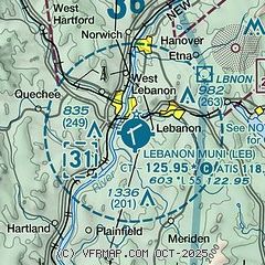
| Sectional chart |
|---|
|
 Download PDF
of official airport diagram from the FAA
| Airport distance calculator |
|---|
|
|
| Sunrise and sunset |
|---|
|
Times for 10-Apr-2026
| | Local
(UTC-4) | | Zulu
(UTC) |
|---|
| Morning civil twilight | | 05:47 | | 09:47 |
| Sunrise | | 06:16 | | 10:16 |
| Sunset | | 19:25 | | 23:25 |
| Evening civil twilight | | 19:55 | | 23:55 |
|
| Current date and time |
|---|
| Zulu (UTC) | 11-Apr-2026 00:12:47 |
|---|
| Local (UTC-4) | 10-Apr-2026 20:12:47 |
|---|
|
| METAR |
|---|
| KLEB | 102353Z 20012G19KT 10SM OVC100 20/05 A2996 RMK AO2 SLP142 T02000050 10244 20200 55007
|
KVSF
19nm SW | 102354Z AUTO 10SM BKN100 18/04 A2998 RMK AO2 SLP155 T01830044 10228 20183 55005
|
|
| TAF |
|---|
| KLEB | 101751Z 1018/1118 20011KT P6SM SCT100 SCT200 FM102000 20012G22KT P6SM BKN250 FM110200 22007KT 6SM -SHRA BR SCT035 OVC050 FM110400 25010KT 4SM -SHRA BKN025 OVC035 FM110700 31011G17KT P6SM BKN030 FM111200 32012G18KT P6SM SCT035
|
|
| NOTAMs |
|---|
NOTAMs are issued by the DoD/FAA and will open in a separate window not controlled by AirNav.
|
|


