FAA INFORMATION EFFECTIVE 16 APRIL 2026
Location
| FAA Identifier: | MMT |
| Lat/Long: | 33-55-14.7400N 080-48-04.0800W
33-55.245667N 080-48.068000W
33.9207611,-80.8011333
(estimated) |
| Elevation: | 254 ft. / 77.4 m (surveyed) |
| Variation: | 08W (2020) |
| From city: | 10 miles E of EASTOVER, SC |
| Time zone: | UTC -4 (UTC -5 during Standard Time) |
| Zip code: | 29044 |
Airport Operations
| Airport use: | Private use. Permission required prior to landing |
| Activation date: | 04/1943 |
| Control tower: | yes |
| ARTCC: | JACKSONVILLE CENTER |
| FSS: | ANDERSON FLIGHT SERVICE STATION |
| NOTAMs facility: | MMT (NOTAM-D service available) |
| Attendance: | MON-FRI 1300-0400Z++, ALL SAT-SUN 1300-2100Z++
EXC HOL.
SEE FLIP AP/1 SUPPLEMENTARY ARPT RMK. |
| Segmented circle: | no |
| Lights: | RWY 14/32 70 FT GATED THLD LGT. RWY LIGHTS OPER 1300-0400Z++ MON-FRI, 1300-2100Z++ SAT-SUN, EXC HOL. ACTVT PAPI RWYS 14 & 32; MIRL RWY 05/23, HIRL RWY 14/32 - 253.5. REIL RWY 14; ALSF-1 RWY 32 OPR DRG TWR HRS. |
| Beacon: | white-green (lighted land airport)
SS-0400Z+. RTG BCN OPR SS-0400Z++MON-FRI, EXC HOL. |
Airport Communications
| CTAF: | 132.4 |
| ATIS: | 327.05 |
| MC ENTIRE GROUND: | 127.625 226.675 [1300-0400Z++ MON-FRI EXC HOL, 1300-2100Z++ SAT-SUN] |
| MC ENTIRE TOWER: | 132.4 253.5 [1300-0400Z++ MON-FRI EXC HOL, 1300-2100Z++ SAT-SUN] |
| SHAW APPROACH: | 125.4 |
| SHAW DEPARTURE: | 125.4 |
| ANG OPS: | 134.1 246.7 32.65FM 34.55FM 40.15FM |
| ARNG OPS: | 41.3FM |
| GCA: | 124.925 379.5 |
| PMSV METRO: | 342.5 |
| PTD: | 142.3 |
| WX ASOS at CUB (10 nm W): | 118.675 (803-929-0665) |
| WX ASOS at CAE (16 nm W): | PHONE 803-369-6879 |
- SFA
- GCA NML OPR 1400-2000Z++, TUES - FRI, CTC TWR C803-647-8275, DSN 583-8275 FOR CURRENT AVAILABILITY/OPERATIONAL STATUS.
- APCH/DEP SVC PRVDD BY JACKSONVILLE ARTCC (ZJX) ON FREQS 124.7/269.55 (COLUMBIA RCAG) WHEN SHAW APCH CTL CLSD.
Nearby radio navigation aids
| VOR radial/distance | | VOR name | | Freq | | Var |
|---|
| MMT at field | | MC ENTIRE VORTAC | | 113.20 | | 08W |
| CAEr075/13.2 | | COLUMBIA VORTAC | | 114.70 | | 02W |
| NDB name | | Hdg/Dist | | Freq | | Var | | ID |
|---|
| MANNING | | 310/35.8 | | 381 | | 06W | | MNI | -- -. .. |
Airport Services
| Fuel available: | 100 JET-A
100:FUEL NOT AVBL TO TRANSIENT ACFT. SINGLE POINT REFUELING. JP4 AVBL. |
| Parking: | hangars |
| Airframe service: | MINOR |
| Powerplant service: | MINOR |
| Bottled oxygen: | NONE |
| Bulk oxygen: | LOW |
Runway Information
Runway 18/36
| Dimensions: | 4500 x 150 ft. / 1372 x 46 m
RWY 18/36 CLSD INDEFLY. |
| Surface: | concrete |
| RUNWAY 18 | | RUNWAY 36 |
| Traffic pattern: | left | | left |
Runway 5/23
| Dimensions: | 2030 x 90 ft. / 619 x 27 m |
| Surface: | asphalt, in good condition |
| Weight bearing capacity: | |
| Runway edge lights: | medium intensity |
| RUNWAY 5 | | RUNWAY 23 |
| Latitude: | 33-55.640167N | | 33-55.879500N |
| Longitude: | 080-48.348333W | | 080-48.068333W |
| Elevation: | 249.3 ft. | | 254.0 ft. |
| Traffic pattern: | left | | left |
| Runway heading: | 052 magnetic, 044 true | | 232 magnetic, 224 true |
| Markings: | basic, in good condition | | basic, in good condition |
| Touchdown point: | yes, no lights | | yes, no lights |
Runway 14/32
| Dimensions: | 9012 x 150 ft. / 2747 x 46 m |
| Surface: | PEM |
| Weight bearing capacity: | |
| Runway edge lights: | high intensity |
| RUNWAY 14 | | RUNWAY 32 |
| Latitude: | 33-55.646333N | | 33-54.613333N |
| Longitude: | 080-48.677167W | | 080-47.396000W |
| Elevation: | 251.0 ft. | | 243.1 ft. |
| Traffic pattern: | left | | left |
| Runway heading: | 142 magnetic, 134 true | | 322 magnetic, 314 true |
| Markings: | precision, in good condition | | precision, in good condition |
| Visual slope indicator: | 4-light PAPI on left (2.50 degrees glide path) | | 4-light PAPI on right (2.50 degrees glide path) |
| Approach lights: | | | ALSF1: standard 2,400 foot high intensity approach lighting system with centerline sequenced flashers (category I) |
| Runway end identifier lights: | yes | | no |
| Touchdown point: | yes, no lights | | yes, no lights |
| Instrument approach: | | | ILS |
Airport Ownership and Management from official FAA records
| Ownership: | U.S. Air Force |
| Owner: | U.S. AIR FORCE
MCENTIRE ANGB
COLUMBIA, SC 29044
Phone 803-776-5121 |
| Manager: | CHIEF AIRFIELD MANAGEMENT
MCENTIRE ANGB
COLUMBIA, SC 29044
Phone 803-647-8231 |
Additional Remarks
| E60-32 | BAK-14 BAK-12A(B) (1501 FT). |
| E60-14 | BAK-14 BAK-12 A(B) (1500 FT). HOOK MB100 (B) (37 FT OVRN). |
| - | RSTD: PPR 48 HR NTC RQR, CTC ANG OPS C803-647-8231, FAX DSN 583-8733, C803-647-8733. |
| - | CAUTION: SEE AP/1 FOR WX OBS LIMITATIONS. REMAIN BLW 1000 FT TIL DEP END OF RY OR UNLESS TWR CLEARS. |
| - | TFC PAT: OVERHEAD 1500 FT, COPTER/RECTANGULAR 1000 FT. |
| - | MISC: TRAN PRK EXTREMELY LTD. |
| - | MISC: TRAN ACFT EXP PROGRESSIVE TAXI INSTR. |
| - | ARNG: PPR FOR ARMY, AR, AND ARNG R/W ACFT ONLY, C803-299-1814/5. OPR 1300-0400Z++ MON-FRI EXC HOL. FUEL NOT AVBL FOR TRAN ACFT. |
| - | BEARING STRENGTH RWY 14-32: ST175; SBTT549; TST746; DDT706 |
| - | MISC: WX OBSN VIS IS LTD FROM 5/8 MILE S TO 1/10 MILE WNW. |
| - | AIRCRAFT SUNSHADES 742 FT W OF RUNWAY 14-32. |
| - | PMSV METRO: CTC SHAW AFB FOR METRO. MCENTIRE FCSTR AVBL 1200-0100Z++ MON-FRI CLSD SAT-SUN AND HOL. OPR HR VARY WITH LCL FLYING SKED, DSN 583-8247, C803-647-8247. DURING NON-OPERATIONAL HOURS CONTACT 26 OWS BARKSDALE AFB DSN 331-2651, C318-529-2651. AFLD WX MNT BY AN/FMQ-19 AMS, AUGMENTED/BACKED UP BY HUMAN OBSN DURING OPERATING HOURS AND FOR RESOURCE PROTECTION. |
| - | RY 05/23 IS HELICOPTER ONLY. |
| - | AFLD WX MAINT BY AN/FMQ-19 ASOS, AUGMENTED BY HUMAN OBSN WHEN RQR DUR OPR HR. |
| - | MISC: FLEET SVC NOT AVBL WITHOUT PRIOR COORD. |
| - | MISC: WIND INFO FOR RWY 23 PROVIDED BY DEP END SENSOR. |
| - | CAUTION: NSTD COPTER OPS ON CLSD RWY 18/36. |
| - | NML DLY ACFT AND RESCUE FIRE FIGHTING (ARFF) CAPABILITY IS 2500 GAL WATER AND 322 GAL FOAM; FIRE DISPATCH DSN 583-8287. |
| - | FOR CD CTC SHAW APCH AT 803-895-4884, WHEN APCH CLSD CTC JACKSONVILLE ARTCC AT 904-845-1592. |
| - | MISC: RWY 14-32 ASPHALT EXC FOR CONC ON FIRST 2000 FT OF RWY 32 AND FIRST 1700 FT OF RWY 14. 200 FT CONC EITHER SIDE OF RWY 14/32 BARRIER CABLES. |
| - | A-GEAR: BAK-12A CABLE RAISED BY BAK-14 DEVICE O/R TWR. DEPARTURE END CABLE WILL BE RAISED FOR ALL TAIL HOOK EQUIPPED ACFT. RWY 14/32 N AND S A-G CABLES WILL BE IN RAISED POSN WHEN AFLD CLSD. |
| - | JASU: 1(A/M32A-86)9(AM32A-60A) |
| - | FUEL: JET A. (DOD COST ACCOUNTING CODE NR RQR FOR OTHER MIL SVC FOR REFUELING.) |
| - | FLUID: SP LPOX |
| - | OIL: O-133-148-156 SOAP |
| - | TRAN ALERT: SVC AVBL WITH PRIOR COORD. TRAN PRK EXTREMELY LTD. |
Instrument Procedures
NOTE: All procedures below are presented as PDF files. If you need a reader for these files, you should download the free Adobe Reader.NOT FOR NAVIGATION. Please procure official charts for flight.
FAA instrument procedures published for use from 16 April 2026 at 0901Z to 14 May 2026 at 0900Z.
IAPs - Instrument Approach Procedures |
|---|
| HI-ILS OR LOC/DME RWY 32 | |
download (190KB) |
| ILS OR LOC/DME RWY 32 | |
download (148KB) |
| HI-TACAN RWY 32 | |
download (183KB) |
| TACAN RWY 14 | |
download (131KB) |
| TACAN RWY 32 | |
download (146KB) |
| NOTE: Special Take-Off Minimums/Departure Procedures apply | |
download |
Other nearby airports with instrument procedures:
KCUB - Jim Hamilton L B Owens Airport (10 nm W)
KCAE - Columbia Metro Airport (16 nm W)
KSSC - Shaw Air Force Base (17 nm E)
KSMS - Sumter Airport (22 nm E)
KXNO - North Air Force Auxiliary Field (23 nm SW)
|
|

Road maps at:
MapQuest
Bing
Google
| Aerial photo |
|---|
WARNING: Photo may not be current or correct
 Photo courtesy of AirNav, LLC
Photo taken 25-Jun-2011
looking south.
Photo courtesy of AirNav, LLC
Photo taken 25-Jun-2011
looking south.
Do you have a better or more recent aerial photo of Mc Entire Joint National Guard Base that you would like to share? If so, please send us your photo.
|
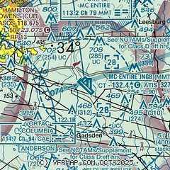
| Sectional chart |
|---|
|
 Download PDF
of official airport diagram from the FAA
| Airport distance calculator |
|---|
|
|
| Sunrise and sunset |
|---|
|
Times for 25-Apr-2026
| | Local
(UTC-4) | | Zulu
(UTC) |
|---|
| Morning civil twilight | | 06:15 | | 10:15 |
| Sunrise | | 06:42 | | 10:42 |
| Sunset | | 20:01 | | 00:01 |
| Evening civil twilight | | 20:27 | | 00:27 |
|
| Current date and time |
|---|
| Zulu (UTC) | 25-Apr-2026 09:33:16 |
|---|
| Local (UTC-4) | 25-Apr-2026 05:33:16 |
|---|
|
| METAR |
|---|
| KMMT | 250855Z AUTO 00000KT 8SM CLR 14/12 A2981 RMK AO2 DZB0758E41 SLP095 P0000 60000 T01370119 55002 $
|
KCUB
10nm W | 250853Z AUTO 00000KT 10SM BKN090 16/13 A2983 RMK AO2 SLP100 T01610128 56003
|
KCAE
16nm W | 250856Z 27003KT 10SM OVC090 17/13 A2982 RMK AO2 SLP095 T01720128 58002
|
KSSC
17nm E | 250855Z AUTO 19005KT 10SM CLR 16/14 A2982 RMK AO2 SLP098 T01630138 55000 $
|
|
| TAF |
|---|
| KMMT | 250700Z 2507/2613 VRB06KT 9999 SKC QNH2976INS BECMG 2521/2522 25010KT 9000 -RA SCT060 OVC070 QNH2974INS TX30/2517Z TN13/2509Z
|
KCUB
10nm W | 250520Z 2506/2606 00000KT P6SM SKC FM251500 23006KT P6SM SCT100 FM252200 26008KT 6SM -SHRA BKN070
|
KCAE
16nm W | 250520Z 2506/2606 21004KT P6SM SKC FM251500 23008KT P6SM SCT100 FM252200 26009KT 6SM -SHRA BKN070
|
KSSC
17nm E | 250700Z 2507/2613 20006KT 9999 SKC QNH2982INS BECMG 2514/2515 22009KT 9999 SCT200 QNH2981INS BECMG 2523/2524 18010G15KT 8000 -SHRA VCTS BKN060 BKN200 QNH2976INS TEMPO 2600/2605 -TSRA BECMG 2605/2606 18006KT 4800 VCSH OVC005 QNH2980INS BECMG 2609/2610 03006KT 4000 BR OVC010 QNH2980INS TX30/2521Z TN16/2510Z
|
|
| NOTAMs |
|---|
NOTAMs are issued by the DoD/FAA and will open in a separate window not controlled by AirNav.
|
|


