FAA INFORMATION EFFECTIVE 09 JULY 2026
Location
| FAA Identifier: | SSC |
| Lat/Long: | 33-58-21.8065N 080-28-14.0317W
33-58.363442N 080-28.233862W
33.9727240,-80.4705644
(estimated) |
| Elevation: | 241 ft. / 73.5 m (surveyed) |
| Variation: | 08W (2015) |
| From city: | 6 miles NW of SUMTER, SC |
| Time zone: | UTC -4 (UTC -5 during Standard Time) |
| Zip code: | 29152 |
Airport Operations
| Airport use: | Private use. Permission required prior to landing |
| Activation date: | 06/1942 |
| Control tower: | yes |
| ARTCC: | JACKSONVILLE CENTER |
| FSS: | ANDERSON FLIGHT SERVICE STATION |
| NOTAMs facility: | SSC (NOTAM-D service available) |
| Attendance: | CONTINUOUS
OPR 1100-0300Z++ MON-FRI, 1300-2100Z++ SAT-SUN, OR BY NOTAM. CLSD FED HOL AND ACC FAMILY DAYS. |
| Wind indicator: | yes |
| Segmented circle: | no |
| Beacon: | white-green (lighted land airport)
Operates sunset to sunrise. |
Airport Communications
| ATIS: | 132.125 270.1 |
| SHAW GROUND: | 126.1 275.8 [OPR 1100-0300Z++ MON-FRI, 1300-2100Z++ SAT-SUN, CLSD FED HOL, AND ACC FAMILY DAYS.] |
| SHAW TOWER: | 126.65 254.25 [OPR 1100-0300Z++ MON-FRI, 1300-2100Z++ SAT-SUN, CLSD FED HOL, AND ACC FAMILY DAYS.] |
| SHAW APPROACH: | 125.4 318.1 [OPR 1100-0300Z++ MON-FRI, 1300-2100Z++ SAT-SUN, CLSD FED HOL, AND ACC FAMILY DAYS.] |
| SHAW DEPARTURE: | 125.4 318.1 [OPR 1100-0300Z++ MON-FRI, 1300-2100Z++ SAT-SUN, CLSD FED HOL, AND ACC FAMILY DAYS.] |
| CLEARANCE DELIVERY: | 121.8 289.4 |
| CLASS C: | 125.4 318.1 |
| COMD POST: | 381.3 |
| EMERG: | 121.5 243.0 |
| PTD: | 139.6 372.2 |
| WX AWOS-3 at SMS (6 nm E): | 118.075 (803-469-6750) |
| WX AWOS-3PT at CDN (19 nm N): | 119.975 (803-424-1979) |
- TA31 PAR OPERS 0700-2230.
- APCH/DEP SVC PRVDD BY JACKSONVILLE ARTCC ON FREQS 124.7/269.55 (COLUMBIA RCAG) WHEN SHAW APCH CTL CLSD.
- SFA
- PMSV METRO: AVBL VIA PHONE PATCH.
- (RAYMOND 26)
- NO-NOTAM MP: 0400-1100Z++ TUE-FRI DLY (1500/3+1).
Nearby radio navigation aids
| VOR radial/distance | | VOR name | | Freq | | Var |
|---|
| MMTr088/16.8 | | MC ENTIRE VORTAC | | 113.20 | | 08W |
| CAEr079/29.9 | | COLUMBIA VORTAC | | 114.70 | | 02W |
| NDB name | | Hdg/Dist | | Freq | | Var | | ID |
|---|
| MANNING | | 336/26.6 | | 381 | | 06W | | MNI | -- -. .. |
| HARTSVILLE | | 221/31.3 | | 341 | | 07W | | HVS | .... ...- ... |
| EVANS | | 287/35.8 | | 420 | | 06W | | CFY | -.-. ..-. -.-- |
Airport Services
| Fuel available: | A++ |
| Parking: | hangars |
| Airframe service: | MINOR |
| Powerplant service: | MINOR |
| Bottled oxygen: | NONE |
| Bulk oxygen: | LOW |
Runway Information
Runway 4L/22R
| Dimensions: | 10014 x 150 ft. / 3052 x 46 m |
| Surface: | concrete |
| Weight bearing capacity: | |
| Runway edge lights: | high intensity |
| Operational restrictions: | GRVD CONC. FIRST 1000 FT OF RWY 04R AND FIRST 1000 FT OF RWY 22L CONC AND MIDDLE 6014 FT GRVD CONC. |
| RUNWAY 4L | | RUNWAY 22R |
| Latitude: | 33-57.702288N | | 33-59.059385N |
| Longitude: | 080-28.890758W | | 080-27.762093W |
| Elevation: | 237.0 ft. | | 239.3 ft. |
| Traffic pattern: | left | | left |
| Runway heading: | 043 magnetic, 035 true | | 223 magnetic, 215 true |
| Markings: | precision, in good condition | | precision, in good condition |
| Visual slope indicator: | 4-light PAPI on left (2.80 degrees glide path) | | 4-light PAPI on left (2.80 degrees glide path) |
| RVR equipment: | touchdown | | touchdown |
| Approach lights: | ALSF1: standard 2,400 foot high intensity approach lighting system with centerline sequenced flashers (category I)
NON-STD CONFIGN 2600 FT LONG. | | ALSF1: standard 2,400 foot high intensity approach lighting system with centerline sequenced flashers (category I) |
| Runway end identifier lights: | no | | no |
| Touchdown point: | yes, no lights | | yes, no lights |
| Instrument approach: | ILS | | ILS |
Runway 4R/22L
| Dimensions: | 8014 x 150 ft. / 2443 x 46 m |
| Surface: | concrete |
| Weight bearing capacity: | |
| Runway edge lights: | high intensity |
| RUNWAY 4R | | RUNWAY 22L |
| Latitude: | 33-57.798660N | | 33-58.884747N |
| Longitude: | 080-28.569717W | | 080-27.666668W |
| Elevation: | 235.8 ft. | | 233.9 ft. |
| Traffic pattern: | left | | left |
| Runway heading: | 043 magnetic, 035 true | | 223 magnetic, 215 true |
| Markings: | precision, in good condition | | precision, in good condition |
| Visual slope indicator: | 4-light PAPI on left (3.00 degrees glide path) | | 4-light PAPI on left (3.00 degrees glide path) |
| Approach lights: | SALSF | | ALSF1: standard 2,400 foot high intensity approach lighting system with centerline sequenced flashers (category I) |
| Runway end identifier lights: | no | | no |
| Touchdown point: | yes, no lights | | yes, no lights |
| Instrument approach: | LOC/GS | | |
Airport Ownership and Management from official FAA records
| Ownership: | U.S. Air Force |
| Owner: | U.S. AIR FORCE
SHAW AFB
SUMTER, SC 29152 |
| Manager: | CHIEF AIRFIELD MANAGEMENT
SHAW AFB
SUMTER, SC 29152
Phone 403-965-3338 |
Additional Remarks
| E60-22L | HOOK BAK-12B(B) (1221 FT). |
| E60-22L | HOOK MB 100(B) (65 FT OVRN). |
| E60-04L | HOOK BAK-12A(B) (45 FT OVRN) HOOK BAK12B(B) (1457 FT). |
| E60-22R | HOOK BAK12B(B) (1457 FT) HOOK BAK-12A(B) (45 FT OVRN). |
| E60-04R | HOOK MB 100(B) (75 FT OVRN). |
| E60-04R | BAK-12B(B) (1210 FT). |
| - | BEARING STRENGTH RWY 04L-22R: ST175; SBTT576, DDT745. |
| - | RSTD: OFFL BUS RSTD TO 20 FTR WG MSN SUPPORT. 20 FTR WG QUIET HR IN EFF 0300-1100Z++. PPR ALL LDG ACFT, 24 HR PN RQR, CTC AFLD MGMT 1200-2300Z++, DSN 965-2356, C803-895-2357, AFTER HOURS/STANDBY 803-983-0522. TRAN ACFT CTC BASE OPS PTD PRIOR ARR TO CONFIRM FM SVC RQR. DSN 965-2356, C803-895-2357, FAX 2360. |
| - | RSTD: ISSUED PPR VALID 1 HR +/- ETA, EARLY/LATE ARR/DEP MUST RE-COORD. TRAN ACFT CTC TWR PRIOR TO EXITING RWY. |
| - | CAUTION: TRAN PILOTS WILL NOT CLIMB ABV 1000 FT ON DEP DUR VFR COND TIL CLEAR OF ARPT BDRY UNLESS SPECIFICALLY CLEARED TO DO SO BY ATC. SPECIFIC TAXI INSTR FOR HVY ACFT CTC GND, MAY RQR BACK TAXIING ON RWY TO APROP LADDER TWY. UNCONTROLLED VEH TFC ON TWY AND APN. |
| - | TFC PAT: RECTANGULAR 1300 FT, OVERHEAD 2000 FT. |
| - | CSTMS/AG/IMG: 24 HR PN RQR FOR CSTMS AND AG. |
| - | 45 FT OBSTN LCTD 140 FT S TWY CNTRLN. |
| - | MISC: ACC RSRS APPLIED TO ACC ACFT ONLY. |
| - | BEARING STRENGTH RWY 04R-22L: ST130; SBTT351; DDT490. |
| - | TRAN ALERT: TRANSIENT ALERT AFTER HOURS SUPPORT IS NOT AUTH UNLESS SUPPORTING HIGHER HQ DIRECTED MISSIONS. |
| - | TRAN ACFT CTC BASE OPS PTD PRIOR TO ARRIVAL TO CONFIRM SVC RQR. |
| - | RSTD: SOUTH TRIM PAD AND TEST CELL SW OF TWY A CLSD. |
| - | RSTD: AERODROME UNUSE AS WX ALTN OUTSIDE OF TRAN ALERT HR OF OPNS. |
| - | LGT: ALL RWY THR LGT GATED. |
| - | RSTD: HVY ACFT EXP ARR/DEP DELAYS DUR WING FLYING. |
| - | MISC: WX 965-2362, C803-895-2362, FORECASTER AVBL H24. TELEWORKING DUR AFLD CLOSURES. REMOTE BRIEFING SVC AVBL FR 26 OWS, BARKSDALE AFB, DSN 331-2651/2635/2636, C318-529-2651/2635/2636, WEBSITE: HTTPS://26OWS..US.AF.MIL. |
| - | MISC: WX OBS AVBL H24 VIA AN/FMQ-19 AUTOMATED OBSN SYS. AUGMENTED AN/FMQ-19 WHEN RQR DUR OPR HR AND RESOURCE PROTECTION. HUMAN OBSN SFC VIS LTD FROM 230-030 BY FLIGHTLINE HANGARS, BUILDINGS AND TREES. |
| - | FOR AIR EVAC OR URGENT REQ DUR AFLD CLOSURE, AIRCREWS MUST CTC COMD POST DSN 312-965-5850 OR VIA UHF. |
| - | A-GEAR: NML BAK-12 CONFIGURATION: BOTH RWY 04L/22R OVRN A-G BAK-12S ARE IN THE RAISED POSN. RWY 04L/22R APPROACH END CABLE DISCONNECTED. RWY 04R/22L, ALL CABLES IN RAISED POSN. BAK-12A ARE NSTD 900 FT RUN OUT, 1/4 IN CABLE AND 50000 LB WT SETTING. CALL TWR OR BASE OPS AT LEAST 20 MIN IN ADVANCE TO REQ OTHER CONFIGURATIONS. |
| - | MISC: ACFT THAT RQR IMMED ASSISTANCE AFTER DUTY HR, HOL, AND WKENDS, CTC COMD POST C803-895-5850, DSN 965-5850. |
| - | SERVICE-LGT: RWY 04R/22L PRE-THR BARS REMOVED. |
| - | RSTD: RWY 04R-22L AVBL FOR 20 FW USE ONLY. |
| - | RSTD: RWY 04L/22R CLSD EVERY 1ST AND 3RD MON AND RWY 04R/22L CLSD EVERY 2ND AND 4TH MON OF THE MONTH FR 1100-1500Z++ FOR BAK-12 PMI. |
| - | MISC: AMOPS UNABLE TO STORE CLASSIFIED MATERIAL, CONTACT SHAW COMMAND POST WITH CLASSIFIED STORAGE NEEDS, DSN 895-5850. |
| - | JASU: 2(M32A-60) 2(A/M32A-86). |
| - | FLUID: PRESAIR LPOX LOX. LOX - 24 HOURS PN. |
| - | OIL: O-128-133-148. |
| - | TRAN ALERT: NO FLEET SVC AVBL. EXP 2-3 HR SVC/REFUEL DELAYS WKENDS, HOL AND PEAK PERIODS; LTD MAINT. CONCURRENT REFUELING NOT AVBL. NO DE-ICE SVC AVBL. TRAN ACFT WILL RETAIN DRAG CHUTES TO PRK. TRAN ALERT SVC AVBL 1130-2330Z++ MON-FRI; CLSD HOL. |
Instrument Procedures
NOTE: All procedures below are presented as PDF files. If you need a reader for these files, you should download the free Adobe Reader.NOT FOR NAVIGATION. Please procure official charts for flight.
FAA instrument procedures published for use from 09 July 2026 at 0901Z to 06 August 2026 at 0900Z.
IAPs - Instrument Approach Procedures |
|---|
| HI-ILS OR LOC Z RWY 04L **CHANGED** | |
download (156KB) |
| HI-ILS OR LOC Z RWY 22R **CHANGED** | |
download (164KB) |
| ILS OR LOC Y RWY 04L **CHANGED** | |
download (147KB) |
| ILS OR LOC Y RWY 22R **CHANGED** | |
download (140KB) |
| HI-TACAN Z RWY 04L **CHANGED** | |
download (148KB) |
| HI-TACAN Z RWY 22R **CHANGED** | |
download (150KB) |
| TACAN Y RWY 04L **CHANGED** | |
download (135KB) |
| TACAN Y RWY 22R **CHANGED** | |
download (136KB) |
Departure Procedures |
|---|
| GABLE FOUR | |
download (66KB) |
| PINIE FOUR | |
download (81KB) |
| NOTE: Special Take-Off Minimums/Departure Procedures apply | |
download |
Other nearby airports with instrument procedures:
KSMS - Sumter Airport (6 nm E)
KMMT - Mc Entire Joint National Guard Base (17 nm W)
KCDN - Woodward Field Airport (19 nm N)
KCUB - Jim Hamilton L B Owens Airport (26 nm W)
KMNI - Santee Cooper Regional Airport (27 nm SE)
|
|

Road maps at:
MapQuest
Bing
Google
| Aerial photo |
|---|
WARNING: Photo may not be current or correct
 Photo by Kelly Graf
Taken in the Summer of 2009
Photo by Kelly Graf
Taken in the Summer of 2009
Do you have a better or more recent aerial photo of Shaw Air Force Base that you would like to share? If so, please send us your photo.
|
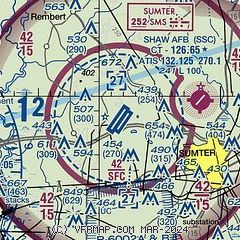
| Sectional chart |
|---|
|
| Airport distance calculator |
|---|
|
|
| Sunrise and sunset |
|---|
|
Times for 29-Jul-2026
| | Local
(UTC-4) | | Zulu
(UTC) |
|---|
| Morning civil twilight | | 06:05 | | 10:05 |
| Sunrise | | 06:32 | | 10:32 |
| Sunset | | 20:24 | | 00:24 |
| Evening civil twilight | | 20:52 | | 00:52 |
|
| Current date and time |
|---|
| Zulu (UTC) | 29-Jul-2026 05:20:28 |
|---|
| Local (UTC-4) | 29-Jul-2026 01:20:28 |
|---|
|
| METAR |
|---|
| KSSC | 290355Z 24005KT 10SM SCT250 30/23 A2966 RMK AO2A LTG DSNT NE SLP042 T02960233 $
|
KSMS
6nm E | 290455Z AUTO 20004KT 10SM CLR 28/25 A2969 RMK AO2
|
KMMT
16nm W | 290355Z AUTO 24004KT 10SM CLR 30/24 A2966 RMK AO2 LTG DSNT NW SLP043 T03040238 $
|
KCDN
19nm N | 290450Z AUTO 23003KT 10SM OVC055 28/26 A2970 RMK AO2
|
|
| TAF |
|---|
| KSSC | 290228Z 2902/3005 21010G15KT 9999 VCTS SCT060CB BKN090 QNH2967INS TEMPO 2904/2906 22015G25KT 8000 -TSRA BECMG 2906/2907 28006KT 9999 NSW SCT040 SCT200 QNH2970INS BECMG 2912/2913 34006KT 9999 FEW200 QNH2973INS BECMG 2916/2917 30006KT 9999 FEW060 BKN200 QNH2972INS BECMG 2919/2920 30009KT 9999 FEW060 FEW200 QNH2973INS BECMG 2923/2924 35006KT 9999 BKN070 QNH2975INS TX34/2921Z TN26/2912Z
|
KMMT
16nm W | 282300Z 2823/3005 24006KT 9999 SCT080 SCT110 QNH2964INS BECMG 2901/2902 25006KT 8000 -SHRA SCT070 OVC100 QNH2967INS TEMPO 2903/2905 28025G35KT 3200 TSRA BKN030CB OVC060 BECMG 2905/2906 28003KT 9999 VCSH SCT030 OVC045 QNH2970INS BECMG 2919/2920 28006KT 9999 NSW SCT070 SCT230 QNH2974INS TX35/2823Z TN25/2911Z
|
|
| NOTAMs |
|---|
NOTAMs are issued by the DoD/FAA and will open in a separate window not controlled by AirNav.
|
|

