FAA INFORMATION EFFECTIVE 14 MAY 2026
Location
| FAA Identifier: | SNY |
| Lat/Long: | 41-05-59.1390N 102-59-05.9750W
41-05.985650N 102-59.099583W
41.0997608,-102.9849931
(estimated) |
| Elevation: | 4314.2 ft. / 1315.0 m (surveyed) |
| Variation: | 11E (1980) |
| From city: | 3 miles S of SIDNEY, NE |
| Time zone: | UTC -6 (UTC -7 during Standard Time) |
| Zip code: | 69162 |
Airport Operations
| Airport use: | Open to the public |
| Activation date: | 01/1948 |
| Control tower: | no |
| ARTCC: | DENVER CENTER |
| FSS: | COLUMBUS FLIGHT SERVICE STATION |
| NOTAMs facility: | SNY (NOTAM-D service available) |
| Attendance: | 0700-1800
AFTER HRS CALL 308-254-5058. |
| Wind indicator: | yes |
| Segmented circle: | yes |
| Lights: | DUSK-DAWN. ACTVT HIRL RY 13/31 & REIL RYS 13 & 31 - CTAF. |
| Beacon: | white-green (lighted land airport)
Operates sunset to sunrise. |
Airport Communications
| CTAF/UNICOM: | 122.8 |
| WX ASOS: | 125.775 (308-254-3525) |
- APCH/DEP CTL SVC PRVDD BY DENVER ARTCC (ZDV) ON FREQS 118.475/225.4 (BRUSH/B/ RCAG).
Nearby radio navigation aids
| VOR radial/distance | | VOR name | | Freq | | Var |
|---|
| SNY at field | | SIDNEY VOR/DME | | 115.90 | | 13E |
| NDB name | | Hdg/Dist | | Freq | | Var | | ID |
|---|
| CHAPPELL | | 263/23.8 | | 383 | | 10E | | CNP | -.-. -. .--. |
| OSHKOSH | | 229/33.8 | | 233 | | 09E | | OKS | --- -.- ... |
Airport Services
| Fuel available: | 100LL JET-A |
| Parking: | hangars and tiedowns |
| Airframe service: | MAJOR |
| Powerplant service: | MINOR |
| Bottled oxygen: | LOW |
| Bulk oxygen: | NONE |
Runway Information
Runway 13/31
| Dimensions: | 6600 x 100 ft. / 2012 x 30 m |
| Surface: | concrete, in good condition |
| Weight bearing capacity: | | Single wheel: | 32.0 | | Double wheel: | 52.0 | | Double tandem: | 96.0 |
|
| Runway edge lights: | high intensity |
| RUNWAY 13 | | RUNWAY 31 |
| Latitude: | 41-06.462992N | | 41-05.695442N |
| Longitude: | 102-59.625637W | | 102-58.608757W |
| Elevation: | 4314.2 ft. | | 4281.9 ft. |
| Traffic pattern: | left | | left |
| Runway heading: | 124 magnetic, 135 true | | 304 magnetic, 315 true |
| Markings: | nonprecision, in good condition | | nonprecision, in good condition |
| Visual slope indicator: | 2-light PAPI on left (3.00 degrees glide path) | | 2-light PAPI on left (3.00 degrees glide path)
UNUSBL BYD 8 DEGS RIGHT OF CNTRLN. |
| Runway end identifier lights: | yes | | yes |
| Touchdown point: | yes, no lights | | yes, no lights |
Runway 3/21
| Dimensions: | 4705 x 75 ft. / 1434 x 23 m |
| Surface: | turf, in good condition |
| RUNWAY 3 | | RUNWAY 21 |
| Latitude: | 41-05.541802N | | 41-06.166937N |
| Longitude: | 102-59.377287W | | 102-58.772525W |
| Elevation: | 4297.5 ft. | | 4284.4 ft. |
| Traffic pattern: | left | | left |
| Runway heading: | 025 magnetic, 036 true | | 205 magnetic, 216 true |
| Markings: | , in fair condition | | , in fair condition |
| Touchdown point: | yes, no lights | | yes, no lights |
Airport Ownership and Management from official FAA records
| Ownership: | Publicly-owned |
| Owner: | SIDNEY AIRPORT AUTHORITY
PO BOX 490
SIDNEY, NE 69162-0490
Phone (308) 254-5058
RON MEYER, CHAIRMAN, AIRPORT AUTHORITY |
| Manager: | GEORGE LAPASEOTES
11149 ROAD 16
SIDNEY, NE 69162-4002
Phone (308) 254-5058
MGR CAN ALSO BE REACHED AT 308-641-2584. |
Additional Remarks
| A57-21 | RWY 21 CLNC SLOPE 40:1 TO RWY THR CONES DUE TO HILL 366 FT FM & 9 FT ABV RWY END. |
| A57-03 | RWY 03 CLNC SLOPE 28:1 TO RWY THR CONES DUE TO PLINE 566 FT FM & 20 FT ABV RWY END, ON CNTRLN. |
| A57-13 | RWY 13 CLNC SLOPE 50:1 TO RWY THR. |
| A57-31 | RWY 31 CLNC SLOPE 50:1 TO RWY THR. |
| - | FOR CD CTC DENVER ARTCC ON FREQ. IF UNA, CTC FSS ON FREQ VIA RCO. IF UNA, CTC DENVER ARTCC AT 303-651-4257. |
Instrument Procedures
NOTE: All procedures below are presented as PDF files. If you need a reader for these files, you should download the free Adobe Reader.NOT FOR NAVIGATION. Please procure official charts for flight.
FAA instrument procedures published for use from 14 May 2026 at 0901Z to 11 June 2026 at 0900Z.
IAPs - Instrument Approach Procedures |
|---|
| RNAV (GPS) RWY 13 | |
download (211KB) |
| RNAV (GPS) RWY 31 | |
download (185KB) |
| VOR/DME RWY 13 | |
download (214KB) |
| VOR/DME RWY 31 | |
download (215KB) |
| NOTE: Special Alternate Minimums apply | |
download (140KB) |
| NOTE: Special Take-Off Minimums/Departure Procedures apply | |
download (352KB) |
Other nearby airports with instrument procedures:
KCNP - Billy G Ray Field Airport (24 nm E)
KIBM - Kimball Municipal Airport/Robert E Arraj Field (32 nm W)
KSTK - Sterling Municipal Airport (32 nm SW)
KOKS - Garden County Airport/King Rhiley Field (34 nm NE)
KHEQ - Holyoke Airport (45 nm SE)
|
|

Road maps at:
MapQuest
Bing
Google
| Aerial photo |
|---|
WARNING: Photo may not be current or correct

Do you have a better or more recent aerial photo of Sidney Municipal Airport/Lloyd W. Carr Field that you would like to share? If so, please send us your photo.
|
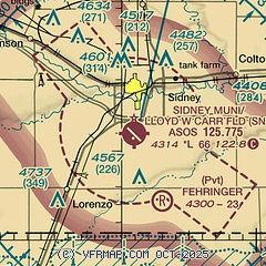
| Sectional chart |
|---|
|
| Airport distance calculator |
|---|
|
|
| Sunrise and sunset |
|---|
|
Times for 28-May-2026
| | Local
(UTC-6) | | Zulu
(UTC) |
|---|
| Morning civil twilight | | 04:52 | | 10:52 |
| Sunrise | | 05:25 | | 11:25 |
| Sunset | | 20:14 | | 02:14 |
| Evening civil twilight | | 20:46 | | 02:46 |
|
| Current date and time |
|---|
| Zulu (UTC) | 28-May-2026 18:25:07 |
|---|
| Local (UTC-6) | 28-May-2026 12:25:07 |
|---|
|
| METAR |
|---|
| KSNY | 281753Z AUTO 15017G26KT 10SM FEW027 SCT060 22/12 A3011 RMK AO2 PK WND 13026/1748 SLP158 T02220122 10222 20122 58009
|
|
| TAF |
|---|
| KSNY | 281720Z 2818/2918 14015KT P6SM SCT027 SCT035 TEMPO 2819/2823 4SM -TSRA OVC020CB FM282300 13015KT P6SM BKN070 FM290600 15013KT P6SM BKN013 FM291600 16014G22KT P6SM BKN045
|
|
| NOTAMs |
|---|
NOTAMs are issued by the DoD/FAA and will open in a separate window not controlled by AirNav.
|
|


