FAA INFORMATION EFFECTIVE 09 JULY 2026
Location
| FAA Identifier: | MTO |
| Lat/Long: | 39-28-40.4000N 088-16-47.9000W
39-28.673333N 088-16.798333W
39.4778889,-88.2799722
(estimated) |
| Elevation: | 722.3 ft. / 220.2 m (surveyed) |
| Variation: | 03W (2015) |
| From city: | 4 miles E of central business district of the associated city |
| Time zone: | UTC -5 (UTC -6 during Standard Time) |
| Zip code: | 61938 |
Airport Operations
| Airport use: | Open to the public |
| Activation date: | 10/1951 |
| Control tower: | no |
| ARTCC: | CHICAGO CENTER |
| FSS: | SAINT LOUIS FLIGHT SERVICE STATION |
| NOTAMs facility: | MTO (NOTAM-D service available) |
| Attendance: | APR-OCT M-F 0700-2000, NOV-MAR M-F 0700-1900, ALL SAT-SUN 0700-1700 |
| Wind indicator: | lighted |
| Segmented circle: | yes |
| Lights: | ACTVT MALSR RWY 29; REIL RWY 06, 11 & 24; MIRL RWY 06/24 - CTAF. ACTVT HIRL RWY 11/29 & INCR INTST - CTAF. |
| Beacon: | white-green (lighted land airport)
Operates sunset to sunrise. |
| Fire and rescue: | ARFF index A |
| Airline operations: | CLSD TO SKEDD ACR OPNS GTR THAN 9 PAX SEATS. UNSCHEDULED ACR OPNS GTR THAN 30 PAX SEATS, 24-HR PPR - CALL AMGR 217-234-7120. |
Airport Communications
| CTAF/UNICOM: | 122.7 |
| WX ASOS: | 118.475 (217-234-8442) |
| CHAMPAIGN APPROACH: | 132.85 |
| CHAMPAIGN DEPARTURE: | 132.85 |
- APCH/DEP SVC PRVDD BY CHICAGO ARTCC ON REMOTED CHAMPAIGN APCH CTL FREQS 121.35 & 353.95 (DANVILLE RCAG) WHEN CHAMPAIGN APCH CTL CLSD.
Nearby radio navigation aids
| VOR radial/distance | | VOR name | | Freq | | Var |
|---|
| AXCr117/30.9 | | ADDERS VORTAC | | 117.20 | | 03E |
| CMIr177/33.4 | | CHAMPAIGN VORTAC | | 115.75 | | 03E |
| BIBr013/34.7 | | BIBLE GROVE VORTAC | | 109.00 | | 03E |
| NDB name | | Hdg/Dist | | Freq | | Var | | ID |
|---|
| SHELBYVILLE | | 083/26.5 | | 365 | | 02W | | SYZ | ... -.-- --.. |
Airport Services
| Fuel available: | 100LL JET-A |
| Parking: | hangars and tiedowns |
| Airframe service: | MAJOR |
| Powerplant service: | MAJOR |
| Bottled oxygen: | HIGH/LOW |
| Bulk oxygen: | NONE |
Runway Information
Runway 11/29
| Dimensions: | 6501 x 150 ft. / 1982 x 46 m |
| Surface: | asphalt/grooved, in good condition |
| Weight bearing capacity: | | Single wheel: | 120.0 | | Double wheel: | 250.0 | | Double tandem: | 550.0 | | Dual double tandem: | 1120.0 |
|
| Runway edge lights: | high intensity |
| RUNWAY 11 | | RUNWAY 29 |
| Latitude: | 39-28.875785N | | 39-28.458833N |
| Longitude: | 088-17.381270W | | 088-16.108555W |
| Elevation: | 714.4 ft. | | 714.3 ft. |
| Traffic pattern: | right | | left |
| Runway heading: | 116 magnetic, 113 true | | 296 magnetic, 293 true |
| Declared distances: | TORA:6501 TODA:6501 ASDA:6501 LDA:6501 | | TORA:6501 TODA:6501 ASDA:6501 LDA:6501 |
| Markings: | precision, in fair condition | | precision, in fair condition |
| Visual slope indicator: | 4-light PAPI on left (3.00 degrees glide path) | | |
| Approach lights: | | | MALSR: 1,400 foot medium intensity approach lighting system with runway alignment indicator lights |
| Runway end identifier lights: | yes | | no |
| Touchdown point: | yes, no lights | | yes, no lights |
| Instrument approach: | | | ILS |
| Obstructions: | none | | 56 ft. tree, 2592 ft. from runway, 780 ft. right of centerline, 42:1 slope to clear |
Runway 6/24
| Dimensions: | 5799 x 100 ft. / 1768 x 30 m |
| Surface: | asphalt/grooved, in good condition |
| Weight bearing capacity: | | Single wheel: | 120.0 | | Double wheel: | 218.0 | | Double tandem: | 289.0 | | Dual double tandem: | 768.0 |
|
| Runway edge lights: | medium intensity |
| RUNWAY 6 | | RUNWAY 24 |
| Latitude: | 39-28.448482N | | 39-28.923127N |
| Longitude: | 088-17.299728W | | 088-16.230160W |
| Elevation: | 718.8 ft. | | 712.1 ft. |
| Traffic pattern: | right | | left |
| Runway heading: | 063 magnetic, 060 true | | 243 magnetic, 240 true |
| Declared distances: | TORA:5799 TODA:5799 ASDA:5799 LDA:5799 | | TORA:5799 TODA:5799 ASDA:5799 LDA:5799 |
| Markings: | nonprecision, in good condition | | nonprecision, in good condition |
| Visual slope indicator: | 4-box VASI on left (3.00 degrees glide path) | | 4-box VASI on left (3.00 degrees glide path) |
| Runway end identifier lights: | yes | | yes |
| Touchdown point: | yes, no lights | | yes, no lights |
| Obstructions: | 52 ft. tree, 2139 ft. from runway, 103 ft. left of centerline, 37:1 slope to clear | | none |
Runway 18/36
| Dimensions: | 1098 x 250 ft. / 335 x 76 m |
| Surface: | turf |
| Runway edge markings: | CORNER STONE MARKERS; LENGTH & WIDTH. |
| Operational restrictions: | RWY 18/36 NOT AVBL FOR PART 121/PART 380 OPS WITH SKED PAX CARRYING OPS MORE THAN 9 PAX SEATS AND NON-SKED PAX CARRYING OPS MORE THAN 30 PAX SEATS. |
| RUNWAY 18 | | RUNWAY 36 |
| Latitude: | 39-28.738935N | | 39-28.558633N |
| Longitude: | 088-17.304053W | | 088-17.285473W |
| Elevation: | 714.7 ft. | | 718.9 ft. |
| Traffic pattern: | right | | left |
| Runway heading: | 178 magnetic, 175 true | | 358 magnetic, 355 true |
| Declared distances: | TORA:1080 TODA:1080 ASDA:1080 LDA:1080 | | TORA:1080 TODA:1080 ASDA:1080 LDA:1080 |
| Touchdown point: | yes, no lights | | yes, no lights |
Airport Ownership and Management from official FAA records
| Ownership: | Publicly-owned |
| Owner: | COLES COUNTY AIRPORT AUTHORITY
432 AIRPORT ROAD
MATTOON, IL 61938
Phone 217-234-7120 |
| Manager: | ANDREW FEARN
432 AIRPORT ROAD
MATTOON, IL 61938
Phone 217-234-7120 |
Additional Remarks
| A39-11/29 | PCR VALUE: 2110/F/D/X/T |
| A39-06/24 | PCR VALUE: 680/F/D/X/T |
| - | BIRDS ON & INVOF ARPT. |
| - | ARPT SFC COND NOT MONITORED BTN 2300Z-1300Z. |
| - | FOR CD CTC CHAMPAIGN APCH AT 217-355-4071, WHEN APCH CLSD CTC CHICAGO ARTCC AT 630-906-8921 |
Instrument Procedures
NOTE: All procedures below are presented as PDF files. If you need a reader for these files, you should download the free Adobe Reader.NOT FOR NAVIGATION. Please procure official charts for flight.
FAA instrument procedures published for use from 09 July 2026 at 0901Z to 06 August 2026 at 0900Z.
IAPs - Instrument Approach Procedures |
|---|
| ILS OR LOC RWY 29 | |
download (254KB) |
| RNAV (GPS) RWY 06 | |
download (247KB) |
| RNAV (GPS) RWY 11 | |
download (259KB) |
| RNAV (GPS) RWY 24 | |
download (234KB) |
| RNAV (GPS) RWY 29 | |
download (224KB) |
| NOTE: Special Alternate Minimums apply | |
download (149KB) |
| NOTE: Special Take-Off Minimums/Departure Procedures apply | |
download (482KB) |
Other nearby airports with instrument procedures:
1H8 - Casey Municipal Airport (17 nm SE)
2H0 - Shelby County Airport (27 nm W)
1H2 - Effingham County Regional Airport (27 nm SW)
KPRG - Edgar County Airport (31 nm NE)
KCMI - University of Illinois/Willard Airport (34 nm N)
|
|

Road maps at:
MapQuest
Bing
Google
| Aerial photo |
|---|
WARNING: Photo may not be current or correct

Do you have a better or more recent aerial photo of Coles County Memorial Airport that you would like to share? If so, please send us your photo.
|
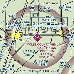
| Sectional chart |
|---|
|
CAUTION: Diagram may not be current

| Airport distance calculator |
|---|
|
|
| Sunrise and sunset |
|---|
|
Times for 15-Jul-2026
| | Local
(UTC-5) | | Zulu
(UTC) |
|---|
| Morning civil twilight | | 05:08 | | 10:08 |
| Sunrise | | 05:39 | | 10:39 |
| Sunset | | 20:19 | | 01:19 |
| Evening civil twilight | | 20:50 | | 01:50 |
|
| Current date and time |
|---|
| Zulu (UTC) | 15-Jul-2026 19:46:13 |
|---|
| Local (UTC-5) | 15-Jul-2026 14:46:13 |
|---|
|
| METAR |
|---|
| KMTO | 151853Z AUTO 22003KT 10SM FEW041 31/21 A3009 RMK AO2 SLP184 T03110211
|
|
| TAF |
|---|
KCMI
33nm N | 151720Z 1518/1618 VRB04KT P6SM FEW035 FM160100 VRB03KT P6SM SCT250
|
KDEC
34nm NW | 151720Z 1518/1618 VRB04KT P6SM FEW040 FM160100 VRB03KT P6SM FEW250
|
|
| NOTAMs |
|---|
NOTAMs are issued by the DoD/FAA and will open in a separate window not controlled by AirNav.
|
|


