FAA INFORMATION EFFECTIVE 09 JULY 2026
Location
| FAA Identifier: | FAI |
| Lat/Long: | 64-48-55.2800N 147-51-24.0000W
64-48.921333N 147-51.400000W
64.8153556,-147.8566667
(estimated) |
| Elevation: | 439 ft. / 133.8 m (surveyed) |
| Variation: | 15E (2025) |
| From city: | 3 miles SW of FAIRBANKS, AK |
| Time zone: | UTC -8 (UTC -9 during Standard Time) |
| Zip code: | 99709 |
Airport Operations
| Airport use: | Open to the public |
| Activation date: | 06/1951 |
| Control tower: | yes |
| ARTCC: | ANCHORAGE CENTER |
| FSS: | FAIRBANKS FLIGHT SERVICE STATION (on field) [907-474-0788] |
| NOTAMs facility: | FAI (NOTAM-D service available) |
| Attendance: | CONTINUOUS |
| Pattern altitude: | TFC PAT ALT (SINGLE ENGINE RECIPROCATING ACFT) 1500 FT MSL. TFC PAT ALT (ALL MULTI-ENGINE, LARGE AND TURBINE-POWERED ACFT) 2000 FT MSL. |
| Wind indicator: | lighted |
| Segmented circle: | no |
| Beacon: | white-green (lighted land airport)
Operates sunset to sunrise. |
| Landing fee: | yes |
| Fire and rescue: | ARFF index C |
| International operations: | customs landing rights airport |
Airport Communications
| ATIS: | 124.4 |
| WX ASOS: | 124.4 (907-621-7609) |
| FAIRBANKS GROUND: | 121.9 |
| FAIRBANKS TOWER: | 118.3 257.8 |
| FAIRBANKS APPROACH: | 125.35 ;180-359 127.1 ;360-179 251.1 ;360-179 363.2 ;180-359 119.85 |
| FAIRBANKS DEPARTURE: | 125.35 ;180-359 127.1 ;360-179 251.1 ;360-179 363.2 ;180-359 327.1 |
| CLEARANCE DELIVERY: | 127.6 |
| EMERG: | 121.5 243.0 |
| IC: | 125.35 ;180-359 363.2 ;180-359 |
| TRSA: | 125.35 ;180-359 127.1 ;360-179 251.1 ;360-179 363.2 ;180-359 |
- SECTORIZATION BASED ON CHENA NDB.
- COMMUNICATIONS PRVDD BY FAIRBANKS FSS ON FREQS 124.1 & 132.65.
Nearby radio navigation aids
| VOR radial/distance | | VOR name | | Freq | | Var |
|---|
| FAIr056/4.1 | | FAIRBANKS VORTAC | | 108.60 | | 21E |
| ENNr046/34.0 | | NENANA VORTAC | | 115.80 | | 21E |
| NDB name | | Hdg/Dist | | Freq | | Var | | ID |
|---|
| CHENA | | 244/9.3 | | 257 | | 17E | | CUN | -.-. ..- -. |
| ICE POOL | | 050/35.2 | | 525 | | 13E | | ICW | .. -.-. .-- |
Airport Services
| Fuel available: | 100LL JET-A1 |
| Parking: | hangars |
| Airframe service: | MAJOR |
| Powerplant service: | MAJOR |
| Bulk oxygen: | HIGH/LOW |
Runway Information
Runway 2L/20R
| Dimensions: | 11800 x 150 ft. / 3597 x 46 m |
| Surface: | asphalt/grooved, in good condition |
| Weight bearing capacity: | | Single wheel: | 75.0 | | Double wheel: | 220.0 | | Double tandem: | 580.0 | | Dual double tandem: | 1100.0 |
|
| Runway edge lights: | high intensity |
| RUNWAY 2L | | RUNWAY 20R |
| Latitude: | 64-48.157927N | | 64-49.681847N |
| Longitude: | 147-53.153063W | | 147-50.352155W |
| Elevation: | 435.6 ft. | | 438.9 ft. |
| Traffic pattern: | left | | left |
| Runway heading: | 023 magnetic, 038 true | | 203 magnetic, 218 true |
| Displaced threshold: | 750 ft. | | 750 ft. |
| Declared distances: | TORA:11800 TODA:12800 ASDA:11800 LDA:11050 | | TORA:11800 TODA:12800 ASDA:11800 LDA:11050 |
| Markings: | precision, in good condition | | precision, in good condition |
| Visual slope indicator: | 4-light PAPI on left (3.00 degrees glide path) | | 4-light PAPI on left (3.00 degrees glide path)
UNUSBL BYD 8 DEGS RIGHT OF CNTRLN. |
| RVR equipment: | touchdown, midfield, rollout | | touchdown, midfield, rollout |
| Approach lights: | ALSF2: standard 2,400 foot high intensity approach lighting system with centerline sequenced flashers (category II or III) | | MALSR: 1,400 foot medium intensity approach lighting system with runway alignment indicator lights |
| Centerline lights: | yes | | yes |
| Touchdown point: | yes, lighted | | yes, no lights |
| Instrument approach: | ILS/DME | | ILS/DME |
| Obstructions: | 72 ft. tree, 2711 ft. from runway, 652 ft. left of centerline, 34:1 slope to clear | | 86 ft. tree, 3096 ft. from runway, 430 ft. right of centerline, 33:1 slope to clear |
Runway 2R/20L
| Dimensions: | 4510 x 75 ft. / 1375 x 23 m |
| Surface: | asphalt, in good condition |
| Weight bearing capacity: | | Single wheel: | 21.0 | | Double wheel: | 40.0 |
|
| Runway edge lights: | medium intensity |
| Operational restrictions: | NOT AVBL FOR PART 121/PART 380 OPS WITH SKED PAX CARRYING OPS MORE THAN 9 PAX SEATS & NON-SKED PAX CARRYING OPS MORE THAN 30 PAX SEATS. |
| RUNWAY 2R | | RUNWAY 20L |
| Latitude: | 64-48.014360N | | 64-48.596820N |
| Longitude: | 147-52.537220W | | 147-51.467125W |
| Elevation: | 433.5 ft. | | 434.5 ft. |
| Traffic pattern: | right | | left |
| Runway heading: | 023 magnetic, 038 true | | 203 magnetic, 218 true |
| Markings: | nonprecision, in good condition | | nonprecision, in good condition |
| Visual slope indicator: | 4-light PAPI on left (3.00 degrees glide path) | | 4-light PAPI on left (3.00 degrees glide path) |
| Runway end identifier lights: | no | | yes |
| Touchdown point: | yes, no lights | | yes, no lights |
| Obstructions: | 79 ft. trees, 2175 ft. from runway, 350 ft. both sides of centerline, 25:1 slope to clear | | none |
Runway 2/20
| Dimensions: | 2900 x 75 ft. / 884 x 23 m |
| Surface: | gravel |
| Operational restrictions: | NOT AVBL FOR PART 121/PART 380 OPS WITH SKED PAX CARRYING OPS MORE THAN 9 PAX SEATS & NON-SKED PAX CARRYING OPS MORE THAN 30 PAX SEATS. SUMMER & SKI STRIP WINTER USE; AVBL LCL NOTAM & ATCT BFR ARR OR DEP. |
| RUNWAY 2 | | RUNWAY 20 |
| Latitude: | 64-48.963337N | | 64-49.337740N |
| Longitude: | 147-50.793330W | | 147-50.104525W |
| Elevation: | 433.0 ft. | | 433.6 ft. |
| Traffic pattern: | left | | left |
| Runway heading: | 023 magnetic, 038 true | | 203 magnetic, 218 true |
| Touchdown point: | yes, no lights | | yes, no lights |
Runway 2W/20W
| Dimensions: | 5400 x 100 ft. / 1646 x 30 m |
| Surface: | water |
| Operational restrictions: | NOT AVBL FOR PART 121/PART 380 OPS WITH SKED PAX CARRYING OPS MORE THAN 9 PAX SEATS & NON-SKED PAX CARRYING OPS MORE THAN 30 PAX SEATS. CTLD; APREQ - ATCT 118.3. CTC CD ASAP AFT ENG START. FROZEN IN WINTER; SFC UNMNT. THR BUOYS 500 FT FM N & S SHORE MARK WATERLANE. STEP TAX OUTSIDE OF WATERLANE NA. E OF WATERLANE UNCTLD; TAX AT PILOT DISCRETION. |
| RUNWAY 2W | | RUNWAY 20W |
| Latitude: | 64-48.966732N | | 64-49.663915N |
| Longitude: | 147-51.276487W | | 147-49.993822W |
| Elevation: | 423.4 ft. | | 423.4 ft. |
| Traffic pattern: | left | | left |
| Runway heading: | 023 magnetic, 038 true | | 203 magnetic, 218 true |
| Markings: | buoys, in good condition | | buoys, in good condition |
| Touchdown point: | yes, no lights | | yes, no lights |
| Obstructions: | 14 ft. fence, 553 ft. from runway, 170 ft. left of centerline, 39:1 slope to clear | | 11 ft. fence, 505 ft. from runway, 45:1 slope to clear |
Airport Ownership and Management from official FAA records
| Ownership: | Publicly-owned |
| Owner: | STATE OF ALASKA DOTPF
6450 AIRPORT WAY - SUITE 1
FAIRBANKS, AK 99709
Phone 907-474-2500
ALASKA INTL SYS. |
| Manager: | ANGIE SPEAR
6450 AIRPORT WAY - SUITE 1
FAIRBANKS, AK 99709
Phone 907-474-2500 |
Additional Remarks
| A39-02R/20L | PCR VALUE: 46/F/B/X/T |
| A39-02L/20R | PCR VALUE: 780/F/B/X/T |
| - | CTN: SN REMOVAL EQUIP 1 OCT 1 - MAY 15. |
| - | MIL CONTR FUEL AVBL. |
| - | OPS IN MOAS E OF FAIRBANKS - EIELSON RANGE CTL 125.3/126.3 OR 1-800-758-8723. |
| - | NOISE ABATEMENT PROC IN EFCT 2200-0800; LRG, TURBINE & HVY ARR RWY 02L; DEP RWY 20R BASED ON WIND. ENG RUNUP LCT - ARPT OPS. |
| - | CTN: AVOID LNDG ON TWY; N/S TWY PARL TO RWY 02L/20R W SIDE. |
| - | WX CAMERA AVBL ON INTERNET AT HTTPS://WEATHERCAMS.FAA.GOV. |
| - | TSNT PRKG WINGSPAN LESS THAN 79 FT E RAMP. TSNT PRKG W RAMP NA. LTD TSNT FLOAT PLANE PRKG - 907-455-4571. MEDIVAC & TSNT HEL PRKG OR INFO - 907-451-2300. |
| - | COLD TEMPERATURE AIRPORT. ALTITUDE CORRECTION REQUIRED AT OR BELOW -29C. |
| - | SEE ADDITIONAL PAGES UNDER NOTICES FOR TRSA AND FAIRBANKS AREA INFORMATION. |
| - | NWS WEATHER BALLOON LAUNCH SITE 2000 FEET WEST OF MIDFIELD RUNWAY 02L/20R. LAUNCHES ARE TWICE DAILY AT 1100 AND 2300 HOURS UTC. |
| - | ATCT 538 MS ATCT 64 48 39.438 N 147 50 55.722 W. |
| - | RWY 02R/20L IS LIMITED FOR USE BY ACFT DESIGN GROUP B II, ACFT OR SMALLER. |
| - | TWY B SCTY GATE - ACTVT 121.75 OR 907-451-2300. |
| - | COMPASS ROSE CLBR NA. |
| - | PPR MIL OPS HVY CARGO OR TRML APN - APRT OPS. |
| - | BIRDS INVOF SPRING - FALL. |
Instrument Procedures
NOTE: All procedures below are presented as PDF files. If you need a reader for these files, you should download the free Adobe Reader.NOT FOR NAVIGATION. Please procure official charts for flight.
FAA instrument procedures published for use from 09 July 2026 at 0901Z to 06 August 2026 at 0900Z.
STARs - Standard Terminal Arrivals |
|---|
| HRDNG FOUR (RNAV) **NEW** | |
download (240KB) |
| LIBER FIVE (RNAV) **NEW** | |
download (210KB) |
IAPs - Instrument Approach Procedures |
|---|
| HI-ILS Y OR LOC Y RWY 20R **CHANGED** | |
download (164KB) |
| ILS OR LOC RWY 02L | |
download (293KB) |
| ILS Z OR LOC Z RWY 20R | |
download (317KB) |
| ILS RWY 02L (SA CAT I) | |
download (258KB) |
| ILS Z RWY 20R (SA CAT I - II) | |
download (298KB) |
| ILS RWY 02L (CAT II - III) | |
download (269KB) |
| RNAV (RNP) Z RWY 02L | |
download (314KB) |
| RNAV (RNP) Z RWY 20R | |
download (298KB) |
| RNAV (GPS) RWY 02R | |
download (284KB) |
| RNAV (GPS) RWY 20L | |
download (260KB) |
| RNAV (GPS) Y RWY 02L | |
download (308KB) |
| RNAV (GPS) Y RWY 20R | |
download (271KB) |
| TACAN RWY 20R | |
download (277KB) |
| NOTE: Special Alternate Minimums apply | |
download (172KB) |
Departure Procedures |
|---|
| DRRLL FOUR (RNAV) | |
download (161KB) |
| GALENA EIGHT | |
download (154KB) |
| MCKINLEY FOUR | |
download (167KB) |
| PUYVO FIVE (RNAV) | |
download (162KB) |
| RDFLG FIVE (RNAV) | |
download (162KB) |
| NOTE: Special Take-Off Minimums/Departure Procedures apply | |
download (408KB) |
Other nearby airports with instrument procedures:
PAFB - Ladd Army Airfield (6 nm E)
PAEI - Eielson Air Force Base (21 nm SE)
PANN - Nenana Municipal Airport (35 nm SW)
PAHV - Healy River Airport (64 nm SW)
PAML - Manley Hot Springs Airport (72 nm W)
|
|

Road maps at:
MapQuest
Bing
Google
| Aerial photo |
|---|
WARNING: Photo may not be current or correct

Do you have a better or more recent aerial photo of Fairbanks International Airport that you would like to share? If so, please send us your photo.
|
| Sectional chart |
|---|
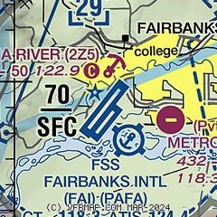
|
 Download PDF
of official airport diagram from the FAA
| Airport distance calculator |
|---|
|
|
| Sunrise and sunset |
|---|
|
Times for 17-Jul-2026
| | Local
(UTC-8) | | Zulu
(UTC) |
|---|
| Morning civil twilight | | + | | + |
| Sunrise | | 04:02 | | 12:02 |
| Sunset | | 23:53 | | 07:53 |
| Evening civil twilight | | + | | + |
|
| Current date and time |
|---|
| Zulu (UTC) | 17-Jul-2026 20:00:12 |
|---|
| Local (UTC-8) | 17-Jul-2026 12:00:12 |
|---|
|
| METAR |
|---|
| PAFA | 171953Z VRB04KT 10SM FEW060 SCT090 SCT140 17/06 A2981 RMK AO2 SLP100 T01670061 $
|
PAFB
6nm E | 171855Z 00000KT 10SM FEW050 FEW130 15/07 A2982 RMK AO2A SLP104 T01540067
|
|
| TAF |
|---|
| PAFA | 171137Z 1712/1818 VRB04KT P6SM VCSH BKN060 OVC090 FM171400 22006KT P6SM SCT050 FM180000 24006KT P6SM VCTS FEW050CB FM180600 VRB04KT P6SM SCT050
|
PAFB
6nm E | 170600Z 1706/1812 VRB06KT 9999 FEW060 BKN100 BKN200 QNH2980INS TEMPO 1801/1804 24012KT VCTS SCT030 BKN050 620901 BECMG 1806/1807 24012KT 9999 SCT200 QNH2982INS TX20/1802Z TN12/1712Z
|
|
| NOTAMs |
|---|
NOTAMs are issued by the DoD/FAA and will open in a separate window not controlled by AirNav.
|
|


