FAA INFORMATION EFFECTIVE 16 APRIL 2026
Location
| FAA Identifier: | S52 |
| Lat/Long: | 48-25-29.8140N 120-08-45.1880W
48-25.496900N 120-08.753133W
48.4249483,-120.1458856
(estimated) |
| Elevation: | 1706 ft. / 520 m (estimated) |
| Variation: | 20E (1985) |
| From city: | 3 miles SE of WINTHROP, WA |
| Time zone: | UTC -7 (UTC -8 during Standard Time) |
| Zip code: | 98862 |
Airport Operations
| Airport use: | Open to the public |
| Activation date: | 12/1938 |
| Control tower: | no |
| ARTCC: | SEATTLE CENTER |
| FSS: | SEATTLE FLIGHT SERVICE STATION |
| NOTAMs facility: | SEA (NOTAM-D service available) |
| Attendance: | UNATNDD |
| Wind indicator: | yes |
| Segmented circle: | yes |
| Lights: | ACTVT MIRL RY 13/31 - CTAF. |
| Beacon: | white-green (lighted land airport)
ROTG BCN PCL - CTAF. |
Airport Communications
| CTAF/UNICOM: | 122.8 |
| WX AWOS-3: | 118.425 (509-997-0142) |
- USDA FOREST SVC SMOKE JUMP BASE UNICOM. LTD ADVISORIES RELATED TO BASE OPS MOSTLY DURING SUMMER FIRE SEASON.
Airport Services
| Fuel available: | 100LL JET-A |
| Parking: | tiedowns |
| Airframe service: | NONE |
| Powerplant service: | NONE |
| Bottled oxygen: | NONE |
| Bulk oxygen: | NONE |
Runway Information
Runway 13/31
| Dimensions: | 5049 x 75 ft. / 1539 x 23 m |
| Surface: | asphalt, in excellent condition |
| Weight bearing capacity: | |
| Runway edge lights: | medium intensity |
| RUNWAY 13 | | RUNWAY 31 |
| Latitude: | 48-25.844583N | | 48-25.149183N |
| Longitude: | 120-09.094067W | | 120-08.412267W |
| Elevation: | 1694.0 ft. | | |
| Traffic pattern: | left | | left |
| Displaced threshold: | 129 ft. | | 231 ft. |
| Declared distances: | TORA:5049 TODA:5049 ASDA:4749 LDA:4619 | | TORA:5049 TODA:5049 ASDA:4919 LDA:4619 |
| Markings: | basic, in good condition | | basic, in good condition |
| Visual slope indicator: | 2-light PAPI on left (3.50 degrees glide path) | | |
| Obstructions: | 4 ft. other, 200 ft. from runway, 175 ft. left and right of centerline
ROAD AT 0 FT. | | 39 ft. trees, 538 ft. from runway, 33 ft. left and right of centerline, 9:1 slope to clear
ROAD 0 FT, 125 FT L, ROAD 182 FT, +5 FT STEEL POST & FENCE AT 78 FT, 80 FT L. |
Airport Ownership and Management from official FAA records
| Ownership: | Publicly-owned |
| Owner: | WSDOT AVIATION DIVISION
PO BOX 47312
OLYMPIA, WA 98504-7264
Phone 800-552-0666 |
| Manager: | JOHN WILSON
PO BOX 47312
OLYMPIA, WA 98504-7264
Phone 360-618-2477 |
Additional Remarks
| - | SOME OBSTNS IN PRIMARY AND TRANSITIONAL SFCS. |
| - | PEDESTRIANS, VEHICLES, AND ANIMALS ON AND INVOF RY. |
| - | SMOKE JUMPER BASE PRCHT OPS COMMON DURG SPRING AND SUMMER MONTHS. |
Instrument Procedures
There are no published instrument procedures at S52.
Some nearby airports with instrument procedures:
KOMK - Omak Airport (25 nm E)
3W7 - Grand Coulee Dam Airport (52 nm SE)
KEAT - Pangborn Memorial Airport (62 nm S)
2S8 - Wilbur Airport (69 nm SE)
KEPH - Ephrata Municipal Airport (72 nm S)
|
|

Road maps at:
MapQuest
Bing
Google
| Aerial photo |
|---|
WARNING: Photo may not be current or correct
 Photo by P.J. Reinders
Taken in September 2008
Photo by P.J. Reinders
Taken in September 2008
Do you have a better or more recent aerial photo of Methow Valley State Airport that you would like to share? If so, please send us your photo.
|
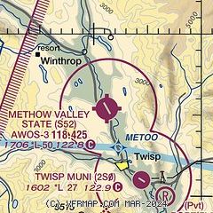
| Sectional chart |
|---|
|
| Airport distance calculator |
|---|
|
|
| Sunrise and sunset |
|---|
|
Times for 25-Apr-2026
| | Local
(UTC-7) | | Zulu
(UTC) |
|---|
| Morning civil twilight | | 05:18 | | 12:18 |
| Sunrise | | 05:52 | | 12:52 |
| Sunset | | 20:05 | | 03:05 |
| Evening civil twilight | | 20:39 | | 03:39 |
|
| Current date and time |
|---|
| Zulu (UTC) | 26-Apr-2026 01:30:08 |
|---|
| Local (UTC-7) | 25-Apr-2026 18:30:08 |
|---|
|
| METAR |
|---|
| KS52 | 260115Z AUTO 19009KT 4SM HZ SCT100 SCT120 16/M11 A2977 RMK AO2 T01571111
|
|
| NOTAMs |
|---|
NOTAMs are issued by the DoD/FAA and will open in a separate window not controlled by AirNav.
|
|

