FAA INFORMATION EFFECTIVE 15 MAY 2025
Location
| FAA Identifier: | OLM |
| Lat/Long: | 46-58-09.8560N 122-54-09.1610W
46-58.164267N 122-54.152683W
46.9694044,-122.9025447
(estimated) |
| Elevation: | 207.8 ft. / 63 m (estimated) |
| Variation: | 15E (2020) |
| From city: | 4 miles S of OLYMPIA, WA |
| Time zone: | UTC -7 (UTC -8 during Standard Time) |
| Zip code: | 98501 |
Airport Operations
| Airport use: | Open to the public |
| Activation date: | 12/1937 |
| Control tower: | yes |
| ARTCC: | SEATTLE CENTER |
| FSS: | SEATTLE FLIGHT SERVICE STATION |
| NOTAMs facility: | OLM (NOTAM-D service available) |
| Attendance: | 0800-1700 |
| Wind indicator: | lighted |
| Segmented circle: | yes |
| Lights: | WHEN ATCT CLSD ACTVT HIRL RY 17/35; MALSR 17; REIL RY 35, TWY LGTS & DIRECTIONAL SIGNAGE - CTAF. PAPI RYS 17 & 35 OPER CONT. |
| Beacon: | white-green (lighted land airport)
Operates sunset to sunrise. |
| Landing fee: | yes |
| International operations: | customs landing rights airport |
Airport Communications
| CTAF: | 124.4 |
| UNICOM: | 122.95 |
| ATIS: | 135.725 |
| WX ASOS: | PHONE 360-754-0781 |
| OLYMPIA GROUND: | 121.6 [0800-2000] |
| OLYMPIA TOWER: | 124.4 254.25 [0800-2000] |
| SEATTLE APPROACH: | 121.1 |
| SEATTLE DEPARTURE: | 121.1 |
| WX AWOS-3 at CLS (18 nm S): | 118.025 (360-740-5164) |
| WX ASOS at SHN (19 nm NW): | 119.275 (360-358-3006) |
- EMERG FREQ 121.5 NOT MON AT TOWER
Nearby radio navigation aids
| VOR radial/distance | | VOR name | | Freq | | Var |
|---|
| OLM at field | | OLYMPIA VORTAC | | 113.40 | | 19E |
| SEAr202/37.0 | | SEATTLE VORTAC | | 116.80 | | 19E |
Airport Services
| Fuel available: | 100LL JET-A |
| Parking: | hangars and tiedowns |
| Airframe service: | MAJOR |
| Powerplant service: | MAJOR |
| Bottled oxygen: | NONE |
| Bulk oxygen: | NONE |
Runway Information
Runway 17/35
| Dimensions: | 5500 x 150 ft. / 1676 x 46 m |
| Surface: | asphalt/grooved, in good condition |
| Weight bearing capacity: | | Single wheel: | 75.0 | | Double wheel: | 94.0 | | Double tandem: | 142.0 |
|
| Runway edge lights: | high intensity |
| RUNWAY 17 | | RUNWAY 35 |
| Latitude: | 46-58.582000N | | 46-57.694667N |
| Longitude: | 122-54.143333W | | 122-54.402500W |
| Elevation: | 196.6 ft. | | 202.8 ft. |
| Traffic pattern: | left | | right |
| Runway heading: | 176 magnetic, 191 true | | 356 magnetic, 011 true |
| Markings: | precision, in poor condition | | nonprecision, in poor condition |
| Visual slope indicator: | 4-light PAPI on left (3.00 degrees glide path) | | 4-light PAPI on left (3.00 degrees glide path) |
| Approach lights: | MALSR: 1,400 foot medium intensity approach lighting system with runway alignment indicator lights | | |
| Runway end identifier lights: | | | yes |
| Touchdown point: | yes, no lights | | yes, no lights |
| Instrument approach: | ILS | | |
Runway 8/26
| Dimensions: | 4157 x 150 ft. / 1267 x 46 m |
| Surface: | asphalt, in good condition |
| Weight bearing capacity: | |
| RUNWAY 8 | | RUNWAY 26 |
| Latitude: | 46-58.279400N | | 46-58.117733N |
| Longitude: | 122-54.478950W | | 122-53.508250W |
| Elevation: | 194.1 ft. | | 204.1 ft. |
| Traffic pattern: | right | | left |
| Runway heading: | 089 magnetic, 104 true | | 269 magnetic, 284 true |
| Markings: | basic, in good condition | | basic, in good condition |
| Touchdown point: | yes, no lights | | yes, no lights |
| Obstructions: | 58 ft. trees, 1360 ft. from runway, 325 ft. left of centerline, 20:1 slope to clear | | 107 ft. tree, 950 ft. from runway, 207 ft. right of centerline, 7:1 slope to clear |
Airport Ownership and Management from official FAA records
| Ownership: | Publicly-owned |
| Owner: | PORT OF OLYMPIA
606 COLUMBIA ST NW, SUITE 300
OLYMPIA, WA 98501-0827
Phone 360-528-8000 |
| Manager: | CHRIS PAOLINI
7643 OLD HWY 99 SE
OLYMPIA, WA 98501
Phone 360-528-8074 |
Additional Remarks
| - | TWY LGTS ON TWY W, A, L, AND B. |
| - | AIRPORT FIELD CONDITIONS UNMONITORED 1700 LCL - 0700 LCL. |
| - | EMERG FREQ 121.5 NOT MNT AT TWR. |
| - | FOR CD WHEN ATCT IS CLSD CTC SEATTLE APCH AT 206-214-4723. |
Instrument Procedures
NOTE: All procedures below are presented as PDF files. If you need a reader for these files, you should download the free Adobe Reader.NOT FOR NAVIGATION. Please procure official charts for flight.
FAA instrument procedures published for use from 15 May 2025 at 0901Z to 13 June 2025 at 0900z.
IAPs - Instrument Approach Procedures |
|---|
| ILS OR LOC RWY 17 | |
download (316KB) |
| RNAV (GPS) RWY 17 | |
download (313KB) |
| RNAV (GPS) RWY 35 | |
download (223KB) |
| VOR RWY 35 | |
download (256KB) |
| VOR-A | |
download (235KB) |
| NOTE: Special Alternate Minimums apply | |
download (87KB) |
Departure Procedures |
|---|
| YELM FIVE | |
download (203KB) |
| NOTE: Special Take-Off Minimums/Departure Procedures apply | |
download (376KB) |
Other nearby airports with instrument procedures:
KGRF - Gray Army Airfield (Joint Base Lewis-McChord) (15 nm NE)
KCLS - Chehalis-Centralia Airport (18 nm S)
KSHN - Sanderson Field Airport (19 nm NW)
KTCM - McChord Field Airport (Joint Base Lewis-McChord) (20 nm NE)
KTIW - Tacoma Narrows Airport (22 nm NE)
|
|

Road maps at:
MapQuest
Bing
Google
| Aerial photo |
|---|
WARNING: Photo may not be current or correct
 Photo by N. Jacob Libby
Photo taken 15-Mar-2020
Looking NW from 3,715 feet MSL.
Photo by N. Jacob Libby
Photo taken 15-Mar-2020
Looking NW from 3,715 feet MSL.
Do you have a better or more recent aerial photo of Olympia Regional Airport that you would like to share? If so, please send us your photo.
|
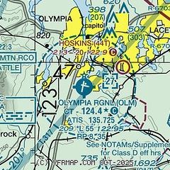
| Sectional chart |
|---|
|
CAUTION: Diagram may not be current
 Download PDF
of official airport diagram from the FAA
| Airport distance calculator |
|---|
|
|
| Sunrise and sunset |
|---|
|
Times for 16-May-2025
| | Local
(UTC-7) | | Zulu
(UTC) |
|---|
| Morning civil twilight | | 05:00 | | 12:00 |
| Sunrise | | 05:36 | | 12:36 |
| Sunset | | 20:40 | | 03:40 |
| Evening civil twilight | | 21:16 | | 04:16 |
|
| Current date and time |
|---|
| Zulu (UTC) | 17-May-2025 04:42:54 |
|---|
| Local (UTC-7) | 16-May-2025 21:42:54 |
|---|
|
| METAR |
|---|
| KOLM | 170354Z AUTO 25004KT 10SM FEW038 OVC045 13/11 A2993 RMK AO2 SLP136 T01280106
|
KGRF
15nm NE | 170355Z AUTO 00000KT 10SM OVC060 14/10 A2991 RMK AO2 SLP132 T01420098 $
|
KCLS
18nm S | 170415Z AUTO 00000KT 10SM OVC028 13/13 A2993 RMK AO2
|
KSHN
18nm NW | 170416Z AUTO 00000KT 3SM BR BKN004 OVC019 12/11 A2992 RMK AO2 RAE12 P0001 T01170111
|
KTCM
20nm NE | 170355Z AUTO 00000KT 10SM OVC048 14/10 A2992 RMK AO2 SLP136 T01430097
|
|
| TAF |
|---|
| KOLM | 161729Z 1618/1718 20007KT 6SM BR VCSH OVC025 FM162200 19006KT P6SM -SHRA OVC022 FM170200 21005KT P6SM -SHRA OVC030 FM170900 VRB03KT 5SM -SHRA BR OVC010
|
KGRF
15nm NE | 162100Z 1621/1803 15006KT 9999 VCSH FEW015 BKN020 OVC035 610706 QNH2990INS TEMPO 1621/1705 4800 -SHRA BKN015 OVC020 BECMG 1704/1705 11006KT 8000 -RA FEW005 OVC010 620705 QNH2983INS BECMG 1716/1717 25010G18KT 9999 VCSH BKN025 OVC035 610557 QNH2986INS TEMPO 1718/1722 9000 -SHRA OVC025 BECMG 1800/1801 26012G18KT 9999 NSW SCT030 QNH2990INS TX16/1621Z TN10/1712Z
|
KTCM
20nm NE | 162100Z 1621/1803 20008KT 9999 SCT015 OVC030 610606 QNH3002INS BECMG 1701/1702 20006KT 9000 -SHRA BKN015 OVC025 610705 QNH2993INS BECMG 1707/1708 20005KT 9000 -SHRA BKN008 OVC020 610606 QNH2988INS BECMG 1712/1713 24006KT 9999 VCSH BKN008 OVC015 610606 QNH2984INS BECMG 1716/1717 22010G18KT 9999 VCSH SCT015 BKN030 610606 QNH2985INS TX15/1622Z TN10/1714Z
|
|
| NOTAMs |
|---|
NOTAMs are issued by the DoD/FAA and will open in a separate window not controlled by AirNav.
|
|


