FAA INFORMATION EFFECTIVE 09 JULY 2026
Location
| FAA Identifier: | HFF |
| Lat/Long: | 35-02-10.6860N 079-29-51.0470W
35-02.178100N 079-29.850783W
35.0363017,-79.4975131
(estimated) |
| Elevation: | 376 ft. / 115 m (estimated) |
| Variation: | 09W (2025) |
| From city: | 1 mile E of CAMP MACKALL, NC |
| Time zone: | UTC -4 (UTC -5 during Standard Time) |
| Zip code: | 28347 |
Airport Operations
| Airport use: | Private use. Permission required prior to landing |
| Control tower: | yes |
| ARTCC: | WASHINGTON CENTER |
| FSS: | RALEIGH FLIGHT SERVICE STATION |
| NOTAMs facility: | HFF (NOTAM-D service available) |
| Attendance: | MON-SAT 1310-0500Z++ |
| Segmented circle: | no |
| Lights: | ACTVT MIRL RWY 12/30 - CTAF. |
| Beacon: | white-white-green (lighted military airport)
0800-0000. |
Airport Communications
| CTAF: | 121.0 |
| WX ASOS: | 141.25 (910-396-7804) |
| MACKALL GROUND: | 128.35 251.05 41.75FM [1310-0500Z++MON-SAT, EXC FED HOL.] |
| MACKALL TOWER: | 121.0 254.4 [1310-0500Z++MON-SAT, EXC FED HOL.] |
| FAYETTEVILLE APPROACH: | 127.8 |
| FAYETTEVILLE DEPARTURE: | 127.8 |
| D-ATIS: | 141.4 |
| OPS: | 395.225 |
| PMSV METRO: | 141.25 265.6 |
| RANGE CTL: | 139.35 249.9 38.9FM |
| WX AWOS-3PT at SOP (13 nm NE): | 127.575 (910-692-4287) |
| WX AWOS-3 at RCZ (16 nm SW): | 118.775 (910-997-4093) |
| WX ASOS at MEB (16 nm SE): | 134.125 (910-844-5338) |
- OPR 0500Z++ MON - 0400Z++ SAT.
Nearby radio navigation aids
| VOR radial/distance | | VOR name | | Freq | | Var |
|---|
| SDZr161/11.6 | | SANDHILLS VORTAC | | 111.80 | | 03W |
| FAYr280/30.7 | | FAYETTEVILLE VOR/DME | | 114.85 | | 04W |
Airport Services
| Fuel available: | A++ |
| Oil available: | WHEN TWR CLSD. |
Runway Information
Runway 16/34
| Dimensions: | 5529 x 100 ft. / 1685 x 30 m |
| Surface: | concrete |
| Weight bearing capacity: | |
| RUNWAY 16 | | RUNWAY 34 |
| Latitude: | 35-02.676500N | | 35-01.806000N |
| Longitude: | 079-29.785167W | | 079-29.456667W |
| Elevation: | 349.0 ft. | | 329.0 ft. |
| Traffic pattern: | left | | left |
| Runway heading: | 172 magnetic, 163 true | | 352 magnetic, 343 true |
| Displaced threshold: | 277 ft. | | 469 ft. |
| Touchdown point: | yes, no lights | | yes, no lights |
Runway 4/22
| Dimensions: | 4996 x 100 ft. / 1523 x 30 m |
| Surface: | asphalt |
| Weight bearing capacity: | |
| RUNWAY 4 | | RUNWAY 22 |
| Latitude: | 35-02.058217N | | 35-02.730833N |
| Longitude: | 079-30.378183W | | 079-29.800067W |
| Elevation: | 375.5 ft. | | 350.3 ft. |
| Traffic pattern: | left | | left |
| Runway heading: | 044 magnetic, 035 true | | 224 magnetic, 215 true |
| Markings: | nonprecision, in fair condition | | nonprecision, in fair condition |
| Touchdown point: | yes, no lights | | yes, no lights |
Runway 12/30
| Dimensions: | 4794 x 100 ft. / 1461 x 30 m |
| Surface: | asphalt |
| Weight bearing capacity: | |
| Runway edge lights: | medium intensity |
| RUNWAY 12 | | RUNWAY 30 |
| Latitude: | 35-02.010167N | | 35-01.749217N |
| Longitude: | 079-30.321000W | | 079-29.413933W |
| Elevation: | 375.0 ft. | | 331.7 ft. |
| Traffic pattern: | left | | left |
| Runway heading: | 118 magnetic, 109 true | | 298 magnetic, 289 true |
| Markings: | precision, in good condition | | precision, in good condition |
| Runway end identifier lights: | no | | no |
| Touchdown point: | yes, no lights | | yes, no lights |
Airport Ownership and Management from official FAA records
| Ownership: | U.S. Army |
| Owner: | US ARMY AERONAUTICAL SVCS AGENCY
FT BELVOIR, VA 22060 |
| Manager: | LARRY LEWIS
SIMMONS AAAF BLDG P4541
FT BRAGG, NC 28307
Phone 910-907-0636 |
Additional Remarks
| - | BASE OPS OPR 1200-0500Z++, MON-SAT, EXC HOL. AFLD SUBJ CLOSING ON SHORT NTC. |
| - | RSTD: TWY D LTD TO ACN 32 R/B/X/T. |
| - | RSTD: RWY 04-22 CLSD TO ALL FIXED WING. |
| - | FOR NOTAMS ON FAA CIRCUITS CK RDU. |
| - | CAUTION: EXTV MIL ACT VCNTY AFLD, DAY AND NGT. RWY LGT INTMT BTN SR-SS DUE TO LCL NGT VISION TRNG, NON-PARTICIPATING ACFT CTC TWR TO INCR INTS. |
| - | MISC WX: 26 OWS BARKSDALE AFB, LA DSN 331-2651, C318-529-2651. CTC TWR CHIEF DSN 236-7308/9775 DUR OPR HR, OT DSN 236-7804. |
| - | CAUTION: ANY USE OF TACTICAL LGT CONFIGURATION (AMP), MUST CTC AFLD MGR FOR COORD. EXTV MIL ACFT INVOF AFLD, DAY AND NGT. ADVISORY: RNG CTL 121.0, 304.6. |
| - | RSTD: PPR C910-907-0608/0609 OR C910-396-0217, DSN 337-0608/0609 OR 236-0217; OT CTC SIMMONS BASE OPS C910-396-7804, DSN 236-6230. PPR FOR ALL TRAN F/W ACFT NOT SKED ON AIR MOVEMENT TABLE. |
| - | RSTD: NO SUAS ACT ALLOWED UNLESS TWR IS OPEN. UAS RWY 16/34 RSTD TO UAS ACFT ONLY UNLESS APPROVED BY AFLD MGMT. |
| - | WHEN ATCT CLSD, FOR CD CTC WASHINGTON ARTCC AT 703-771-3587. |
| - | RSTD: UAS/SUAS OPS ACT IN/NEAR CLASS D AND BTN CLASS D AND R5311/A351, UAS SFC TO 2500 FT, SUAS SFC TO 400 FT. |
| - | MISC: CTC AFLD MGR C910-907-0636, DSN 337-0636 DUR OPR HRS, OT DSN 236-7804. |
| - | MISC: FULL WX SVC AVBL FR SIMMONS AAF 0500Z++ MON THRU 0500Z++ SAT, EXC FEDERAL HOL, DSN 236-7100/7414, C910-396-7100/7414. OT REMOTE BRIEFING FR STAND-BY FCSTR, C910-920-0116. PRIM WX SENSORS AUTOMATED H24. DUR AUGMENTATION/BACK-UP, ATC WILL ASSIST IN COOPERATIVE WATCH. CONDS OF ENTIRE AFLD MAY NOT BE REPRESENTED DUE TO BLDG OBST SW-SE. |
| - | MISC: RWY 16-34 RSTD TO UAS ONLY. |
| - | WT LTD WAIVER REQ CG 18TH AIRBORNE CORPS FT BRAGG ATTN AFZA-CA-PO WITH NR OF CYCLES EST GROSS WT & DATE/TIME/GROUP. |
| - | FUEL AVBL 1300:2030Z TRANS PPR. HOT REFUEL HOURS 1300-0500Z++MON-FRI. |
| - | PPR PHONE C919-396-6230/V236-6230 DURING OPR HRS; OTHER TIMES V236-7804. |
Instrument Procedures
NOTE: All procedures below are presented as PDF files. If you need a reader for these files, you should download the free Adobe Reader.NOT FOR NAVIGATION. Please procure official charts for flight.
FAA instrument procedures published for use from 09 July 2026 at 0901Z to 06 August 2026 at 0900Z.
IAPs - Instrument Approach Procedures |
|---|
| RNAV (GPS) RWY 12 | |
download (125KB) |
| RNAV (GPS) RWY 30 | |
download (116KB) |
| NOTE: Special Take-Off Minimums/Departure Procedures apply | |
download (389KB) |
Other nearby airports with instrument procedures:
KSOP - Moore County Airport (13 nm NE)
5W4 - P K Airpark (15 nm E)
KRCZ - Richmond County Airport (16 nm SW)
KMEB - Laurinburg/Maxton Airport (16 nm SE)
KPOB - Pope Army Airfield (25 nm E)
|
|

Road maps at:
MapQuest
Bing
Google
| Aerial photo |
|---|
WARNING: Photo may not be current or correct
 Photo courtesy of AirNav, LLC
Photo taken 07-May-2017
looking southeast.
Photo courtesy of AirNav, LLC
Photo taken 07-May-2017
looking southeast.
Do you have a better or more recent aerial photo of Mackall Army Airfield that you would like to share? If so, please send us your photo.
|
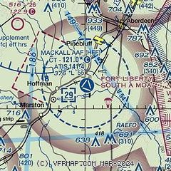
| Sectional chart |
|---|
|
| Airport distance calculator |
|---|
|
|
| Sunrise and sunset |
|---|
|
Times for 19-Jul-2026
| | Local
(UTC-4) | | Zulu
(UTC) |
|---|
| Morning civil twilight | | 05:50 | | 09:50 |
| Sunrise | | 06:19 | | 10:19 |
| Sunset | | 20:30 | | 00:30 |
| Evening civil twilight | | 20:58 | | 00:58 |
|
| Current date and time |
|---|
| Zulu (UTC) | 19-Jul-2026 22:33:54 |
|---|
| Local (UTC-4) | 19-Jul-2026 18:33:54 |
|---|
|
| METAR |
|---|
| KHFF | 192155Z AUTO 26011KT 10SM FEW080 35/23 A2981 RMK AO2 LTG DSNT NE AND W-NW SLP092 T03480228 $
|
KSOP
12nm NE | 192203Z AUTO 21012KT 10SM VCTS CLR 35/22 A2984 RMK AO2 LTG DSNT W-N TSB2157 $
|
KRCZ
16nm SW | 192215Z AUTO 21010G14KT 10SM CLR 32/23 A2985 RMK AO2 T03220227
|
KMEB
16nm SE | 192152Z AUTO 23008KT 10SM CLR 33/24 A2985 RMK AO2 SLP104 T03280239
|
|
| TAF |
|---|
KFBG
29nm E | 191914Z 1919/2023 25009KT 9999 SCT040 OVC065 QNH2988INS TEMPO 1919/2000 22015G35KT 4800 -TSRAGR BKN050CB OVC120 BECMG 2000/2001 23006KT 9999 VCSH BKN060 OVC120 QNH2986INS BECMG 2010/2011 24006KT 9000 BR FEW015 SCT025 OVC040 QNH2995INS BECMG 2012/2013 24006KT 9999 NSW FEW050 SCT070 QNH2996INS BECMG 2017/2018 26006KT 9999 VCSH BKN032 OVC045 QNH2997INS TEMPO 2018/2021 25006KT 3200 TSRA BKN035CB BKN055 BECMG 2022/2023 25006KT 9999 VCSH BKN048 OVC065 QNH2993INS TX38/1920Z TN24/2010Z
|
KFAY
30nm E | 191730Z 1918/2018 23012G20KT P6SM SCT040 SCT050 BKN070 TEMPO 1918/1922 VRB15G30KT 4SM -TSRA BKN050CB FM192200 23008KT P6SM SCT050 BKN100 PROB30 2002/2007 VRB15G30KT 2SM -TSRA BR BKN040CB FM200900 22005KT P6SM SCT050 BKN100
|
|
| NOTAMs |
|---|
NOTAMs are issued by the DoD/FAA and will open in a separate window not controlled by AirNav.
|
|

