FAA INFORMATION EFFECTIVE 09 JULY 2026
Location
| FAA Identifier: | MIE |
| Lat/Long: | 40-14-32.9000N 085-23-44.7000W
40-14.548333N 085-23.745000W
40.2424722,-85.3957500
(estimated) |
| Elevation: | 937.4 ft. / 285.7 m (surveyed) |
| Variation: | 03W (1985) |
| From city: | 3 miles NW of MUNCIE, IN |
| Time zone: | UTC -4 (UTC -5 during Standard Time) |
| Zip code: | 47303 |
Airport Operations
| Airport use: | Open to the public |
| Control tower: | yes |
| ARTCC: | INDIANAPOLIS CENTER |
| FSS: | TERRE HAUTE FLIGHT SERVICE STATION |
| NOTAMs facility: | MIE (NOTAM-D service available) |
| Attendance: | 0600-2200 |
| Wind indicator: | lighted |
| Segmented circle: | yes |
| Lights: | ACTVT MALSR RWY 32; REIL RWY 3, 14 & 21; PAPI RWY 14 & 21; MIRL RWY 3/21; HIRL RWY 14/32 - CTAF. REIL RWY 3, 14 & 21 HIGH INTSTY ONLY. PAPI RWY 3 ON CONSLY. |
| Beacon: | white-green (lighted land airport)
Operates sunset to sunrise. |
| Fire and rescue: | ARFF index A |
| Airline operations: | CLOSED TO SCHEDULED ACR OPNS GREATER THAN 9 PASSENGER SEATS. 96 HRS PPR FOR UNSKED ACR OPNS WITH MORE THAN 30 PSGR SEATS CALL AMGR 765-747-5690. |
Airport Communications
| CTAF: | 120.1 |
| UNICOM: | 122.95 |
| ATIS: | 133.25 |
| WX ASOS: | 132.675 (765-288-9617) |
| MUNCIE GROUND: | 121.9 [0600-2200] |
| MUNCIE TOWER: | 120.1 [0600-2200] |
| INDIANAPOLIS APPROACH: | 120.65 |
| INDIANAPOLIS DEPARTURE: | 120.65 |
| EMERG: | 121.5 243.0 |
| WX AWOS-3 at AID (13 nm SW): | 128.55 (765-442-1245) |
| WX AWOS-3 at MZZ (20 nm NW): | 108.6 (765-674-1317) |
- APCH/DEP SVC PRVDD BY INDIANAPOLIS TRACON ON FREQS 120.65/317.8.
Nearby radio navigation aids
| VOR radial/distance | | VOR name | | Freq | | Var |
|---|
| MZZr142/19.9 | | MARION VOR/DME | | 108.60 | | 03W |
| NDB name | | Hdg/Dist | | Freq | | Var | | ID |
|---|
| BALLL | | 320/5.0 | | 365 | | 03W | | JN | .--- -. |
| VIDEO | | 030/11.6 | | 394 | | 03W | | AI | .- .. |
| NEW CASTLE | | 357/22.0 | | 385 | | 06W | | UWL | ..- .-- .-.. |
Airport Services
| Fuel available: | 100LL JET-A |
| Parking: | hangars and tiedowns |
| Airframe service: | MINOR |
| Powerplant service: | MINOR |
| Bottled oxygen: | HIGH |
| Bulk oxygen: | HIGH |
Runway Information
Runway 14/32
| Dimensions: | 6500 x 150 ft. / 1981 x 46 m |
| Surface: | asphalt/grooved, in good condition |
| Weight bearing capacity: | | Single wheel: | 91.0 | | Double wheel: | 125.0 | | Double tandem: | 215.0 |
|
| Runway edge lights: | high intensity |
| Operational restrictions: | CALM WIND RWY. |
| RUNWAY 14 | | RUNWAY 32 |
| Latitude: | 40-14.923555N | | 40-14.152087N |
| Longitude: | 085-24.354143W | | 085-23.385658W |
| Elevation: | 928.6 ft. | | 936.4 ft. |
| Traffic pattern: | left | | left |
| Runway heading: | 139 magnetic, 136 true | | 319 magnetic, 316 true |
| Declared distances: | TORA:6500 TODA:6500 ASDA:6500 LDA:6500 | | TORA:6500 TODA:6500 ASDA:6500 LDA:6500 |
| Markings: | precision, in fair condition | | precision, in fair condition |
| Visual slope indicator: | 4-light PAPI on left (3.00 degrees glide path) | | |
| Approach lights: | | | MALSR: 1,400 foot medium intensity approach lighting system with runway alignment indicator lights |
| Runway end identifier lights: | yes | | no |
| Touchdown point: | yes, no lights | | yes, no lights |
| Instrument approach: | | | ILS |
| Obstructions: | 98 ft. trees, 4200 ft. from runway, 50 ft. right of centerline, 40:1 slope to clear | | 73 ft. trees, 3066 ft. from runway, 857 ft. left of centerline, 39:1 slope to clear |
Runway 3/21
| Dimensions: | 5198 x 100 ft. / 1584 x 30 m |
| Surface: | asphalt/grooved, in fair condition |
| Weight bearing capacity: | | Single wheel: | 80.0 | | Double wheel: | 100.0 | | Double tandem: | 125.0 |
|
| Runway edge lights: | medium intensity |
| Operational restrictions: | RWY 03/21 NOT AVBL FOR PART 121/PART 380 OPS WITH SKED PAX CARRYING OPS MORE THAN 9 PAX SEATS AND NON-SKED PAX CARRYING OPS MORE THAN 30 PAX SEATS. |
| RUNWAY 3 | | RUNWAY 21 |
| Latitude: | 40-14.164475N | | 40-14.958942N |
| Longitude: | 085-23.796157W | | 085-23.380270W |
| Elevation: | 937.3 ft. | | 934.7 ft. |
| Traffic pattern: | left | | left |
| Runway heading: | 025 magnetic, 022 true | | 205 magnetic, 202 true |
| Declared distances: | TORA:5197 TODA:5197 ASDA:5197 LDA:5197 | | TORA:5197 TODA:5197 ASDA:5197 LDA:5197 |
| Markings: | nonprecision, in fair condition | | nonprecision, in fair condition |
| Visual slope indicator: | 4-light PAPI on left (3.00 degrees glide path) | | 4-light PAPI on left (3.00 degrees glide path) |
| Runway end identifier lights: | yes | | yes |
| Touchdown point: | yes, no lights | | yes, no lights |
| Obstructions: | 58 ft. tree, 1570 ft. from runway, 241 ft. left of centerline, 23:1 slope to clear | | 44 ft. tree, 1281 ft. from runway, 424 ft. left of centerline, 25:1 slope to clear |
Airport Ownership and Management from official FAA records
| Ownership: | Publicly-owned |
| Owner: | DELAWARE COUNTY ARPT AUTH
311 W. CARL SIMMONS RD.
MUNCIE, IN 47303
Phone 765-747-5690 |
| Manager: | TIM BATY
311 W. CARL SIMMONS RD.
MUNCIE, IN 47303
Phone 765-747-5690
765-729-1078 |
Additional Remarks
| A39-14/32 | PCR VALUE: 580/F/D/X/T |
| A39-03/21 | PCR VALUE: 640/F/D/X/T |
| - | DEER ON & INVOF ARPT. |
| - | SVC AFT HR - 765-729-1078. |
| - | WHEN ATCT IS CLSD FOR CD CTC INDIANAPOLIS APCH AT 317-227-5743. |
| - | SFC COND UNMNT MON-FRI 1500-0700 & WKEND. |
Instrument Procedures
NOTE: All procedures below are presented as PDF files. If you need a reader for these files, you should download the free Adobe Reader.NOT FOR NAVIGATION. Please procure official charts for flight.
FAA instrument procedures published for use from 09 July 2026 at 0901Z to 06 August 2026 at 0900Z.
IAPs - Instrument Approach Procedures |
|---|
| ILS OR LOC RWY 32 | |
download (226KB) |
| RNAV (GPS) RWY 03 | |
download (230KB) |
| RNAV (GPS) RWY 14 | |
download (241KB) |
| RNAV (GPS) RWY 21 | |
download (246KB) |
| RNAV (GPS) RWY 32 | |
download (215KB) |
| NOTE: Special Alternate Minimums apply | |
download (150KB) |
| NOTE: Special Take-Off Minimums/Departure Procedures apply | |
download (167KB) |
Other nearby airports with instrument procedures:
KAID - Anderson Regional Airport (13 nm SW)
KMZZ - Marion Municipal Airport - McKinney Field (20 nm NW)
I22 - Randolph County Airport (22 nm E)
KUWL - New Castle Henry County Airport / Marlatt Field (22 nm S)
KPLD - Portland Municipal Airport (22 nm NE)
|
|

Road maps at:
MapQuest
Bing
Google
| Aerial photo |
|---|
WARNING: Photo may not be current or correct
 Photo by Kelly Earnst
Photo taken 10-Aug-2019
looking north.
Photo by Kelly Earnst
Photo taken 10-Aug-2019
looking north.
Do you have a better or more recent aerial photo of Delaware County Regional Airport that you would like to share? If so, please send us your photo.
|
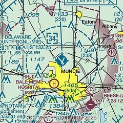
| Sectional chart |
|---|
|
 Download PDF
of official airport diagram from the FAA
| Airport distance calculator |
|---|
|
|
| Sunrise and sunset |
|---|
|
Times for 23-Jul-2026
| | Local
(UTC-4) | | Zulu
(UTC) |
|---|
| Morning civil twilight | | 06:01 | | 10:01 |
| Sunrise | | 06:32 | | 10:32 |
| Sunset | | 21:04 | | 01:04 |
| Evening civil twilight | | 21:35 | | 01:35 |
|
| Current date and time |
|---|
| Zulu (UTC) | 23-Jul-2026 16:26:50 |
|---|
| Local (UTC-4) | 23-Jul-2026 12:26:50 |
|---|
|
| METAR |
|---|
| KMIE | 231553Z 11008KT 10SM BKN055 23/11 A3023 RMK AO2 SLP229 T02280111
|
KAID
13nm SW | 231359Z 04004KT 10SM CLR 22/11 A3022
|
KMZZ
20nm NW | 231615Z AUTO 07006KT 10SM SCT060 22/06 A3023 RMK AO2 T02190064
|
|
| TAF |
|---|
KGUS
42nm NW | 222100Z 2221/2403 VRB06KT 9999 FEW050 SCT180 QNH3004INS TX26/2320Z TN11/2310Z LAST NO AMDS AFT 2303 NEXT 2313
|
KFWA
44nm N | 231120Z 2312/2412 VRB03KT P6SM SKC
|
|
| NOTAMs |
|---|
NOTAMs are issued by the DoD/FAA and will open in a separate window not controlled by AirNav.
|
|


