FAA INFORMATION EFFECTIVE 16 APRIL 2026
Location
| FAA Identifier: | N30 |
| Lat/Long: | 41-30-56.1300N 075-15-05.6150W
41-30.935500N 075-15.093583W
41.5155917,-75.2515597
(estimated) |
| Elevation: | 1357 ft. / 414 m (estimated) |
| Variation: | 13W (2005) |
| From city: | 3 miles S of HONESDALE, PA |
| Time zone: | UTC -4 (UTC -5 during Standard Time) |
| Zip code: | 18431 |
Airport Operations
| Airport use: | Open to the public |
| Activation date: | 03/1965 |
| Control tower: | no |
| ARTCC: | NEW YORK CENTER |
| FSS: | WILLIAMSPORT FLIGHT SERVICE STATION |
| NOTAMs facility: | IPT (NOTAM-D service available) |
| Attendance: | 0900-1700 |
| Wind indicator: | lighted |
| Segmented circle: | no |
| Lights: | SS-SR |
| Beacon: | white-green (lighted land airport)
Operates sunset to sunrise. |
Airport Communications
| CTAF/UNICOM: | 122.8 |
| WILKES-BARRE APPROACH: | 120.95 |
| WILKES-BARRE DEPARTURE: | 120.95 |
Nearby radio navigation aids
| VOR radial/distance | | VOR name | | Freq | | Var |
|---|
| LVZr064/24.5 | | WILKES-BARRE VORTAC | | 111.60 | | 10W |
| HUOr293/30.3 | | HUGUENOT VOR/DME | | 116.10 | | 11W |
| HNKr186/33.0 | | HANCOCK VOR/DME | | 116.80 | | 11W |
| STWr342/35.6 | | STILLWATER VOR/DME | | 109.60 | | 11W |
Airport Services
| Fuel available: | 100LL |
| Parking: | hangars and tiedowns |
| Airframe service: | MAJOR |
| Powerplant service: | MAJOR |
| Bottled oxygen: | NONE |
| Bulk oxygen: | NONE |
Runway Information
Runway 18/36
| Dimensions: | 2986 x 50 ft. / 910 x 15 m |
| Surface: | asphalt, in fair condition |
| Weight bearing capacity: | |
| Runway edge lights: | non-standard |
| RUNWAY 18 | | RUNWAY 36 |
| Latitude: | 41-31.175000N | | 41-30.696000N |
| Longitude: | 075-15.167500W | | 075-15.019667W |
| Elevation: | 1346.0 ft. | | 1329.0 ft. |
| Traffic pattern: | left | | left |
| Runway heading: | 180 magnetic, 167 true | | 000 magnetic, 347 true |
| Displaced threshold: | 519 ft. | | 589 ft. |
| Markings: | basic, in good condition | | basic, in good condition |
| Touchdown point: | yes, no lights | | yes, no lights |
| Obstructions: | 84 ft. tree, 1270 ft. from runway, 224 ft. left of centerline, 12:1 slope to clear
APCH RATIO 21:1 TO DTHR. | | 51 ft. tree, 259 ft. from runway, 110 ft. left of centerline, 1:1 slope to clear
APCH RATIO 17:1 TO DTHR. |
Airport Ownership and Management from official FAA records
| Ownership: | Privately-owned |
| Owner: | EARLYNN AVIATION
30 BOMBER LANE
HONESDALE, PA 18431
Phone 570-253-5833 |
| Manager: | RICHARD QUITONI
30 BOMBER LANE
HONESDALE, PA 18431
Phone 570-253-5833 |
Additional Remarks
| - | FOR CD CTC WILKES-BARRE APCH AT 570-655-2084. |
Instrument Procedures
NOTE: All procedures below are presented as PDF files. If you need a reader for these files, you should download the free Adobe Reader.NOT FOR NAVIGATION. Please procure official charts for flight.
FAA instrument procedures published for use from 16 April 2026 at 0901Z to 14 May 2026 at 0900Z.
IAPs - Instrument Approach Procedures |
|---|
| RNAV (GPS)-B | |
download (151KB) |
| VOR-A | |
download (190KB) |
| NOTE: Special Take-Off Minimums/Departure Procedures apply | |
download (149KB) |
Other nearby airports with instrument procedures:
9N3 - Seamans Field Airport (23 nm W)
KMSV - Sullivan County International Airport (23 nm NE)
KMPO - Pocono Mountains Regional Airport (23 nm S)
KAVP - Wilkes-Barre/Scranton International Airport (24 nm SW)
KWBW - Wilkes-Barre Wyoming Valley Airport (30 nm SW)
|
|

Road maps at:
MapQuest
Bing
Google
| Aerial photo |
|---|
WARNING: Photo may not be current or correct
 Photo by David M. Conboy
Photo taken 09-Mar-2020
looking south.
Photo by David M. Conboy
Photo taken 09-Mar-2020
looking south.
Do you have a better or more recent aerial photo of Cherry Ridge Airport that you would like to share? If so, please send us your photo.
|
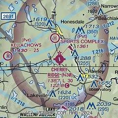
| Sectional chart |
|---|
|
| Airport distance calculator |
|---|
|
|
| Sunrise and sunset |
|---|
|
Times for 23-Apr-2026
| | Local
(UTC-4) | | Zulu
(UTC) |
|---|
| Morning civil twilight | | 05:41 | | 09:41 |
| Sunrise | | 06:10 | | 10:10 |
| Sunset | | 19:49 | | 23:49 |
| Evening civil twilight | | 20:18 | | 00:18 |
|
| Current date and time |
|---|
| Zulu (UTC) | 23-Apr-2026 08:56:02 |
|---|
| Local (UTC-4) | 23-Apr-2026 04:56:02 |
|---|
|
| METAR |
|---|
KMPO
24nm S | 230821Z AUTO 33004KT 4SM BR FEW004 03/03 A2996 RMK AO2 T00330033
|
KMSV
24nm NE | 230842Z AUTO 01003KT 1/2SM FG CLR 02/02 A2995 RMK AO2 FZRANO RVRNO PNO $
|
KAVP
24nm SW | 230754Z 00000KT 8SM CLR 07/06 A2996 RMK AO2 SLP145 T00720061
|
KFWN
34nm SE | 230813Z AUTO 00000KT 4SM BR FEW002 03/01 A2996 RMK AO2 T00280006 $
|
K12N
38nm SE | 230754Z AUTO 00000KT 04/03 A2995 RMK AO1 SLP147 T00440033
|
KMGJ
44nm E | SuperAWOS
230836Z AUTO 21004KT 1/4SM -RA FG VV002 02/02 A2994 RMK AO2 RAB26 P0000 T00220022
|
KHZL
46nm SW | 230835Z AUTO 00000KT 1SM BR BKN075 05/04 A3000 RMK AO2
|
|
| TAF |
|---|
KAVP
24nm SW | 230520Z 2306/2406 11003KT P6SM FEW050 SCT200 FM231500 33012G21KT P6SM FEW250 FM240000 03007KT P6SM FEW220
|
|
| NOTAMs |
|---|
NOTAMs are issued by the DoD/FAA and will open in a separate window not controlled by AirNav.
|
|

