FAA INFORMATION EFFECTIVE 11 JUNE 2026
Location
| FAA Identifier: | 0A9 |
| Lat/Long: | 36-22-17.6086N 082-10-21.8076W
36-22.293477N 082-10.363460W
36.3715579,-82.1727243
(estimated) |
| Elevation: | 1592.5 ft. / 485 m (estimated) |
| Variation: | 06W (2005) |
| From city: | 3 miles NE of ELIZABETHTON, TN |
| Time zone: | UTC -4 (UTC -5 during Standard Time) |
| Zip code: | 37643 |
Airport Operations
| Airport use: | Open to the public |
| Activation date: | 06/1952 |
| Control tower: | no |
| ARTCC: | ATLANTA CENTER |
| FSS: | NASHVILLE FLIGHT SERVICE STATION |
| NOTAMs facility: | BNA (NOTAM-D service available) |
| Attendance: | APR-OCT 0730-1930, NOV-MAR 0800-1700 |
| Wind indicator: | yes |
| Segmented circle: | yes |
| Lights: | ACTVT REIL RWY 06 - CTAF. LIRL RWY 6/24 PPR - AMGR. |
Airport Communications
| CTAF/UNICOM: | 123.0 |
| WX AWOS-3PT: | 135.675 (423-543-1801) |
| TRI CITY APPROACH: | 134.425 [0600-2350] |
| ATLANTA ARTCC APPROACH: | 125.25 [2350-0600] |
| TRI CITY DEPARTURE: | 134.425 [0600-2350] |
| ATLANTA ARTCC DEPARTURE: | 125.25 [2350-0600] |
| WX ASOS at TRI (13 nm NW): | 118.25 (423-218-2712) |
| WX AWOS-3 at 6A4 (17 nm E): | 126.225 (423-727-4365) |
- APCH/DEP SVC PRVDD BY ATLANTA ARTCC ON FREQS 127.85/269.3 (GLADE SPRINGS RCAG) WHEN TRI CITY APCH CTL CLSD.
Nearby radio navigation aids
| VOR radial/distance | | VOR name | | Freq | | Var |
|---|
| HMVr212/4.4 | | HOLSTON MOUNTAIN VORTAC | | 114.60 | | 04W |
| GZGr191/27.6 | | GLADE SPRING VOR/DME | | 115.55 | | 02W |
| NDB name | | Hdg/Dist | | Freq | | Var | | ID |
|---|
| MOCCA | | 155/13.1 | | 299 | | 07W | | TR | - .-. |
| HEMLOCK | | 315/19.3 | | 320 | | 02W | | BAR | -... .- .-. |
Airport Services
| Fuel available: | 100LL JET-A |
| Parking: | hangars and tiedowns |
Runway Information
Runway 6/24
| Dimensions: | 5001 x 70 ft. / 1524 x 21 m |
| Surface: | asphalt, in excellent condition |
| Weight bearing capacity: | |
| Runway edge lights: | low intensity
NSTD |
| RUNWAY 6 | | RUNWAY 24 |
| Latitude: | 36-22.072793N | | 36-22.514158N |
| Longitude: | 082-10.793810W | | 082-09.933108W |
| Elevation: | 1555.8 ft. | | 1592.5 ft. |
| Traffic pattern: | right | | left |
| Runway heading: | 064 magnetic, 058 true | | 244 magnetic, 238 true |
| Displaced threshold: | 97 ft. | | 902 ft. |
| Declared distances: | TORA:5001 TODA:5001 ASDA:5001 LDA:4904 | | TORA:5001 TODA:5001 ASDA:5001 LDA:4099 |
| Markings: | nonprecision, in good condition | | nonprecision, in good condition |
| Visual slope indicator: | 2-box SAVASI on left (3.75 degrees glide path) | | |
| Runway end identifier lights: | yes | | no |
| Touchdown point: | yes, no lights | | yes, no lights |
| Obstructions: | 21 ft. tree, 840 ft. from runway, 6 ft. both sides of centerline, 30:1 slope to clear
APCH SLOPE 27:1 TO DTHR. | | 156 ft. tree, 3108 ft. from runway, 166 ft. right of centerline, 18:1 slope to clear |
Airport Ownership and Management from official FAA records
| Ownership: | Publicly-owned |
| Owner: | CITY OF ELIZABETHTON
136 SOUTH SYCAMORE STREET
ELIZABETHTON, TN 37643
Phone (423) 547-6200 |
| Manager: | DAN COGAN
415 HIGHWAY 91
ELIZABETHTON, TN 37643
Phone 423-543-2801 |
Additional Remarks
| A30A-24 | DALGT OPS ONLY. HIGH PERF DEP MNTN RWY HDG UNTIL 2600 FT MSL. |
| - | COLD TEMPERATURE AIRPORT. ALTITUDE CORRECTION REQUIRED AT OR BELOW -10C. |
| - | FOR CD CTC ATLANTA ARTCC AT 770-210-7692. |
Instrument Procedures
NOTE: All procedures below are presented as PDF files. If you need a reader for these files, you should download the free Adobe Reader.NOT FOR NAVIGATION. Please procure official charts for flight.
FAA instrument procedures published for use from 11 June 2026 at 0901Z to 09 July 2026 at 0900z.
IAPs - Instrument Approach Procedures |
|---|
| RNAV (GPS) RWY 06 | |
download (321KB) |
| NOTE: Special Alternate Minimums apply | |
download (141KB) |
| NOTE: Special Take-Off Minimums/Departure Procedures apply | |
download (399KB) |
Other nearby airports with instrument procedures:
KTRI - Tri-Cities Airport (13 nm NW)
6A4 - Johnson County Airport (17 nm E)
KVJI - Virginia Highlands Airport (20 nm N)
KGCY - Greeneville Municipal Airport (33 nm W)
KRVN - Hawkins County Airport (35 nm W)
|
|

Road maps at:
MapQuest
Bing
Google
| Aerial photo |
|---|
WARNING: Photo may not be current or correct
 Photo by Dan Cogan
Photo taken 13-Sep-2018
looking east.
Photo by Dan Cogan
Photo taken 13-Sep-2018
looking east.
Do you have a better or more recent aerial photo of William B Greene Jr Regional Airport that you would like to share? If so, please send us your photo.
|
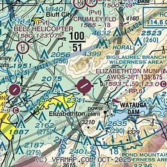
| Sectional chart |
|---|
|
| Airport distance calculator |
|---|
|
|
| Sunrise and sunset |
|---|
|
Times for 17-Jun-2026
| | Local
(UTC-4) | | Zulu
(UTC) |
|---|
| Morning civil twilight | | 05:41 | | 09:41 |
| Sunrise | | 06:11 | | 10:11 |
| Sunset | | 20:48 | | 00:48 |
| Evening civil twilight | | 21:18 | | 01:18 |
|
| Current date and time |
|---|
| Zulu (UTC) | 17-Jun-2026 14:11:32 |
|---|
| Local (UTC-4) | 17-Jun-2026 10:11:32 |
|---|
|
| METAR |
|---|
| K0A9 | 171355Z AUTO VRB03KT 10SM 22/17 A2992 RMK AO2
|
KTRI
13nm NW | 171353Z 19005KT 10SM BKN014 OVC020 20/16 A2992 RMK AO2 SLP112 T02000161 $
|
KVJI
19nm NE | 171255Z AUTO 24010KT 10SM CLR 18/15 A2993 RMK AO2
|
|
| TAF |
|---|
KTRI
13nm NW | 171123Z 1712/1812 VRB03KT P6SM BKN200 FM171600 24008G15KT P6SM BKN250 FM180000 22005KT P6SM FEW250 FM180600 21007KT P6SM BKN250 WS020/24035KT
|
|
| NOTAMs |
|---|
NOTAMs are issued by the DoD/FAA and will open in a separate window not controlled by AirNav.
|
|


