FAA INFORMATION EFFECTIVE 11 JUNE 2026
Location
| FAA Identifier: | 42I |
| Lat/Long: | 40-00-26.2500N 082-00-48.5250W
40-00.437500N 082-00.808750W
40.0072917,-82.0134792
(estimated) |
| Elevation: | 790 ft. / 241 m (estimated) |
| Variation: | 06W (1985) |
| From city: | 4 miles N of ZANESVILLE, OH |
| Time zone: | UTC -5 (UTC -6 during Standard Time) |
| Zip code: | 43701 |
Airport Operations
| Airport use: | Open to the public |
| Activation date: | 07/1971 |
| Control tower: | no |
| ARTCC: | INDIANAPOLIS CENTER |
| FSS: | CLEVELAND FLIGHT SERVICE STATION |
| NOTAMs facility: | CLE (NOTAM-D service available) |
| Attendance: | MON-SAT 1000-DUSK, ALL SUN 1200-DUSK
UNATNDD MAJOR HOLS. |
| Wind indicator: | lighted |
| Segmented circle: | no |
| Lights: | ACTVT NSTD LIRL RWY 10/28 - CTAF (KEY MIKE 3X SLOWLY). |
| Beacon: | white-green (lighted land airport)
ACTVT ROTG BCN - CTAF (KEY MIKE 3X SLOWLY). |
Airport Communications
| CTAF/UNICOM: | 122.8 |
| WX ASOS at ZZV (7 nm SE): | 127.0 (740-453-8139) |
| WX AWOS-3 at I40 (20 nm N): | 118.875 (740-295-7370) |
Nearby radio navigation aids
| VOR radial/distance | | VOR name | | Freq | | Var |
|---|
| APEr114/27.8 | | APPLETON VORTAC | | 116.70 | | 06W |
Airport Services
| Fuel available: | 100LL
100LL:FULL SVC. |
| Parking: | tiedowns |
| Airframe service: | MAJOR |
| Powerplant service: | MAJOR |
| Bottled oxygen: | NONE |
| Bulk oxygen: | NONE |
Runway Information
Runway 10/28
| Dimensions: | 3100 x 26 ft. / 945 x 8 m |
| Surface: | asphalt, in good condition |
| Weight bearing capacity: | |
| Runway edge lights: | non-standard
NSTD LIRL DUE TO OFF CNTR LCTN 50 FT NORTH & 30 FT SOUTH OF CNTRLN; RQRD TO KEY MIKE SLOWLY TO ACTVT. |
| Runway edge markings: | NSTD BASIC MRKGS DUE TO SOLID WHITE LN UNDER RWY NRS. |
| RUNWAY 10 | | RUNWAY 28 |
| Latitude: | 40-00.454500N | | 40-00.420500N |
| Longitude: | 082-01.140000W | | 082-00.477500W |
| Elevation: | 780.0 ft. | | 790.0 ft. |
| Traffic pattern: | left | | right |
| Runway heading: | 100 magnetic, 094 true | | 280 magnetic, 274 true |
| Displaced threshold: | no | | 61 ft. |
| Markings: | NSTD, in fair condition | | NSTD, in fair condition |
| Runway end identifier lights: | no | | no |
| Obstructions: | 70 ft. tree, 1010 ft. from runway, 125 ft. right of centerline, 11:1 slope to clear | | 65 ft. trees, 340 ft. from runway, 90 ft. right of centerline, 2:1 slope to clear
50 FT TREES, 87 FT DIST, 117 FT R; 70 FT TREE, 167 FT DIST, 111 FT R. |
Airport Ownership and Management from official FAA records
| Ownership: | Privately-owned |
| Owner: | C E NORMAN
1200 FAIRVIEW RD
ZANESVILLE, OH 43701-9729
Phone 740-454-1615
OWNER RESIDES ADJ TO ARPT. |
| Manager: | ROBERT NORMAN
1200 FAIRVIEW RD
ZANESVILLE, OH 43701-9729
Phone 740-454-1615 |
Additional Remarks
| - | DEER, BIRDS, & OTR WILDLIFE ON & INVOF ARPT. |
| - | RWY 10 FIRST 280 FT OF PAVEMENT IS A TWY. |
Instrument Procedures
There are no published instrument procedures at 42I.
Some nearby airports with instrument procedures:
KZZV - Zanesville Municipal Airport (7 nm SE)
I40 - Richard Downing Airport (20 nm N)
KCDI - Cambridge Municipal Airport (20 nm E)
KVTA - Licking County Regional Airport (21 nm W)
I86 - Ed Newlon Field Airport (21 nm SW)
|
|

Road maps at:
MapQuest
Bing
Google
| Aerial photo |
|---|
WARNING: Photo may not be current or correct
 Photo courtesy of AirNav, LLC
Photo taken 09-May-2010
Photo courtesy of AirNav, LLC
Photo taken 09-May-2010
Do you have a better or more recent aerial photo of Parr Airport that you would like to share? If so, please send us your photo.
|
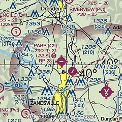
| Sectional chart |
|---|
|
| Airport distance calculator |
|---|
|
|
| Sunrise and sunset |
|---|
|
Times for 12-Jun-2026
| | Local
(UTC-5) | | Zulu
(UTC) |
|---|
| Morning civil twilight | | 04:27 | | 09:27 |
| Sunrise | | 05:00 | | 10:00 |
| Sunset | | 19:56 | | 00:56 |
| Evening civil twilight | | 20:29 | | 01:29 |
|
| Current date and time |
|---|
| Zulu (UTC) | 12-Jun-2026 19:01:15 |
|---|
| Local (UTC-5) | 12-Jun-2026 14:01:15 |
|---|
|
| METAR |
|---|
KZZV
6nm SE | 121853Z AUTO VRB05KT 10SM FEW021 FEW026 BKN035 25/20 A2991 RMK AO2 SLP121 T02500200
|
|
| TAF |
|---|
KZZV
6nm SE | 121720Z 1218/1318 29008G16KT P6SM SCT030 BKN250 TEMPO 1218/1220 BKN020 FM130000 VRB03KT P6SM SKC
|
|
| NOTAMs |
|---|
NOTAMs are issued by the DoD/FAA and will open in a separate window not controlled by AirNav.
|
|


