FAA INFORMATION EFFECTIVE 17 APRIL 2025
Location
| FAA Identifier: | EFK |
| Lat/Long: | 44-53-17.4320N 072-13-43.0870W
44-53.290533N 072-13.718117W
44.8881756,-72.2286353
(estimated) |
| Elevation: | 933.9 ft. / 284.7 m (surveyed) |
| Variation: | 17W (1995) |
| From city: | 3 miles SW of NEWPORT, VT |
| Time zone: | UTC -4 (UTC -5 during Standard Time) |
| Zip code: | 05855 |
Airport Operations
| Airport use: | Open to the public |
| Activation date: | 11/1943 |
| Control tower: | no |
| ARTCC: | BOSTON CENTER |
| FSS: | BURLINGTON FLIGHT SERVICE STATION |
| NOTAMs facility: | BTV (NOTAM-D service available) |
| Attendance: | 0900-1700 |
| Wind indicator: | lighted |
| Segmented circle: | yes |
| Lights: | ACTVT PAPI RWY 18 & 36; MIRL RWY 18/36 - CTAF. |
| Beacon: | white-green (lighted land airport)
Operates sunset to sunrise. |
| International operations: | customs landing rights airport |
Airport Communications
| CTAF/UNICOM: | 122.8 |
| WX AWOS-3P: | 118.275 (802-334-4427) |
- APCH/DEP SVC PRVDD BY BOSTON ARTCC ON FREQS 135.7/282.2 (BERLIN RCAG).
Nearby radio navigation aids
| NDB name | | Hdg/Dist | | Freq | | Var | | ID |
|---|
| MAHN | | 341/39.1 | | 386 | | 17W | | GMA | --. -- .- |
Airport Services
| Fuel available: | 100LL JET-A+
100LL:24/7 SELF SERVE. MOBILE FUEL VEHICLE WHEN ATNDD.
A+:24/7 SELF SERVE. MOBILE FUEL VEHICLE WHEN ATNDD. |
| Parking: | hangars and tiedowns |
| Airframe service: | MAJOR |
| Powerplant service: | MAJOR |
| Bottled oxygen: | NONE |
| Bulk oxygen: | NONE |
Runway Information
Runway 18/36
| Dimensions: | 5301 x 100 ft. / 1616 x 30 m |
| Surface: | asphalt, in excellent condition |
| Weight bearing capacity: | | PCN 33 /F/D/X/T | | Single wheel: | 30.0 | | Double wheel: | 44.0 |
|
| Runway edge lights: | medium intensity |
| RUNWAY 18 | | RUNWAY 36 |
| Latitude: | 44-53.640052N | | 44-52.822790N |
| Longitude: | 072-13.822818W | | 072-13.393905W |
| Elevation: | 930.2 ft. | | 933.9 ft. |
| Traffic pattern: | left | | left |
| Runway heading: | 177 magnetic, 160 true | | 357 magnetic, 340 true |
| Displaced threshold: | 299 ft. | | no |
| Markings: | nonprecision, in good condition | | nonprecision, in good condition |
| Visual slope indicator: | 4-light PAPI on left (3.00 degrees glide path) | | 4-light PAPI on left (3.00 degrees glide path) |
| Runway end identifier lights: | yes | | yes |
| Touchdown point: | yes, no lights | | yes, no lights |
| Obstructions: | none | | 71 ft. pole, lighted, 2002 ft. from runway, 126 ft. right of centerline, 25:1 slope to clear |
Runway 5/23
| Dimensions: | 3996 x 100 ft. / 1218 x 30 m |
| Surface: | asphalt, in fair condition |
| Weight bearing capacity: | | Single wheel: | 30.0 | | Double wheel: | 44.0 |
|
| RUNWAY 5 | | RUNWAY 23 |
| Latitude: | 44-53.082888N | | 44-53.655035N |
| Longitude: | 072-14.091615W | | 072-13.635832W |
| Elevation: | 923.1 ft. | | 926.1 ft. |
| Traffic pattern: | left | | left |
| Runway heading: | 047 magnetic, 030 true | | 227 magnetic, 210 true |
| Markings: | basic, in fair condition | | basic, in fair condition |
| Touchdown point: | yes, no lights | | yes, no lights |
| Obstructions: | 43 ft. trees, 578 ft. from runway, 80 ft. left of centerline, 8:1 slope to clear | | 32 ft. pole, lighted, 865 ft. from runway, 93 ft. left of centerline, 20:1 slope to clear |
Airport Ownership and Management from official FAA records
| Ownership: | Publicly-owned |
| Owner: | STATE OF VERMONT
219 N MAIN ST
BARRE, VT 05641
Phone 802-279-9746 |
| Manager: | EDDIE MIDDLETON
219 N MAIN ST
BARRE, VT 05641
Phone 802-279-9746 |
Additional Remarks
| - | GULLS ON & INVOF ARPT. |
| - | RWY CONDS MAY NOT BE MNT OR RPRTD WHEN ARPT IS UNATNDD. |
| - | COLD TEMPERATURE AIRPORT. ALTITUDE CORRECTION REQUIRED AT OR BELOW -32C. |
| - | FOR CD CTC BOSTON ARTCC AT 603-879-6859. |
Instrument Procedures
NOTE: All procedures below are presented as PDF files. If you need a reader for these files, you should download the free Adobe Reader.NOT FOR NAVIGATION. Please procure official charts for flight.
FAA instrument procedures published for use from 17 April 2025 at 0901Z to 15 May 2025 at 0900z.
IAPs - Instrument Approach Procedures |
|---|
| RNAV (GPS) RWY 36 **CHANGED** | |
download (255KB) |
| NOTE: Special Alternate Minimums apply | |
download (147KB) |
| NOTE: Special Take-Off Minimums/Departure Procedures apply | |
download (515KB) |
Other nearby airports with instrument procedures:
KCDA - Caledonia County Airport (21 nm SE)
KMVL - Morrisville-Stowe State Airport (27 nm SW)
KFSO - Franklin County State Airport (37 nm W)
KHIE - Mount Washington Regional Airport (43 nm SE)
KMPV - Edward F Knapp State Airport (43 nm S)
|
|

Road maps at:
MapQuest
Bing
Google
| Aerial photo |
|---|
WARNING: Photo may not be current or correct

Do you have a better or more recent aerial photo of Northeast Kingdom International Airport that you would like to share? If so, please send us your photo.
|
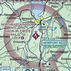
| Sectional chart |
|---|
|
| Airport distance calculator |
|---|
|
|
| Sunrise and sunset |
|---|
|
Times for 23-Apr-2025
| | Local
(UTC-4) | | Zulu
(UTC) |
|---|
| Morning civil twilight | | 05:21 | | 09:21 |
| Sunrise | | 05:52 | | 09:52 |
| Sunset | | 19:43 | | 23:43 |
| Evening civil twilight | | 20:14 | | 00:14 |
|
| Current date and time |
|---|
| Zulu (UTC) | 23-Apr-2025 20:45:53 |
|---|
| Local (UTC-4) | 23-Apr-2025 16:45:53 |
|---|
|
| METAR |
|---|
KEFK
3nm NE | 232035Z AUTO 31012G19KT 260V350 10SM CLR 13/00 A3018 RMK AO2 T01311005
|
|
| TAF |
|---|
KEFK
3nm NE | 231721Z 2318/2418 26011G18KT P6SM SCT070 FM240000 VRB03KT P6SM FEW120
|
|
| NOTAMs |
|---|
NOTAMs are issued by the DoD/FAA and will open in a separate window not controlled by AirNav.
|
|


