FAA INFORMATION EFFECTIVE 09 JULY 2026
Location
| FAA Identifier: | FST |
| Lat/Long: | 30-54-54.9000N 102-54-46.0000W
30-54.915000N 102-54.766667W
30.9152500,-102.9127778
(estimated) |
| Elevation: | 3011 ft. / 917.8 m (surveyed) |
| Variation: | 09E (1995) |
| From city: | 2 miles NW of FORT STOCKTON, TX |
| Time zone: | UTC -5 (UTC -6 during Standard Time) |
| Zip code: | 79735 |
Airport Operations
| Airport use: | Open to the public |
| Activation date: | 01/1947 |
| Control tower: | no |
| ARTCC: | ALBUQUERQUE CENTER |
| FSS: | SAN ANGELO FLIGHT SERVICE STATION |
| NOTAMs facility: | FST (NOTAM-D service available) |
| Attendance: | 0800-1700 |
| Wind indicator: | lighted |
| Segmented circle: | yes |
| Lights: | MIRL RWYS 03/21 & 12/30 PRESET LOW INTST; TO INCR INTST - CTAF. PAPI RWYS 12 & 30 OPR CONSLY. |
| Beacon: | white-green (lighted land airport)
Operates sunset to sunrise. |
Airport Communications
| CTAF/UNICOM: | 122.8 |
| WX ASOS: | 118.525 (432-336-7591) |
- APCH/DEP SVC PRVDD BY ALBUQUERQUE ARTCC (ABQ) ON FREQS 135.875/292.15 (FORT STOCKTON RCAG).
Nearby radio navigation aids
| VOR radial/distance | | VOR name | | Freq | | Var |
|---|
| FSTr113/3.9 | | FORT STOCKTON VORTAC | | 116.90 | | 11E |
Airport Services
| Fuel available: | 100LL JET-A+
100LL:FOR FUEL & SVCS AFT HRS CALL 432-336-9900 OR UNICOM. 24 HR SELF SERVE AVBL. |
| Parking: | hangars and tiedowns |
| Bottled oxygen: | NONE |
Runway Information
Runway 12/30
| Dimensions: | 7508 x 100 ft. / 2288 x 30 m |
| Surface: | asphalt, in good condition |
| Weight bearing capacity: | |
| Runway edge lights: | medium intensity |
| RUNWAY 12 | | RUNWAY 30 |
| Latitude: | 30-55.206918N | | 30-54.470193N |
| Longitude: | 102-55.606643W | | 102-54.452403W |
| Elevation: | 2985.2 ft. | | 3010.4 ft. |
| Traffic pattern: | left | | left |
| Runway heading: | 118 magnetic, 127 true | | 298 magnetic, 307 true |
| Markings: | nonprecision, in good condition | | nonprecision, in good condition |
| Visual slope indicator: | 4-light PAPI on left (3.00 degrees glide path)
UNUSBL BYD 8 DEG RIGHT OF RCL. | | 4-light PAPI on left (3.00 degrees glide path)
UNUSBL BYD 8 DEG RIGHT OF RCL. |
| Touchdown point: | yes, no lights | | yes, no lights |
| Obstructions: | 20 ft. tree, 500 ft. from runway, 165 ft. left of centerline, 15:1 slope to clear
5 FT FENCE, 0-199 FT DSTC, 145 FT L. | | 10 ft. road, 200 ft. from runway, 250 ft. left and right of centerline
GRAVEL ROAD AT 190 FT ACRS APCH. |
Runway 3/21
| Dimensions: | 4400 x 60 ft. / 1341 x 18 m |
| Surface: | asphalt, in fair condition |
| Runway edge lights: | medium intensity |
| RUNWAY 3 | | RUNWAY 21 |
| Latitude: | 30-54.820527N | | 30-55.403488N |
| Longitude: | 102-55.113838W | | 102-54.612740W |
| Elevation: | 3006.7 ft. | | 2956.7 ft. |
| Traffic pattern: | left | | left |
| Runway heading: | 028 magnetic, 037 true | | 208 magnetic, 217 true |
| Markings: | basic, in fair condition | | basic, in fair condition |
| Touchdown point: | yes, no lights | | yes, no lights |
| Obstructions: | 110 ft. pline, 2100 ft. from runway, 195 ft. left and right of centerline, 17:1 slope to clear | | none |
Runway 7/25
| Dimensions: | 4961 x 150 ft. / 1512 x 46 m |
| Surface: | turf, in poor condition
RWY NOT MKD - ROUGH WITH THORNS. |
| RUNWAY 7 | | RUNWAY 25 |
| Latitude: | 30-54.916750N | | 30-55.034488N |
| Longitude: | 102-54.974978W | | 102-54.035820W |
| Elevation: | 2994.1 ft. | | 2965.6 ft. |
| Traffic pattern: | left | | left |
| Runway heading: | 073 magnetic, 082 true | | 253 magnetic, 262 true |
| Markings: | none, in fair condition | | none, in fair condition |
| Touchdown point: | yes, no lights | | yes, no lights |
| Obstructions: | none | | 9 ft. trees, 186 ft. from runway, 23 ft. left of centerline, 20:1 slope to clear |
Runway 16/34
| Dimensions: | 3981 x 150 ft. / 1213 x 46 m |
| Surface: | turf, in poor condition
RWY NOT MKD - ROUGH WITH THORNS. |
| RUNWAY 16 | | RUNWAY 34 |
| Latitude: | 30-55.247543N | | 30-54.598218N |
| Longitude: | 102-54.590200W | | 102-54.476842W |
| Elevation: | 2964.2 ft. | | 3003.7 ft. |
| Traffic pattern: | left | | left |
| Runway heading: | 162 magnetic, 171 true | | 342 magnetic, 351 true |
| Markings: | none, in fair condition | | none, in fair condition |
| Touchdown point: | yes, no lights | | yes, no lights |
| Obstructions: | 10 ft. brush
10 FT TREES AND BRUSH AT THR ACRS APCH. | | 75 ft. tree, 1400 ft. from runway, 148 ft. right of centerline, 18:1 slope to clear |
Runway 11/29
| Dimensions: | 3348 x 100 ft. / 1020 x 30 m |
| Surface: | turf, in poor condition
RWY NOT MKD - ROUGH WITH THORNS. |
| Runway edge markings: | THR NOT MKD. |
| RUNWAY 11 | | RUNWAY 29 |
| Latitude: | 30-54.891762N | | 30-54.565020N |
| Longitude: | 102-54.979595W | | 102-54.463235W |
| Elevation: | 2995.5 ft. | | 3005.4 ft. |
| Traffic pattern: | left | | left |
| Runway heading: | 117 magnetic, 126 true | | 297 magnetic, 306 true |
| Markings: | none, in poor condition | | none, in poor condition |
| Touchdown point: | yes, no lights | | yes, no lights |
| Obstructions: | none | | 10 ft. road, 65 ft. from runway, 6:1 slope to clear |
Airport Ownership and Management from official FAA records
| Ownership: | Publicly-owned |
| Owner: | PECOS COUNTY
PECOS COUNTY COURTHOUSE, 103 W CALLAGHAN
FORT STOCKTON, TX 79735
Phone 432-336-2792 |
| Manager: | TOM CHAPMAN
PO BOX 1624
FORT STOCKTON, TX 79735
Phone 432-336-6261
COUNTY COMMISSIONER. |
Additional Remarks
| - | 3210 FT TWR 2 MI NE. |
| - | FOR CD IF UNA TO CTC ON FSS FREQ, CTC ALBUQUERQUE ARTCC AT 505-856-4561. |
| - | TURF RWY 7/25, 11/29,16/34 ROUGH. RWY ENDS 16 & 25 NOT INSPD DUE TO FLD CONDS. |
Instrument Procedures
NOTE: All procedures below are presented as PDF files. If you need a reader for these files, you should download the free Adobe Reader.NOT FOR NAVIGATION. Please procure official charts for flight.
FAA instrument procedures published for use from 09 July 2026 at 0901Z to 06 August 2026 at 0900Z.
IAPs - Instrument Approach Procedures |
|---|
| RNAV (GPS) RWY 12 | |
download (261KB) |
| RNAV (GPS) RWY 30 | |
download (260KB) |
| VOR RWY 12 | |
download (220KB) |
| NOTE: Special Alternate Minimums apply | |
download (119KB) |
| NOTE: Special Take-Off Minimums/Departure Procedures apply | |
download (301KB) |
Other nearby airports with instrument procedures:
E01 - Roy Hurd Memorial Airport (40 nm N)
KPEQ - Pecos Municipal Airport (42 nm NW)
E38 - Alpine-Casparis Municipal Airport (51 nm SW)
KINK - Winkler County Airport (54 nm N)
KMRF - Marfa Municipal Airport (66 nm SW)
|
|

Road maps at:
MapQuest
Bing
Google
| Aerial photo |
|---|
WARNING: Photo may not be current or correct

Do you have a better or more recent aerial photo of Fort Stockton-Pecos County Airport that you would like to share? If so, please send us your photo.
|
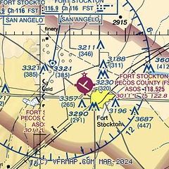
| Sectional chart |
|---|
|
| Airport distance calculator |
|---|
|
|
| Sunrise and sunset |
|---|
|
Times for 14-Jul-2026
| | Local
(UTC-5) | | Zulu
(UTC) |
|---|
| Morning civil twilight | | 06:32 | | 11:32 |
| Sunrise | | 06:59 | | 11:59 |
| Sunset | | 20:56 | | 01:56 |
| Evening civil twilight | | 21:23 | | 02:23 |
|
| Current date and time |
|---|
| Zulu (UTC) | 15-Jul-2026 01:17:22 |
|---|
| Local (UTC-5) | 14-Jul-2026 20:17:22 |
|---|
|
| METAR |
|---|
| KFST | 150053Z AUTO 14007KT 10SM CLR 28/18 A3003 RMK AO2 SLP123 T02780183
|
|
| TAF |
|---|
| KFST | 150005Z 1500/1524 11009KT P6SM SCT045 SCT250 FM150200 14006KT P6SM FEW040 OVC090 FM151200 11006KT P6SM FEW035 OVC040 FM151600 11011KT P6SM SCT045 OVC050 PROB30 1519/1524 VRB15G25KT 6SM -TSRA BKN040CB
|
|
| NOTAMs |
|---|
NOTAMs are issued by the DoD/FAA and will open in a separate window not controlled by AirNav.
|
|


