FAA INFORMATION EFFECTIVE 14 MAY 2026
Location
| FAA Identifier: | LVJ |
| Lat/Long: | 29-31-16.6000N 095-14-31.7000W
29-31.276667N 095-14.528333W
29.5212778,-95.2421389
(estimated) |
| Elevation: | 43.9 ft. / 13.4 m (surveyed) |
| Variation: | 03E (2015) |
| From city: | 17 miles S of HOUSTON, TX |
| Time zone: | UTC -5 (UTC -6 during Standard Time) |
| Zip code: | 77581 |
Airport Operations
| Airport use: | Open to the public |
| Activation date: | 10/1950 |
| Control tower: | no |
| ARTCC: | HOUSTON CENTER |
| FSS: | MONTGOMERY COUNTY FLIGHT SERVICE STATION |
| NOTAMs facility: | LVJ (NOTAM-D service available) |
| Attendance: | 0800-1900 |
| Wind indicator: | lighted |
| Segmented circle: | yes |
| Lights: | MIRL RWY 14/32 SS-SR PRESET LOW INTST; INCR INTST & ACTVT - CTAF. |
| Beacon: | white-green (lighted land airport)
Operates sunset to sunrise. |
Airport Communications
| CTAF/UNICOM: | 122.725 |
| WX ASOS: | 118.525 (281-992-1853) |
| HOUSTON APPROACH: | 134.45 |
| HOUSTON DEPARTURE: | 134.45 |
| CLEARANCE DELIVERY: | 124.0 |
| BLTWY RNAV DP: | 134.45 |
| BLUBELL STAR: | 124.225 |
| BORRN RNAV DP: | 134.45 |
| CESAN STAR: | 121.3 |
| DREMR DP: | 134.45 |
| HOODO RNAV DP: | 134.45 |
| HUDZY STAR: | 120.05 |
| INDIE RNAV DP: | 134.45 |
| KARRR RNAV DP: | 134.45 |
| LURIC DP: | 134.45 |
| MMALT RNAV DP: | 134.45 |
| OHIIO STAR: | 120.05 |
| SNDAY RNAV STAR: | 124.225 |
| STRYA DP: | 134.45 |
| STYCK DP: | 134.45 |
| TKNIQ STAR: | 119.625 |
| TSHIRT STAR: | 119.175 |
| TSHRT STAR: | 119.175 |
| WAPPL STAR: | 120.05 |
| WATFO DP: | 134.45 |
| WYLSN RNAV DP: | 134.45 |
| WX AWOS-3 at EFD (7 nm NE): | 135.575 (713-847-4430) |
| WX ASOS at HOU (8 nm N): | PHONE 713-847-1462 |
| WX AWOS-3 at AXH (12 nm W): | 123.625 (281-431-6572) |
| WX AWOS-3PT at T41 (13 nm NE): | 120.275 (281-471-2206) |
Nearby radio navigation aids
| VOR radial/distance | | VOR name | | Freq | | Var |
|---|
| VUHr302/24.7 | | SCHOLES VOR/DME | | 113.00 | | 06E |
| MHFr260/25.9 | | TRINITY VOR/DME | | 114.75 | | 07E |
| IAHr163/26.7 | | HUMBLE VORTAC | | 116.60 | | 05E |
Airport Services
| Fuel available: | 100LL JET-A |
| Parking: | hangars and tiedowns |
| Airframe service: | MAJOR |
| Powerplant service: | MAJOR |
Runway Information
Runway 14/32
| Dimensions: | 4313 x 75 ft. / 1315 x 23 m |
| Surface: | concrete, in good condition |
| Weight bearing capacity: | |
| Runway edge lights: | medium intensity |
| RUNWAY 14 | | RUNWAY 32 |
| Latitude: | 29-31.567535N | | 29-30.987020N |
| Longitude: | 095-14.764250W | | 095-14.293822W |
| Elevation: | 43.9 ft. | | 39.2 ft. |
| Traffic pattern: | left
HELS USE RIGHT-HAND TFC. | | left
HELS USE RIGHT-HAND TFC. |
| Runway heading: | 142 magnetic, 145 true | | 322 magnetic, 325 true |
| Markings: | nonprecision, in fair condition | | nonprecision, in fair condition |
| Runway end identifier lights: | no | | no |
| Touchdown point: | yes, no lights | | yes, no lights |
| Obstructions: | 50 ft. trees, 201 ft. from runway, 250 ft. left and right of centerline
30 FT TREES, 0-72 FT DSTC, 90 FT L, 50 FT TREE, 150 FT DSTC, 240 R. | | 30 ft. trees, 605 ft. from runway, 40 ft. left of centerline, 13:1 slope to clear |
Airport Ownership and Management from official FAA records
| Ownership: | Privately-owned |
| Owner: | CLOVER ACQUISITION CORP.
17622 AIRFIELD LN
PEARLAND, TX 77581
Phone 281-482-7551 |
| Manager: | JASON PANOS
17622 AIRFIELD LN
PEARLAND, TX 77581
Phone 281-482-7551 |
Additional Remarks
| - | RWY 14 25 FT LGTD POLES IN TREES 520 FT FM THR. |
| - | LGTD OIL DERRICK 116 FT AGL .65 NM SE OF ARPT. |
| - | HEL TFC INVOF ARPT. |
| - | RWY 14 CALM WIND RWY. |
| - | FOR CD CTC HOUSTON APCH AT 281-443-5844. TO CNL IFR CTC HOUSTON APCH AT 281-443-5888. |
| - | RWY 14/32 SAFETY AREA IREG SFC IRRIGATION DITCHES E AND W SIDE ADJ 40 FT, 10 FT DROP. |
| - | BANNER TOWING SR-SS. |
| - | (CONTACT PHONE NR) TREVOR@FLYPEARLAND.COM |
Instrument Procedures
NOTE: All procedures below are presented as PDF files. If you need a reader for these files, you should download the free Adobe Reader.NOT FOR NAVIGATION. Please procure official charts for flight.
FAA instrument procedures published for use from 14 May 2026 at 0901Z to 11 June 2026 at 0900Z.
STARs - Standard Terminal Arrivals |
|---|
| CESAN FOUR (RNAV) | |
2 pages:
[1] [2] (406KB) |
| HUDZY FIVE | |
2 pages:
[1] [2] (284KB) |
| OHIIO FOUR | |
download (266KB) |
| SNDAY ONE (RNAV) | |
download (234KB) |
| TKNIQ THREE (RNAV) | |
2 pages:
[1] [2] (331KB) |
| TSHRT TWO | |
2 pages:
[1] [2] (342KB) |
| WAPPL SEVEN (RNAV) | |
2 pages:
[1] [2] (407KB) |
| WAPPL SEVEN (RNAV), CONT.2 | |
download (284KB) |
IAPs - Instrument Approach Procedures |
|---|
| RNAV (GPS) RWY 32 | |
download (217KB) |
| NOTE: Special Alternate Minimums apply | |
download (42KB) |
Departure Procedures |
|---|
| BLTWY SEVEN (RNAV) | |
download (150KB) |
| BORRN SIX (RNAV) | |
2 pages:
[1] [2] (296KB) |
| HOODO SEVEN (RNAV) | |
download (193KB) |
| INDIE EIGHT (RNAV) | |
download (179KB) |
| KARRR SEVEN (RNAV) | |
2 pages:
[1] [2] (244KB) |
| LURIC EIGHT (RNAV) | |
download (202KB) |
| MMALT SEVEN (RNAV) | |
download (207KB) |
| STRYA EIGHT (RNAV) | |
download (189KB) |
| STYCK EIGHT (RNAV) | |
download (176KB) |
| WATFO SIX (RNAV) | |
download (160KB) |
| WYLSN EIGHT (RNAV) | |
download (164KB) |
| NOTE: Special Take-Off Minimums/Departure Procedures apply | |
download (82KB) |
Other nearby airports with instrument procedures:
KEFD - Ellington Airport (7 nm NE)
KHOU - William P Hobby Airport (8 nm N)
KAXH - Houston Southwest Airport (12 nm W)
T41 - La Porte Municipal Airport (13 nm NE)
KHPY - Baytown Airport (22 nm NE)
|
|

Road maps at:
MapQuest
Bing
Google
| Aerial photo |
|---|
WARNING: Photo may not be current or correct
 Photo by "Lowpass"
Photo taken 05-Mar-2012
looking east.
Photo by "Lowpass"
Photo taken 05-Mar-2012
looking east.
Do you have a better or more recent aerial photo of Pearland Regional Airport that you would like to share? If so, please send us your photo.
|
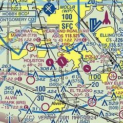
| Sectional chart |
|---|
|
| Airport distance calculator |
|---|
|
|
| Sunrise and sunset |
|---|
|
Times for 30-May-2026
| | Local
(UTC-5) | | Zulu
(UTC) |
|---|
| Morning civil twilight | | 05:56 | | 10:56 |
| Sunrise | | 06:23 | | 11:23 |
| Sunset | | 20:14 | | 01:14 |
| Evening civil twilight | | 20:41 | | 01:41 |
|
| Current date and time |
|---|
| Zulu (UTC) | 30-May-2026 14:17:35 |
|---|
| Local (UTC-5) | 30-May-2026 09:17:35 |
|---|
|
| METAR |
|---|
| KLVJ | 301353Z AUTO VRB04KT 8SM FEW013 27/23 A2994 RMK AO2 SLP138 T02670233
|
KEFD
6nm NE | 301254Z 18005KT 7SM SCT016 27/24 A2993
|
KHOU
7nm N | 301353Z 19006KT 10SM BKN012 BKN250 27/24 A2992 RMK AO2 SLP136 T02670239 $
|
KAXH
12nm W | 301355Z AUTO 21004KT 10SM CLR 27/24 A2994 RMK AO2 T02670237
|
KT41
13nm NE | 301355Z AUTO 20005KT 10SM SCT015 27/24 A2994 RMK AO2 T02700241
|
|
| TAF |
|---|
KHOU
7nm N | 301120Z 3012/3112 VRB03KT 6SM BR SCT010 FM301500 21006KT P6SM FEW015 SCT030 FM301800 16010KT P6SM SCT040 BKN250 FM310300 16007KT P6SM BKN250
|
|
| NOTAMs |
|---|
NOTAMs are issued by the DoD/FAA and will open in a separate window not controlled by AirNav.
|
|


