FAA INFORMATION EFFECTIVE 19 MARCH 2026
Location
| FAA Identifier: | MEI |
| Lat/Long: | 32-19-58.3020N 088-45-05.6600W
32-19.971700N 088-45.094333W
32.3328617,-88.7515722
(estimated) |
| Elevation: | 297.8 ft. / 90.8 m (surveyed) |
| Variation: | 02W (2015) |
| From city: | 3 miles SW of MERIDIAN, MS |
| Time zone: | UTC -5 (UTC -6 during Standard Time) |
| Zip code: | 39307 |
Airport Operations
| Airport use: | Open to the public |
| Activation date: | 04/1940 |
| Control tower: | yes |
| ARTCC: | MEMPHIS CENTER |
| FSS: | GREENWOOD FLIGHT SERVICE STATION |
| NOTAMs facility: | MEI (NOTAM-D service available) |
| Attendance: | 0600-2200
FOR ATTENDANT AFT HRS CALL 601-693-7282. |
| Wind indicator: | lighted |
| Segmented circle: | yes |
| Lights: | ACTVT MALSR RWY 01 & 19; MIRL RWY 04/22; HIRL RWY 01/19; TWY LGTS - CTAF. |
| Beacon: | white-green (lighted land airport)
Operates sunset to sunrise. |
| Fire and rescue: | ARFF index A |
Airport Communications
| CTAF: | 133.975 |
| UNICOM: | 122.95 |
| ATIS: | 126.475 291.675 |
| WX ASOS: | PHONE 601-207-0082 |
| KEY GROUND: | 121.9 348.6 [0600-2200, OTR TIMES BY NOTAM] |
| KEY TOWER: | 133.975 257.8 [0600-2200, OTR TIMES BY NOTAM] |
| MERIDIAN APPROACH: | 120.5 |
| MERIDIAN DEPARTURE: | 120.5 |
| CLEARANCE DELIVERY: | 121.9 348.6 |
| EMERG: | 121.5 243.0 |
- APCH/DEP SVC PRVDD BY MEMPHIS ARTCC ON FREQS 125.975/351.7 (MERIDIAN RCAG) WHEN MERIDIAN APCH CTL CLSD.
Nearby radio navigation aids
| VOR radial/distance | | VOR name | | Freq | | Var |
|---|
| MEIr131/3.8 | | MERIDIAN VORTAC | | 117.00 | | 05E |
Airport Services
| Fuel available: | 100LL JET-A JET-A++ |
| Parking: | hangars and tiedowns |
| Airframe service: | MAJOR |
| Powerplant service: | MAJOR |
| Bulk oxygen: | HIGH/LOW |
Runway Information
Runway 1/19
| Dimensions: | 10003 x 150 ft. / 3049 x 46 m |
| Surface: | asphalt/concrete, in good condition
DTHR CONC. |
| Weight bearing capacity: | | Single wheel: | 120.0 | | Double wheel: | 250.0 | | Double tandem: | 550.0 |
|
| Runway edge lights: | high intensity |
| Operational restrictions: | NON-STD RESA DUE TO SFC VARNS. |
| RUNWAY 1 | | RUNWAY 19 |
| Latitude: | 32-19.063045N | | 32-20.691085N |
| Longitude: | 088-45.384057W | | 088-45.070865W |
| Elevation: | 286.0 ft. | | 293.5 ft. |
| Traffic pattern: | left | | left |
| Runway heading: | 011 magnetic, 009 true | | 191 magnetic, 189 true |
| Displaced threshold: | 990 ft. | | 990 ft. |
| Declared distances: | TORA:10003 TODA:10003 ASDA:10003 LDA:9013 | | TORA:10003 TODA:10003 ASDA:10003 LDA:9013 |
| Markings: | precision, in good condition | | precision, in good condition |
| Visual slope indicator: | 4-light PAPI on left (3.00 degrees glide path) | | 4-light PAPI on left (3.00 degrees glide path) |
| RVR equipment: | touchdown | | touchdown |
| Approach lights: | MALSR: 1,400 foot medium intensity approach lighting system with runway alignment indicator lights | | MALSR: 1,400 foot medium intensity approach lighting system with runway alignment indicator lights |
| Runway end identifier lights: | no | | |
| Touchdown point: | yes, no lights | | yes, no lights |
| Instrument approach: | ILS | | ILS/DME |
Runway 4/22
| Dimensions: | 5052 x 150 ft. / 1540 x 46 m |
| Surface: | asphalt, in excellent condition |
| Weight bearing capacity: | | Single wheel: | 120.0 | | Double wheel: | 213.0 | | Double tandem: | 345.0 |
|
| Runway edge lights: | medium intensity |
| RUNWAY 4 | | RUNWAY 22 |
| Latitude: | 32-19.859362N | | 32-20.458740N |
| Longitude: | 088-45.171388W | | 088-44.489907W |
| Elevation: | 289.8 ft. | | 297.0 ft. |
| Traffic pattern: | left | | left |
| Runway heading: | 046 magnetic, 044 true | | 226 magnetic, 224 true |
| Declared distances: | TORA:5052 TODA:5052 ASDA:5052 LDA:5052 | | TORA:5052 TODA:5052 ASDA:5052 LDA:5052 |
| Markings: | nonprecision, in good condition | | nonprecision, in good condition |
| Visual slope indicator: | 2-light PAPI on left (3.13 degrees glide path) | | 2-light PAPI on left (3.00 degrees glide path) |
| Runway end identifier lights: | no | | no |
| Touchdown point: | yes, no lights | | yes, no lights |
| Obstructions: | 86 ft. trees, 1926 ft. from runway, 444 ft. left of centerline, 20:1 slope to clear | | 35 ft. pole, 1125 ft. from runway, 390 ft. right of centerline, 26:1 slope to clear |
Airport Ownership and Management from official FAA records
| Ownership: | Publicly-owned |
| Owner: | MERIDIAN ARPT AUTH
2811A AIRPORT BLVD
MERIDIAN, MS 39307
Phone 601-482-0364 |
| Manager: | TOM WILLIAMS
2811A AIRPORT BLVD
MERIDIAN, MS 39307
Phone 601-482-0364 |
Additional Remarks
| A39-01/19 | PCR VALUE: 730/F/C/W/U |
| A39-04/22 | PCR VALUE: 120/F/C/W/U |
| - | ANG ATNDD 0700-1630 MON-FRI EXCP HOLS. |
| - | ANG LTD PRKG USE; RSC INFO AVBL FOR ANG OPS DURG NML DUTY HRS. ALL TRAN ACFT 48 HR PPR. OBO. |
| - | ANG RAMP CLSD EXC PPR, 601-484-9734/9714. ARNG DSN 293-2829 C601-696-8829. |
| - | BASH PHASE II PERIOD MAR-MAY, SEP-NOV. CTC AFLD MGMT OR COMD POST FOR CURRENT BIRD WATCH COND. |
| - | ANG PROVIDES ATC SERVICES AT KMEI. |
| - | FOR CD CTC MEMPHIS ARTCC AT 901-368-8453/8449. |
Instrument Procedures
NOTE: All procedures below are presented as PDF files. If you need a reader for these files, you should download the free Adobe Reader.NOT FOR NAVIGATION. Please procure official charts for flight.
FAA instrument procedures published for use from 19 March 2026 at 0901Z to 16 April 2026 at 0900Z.
IAPs - Instrument Approach Procedures |
|---|
| ILS OR LOC RWY 01 | |
download (348KB) |
| ILS OR LOC RWY 19 | |
download (402KB) |
| RNAV (GPS) RWY 01 | |
download (300KB) |
| RNAV (GPS) RWY 04 | |
download (253KB) |
| RNAV (GPS) RWY 19 | |
download (300KB) |
| RNAV (GPS) RWY 22 | |
download (207KB) |
| VOR-A | |
download (185KB) |
| HI-TACAN OR VOR-B | |
download (127KB) |
| NOTE: Special Alternate Minimums apply | |
download (168KB) |
| NOTE: Special Take-Off Minimums/Departure Procedures apply | |
download (323KB) |
Other nearby airports with instrument procedures:
KNMM - Meridian Naval Air Station (Mc Cain Field) Airport (17 nm NE)
KNJW - Joe Williams Naval Outlying Field (28 nm N)
KMPE - Philadelphia Municipal Airport (34 nm NW)
09A - Butler/Choctaw County Airport (34 nm E)
KDYA - Demopolis Regional Airport (41 nm E)
|
|

Road maps at:
MapQuest
Bing
Google
| Aerial photo |
|---|
WARNING: Photo may not be current or correct
 Photo taken 21-Jan-2015
looking north.
Photo taken 21-Jan-2015
looking north.
Do you have a better or more recent aerial photo of Key Field Airport that you would like to share? If so, please send us your photo.
|
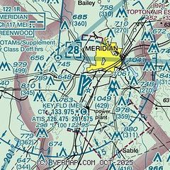
| Sectional chart |
|---|
|
 Download PDF
of official airport diagram from the FAA
| Airport distance calculator |
|---|
|
|
| Sunrise and sunset |
|---|
|
Times for 14-Apr-2026
| | Local
(UTC-5) | | Zulu
(UTC) |
|---|
| Morning civil twilight | | 06:03 | | 11:03 |
| Sunrise | | 06:28 | | 11:28 |
| Sunset | | 19:23 | | 00:23 |
| Evening civil twilight | | 19:48 | | 00:48 |
|
| Current date and time |
|---|
| Zulu (UTC) | 14-Apr-2026 23:31:20 |
|---|
| Local (UTC-5) | 14-Apr-2026 18:31:20 |
|---|
|
| METAR |
|---|
| KMEI | 142258Z 22005KT 10SM CLR 26/13 A3010 RMK AO2 SLP189 T02610128
|
KNMM
15nm NE | 142256Z 16005KT 10SM FEW060 28/12 A3010 RMK AO2 SLP200 T02780122
|
|
| TAF |
|---|
| KMEI | 141720Z 1418/1518 19008KT P6SM FEW050 FM151100 20002KT 4SM BR BKN009 FM151300 19008KT 6SM BR FEW250
|
KNMM
15nm NE | 1415/1515 20008KT 9999 SCT020 SCT050 QNH3010INS FM150100 VRB05KT 9999 FEW010 SCT040 QNH3005INS TEMPO 1510/1514 6000 BR BKN005 TX29/1421Z TN13/1510Z FN20088
|
|
| NOTAMs |
|---|
NOTAMs are issued by the DoD/FAA and will open in a separate window not controlled by AirNav.
|
|


