FAA INFORMATION EFFECTIVE 09 JULY 2026
Location
| FAA Identifier: | RDR |
| Lat/Long: | 47-57-40.6070N 097-24-02.9290W
47-57.676783N 097-24.048817W
47.9612797,-97.4008136
(estimated) |
| Elevation: | 910.9 ft. / 278 m (estimated) |
| Variation: | 03E (2020) |
| From city: | 13 miles W of GRAND FORKS, ND |
| Time zone: | UTC -5 (UTC -6 during Standard Time) |
| Zip code: | 58204 |
Airport Operations
| Airport use: | Private use. Permission required prior to landing |
| Control tower: | yes |
| ARTCC: | MINNEAPOLIS CENTER |
| FSS: | GRAND FORKS FLIGHT SERVICE STATION |
| NOTAMs facility: | GFK (NOTAM-D service available) |
| Attendance: | CONTINUOUS |
| Pattern altitude: | 2410.9 ft. MSL
HVY, LRG, AND HI PER ACFT: OVHD 2500 FT MSL; RECTANGULAR 2000 FT MSL; LGT ACFT AND HEL 1500 FT MSL. |
| Wind indicator: | yes |
| Segmented circle: | no |
| Beacon: | white-white-green (lighted military airport)
Operates sunset to sunrise. |
Airport Communications
| RED RIVER GROUND: | 119.15 275.8 [OPR 1200-0530Z++; CLSD HOL.] |
| RED RIVER TOWER: | 124.9 349.0 [OPR 1200-0530Z++; CLSD HOL.] |
| GRAND FORKS APPROACH: | 118.1 318.1 [1200-0530Z++; CLSD HOL. OT CTC MINNEAPOLIS CENTER.] |
| GRAND FORKS DEPARTURE: | 118.1 318.1 [1200-0530Z++; CLSD HOL. OT CTC MINNEAPOLIS CENTER.] |
| CLEARANCE DELIVERY: | 119.15 360.7 |
| ARR: | 121.1 ;GRAND FORKS 126.6 ;RED RIVER |
| COMD POST: | 311.0 321.0 |
| D-ATIS: | 273.45 |
| EMERG: | 121.5 243.0 |
| PMSV METRO: | 343.5 |
| PTD: | 372.2 |
| WX ASOS at GFK (9 nm E): | PHONE 701-772-3486 |
- APCH/DEP SVC PRVDD BY MINNEAPOLIS ARTCC (ZMP) ON FREQ 132.15/269.6 (GRAND FORKS RCAG) WHEN GRAND FORKS (RDR) APCH CTL CLSD.
- (ATIS DESCRIPTION) DIGITAL-ATIS, DATA LINK ENABLED.
Nearby radio navigation aids
| VOR radial/distance | | VOR name | | Freq | | Var |
|---|
| GFKr264/8.7 | | GRAND FORKS VOR/DME | | 114.30 | | 09E |
| NDB name | | Hdg/Dist | | Freq | | Var | | ID |
|---|
| HISER | | 302/11.2 | | 345 | | 06E | | GF | --. ..-. |
Airport Services
| Oil available: | OIL AVBL IN PACKAGE PRODUCT ONLY, HAND TRANSFER RQR. |
| Parking: | hangars |
| Airframe service: | MAJOR |
| Powerplant service: | MAJOR |
| Bottled oxygen: | NONE |
| Bulk oxygen: | LOW |
Runway Information
Runway 18/36
| Dimensions: | 12351 x 150 ft. / 3765 x 46 m
RWY: FIRST/LAST 1100 FT OF RWY 18/36 IS CONCRETE; MIDDLE 10150 FT OF RWY 18/36 IS ASPHALT. RWY 18/36 GROOVED. |
| Surface: | asphalt/grooved, in good condition |
| Weight bearing capacity: | |
| Runway edge lights: | high intensity |
| RUNWAY 18 | | RUNWAY 36 |
| Latitude: | 47-58.692500N | | 47-56.661075N |
| Longitude: | 097-24.048833W | | 097-24.048813W |
| Elevation: | 896.1 ft. | | 910.9 ft. |
| Traffic pattern: | right
VFR OVERHEAD AND RECTANGULAR TFC PAT RGT HAND RWY 18. | | left |
| Runway heading: | 177 magnetic, 180 true | | 357 magnetic, 000 true |
| Markings: | precision, in poor condition | | precision, in poor condition |
| Visual slope indicator: | 4-light PAPI on left (2.60 degrees glide path) | | 4-light PAPI on left (2.60 degrees glide path) |
| Approach lights: | ALSF1: standard 2,400 foot high intensity approach lighting system with centerline sequenced flashers (category I) | | ALSF1: standard 2,400 foot high intensity approach lighting system with centerline sequenced flashers (category I) |
| Runway end identifier lights: | no | | no |
| Touchdown point: | yes, no lights | | yes, no lights |
| Instrument approach: | LOC/GS | | ILS |
Airport Ownership and Management from official FAA records
| Ownership: | U.S. Air Force |
| Owner: | USAF
GRAND FORKS AFB
GRAND FORKS, ND 58201
Phone 701-747-4409 |
| Manager: | BASE OPERATIONS
GRAND FORKS AFB
GRAND FORKS, ND 58201
Phone 701-747-4360 |
Additional Remarks
| - | JASU: (AM32A-86) (AM32-95) |
| - | CAUTION: UNCTL VEH TFC ON TWY AND RAMPS. |
| - | RSTD: ALL INBD PAX/CARGO ACFT MUST CTC COMD POST NO LATER THAN 30 MIN PRIOR TO LDG. ACFT WITH DGR MATERIALS CTC PTD 30 MIN PRIOR TO ETA. |
| - | FUEL: J8 |
| - | OIL: OIL AVBL IN PACKAGE PRODUCT ONLY, HAND TRANSFER RQR. O-133-148 |
| - | MISC: ACFT WITH VHF RDO EQPT ONLY MAY CTC AM OPS THRU ATC. NO HGR SPACE. ALL ACFT WITH DV ON BOARD CTC COMD POST 60 NM PRIOR LDG. |
| - | ON BASE LODGING FOR TRANS AIRCREWS UNAVBL. |
| - | CAUTION: UAV OPS WITHIN 11 DME HALF CIRCLE RDR R-180 THRU RDR R-360 W OF GRAND FORKS AFB, SFC TO FL 180.UAV OPS ENTIRE CLASS D AIRSPACE. |
| - | SERVICE: TRAN ALERT: OPR 1300-0100Z++ MON-FRI, 1400-2300Z++ SAT AND SUN. NO NML OPR ON FED HOL. |
| - | AFTER HRS REQ MUST HAVE APVL OF RW/CV. |
| - | RSTD: PPR ALL TSNT ACFT, CTC AFLD GMT DSN 362-4409, C701-747-4409 FAX EXTN 4212. |
| - | RSTD: LTD CLASSIFIED STOR FOR TRAN AIRCREWS. |
| - | MISC: WX SVC AVBL H24 AT DSN 362-4396, C701-747-4396. AN/FMQ-19 AUTOMATED OBSERVING SYS IN USE; AUGMENTED BY HUMAN OBSN WHEN NEC. CTC 15 OWS SCOTT AFB DSN 576-9755, C 618-256-9755 DUR WX FLT CLOSURE OR EVAC. BLDG OBSTN MAY IMPACT PREVAILING VIS 010--220-. |
| - | MISC: RWY COND CODE & FICON NOT RPT. |
| - | RSTD: BASH PHASE I & II DTRMD BY BGNG & END OF WATERFOWL MIGRATION; NOTAM WILL BE PUBL WHEN PHASE II IS IMPLEMENTED. |
| - | CAUTION: RWY SFC DETERIORATED. GROOVES IN RWY MAY NOT PRODUCE EXP BA WHEN THE RWY IS WET. |
| - | OPR 1200-0530Z++; CLSD HOL. |
| - | SVC: FLUID: SP PRESAIR DE-ICE NOT AVBL. |
Instrument Procedures
NOTE: All procedures below are presented as PDF files. If you need a reader for these files, you should download the free Adobe Reader.NOT FOR NAVIGATION. Please procure official charts for flight.
FAA instrument procedures published for use from 09 July 2026 at 0901Z to 06 August 2026 at 0900Z.
Other nearby airports with instrument procedures:
KGFK - Grand Forks International Airport (9 nm E)
4V4 - Northwood Municipal Airport-Vince Field (16 nm SW)
KGAF - Hutson Field Airport (27 nm N)
Y37 - Park River Airport-W C Skjerven Field (30 nm NW)
D37 - Warren Municipal Airport (31 nm NE)
|
|

Road maps at:
MapQuest
Bing
Google
| Aerial photo |
|---|

|
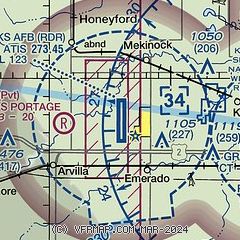
| Sectional chart |
|---|
|
 Download PDF
of official airport diagram from the FAA
| Airport distance calculator |
|---|
|
|
| Sunrise and sunset |
|---|
|
Times for 25-Jul-2026
| | Local
(UTC-5) | | Zulu
(UTC) |
|---|
| Morning civil twilight | | 05:21 | | 10:21 |
| Sunrise | | 05:58 | | 10:58 |
| Sunset | | 21:14 | | 02:14 |
| Evening civil twilight | | 21:52 | | 02:52 |
|
| Current date and time |
|---|
| Zulu (UTC) | 26-Jul-2026 02:35:03 |
|---|
| Local (UTC-5) | 25-Jul-2026 21:35:03 |
|---|
|
| METAR |
|---|
| KRDR | 260155Z AUTO 14007KT 10SM CLR 27/19 A2977 RMK AO2 SLP082 T02740192 $
|
KGFK
9nm E | 260153Z 11006KT 9SM CLR 26/19 A2978 RMK AO2 SLP082 FU ALOFT T02610194 $
|
|
| TAF |
|---|
KGFK
9nm E | 251720Z 2518/2618 07004KT P6SM SKC FM252100 16004KT P6SM SKC FM260800 21006KT P6SM SKC FM261500 04006KT P6SM SKC
|
|
| NOTAMs |
|---|
NOTAMs are issued by the DoD/FAA and will open in a separate window not controlled by AirNav.
|
|


