FAA INFORMATION EFFECTIVE 19 MARCH 2026
Location
| FAA Identifier: | TXW |
| Lat/Long: | 26-10-43.3470N 097-58-26.4230W
26-10.722450N 097-58.440383W
26.1787075,-97.9740064
(estimated) |
| Elevation: | 69.9 ft. / 21 m (estimated) |
| Variation: | 04E (2020) |
| From city: | 1 mile NE of WESLACO, TX |
| Time zone: | UTC -5 (UTC -6 during Standard Time) |
| Zip code: | 78596 |
Airport Operations
| Airport use: | Open to the public |
| Activation date: | 07/1945 |
| Control tower: | no |
| ARTCC: | HOUSTON CENTER |
| FSS: | SAN ANGELO FLIGHT SERVICE STATION |
| NOTAMs facility: | TXW (NOTAM-D service available) |
| Attendance: | MON-SAT 0700-1800
FOR ATNDNT AFT HRS, CALL 956-469-0291 DURG ATNDD HRS. |
| Wind indicator: | lighted |
| Segmented circle: | yes |
| Lights: | MIRL RWY 14/32 PRESET LOW INTST; TO INCR INTST AND ACTVT REIL RWY 32 - CTAF. |
| Beacon: | white-green (lighted land airport)
Operates sunset to sunrise. |
| International operations: | customs landing rights airport |
Airport Communications
| CTAF/UNICOM: | 122.8 |
| WX AWOS-3PT: | 118.575 (956-447-0414) |
| VALLEY APPROACH: | 126.55 |
| VALLEY DEPARTURE: | 126.55 |
| CLEARANCE DELIVERY: | 125.95 |
| WX ASOS at MFE (14 nm W): | PHONE 956-664-8212 |
| WX ASOS at HRL (17 nm E): | 124.85 (956-428-7297) |
| WX AWOS-3PT at EBG (18 nm NW): | 118.025 (956-587-0743) |
Nearby radio navigation aids
| VOR radial/distance | | VOR name | | Freq | | Var |
|---|
| MFEr080/14.4 | | MC ALLEN VOR/DME | | 117.20 | | 09E |
| REXr046/17.2 | | REYNOSA VOR/DME | | 112.40 | | 08E |
| HRLr255/17.6 | | HARLINGEN VOR/DME | | 113.65 | | 05E |
| MAMr311/34.5 | | MATAMOROS VOR/DME | | 114.30 | | 04E |
| BROr286/35.7 | | BROWNSVILLE VORTAC | | 116.30 | | 09E |
Airport Services
| Fuel available: | 100LL JET-A
100LL:FUEL AVBL 24 HRS SELF-SERVE. |
| Parking: | tiedowns |
| Airframe service: | MAJOR |
| Powerplant service: | MAJOR |
| Bottled oxygen: | NONE |
| Bulk oxygen: | NONE |
Runway Information
Runway 14/32
| Dimensions: | 6002 x 75 ft. / 1829 x 23 m |
| Surface: | asphalt, in excellent condition |
| Weight bearing capacity: | |
| Runway edge lights: | medium intensity |
| RUNWAY 14 | | RUNWAY 32 |
| Latitude: | 26-11.110567N | | 26-10.334317N |
| Longitude: | 097-58.781617W | | 097-58.099133W |
| Elevation: | 69.4 ft. | | 69.3 ft. |
| Traffic pattern: | left | | right |
| Runway heading: | 138 magnetic, 142 true | | 318 magnetic, 322 true |
| Markings: | nonprecision, in good condition | | nonprecision, in good condition |
| Visual slope indicator: | 4-light PAPI on left (3.00 degrees glide path) | | 4-light PAPI on left (3.18 degrees glide path) |
| Runway end identifier lights: | no | | yes |
| Touchdown point: | yes, no lights | | yes, no lights |
| Obstructions: | 20 ft. trees, 959 ft. from runway, 189 ft. left of centerline, 37:1 slope to clear | | 32 ft. pole, 1239 ft. from runway, 259 ft. left of centerline, 32:1 slope to clear |
Airport Ownership and Management from official FAA records
| Ownership: | Publicly-owned |
| Owner: | CITY OF WESLACO
255 S. KANSAS AVENUE
WESLACO, TX 78596
Phone 956-968-3181 |
| Manager: | MARIA LILY ALVAREZ
1909 JOE STEPHENS
WESLACO, TX 75459
Phone 956-969-0291
956-969-0291 MLALVAREZ@WESLACOTX.GOV |
Additional Remarks
| - | 30 FT POLE 315 FT NE OF HELIPAD. |
Instrument Procedures
NOTE: All procedures below are presented as PDF files. If you need a reader for these files, you should download the free Adobe Reader.NOT FOR NAVIGATION. Please procure official charts for flight.
FAA instrument procedures published for use from 19 March 2026 at 0901Z to 16 April 2026 at 0900Z.
IAPs - Instrument Approach Procedures |
|---|
| RNAV (GPS) RWY 14 **CHANGED** | |
download (202KB) |
| VOR-A **CHANGED** | |
download (146KB) |
| NOTE: Special Alternate Minimums apply | |
download (138KB) |
| NOTE: Special Take-Off Minimums/Departure Procedures apply | |
download (159KB) |
Other nearby airports with instrument procedures:
KMFE - Mc Allen International Airport (14 nm W)
KHRL - Valley International Airport (17 nm E)
KEBG - South Texas International Airport at Edinburg (18 nm NW)
KBRO - Brownsville/South Padre Island International Airport (34 nm SE)
KPIL - Cameron County Airport (34 nm E)
|
|

Road maps at:
MapQuest
Bing
Google
| Aerial photo |
|---|
WARNING: Photo may not be current or correct

Do you have a better or more recent aerial photo of Mid Valley Airport that you would like to share? If so, please send us your photo.
|
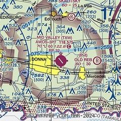
| Sectional chart |
|---|
|
CAUTION: Diagram may not be current

| Airport distance calculator |
|---|
|
|
| Sunrise and sunset |
|---|
|
Times for 01-Apr-2026
| | Local
(UTC-5) | | Zulu
(UTC) |
|---|
| Morning civil twilight | | 07:01 | | 12:01 |
| Sunrise | | 07:24 | | 12:24 |
| Sunset | | 19:48 | | 00:48 |
| Evening civil twilight | | 20:11 | | 01:11 |
|
| Current date and time |
|---|
| Zulu (UTC) | 01-Apr-2026 22:21:56 |
|---|
| Local (UTC-5) | 01-Apr-2026 17:21:56 |
|---|
|
| METAR |
|---|
| KTXW | 012155Z AUTO 15015G18KT 10SM SCT050 31/17 A2984 RMK AO2 T03140174
|
KMFE
15nm W | 012153Z 15015KT 10SM FEW048 SCT060 SCT110 33/19 A2983 RMK AO2 PK WND 13027/2127 SLP098 T03280189 $
|
MMRX
16nm SW | 012141Z 11010G20KT 7SM SCT035 SCT240 32/20 A2983 RMK 8/501
|
KHRL
18nm E | 012152Z 15015G27KT 10SM CLR 32/17 A2985 RMK AO2 PK WND 14028/2130 SLP105 T03170172 $
|
KEBG
18nm NW | 012155Z AUTO 17015G22KT 10SM SCT060 33/18 A2981 RMK AO2
|
|
| TAF |
|---|
KMFE
15nm W | 011720Z 0118/0218 14015G25KT P6SM SCT035 BKN050 FM020800 15010G20KT P6SM BKN015 FM021500 16015G25KT P6SM SCT018
|
MMRX
16nm SW | 011729Z 0118/0218 12010G22KT P6SM BKN020 BECMG 0120/0121 SCT020 FM020600 14015KT 6SM HZ BKN010 FM021600 14015G25KT P6SM BKN020
|
KHRL
18nm E | 011720Z 0118/0218 15015G25KT P6SM SCT035 BKN050 FM020600 15010G20KT P6SM BKN015 FM021500 16015G25KT P6SM SCT018
|
|
| NOTAMs |
|---|
NOTAMs are issued by the DoD/FAA and will open in a separate window not controlled by AirNav.
|
|


