FAA INFORMATION EFFECTIVE 14 MAY 2026
Location
| FAA Identifier: | MRI |
| Lat/Long: | 61-12-48.7670N 149-50-40.9540W
61-12.812783N 149-50.682567W
61.2135464,-149.8447094
(estimated) |
| Elevation: | 143.1 ft. / 43.6 m (surveyed) |
| Variation: | 19E (2010) |
| From city: | 2 miles E of ANCHORAGE, AK |
| Time zone: | UTC -8 (UTC -9 during Standard Time) |
| Zip code: | 99508 |
Airport Operations
| Airport use: | Open to the public |
| Activation date: | 05/1947 |
| Control tower: | yes |
| ARTCC: | ANCHORAGE CENTER |
| FSS: | KENAI FLIGHT SERVICE STATION [907-283-7211] |
| NOTAMs facility: | MRI (NOTAM-D service available) |
| Attendance: | MON-FRI 0730-1730 |
| Pattern altitude: | TPA FOR ACFT 105 KTS OR LESS 900 FT MSL. ACFT GREATER THAN 105 KTS 1200 FT MSL. |
| Wind indicator: | lighted |
| Segmented circle: | no |
| Lights: | ACTVT REIL RWY 07, 16, 25, 34; MIRL RWY 07/25 & 16/34 - CTAF. PAPI RWY 07, 25 & 34; VASI RWY 16 OPR CONSLY. |
| Beacon: | white-green (lighted land airport)
Operates sunset to sunrise. |
| International operations: | customs landing rights airport |
Airport Communications
| CTAF: | 126.0 |
| UNICOM: | 122.95 |
| ATIS: | 124.25 |
| WX ASOS: | 124.25 (907-271-5277) |
| MERRILL GROUND: | 121.7 [0700-2200L.] |
| MERRILL TOWER: | 126.0 127.55 [0700-2200L.] |
| ANCHORAGE APPROACH: | 119.1 |
| ANCHORAGE DEPARTURE: | 119.1 |
| CLASS C: | 119.1 |
| WX ASOS at LHD (4 nm SW): | 125.6 (907-245-5432) |
| WX ASOS at ANC (5 nm SW): | PHONE 907-271-5278 |
| WX ASOS at FRN (6 nm NE): | 134.25 |
| WX AWOS-3P at BCV (16 nm NE): | 135.55 (907-621-7605) |
- INTERFERENCE MAY BE RECEIVED ON ATCT FREQS IN TRAFFIC PATTERN FROM FM BROADCAST STATION.
- WHEN ATCT CLSD CTAF PROCEDURES ARE RECOMMENDED. SEE REGULATORY NOTICES ANCHORAGE TERMINAL AREA MERRILL SEGMENT THIS SUPPLEMENT.
- WHEN ATCT CLSD WX ALSO AVBL ON CTAF, CALL SIGN MERRILL WEATHER OR PHONE 907-271-4355.
Nearby radio navigation aids
| VOR radial/distance | | VOR name | | Freq | | Var |
|---|
| TEDr033/4.3 | | ANCHORAGE VOR/DME | | 113.15 | | 18E |
| BGQr152/21.6 | | BIG LAKE VORTAC | | 112.50 | | 19E |
Airport Services
| Fuel available: | 100 JET-A |
| Parking: | hangars and tiedowns |
| Airframe service: | MAJOR |
| Powerplant service: | MAJOR |
| Bottled oxygen: | LOW |
| Bulk oxygen: | LOW |
Runway Information
Runway 7/25
| Dimensions: | 4000 x 100 ft. / 1219 x 30 m |
| Surface: | asphalt, in good condition |
| Weight bearing capacity: | | Single wheel: | 50.0 | | Double wheel: | 80.0 |
|
| Runway edge lights: | medium intensity |
| RUNWAY 7 | | RUNWAY 25 |
| Latitude: | 61-12.954258N | | 61-12.953968N |
| Longitude: | 149-51.196307W | | 149-49.835143W |
| Elevation: | 131.0 ft. | | 143.1 ft. |
| Traffic pattern: | right | | left |
| Runway heading: | 071 magnetic, 090 true | | 251 magnetic, 270 true |
| Markings: | precision, in good condition | | precision, in good condition |
| Visual slope indicator: | 4-light PAPI on right (3.50 degrees glide path) | | 4-light PAPI on left (3.00 degrees glide path) |
| Runway end identifier lights: | yes | | yes |
| Touchdown point: | yes, no lights | | yes, no lights |
| Obstructions: | 41 ft. pole, 846 ft. from runway, 339 ft. left of centerline, 15:1 slope to clear | | none |
Runway 16/34
| Dimensions: | 2640 x 75 ft. / 805 x 23 m |
| Surface: | asphalt, in fair condition |
| Weight bearing capacity: | |
| Runway edge lights: | medium intensity |
| RUNWAY 16 | | RUNWAY 34 |
| Latitude: | 61-12.940978N | | 61-12.507698N |
| Longitude: | 149-51.150777W | | 149-51.151603W |
| Elevation: | 130.8 ft. | | 123.3 ft. |
| Traffic pattern: | right | | left |
| Runway heading: | 161 magnetic, 180 true | | 341 magnetic, 000 true |
| Markings: | basic, in fair condition | | basic, in fair condition |
| Visual slope indicator: | 2-box VASI on right (3.00 degrees glide path) | | 2-light PAPI on left (3.00 degrees glide path) |
| Runway end identifier lights: | yes | | yes |
| Touchdown point: | yes, no lights | | yes, no lights |
| Obstructions: | 31 ft. bldg, 437 ft. from runway, 268 ft. left of centerline, 7:1 slope to clear | | 27 ft. pole, 331 ft. from runway, 231 ft. left of centerline, 4:1 slope to clear |
Runway 5/23
| Dimensions: | 2000 x 60 ft. / 610 x 18 m |
| Surface: | asphalt/gravel, in good condition
FIRST 60 FT PAVED; RMNG GRVL. |
| Operational restrictions: | USED SEASONALLY AS SNOW RWY. RCMD SKI EQUIP ACFT USE TO MINIMIZE WHEEL RUTTING. |
| RUNWAY 5 | | RUNWAY 23 |
| Latitude: | 61-12.580202N | | 61-12.713380N |
| Longitude: | 149-50.708625W | | 149-50.086607W |
| Elevation: | 133.2 ft. | | 138.0 ft. |
| Traffic pattern: | left | | left |
| Runway heading: | 047 magnetic, 066 true | | 227 magnetic, 246 true |
| Markings: | , in good condition | | , in good condition |
| Runway end identifier lights: | no | | no |
| Touchdown point: | yes, no lights | | yes, no lights |
| Obstructions: | none | | 7 ft. fence, 250 ft. from runway, 115 ft. right of centerline, 7:1 slope to clear |
Airport Ownership and Management from official FAA records
| Ownership: | Publicly-owned |
| Owner: | MUNICIPALITY OF ANCHORAGE
800 MERRIL FIELD DR.
ANCHORAGE, AK 99501-4129
Phone 907-343-6303 |
| Manager: | EARL MALPASS
800 MERRIL FIELD DR
ANCHORAGE, AK 99501-4129
Phone 907-343-6301 |
Additional Remarks
| - | WHEN ATCT CLSD CTC MERRILL WX - CTAF OR 271-4355. |
| - | FLT PLANNING IN ANCHORAGE BOWL AREA - RCO 122.55. |
| - | NONMOVEMENT AREA ACFT CTC GND CTL BFR TAX. |
| - | ANCHORAGE WX CAMERA AVBL ON INTERNET AT HTTPS://WEATHERCAMS.FAA.GOV |
| - | PTNS OF TWY C BTN TWY S & N AND PTNS OF TWY Q NOT VIS FM TWR. |
| - | TWY B SOUTH OF TWY M, TWY G BTN TWY N & RWY 05/23, TWY Q EAST OF TWY C & ALL SFCS SOUTH OF RWY 05/23 UNCTLD. |
| - | COMPASS ROSE AVBL WITH PRIOR CDN - ATCT. |
| - | ARR/DEP ROUTES - SEE AREA NOTICES; SPL NOTICE CARTEE ASP. |
| - | NOISE ABATEMENT; TGL OR PAT WORK NA 2200-0700. |
| - | ALASKA RGNL HOSPITAL 2OK HELI ON ARPT; SEE SEPARATE LISTING FOR INFO. |
| - | OTFC OF ARPT BLO 300 FT NA. |
| - | BIRDS & SEAGULLS ON & INVOF ARPT. |
| - | PPR OVR 12500 LB. |
| - | ALL RWY & TWY LGTS NONSTD HEIGHT. |
| - | 1-8 FT SNOW BERMS ADJ TO RWYS & TWYS DURG WINTER. |
Instrument Procedures
NOTE: All procedures below are presented as PDF files. If you need a reader for these files, you should download the free Adobe Reader.NOT FOR NAVIGATION. Please procure official charts for flight.
FAA instrument procedures published for use from 14 May 2026 at 0901Z to 11 June 2026 at 0900Z.
IAPs - Instrument Approach Procedures |
|---|
| RNAV (GPS) RWY 34 | |
download (397KB) |
| RNAV (GPS) Y RWY 07 | |
download (267KB) |
| RNAV (GPS) Z RWY 07 | |
download (260KB) |
| RNAV (GPS)-A | |
download (267KB) |
| NOTE: Special Alternate Minimums apply | |
download (174KB) |
Departure Procedures |
|---|
| MERRILL ONE (RNAV) | |
download (131KB) |
| NOTE: Special Take-Off Minimums/Departure Procedures apply | |
download (407KB) |
Other nearby airports with instrument procedures:
PAED - Elmendorf Air Force Base (3 nm NE)
PANC - Ted Stevens Anchorage International Airport (5 nm SW)
PAFR - Bryant Army Airfield (6 nm NE)
PAGQ - Big Lake Airport (19 nm N)
PAWS - Wasilla Airport (23 nm N)
|
|

Road maps at:
MapQuest
Bing
Google
| Aerial photo |
|---|
WARNING: Photo may not be current or correct
 Photo by Vicki Eifert
Taken in June 2018
looking southeast.
Photo by Vicki Eifert
Taken in June 2018
looking southeast.
Do you have a better or more recent aerial photo of Merrill Field Airport that you would like to share? If so, please send us your photo.
|
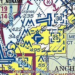
| Sectional chart |
|---|
|
 Download PDF
of official airport diagram from the FAA
| Airport distance calculator |
|---|
|
|
| Sunrise and sunset |
|---|
|
Times for 27-May-2026
| | Local
(UTC-8) | | Zulu
(UTC) |
|---|
| Morning civil twilight | | 03:14 | | 11:14 |
| Sunrise | | 04:45 | | 12:45 |
| Sunset | | 23:08 | | 07:08 |
| Evening civil twilight | | 00:39 | | 08:39 |
|
| Current date and time |
|---|
| Zulu (UTC) | 27-May-2026 14:40:26 |
|---|
| Local (UTC-8) | 27-May-2026 06:40:26 |
|---|
|
| METAR |
|---|
| PAMR | 271353Z 31004KT 10SM FEW070 OVC110 06/02 A2967 RMK AO2 SLP048 T00610017
|
PAED
3nm NE | 271355Z 00000KT 10SM FEW070 BKN110 06/01 A2966 RMK AO2A SLP040 T00630012
|
PALH
4nm SW | 271353Z AUTO 00000KT 10SM OVC100 06/02 A2967 RMK AO2 SLP049 T00610022 TSNO
|
PANC
6nm SW | 271353Z 19003KT 10SM FEW040 BKN095 07/01 A2967 RMK AO2 SLP048 T00670006
|
PAFR
6nm NE | 262355Z AUTO 13011KT 10SM OVC075 13/M02 A2948 RMK AO2 SLP985 T01341022 10137 20107 52005 $
|
PABV
15nm NE | 271356Z AUTO 19005KT 10SM SCT120 06/02 A2969 RMK AO2 SLP055 T00610017 $
|
|
| TAF |
|---|
PAED
3nm NE | 271300Z 2713/2819 32005KT 9999 SCT080 BKN100 510303 QNH2963INS BECMG 2720/2721 27008KT 9999 SCT050 BKN080 620803 510303 QNH2966INS BECMG 2809/2810 01003KT 9999 BKN100 QNH2973INS TX12/2722Z TN06/2811Z
|
PANC
6nm SW | 271143Z 2712/2818 17012G22KT P6SM OVC080 FM271400 VRB04KT P6SM BKN090 FM272200 16013G23KT P6SM SCT060 BKN090 FM280900 16008KT P6SM BKN100
|
|
| NOTAMs |
|---|
NOTAMs are issued by the DoD/FAA and will open in a separate window not controlled by AirNav.
|
|


