FAA INFORMATION EFFECTIVE 17 APRIL 2025
Location
| FAA Identifier: | FDK |
| Lat/Long: | 39-25-01.2760N 077-22-29.0360W
39-25.021267N 077-22.483933W
39.4170211,-77.3747322
(estimated) |
| Elevation: | 308.9 ft. / 94.2 m (surveyed) |
| Variation: | 08W (1980) |
| Time zone: | UTC -4 (UTC -5 during Standard Time) |
| Zip code: | 21701 |
Airport Operations
| Airport use: | Open to the public |
| Activation date: | 12/2003 |
| Control tower: | yes |
| ARTCC: | WASHINGTON CENTER |
| FSS: | LEESBURG FLIGHT SERVICE STATION |
| NOTAMs facility: | FDK (NOTAM-D service available) |
| Attendance: | 0700-2100++
FBO UNATNDD ON CHRISTMAS DAY. |
| Pattern altitude: | 908.9 ft. MSL
TPA - 600 AGL HEL, 1100 AGL SNGL AND LGT TWINS, 1600 AGL LRG TWINS AND JETS. |
| Wind indicator: | lighted |
| Segmented circle: | yes |
| Lights: | ACTVT ODALS RWY 23; REIL RWY 12, 23 & 30; PAPI RWY 23; HIRL RWY 05/23; MIRL RWY 12/30 - CTAF. |
| Beacon: | white-green (lighted land airport)
Operates sunset to sunrise. |
Airport Communications
| CTAF: | 132.4 |
| UNICOM: | 122.95 |
| ATIS: | 124.875 |
| WX AWOS-3: | PHONE 301-600-1457 |
| FREDERICK GROUND: | 127.425 [0700-2100] |
| FREDERICK TOWER: | 132.4 [0700-2100] |
| POTOMAC APPROACH: | 126.1 |
| POTOMAC DEPARTURE: | 126.1 |
| CLEARANCE DELIVERY: | 126.9 ;WHEN TWR CLSD 127.425 |
| CONLE DP: | 126.1 |
| TERPZ DP: | 126.1 |
| TRSTN STAR: | 126.75 |
| WX AWOS-3PT at GAI (18 nm SE): | 128.275 (301-977-2971) |
- POTOMAC CD 126.9 OR 866-709-4993 (WHEN TWR CLSD).
Nearby radio navigation aids
| VOR radial/distance | | VOR name | | Freq | | Var |
|---|
| FDK at field | | FREDERICK VOR | | 109.00 | | 08W |
| EMIr264/18.9 | | WESTMINSTER VORTAC | | 117.90 | | 08W |
| MRBr092/22.0 | | MARTINSBURG VORTAC | | 112.10 | | 07W |
| HGRr134/(27.9) | | HAGERSTOWN VOR | | 109.80 | | 07W |
| AMLr016/29.3 | | ARMEL VOR/DME | | 113.50 | | 08W |
| BALr305/36.3 | | BALTIMORE VORTAC | | 115.10 | | 11W |
| DCAr344/37.0 | | WASHINGTON VOR/DME | | 111.00 | | 09W |
| NDB name | | Hdg/Dist | | Freq | | Var | | ID |
|---|
| ELLICOTT | | 297/28.8 | | 371 | | 11W | | FND | ..-. -. -.. |
| GEORGETOWN | | 347/31.5 | | 323 | | 09W | | GTN | --. - -. |
Airport Services
| Fuel available: | 100LL JET-A
100LL:SELF SERVE 100LL AVBL H24 WITH CREDIT CARD. |
| Parking: | hangars and tiedowns |
| Airframe service: | MAJOR |
| Powerplant service: | MAJOR |
| Bottled oxygen: | HIGH/LOW |
| Bulk oxygen: | NONE |
Runway Information
Runway 5/23
| Dimensions: | 5819 x 100 ft. / 1774 x 30 m |
| Surface: | asphalt/grooved, in good condition |
| Weight bearing capacity: | | PCN 30 /F/C/X/T | | Single wheel: | 60.0 |
|
| Runway edge lights: | high intensity |
| RUNWAY 5 | | RUNWAY 23 |
| Latitude: | 39-24.501022N | | 39-25.229923N |
| Longitude: | 077-22.908840W | | 077-22.106403W |
| Elevation: | 308.9 ft. | | 282.6 ft. |
| Traffic pattern: | right | | left |
| Runway heading: | 048 magnetic, 040 true | | 228 magnetic, 220 true |
| Markings: | nonprecision, in good condition | | precision, in fair condition |
| Visual slope indicator: | 4-light PAPI on left (3.00 degrees glide path) | | 4-light PAPI on left (3.00 degrees glide path) |
| Approach lights: | | | ODALS: omnidirectional approach lighting system |
| Runway end identifier lights: | yes | | yes |
| Touchdown point: | yes, no lights | | yes, no lights |
| Instrument approach: | | | ILS |
| Obstructions: | 42 ft. trees, 1339 ft. from runway, 70 ft. left of centerline, 27:1 slope to clear | | 111 ft. trees, 2894 ft. from runway, 721 ft. left of centerline, 24:1 slope to clear |
Runway 12/30
| Dimensions: | 3599 x 75 ft. / 1097 x 23 m |
| Surface: | asphalt, in good condition |
| Runway edge lights: | medium intensity |
| RUNWAY 12 | | RUNWAY 30 |
| Latitude: | 39-25.402888N | | 39-25.143392N |
| Longitude: | 077-22.789190W | | 077-22.101955W |
| Elevation: | 294.2 ft. | | 284.0 ft. |
| Traffic pattern: | right | | left |
| Runway heading: | 124 magnetic, 116 true | | 304 magnetic, 296 true |
| Markings: | nonprecision, in fair condition | | nonprecision, in fair condition |
| Visual slope indicator: | 2-light PAPI on left (3.00 degrees glide path) | | 2-light PAPI on left (4.00 degrees glide path) |
| Runway end identifier lights: | yes | | yes |
| Touchdown point: | yes, no lights | | yes, no lights |
| Obstructions: | trees | | 153 ft. trees, 3997 ft. from runway, 70 ft. right of centerline, 24:1 slope to clear |
Airport Ownership and Management from official FAA records
| Ownership: | Publicly-owned |
| Owner: | CITY OF FREDERICK
101 N COURT ST
FREDERICK, MD 21701
Phone 301-600-1380 |
| Manager: | ANDREW MOORE
111 AIRPORT DRIVE EAST
FREDERICK, MD 21701
Phone 301-600-2201
EMERG 301-600-1440 |
Additional Remarks
| A30A-23 | -15 FT DEPRESSION 400 FT LONG; 246 FT L OF CNTRLN; PARALLEL TO APCH END. |
| - | FOR CD WHEN TWR CLSD CTC POTOMAC APCH 126.9 OR 866-709-4993. |
Instrument Procedures
NOTE: All procedures below are presented as PDF files. If you need a reader for these files, you should download the free Adobe Reader.NOT FOR NAVIGATION. Please procure official charts for flight.
FAA instrument procedures published for use from 17 April 2025 at 0901Z to 15 May 2025 at 0900z.
STARs - Standard Terminal Arrivals |
|---|
| TRSTN FOUR (RNAV) | |
2 pages:
[1] [2] (318KB) |
IAPs - Instrument Approach Procedures |
|---|
| ILS OR LOC RWY 23 | |
download (338KB) |
| RNAV (GPS) RWY 05 | |
download (207KB) |
| RNAV (GPS) Y RWY 23 | |
download (245KB) |
| RNAV (GPS) Z RWY 23 | |
download (276KB) |
| NOTE: Special Alternate Minimums apply | |
download (166KB) |
Departure Procedures |
|---|
| CONLE FIVE (RNAV) | |
download (226KB) |
| FOXHL ONE (RNAV) | |
download (204KB) |
| LINSE TWO (RNAV) | |
download (211KB) |
| TERPZ EIGHT (RNAV) | |
2 pages:
[1] [2] (348KB) |
| NOTE: Special Take-Off Minimums/Departure Procedures apply | |
download (383KB) |
Other nearby airports with instrument procedures:
W50 - Davis Airport (15 nm SE)
2W2 - Clearview Airpark (17 nm E)
KGAI - Montgomery County Airpark (18 nm SE)
KDMW - Carroll County Regional Airport/Jack B Poage Field (21 nm NE)
KJYO - Leesburg Executive Airport (22 nm SW)
|
|

Road maps at:
MapQuest
Bing
Google
| Aerial photo |
|---|
WARNING: Photo may not be current or correct
 Photo by Casey W Moorman
Photo taken 19-Sep-2019
looking south.
Photo by Casey W Moorman
Photo taken 19-Sep-2019
looking south.
Do you have a better or more recent aerial photo of Frederick Municipal Airport that you would like to share? If so, please send us your photo.
|
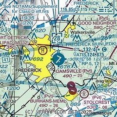
| Sectional chart |
|---|
|
 Download PDF
of official airport diagram from the FAA
| Airport distance calculator |
|---|
|
|
| Sunrise and sunset |
|---|
|
Times for 25-Apr-2025
| | Local
(UTC-4) | | Zulu
(UTC) |
|---|
| Morning civil twilight | | 05:51 | | 09:51 |
| Sunrise | | 06:19 | | 10:19 |
| Sunset | | 19:56 | | 23:56 |
| Evening civil twilight | | 20:24 | | 00:24 |
|
| Current date and time |
|---|
| Zulu (UTC) | 26-Apr-2025 00:01:25 |
|---|
| Local (UTC-4) | 25-Apr-2025 20:01:25 |
|---|
|
| METAR |
|---|
| KFDK | 252247Z 17008KT 10SM OVC050 24/16 A3003
|
KGAI
18nm SE | 252356Z AUTO 17008KT 10SM BKN045 OVC055 22/16 A3006 RMK AO2 SLP189 6//// T02220161 10244 20222 56004 PNO $
|
|
| TAF |
|---|
KMRB
28nm W | 251746Z 2518/2618 17006KT P6SM VCSH OVC060 FM252100 17009KT P6SM -SHRA SCT045 OVC060 PROB30 2522/2602 4SM -TSRA BKN035CB FM260400 18006KT 5SM -SHRA BR BKN015 OVC050 FM260700 19006KT P6SM BKN015 OVC035 FM261500 26009KT P6SM OVC020 PROB30 2615/2617 5SM -SHRA
|
KIAD
29nm S | 252054Z 2521/2624 19012KT P6SM SCT045 BKN080 FM252300 17010G17KT P6SM -SHRA BKN050 FM260400 18007KT 6SM -SHRA BR BKN015 OVC060 FM260900 19008KT P6SM BKN025 OVC050 FM261500 23009KT 6SM -SHRA BKN025 OVC050 FM261700 25010G18KT 6SM -SHRA BKN040 BKN080 PROB30 2617/2620 4SM -TSRA OVC025CB FM262100 31013G24KT P6SM SCT110
|
|
| NOTAMs |
|---|
NOTAMs are issued by the DoD/FAA and will open in a separate window not controlled by AirNav.
|
|


