FAA INFORMATION EFFECTIVE 15 MAY 2025
Location
| FAA Identifier: | SYN |
| Lat/Long: | 44-28-31.8778N 093-00-58.7522W
44-28.531297N 093-00.979203W
44.4755216,-93.0163201
(estimated) |
| Elevation: | 920 ft. / 280 m (estimated) |
| Variation: | 03E (1985) |
| From city: | 1 mile E of STANTON, MN |
| Time zone: | UTC -5 (UTC -6 during Standard Time) |
| Zip code: | 55018 |
Airport Operations
| Airport use: | Open to the public |
| Activation date: | 01/1943 |
| Control tower: | no |
| ARTCC: | MINNEAPOLIS CENTER |
| FSS: | PRINCETON FLIGHT SERVICE STATION |
| NOTAMs facility: | SYN (NOTAM-D service available) |
| Attendance: | 0800-SS
FOR SVC AFT HRS CALL AMGR. |
| Pattern altitude: | 1320 ft. MSL
TPA: 400 FT AGL ULTRALIGHT, 800 FT AGL GLDRS. |
| Wind indicator: | yes |
| Segmented circle: | no |
Airport Communications
| CTAF/UNICOM: | 122.8 |
| WX AWOS-3: | 119.35 (507-664-3806) |
| WX AWOS-3 at LVN (13 nm NW): | 118.0 (952-469-5850) |
| WX AWOS-3 at FBL (15 nm SW): | 120.2 (507-332-2505) |
Nearby radio navigation aids
| VOR radial/distance | | VOR name | | Freq | | Var |
|---|
| FGTr137/11.7 | | FARMINGTON VORTAC | | 115.70 | | 06E |
| FOWr041/22.3 | | HALFWAY VOR/DME | | 111.20 | | 02E |
| MSPr158/26.9 | | MINNEAPOLIS VOR/DME | | 115.30 | | 02E |
| FCMr138/27.8 | | FLYING CLOUD VOR/DME | | 117.70 | | 01E |
Airport Services
| Fuel available: | 100LL UL94 |
| Parking: | hangars and tiedowns |
| Airframe service: | MAJOR |
| Powerplant service: | MAJOR |
| Bottled oxygen: | NONE |
| Bulk oxygen: | NONE |
Runway Information
Runway 18/36
| Dimensions: | 2582 x 200 ft. / 787 x 61 m |
| Surface: | turf, in good condition |
| Runway edge markings: | RWY & DTHR MKD WITH YELLOW CONES. |
| RUNWAY 18 | | RUNWAY 36 |
| Latitude: | 44-28.743833N | | 44-28.318833N |
| Longitude: | 093-00.979167W | | 093-00.979167W |
| Elevation: | 920.0 ft. | | 920.0 ft. |
| Traffic pattern: | left | | left |
| Runway heading: | 177 magnetic, 180 true | | 357 magnetic, 000 true |
| Displaced threshold: | no | | 300 ft. |
| Obstructions: | 11 ft. crops, 8 ft. from runway, 1:1 slope to clear | | 18 ft. road, 60 ft. from runway, 3:1 slope to clear
APCH SLP 20:1 TO DTHR. |
Runway 9/27
| Dimensions: | 1996 x 180 ft. / 608 x 55 m |
| Surface: | turf, in good condition |
| Runway edge markings: | YELLOW CONES. |
| RUNWAY 9 | | RUNWAY 27 |
| Latitude: | 44-28.531167N | | 44-28.531333N |
| Longitude: | 093-01.208667W | | 093-00.749833W |
| Elevation: | 920.0 ft. | | 920.0 ft. |
| Traffic pattern: | left | | left |
| Runway heading: | 087 magnetic, 090 true | | 267 magnetic, 270 true |
| Obstructions: | 11 ft. crops, 9 ft. from runway, 18 ft. both sides of centerline, 1:1 slope to clear
SEASONAL CROPS RYS 09; 27; 18 SLOPE 0:1 WHEN CROPS PRESENT. | | 3 ft. crops, 7 ft. from runway, 51 ft. both sides of centerline, 2:1 slope to clear |
Airport Ownership and Management from official FAA records
| Ownership: | Privately-owned |
| Owner: | STANTON SPORT AVIATION INC
1235 HIGHWAY 19 BLVD
STANTON, MN 55018-7218
Phone 507-645-4030 |
| Manager: | JOHN QUILLING
1235 HIGHWAY 19 BLVD
STANTON, MN 55018-7218
Phone 507-645-4030
SYNAIRPORTMANAGER@GMAIL.COM. |
Additional Remarks
| - | GLDR OPS SFC-8000 FT MSL ON & INVOF ARPT DURG DALGT HRS ON WKENDS EXC WINTER MONTHS. |
| - | CROSSWIND RWY ENDS NOT VSB TO EACH OTR WHEN CROPS PRESENT. |
| - | FOR CD CTC MINNEAPOLIS APCH AT 612-726-9086. |
| - | NOT PLOWED WINTER MONTHS. |
Instrument Procedures
There are no published instrument procedures at KSYN.
Some nearby airports with instrument procedures:
KLVN - Airlake Airport (13 nm NW)
KFBL - Faribault Municipal Airport-Liz Wall Strohfus Field (15 nm SW)
KSGS - South St Paul Municipal Airport/Richard E Fleming Field (23 nm N)
KOWA - Owatonna Degner Regional Airport (24 nm SW)
KRGK - Red Wing Regional Airport (24 nm E)
|
|

Road maps at:
MapQuest
Bing
Google
| Aerial photo |
|---|
WARNING: Photo may not be current or correct
 Photo taken 24-Sep-2006
from a Blanik L-13
Do you have a better or more recent aerial photo of Stanton Airfield that you would like to share? If so, please send us your photo.
|
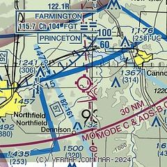
| Sectional chart |
|---|

|
| Airport distance calculator |
|---|
|
|
| Sunrise and sunset |
|---|
|
Times for 30-May-2025
| | Local
(UTC-5) | | Zulu
(UTC) |
|---|
| Morning civil twilight | | 04:57 | | 09:57 |
| Sunrise | | 05:33 | | 10:33 |
| Sunset | | 20:47 | | 01:47 |
| Evening civil twilight | | 21:22 | | 02:22 |
|
| Current date and time |
|---|
| Zulu (UTC) | 30-May-2025 14:17:59 |
|---|
| Local (UTC-5) | 30-May-2025 09:17:59 |
|---|
|
| METAR |
|---|
| KSYN | 301355Z AUTO 30008KT 10SM CLR 18/12 A2996 RMK AO2 T01810118
|
KLVN
12nm NW | 301355Z AUTO 29007KT 10SM CLR 18/10 A2996 RMK AO2
|
KFBL
16nm SW | 301355Z AUTO 30006KT 10SM CLR 18/11 A2997 RMK AO2
|
|
| NOTAMs |
|---|
NOTAMs are issued by the DoD/FAA and will open in a separate window not controlled by AirNav.
|
|


