FAA INFORMATION EFFECTIVE 03 OCTOBER 2024
Location
| FAA Identifier: | MKC |
| Lat/Long: | 39-07-22.5680N 094-35-34.1630W
39-07.376133N 094-35.569383W
39.1229356,-94.5928231
(estimated) |
| Elevation: | 756.8 ft. / 230.7 m (surveyed) |
| Variation: | 01E (2020) |
| Time zone: | UTC -5 (UTC -6 during Standard Time) |
| Zip code: | 64116 |
Airport Operations
| Airport use: | Open to the public |
| Activation date: | 04/1940 |
| Control tower: | yes |
| ARTCC: | KANSAS CITY CENTER |
| FSS: | COLUMBIA FLIGHT SERVICE STATION |
| NOTAMs facility: | MKC (NOTAM-D service available) |
| Attendance: | CONTINUOUS |
| Wind indicator: | lighted |
| Segmented circle: | no |
| Lights: | SS-SR |
| Beacon: | white-green (lighted land airport)
Operates sunset to sunrise. |
| Fire and rescue: | ARFF index A |
| Airline operations: | ARPT CLSD TO ACR OPNS WITH MORE THAN 30 PSGR SEATS EXCP 24 HR PPR CALL AMGR (816) 289-2718. AIR CARRIER OPS NOT AUTHORIZED IN EXCESS OF 15 MINUTES BFR OR AFT SKED ARR OR DEP TIMES W/O PRIOR COORDINATION WITH AMGR CONFIRMING ARFF AVBL PRIOR TO LNDG OR TKOF. |
| International operations: | customs landing rights airport |
Airport Communications
| UNICOM: | 122.95 |
| ATIS: | 120.75 |
| WX ASOS: | 120.75 (816-329-2843) |
| DOWNTOWN GROUND: | 121.9 |
| DOWNTOWN TOWER: | 133.3 233.7 |
| KANSAS CITY APPROACH: | 118.4 |
| KANSAS CITY DEPARTURE: | 118.4 |
| CLEARANCE DELIVERY: | 121.9 |
| PRE-TAXI CLEARANCE: | 121.9 |
| BRAYMER STAR: | 120.95 |
| JHAWK STAR: | 120.95 |
| TYGER STAR: | 120.95 |
| WX ASOS at MCI (12 nm NW): | PHONE 816-329-2808 |
| WX ASOS at LXT (14 nm SE): | 124.175 (816-347-9807) |
| WX ASOS at OJC (18 nm S): | PHONE 913-780-6969 |
| WX AWOS-3T at GPH (18 nm NE): | 120.275 (816-407-3399) |
- INTERFERENCE FROM FM RADIO STATION MAY AFFECT COMMUNICATIONS IN THE IMMEDIATE VICINITY OF THE ARPT.
Nearby radio navigation aids
| VOR radial/distance | | VOR name | | Freq | | Var |
|---|
| MCIr140/11.8 | | KANSAS CITY VORTAC | | 113.25 | | 05E |
| ANXr267/21.7 | | NAPOLEON VORTAC | | 115.15 | | 07E |
Airport Services
| Fuel available: | 100LL JET-A
100LL:100LL SELF SVC AVBL 24 HRS WITH CREDIT CARD ONLY ON WEST SIDE NEAR GA TERMINAL. |
| Parking: | hangars and tiedowns |
| Airframe service: | MAJOR |
| Powerplant service: | MAJOR |
| Bottled oxygen: | HIGH/LOW |
| Bulk oxygen: | HIGH/LOW |
Runway Information
Runway 1/19
| Dimensions: | 6827 x 150 ft. / 2081 x 46 m |
| Surface: | concrete/grooved, in excellent condition |
| Weight bearing capacity: | | PCN 67 /R/B/W/T | | Single wheel: | 86.0 | | Double wheel: | 171.0 | | Double tandem: | 342.0 |
|
| Runway edge lights: | high intensity |
| RUNWAY 1 | | RUNWAY 19 |
| Latitude: | 39-06.881313N | | 39-07.978363N |
| Longitude: | 094-35.720838W | | 094-35.403782W |
| Elevation: | 748.5 ft. | | 756.8 ft. |
| Traffic pattern: | left | | left |
| Runway heading: | 012 magnetic, 013 true | | 192 magnetic, 193 true |
| Displaced threshold: | 299 ft. | | 302 ft. |
| Declared distances: | TORA:6827 TODA:6827 ASDA:6827 LDA:6527 | | TORA:6827 TODA:6827 ASDA:6827 LDA:6525 |
| Markings: | nonprecision, in good condition | | precision, in good condition |
| Visual slope indicator: | 4-box VASI on left (3.70 degrees glide path) | | 4-light PAPI on left (3.00 degrees glide path) |
| RVR equipment: | rollout | | touchdown |
| Approach lights: | RLLS | | MALSF: 1,400 foot medium intensity approach lighting system with sequenced flashers
RY19 MALSF AUGMENTED WITH RAIL. |
| Runway end identifier lights: | yes | | no |
| Touchdown point: | yes, no lights | | yes, no lights |
| Instrument approach: | | | ILS/DME |
| Obstructions: | 38 ft. tree, 747 ft. from runway, 571 ft. right of centerline, 20:1 slope to clear | | 20 ft. road, 700 ft. from runway, 150 ft. left of centerline, 25:1 slope to clear
ROAD & FENCE 0-200' FM THR. |
Runway 4/22
| Dimensions: | 5050 x 100 ft. / 1539 x 30 m |
| Surface: | asphalt, in excellent condition |
| Weight bearing capacity: | | PCN 74 /F/C/W/T | | Single wheel: | 48.0 | | Double wheel: | 73.0 | | Double tandem: | 136.0 |
|
| Runway edge lights: | high intensity |
| RUNWAY 4 | | RUNWAY 22 |
| Latitude: | 39-06.977703N | | 39-07.629338N |
| Longitude: | 094-35.910767W | | 094-35.247018W |
| Elevation: | 742.3 ft. | | 742.9 ft. |
| Traffic pattern: | left | | left |
| Runway heading: | 037 magnetic, 038 true | | 217 magnetic, 218 true |
| Displaced threshold: | 500 ft. | | 699 ft. |
| Declared distances: | TORA:5050 TODA:5050 ASDA:4770 LDA:4270 | | TORA:5050 TODA:5050 ASDA:5050 LDA:4351 |
| Markings: | precision, in good condition | | nonprecision, in good condition |
| Visual slope indicator: | 4-box VASI on left (3.00 degrees glide path) | | 4-box VASI on left (3.30 degrees glide path)
UNUSBL BYD 8 DEGS LEFT OF CRS. |
| RVR equipment: | touchdown | | rollout |
| Runway end identifier lights: | | | yes |
| Touchdown point: | yes, no lights | | yes, no lights |
| Instrument approach: | ILS/DME | | |
| Obstructions: | 20 ft. berm, lighted, 450 ft. from runway, 125 ft. left of centerline, 12:1 slope to clear
APCH RATIO AT DSPLCD THR 47:1. | | 37 ft. rr, lighted, 225 ft. from runway, 100 ft. left of centerline
ROAD & RR 0-200' FM THR. |
Airport Ownership and Management from official FAA records
| Ownership: | Publicly-owned |
| Owner: | CITY OF KANSAS CITY
414 E. 12TH ST
KANSAS CITY, MO 64106
Phone 816-859-7601 |
| Manager: | ROD DEWINKLER
900 NW RICHARDS ROAD
KANSAS CITY, MO 64116
Phone 816-859-7610 |
Additional Remarks
| E60-01 | ENGINEERED MATERIALS ARRESTING SYSYTEM (EMAS) 263 FT IN LENGTH BY 170 FT IN WIDTH LCTD AT THE DER 01. |
| E60-19 | ENGINEERED MATERIALS ARRESTING SYSYTEM (EMAS) 287 FT IN LENGTH BY 170 FT IN WIDTH LCTD AT THE DER 19. |
| - | FLOCKS OF PIGEONS INVOF DEP EOR 04. |
| - | RWY 04/22 VFR E TFC PAT: DEPARTING RWY 04 RIGHT TFC ATTAIN TFC PAT ALT PRIOR TO TURNING CROSSWIND. LDG RWY 22 MNTN TFC PAT ALT UNTIL PASSING N OF MISSOURI RIVER. |
| - | ATCT HAS LIMITED VISIBILITY OF T-HANGAR APRONS N TWY D AND W TWY L . |
| - | FAA SAFETY VIDEO CAN BE ACCESSED AT HTTPS://WWW.FAA.GOV/AIRPORTS/RUNWAY_SAFETY/VIDEOS/MKC/ |
| - | CTN: MULT OBSTRUCTIONS 0.5 MI-1.0 MI ESE FM RWY 19 DER UP TO 290 FT AGL/1100 FT MSL. |
| - | DUE TO OBSTNS, PRIOR TO ANY TURNS TO THE E, ACFT MUST BE AT OR ABV TFC PTN ALT |
| - | WILDLIFE ON & INVOF ARPT. |
Instrument Procedures
NOTE: All procedures below are presented as PDF files. If you need a reader for these files, you should download the free Adobe Reader.NOT FOR NAVIGATION. Please procure official charts for flight.
FAA instrument procedures published for use from 03 October 2024 at 0901Z to 31 October 2024 at 0900z.
STARs - Standard Terminal Arrivals |
|---|
| BRAYMER EIGHT | |
2 pages:
[1] [2] (341KB) |
| JHAWK EIGHT | |
download (218KB) |
| TYGER SEVEN | |
2 pages:
[1] [2] (285KB) |
IAPs - Instrument Approach Procedures |
|---|
| ILS OR LOC RWY 04 | |
download (349KB) |
| ILS OR LOC RWY 19 | |
download (326KB) |
| RNAV (GPS) RWY 04 | |
download (263KB) |
| RNAV (GPS) RWY 22 | |
download (259KB) |
| RNAV (GPS) Y RWY 19 | |
download (260KB) |
| RNAV (GPS) Z RWY 19 | |
download (266KB) |
| NOTE: Special Alternate Minimums apply | |
download (145KB) |
Departure Procedures |
|---|
| CHIEF NINE | |
download (213KB) |
| LAKES FIVE | |
download (270KB) |
| RACER EIGHT | |
download (257KB) |
| ROYAL TWO **NEW** | |
download (234KB) |
| TIFTO EIGHT | |
download (190KB) |
| WILDCAT SIX | |
download (233KB) |
| NOTE: Special Take-Off Minimums/Departure Procedures apply | |
download (425KB) |
Other nearby airports with instrument procedures:
KMCI - Kansas City International Airport (12 nm NW)
KLXT - Lee's Summit Municipal Airport (14 nm SE)
KOJC - Johnson County Executive Airport (18 nm S)
KGPH - Midwest National Air Center Airport (18 nm NE)
3GV - East Kansas City Airport (19 nm E)
|
|

Road maps at:
MapQuest
Bing
Google
| Aerial photo |
|---|
WARNING: Photo may not be current or correct
 Photo by Martin Pauly
Photo taken 06-Jan-2019
looking north-northwest.
Photo by Martin Pauly
Photo taken 06-Jan-2019
looking north-northwest.
Do you have a better or more recent aerial photo of Charles B Wheeler Downtown Airport that you would like to share? If so, please send us your photo.
|
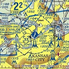
| Sectional chart |
|---|
|
CAUTION: Diagram may not be current
 Download PDF
of official airport diagram from the FAA
| Airport distance calculator |
|---|
|
|
| Sunrise and sunset |
|---|
|
Times for 27-Oct-2024
| | Local
(UTC-5) | | Zulu
(UTC) |
|---|
| Morning civil twilight | | 07:15 | | 12:15 |
| Sunrise | | 07:43 | | 12:43 |
| Sunset | | 18:22 | | 23:22 |
| Evening civil twilight | | 18:49 | | 23:49 |
|
| Current date and time |
|---|
| Zulu (UTC) | 27-Oct-2024 18:24:35 |
|---|
| Local (UTC-5) | 27-Oct-2024 13:24:35 |
|---|
|
| METAR |
|---|
| KMKC | 271754Z VRB04KT 10SM CLR 19/08 A3022 RMK AO2 SLP229 T01940078 10194 20072 58023
|
KMCI
12nm NW | 271753Z 18007KT 10SM CLR 18/08 A3022 RMK AO2 SLP231 T01780078 10178 20061 58019 $
|
KLXT
14nm SE | 271753Z AUTO 16008KT 10SM FEW028 19/07 A3024 RMK AO2 RAB09E19 SLP238 P0000 60000 T01940072 10194 20083 58018 $
|
KGVW
17nm S | 271755Z AUTO 07009KT 10SM CLR 25/19 A3022 RMK A01
|
KOJC
18nm S | 271753Z 23007KT 10SM FEW024 19/10 A3022 RMK AO2 SLP231 T01940100 10194 20067 58019
|
KGPH
18nm NE | 271755Z AUTO 17006KT 10SM CLR 17/06 A3024 RMK AO2
|
|
| TAF |
|---|
| KMKC | 271721Z 2718/2818 16008KT P6SM FEW200 FM281400 16010G20KT P6SM SCT200
|
KMCI
12nm NW | 271721Z 2718/2818 17010KT P6SM FEW200 FM281300 17014G24KT P6SM SCT200
|
|
| NOTAMs |
|---|
NOTAMs are issued by the DoD/FAA and will open in a separate window not controlled by AirNav.
|
|


